1926 USGS Antique Copper Printing Plates Greenwood York Plus A Hardcopy Map

Item History & Price
| Reference Number: Avaluer:37881 |
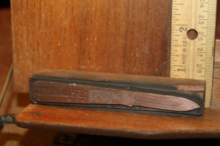
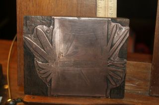
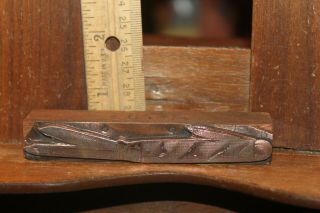
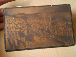
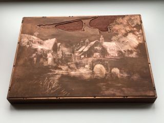
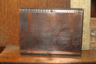
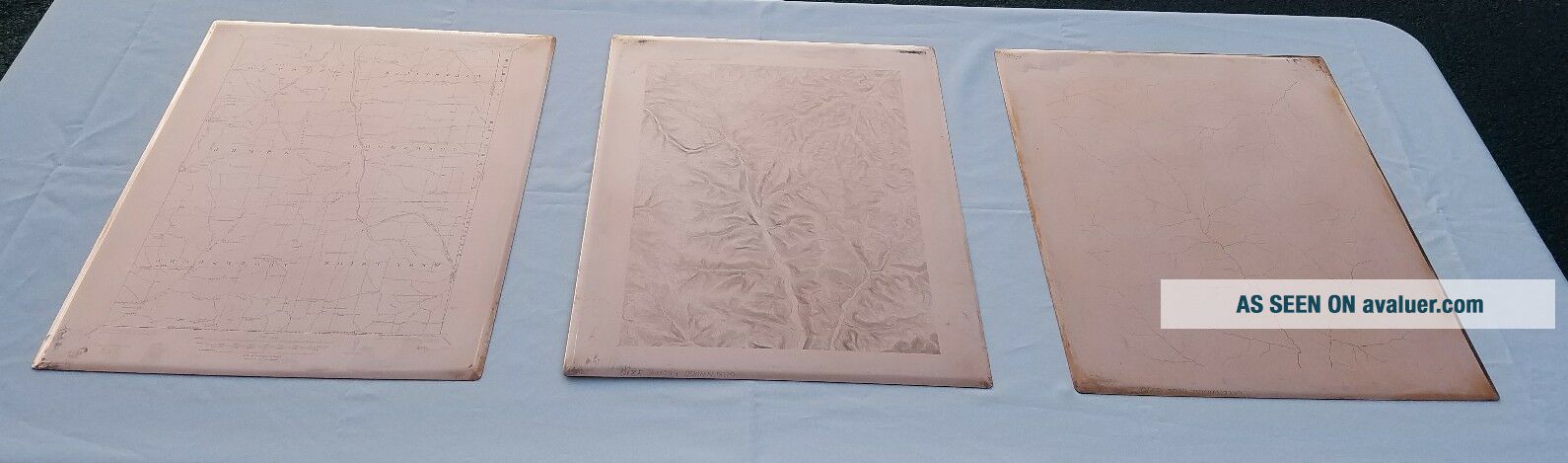
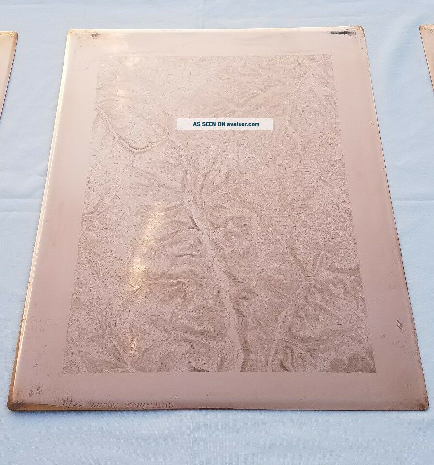
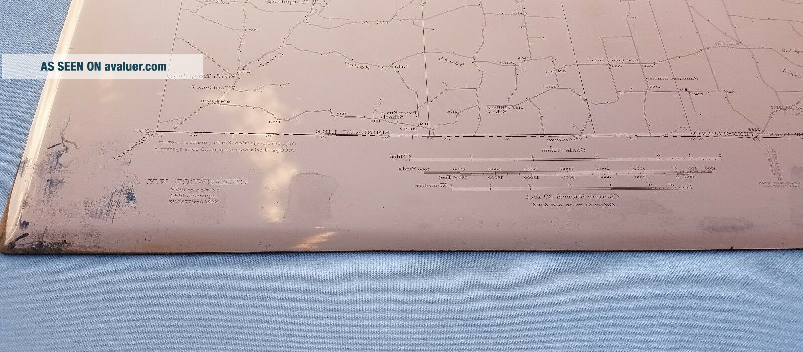
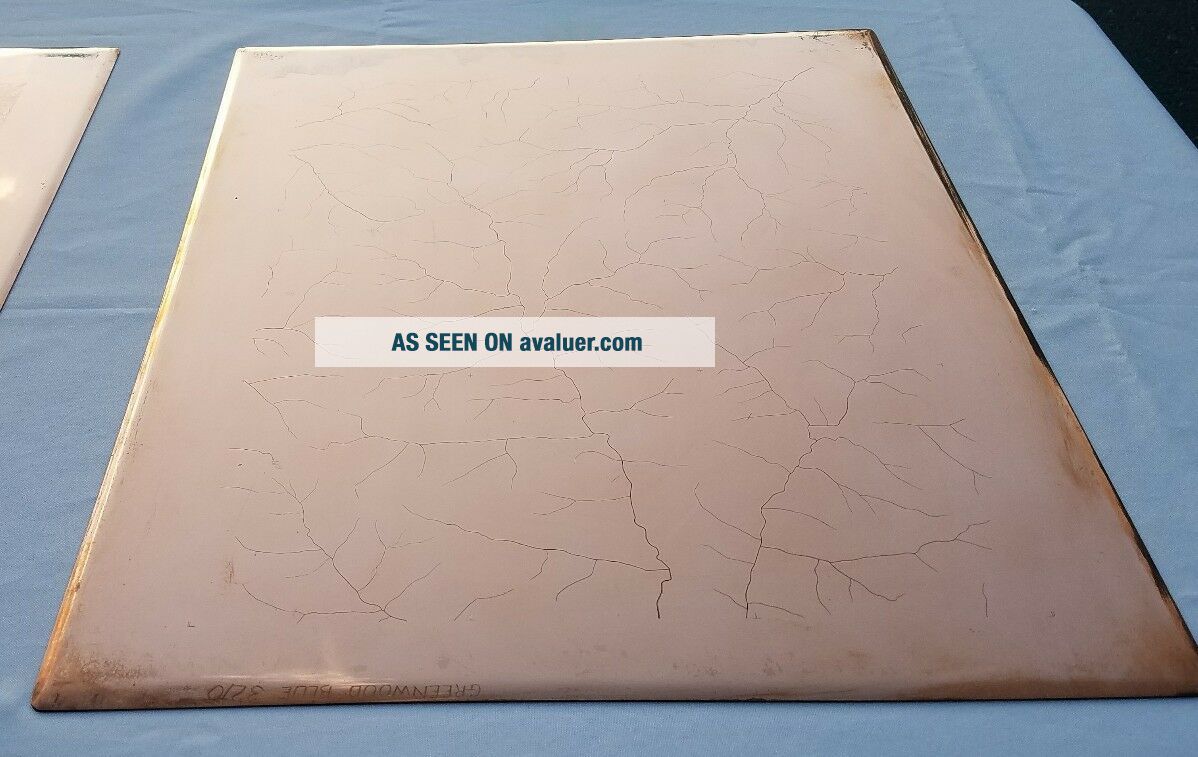
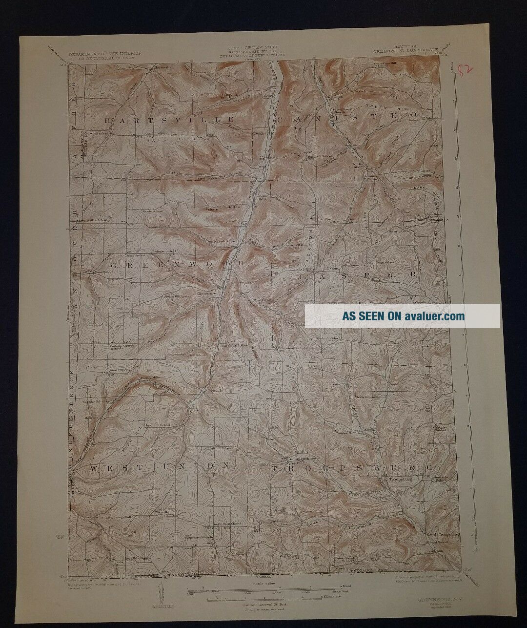
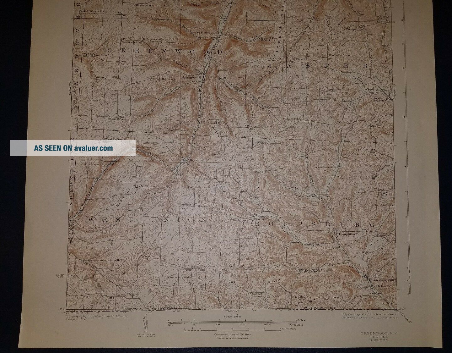
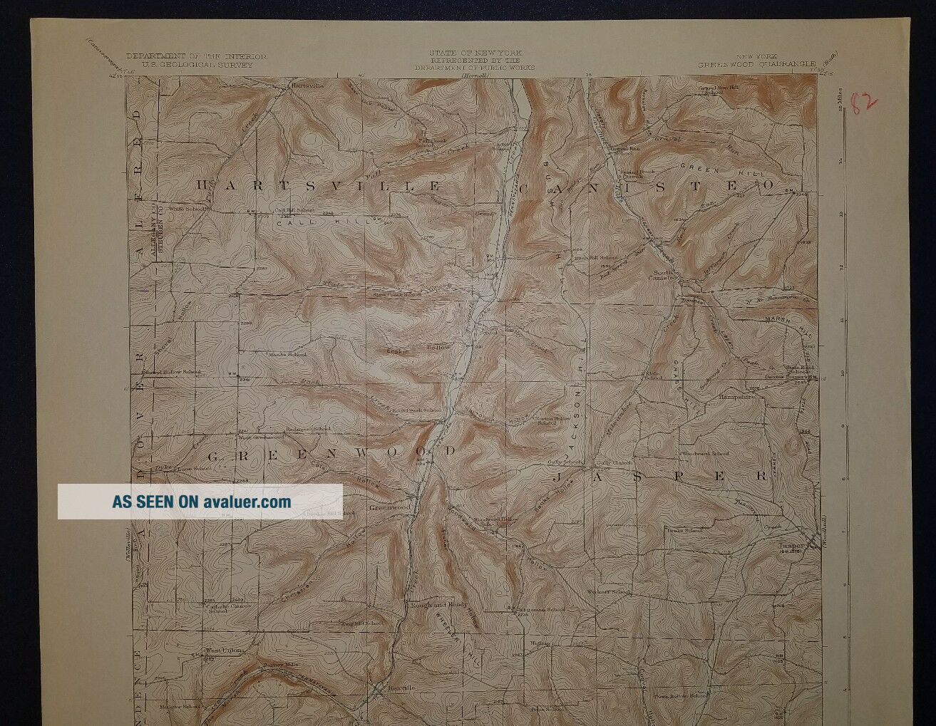
This sale is for three USGS copper plates of the Greenwood Quadrangle (NY) surveyed in 1924, first published 1926. West Union, Troupsburg, Greenwood, Jasper, Hartsville and Canister are shown. Bennett Creek bisects the map and numerous places are called out such as Christian Hollow, Cole Hollow, Fisher Hollow, Wheeler Hill, Norton Hollow, Erskine Hollow, Marsh Hill and Dennis Corners among others.
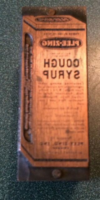
The paper map included in this sale is an original 19...32 printing.
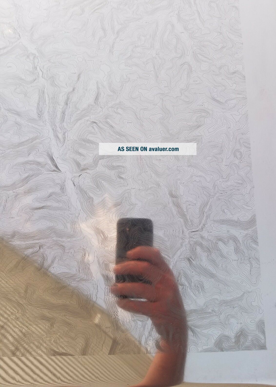
The plates were cleaned using the method recommended by the National Museum Curator USGS National Center. The engravings on the cleaned plates were not enhanced or coated, and the plates and map are unframed. The plates could be hung with mirror clips, put on a shelf or framed. Note that the plates were photographed outside, so the reflection of clouds can be seen in the plates. They have a near mirror finish as shown in one photo where I deliberately allowed the camera to be seen.
A Brief History of the Plates and USGS Map printingFrom the 1880s to the 1950s, the U. S. Geological Survey used engraved copper plates in the process of printing many thousands of topographic and geographic quadrangle maps at several map scales.The heavy engraving plates were inscribed with the points, contour lines, symbols, and text that constitute a topographic map. The plates ranged in size from 4-by-5 inches to 36-by-40 inches; the majority measured 17-by-21 inches with an average weight of around 12.5 pounds each (as is this set).The Printing Process – From Plates to PaperA complicating aspect of this historical USGS printing process is that prints were not directly made from the plates. USGS transferred the image from the engraved plate to a special lithographic stone in order to make large numbers of prints, an approach that preserved the crispness of the engraving. Otherwise, the accuracy of the engraving would have been lost due to the repeated pressure required to transfer the image directly from the plate to each paper copy.For printing purposes, the copper engravings were mirror images (left-to-right reversed). Etched by a USGS cartographic technician called a “map engraver, ” the words and text characters are backwards. For maps, “east” appears on the left side of the plate instead of the right as it does on the printed map.The engraving plates for a topographic map were color-separated in a set; that is, there was a plate for each color of ink to be printed. A typical topographic quadrangle map had a set of three plates: a black ink plate for cultural features, boundaries, and most of the text; a blue inked plate for hydrography; and a brown ink plate for topographic contours.
The scale is 1:62, 500.
These plates and map are suitable for framing and guaranteed original. If the USPS is used the plates and map will be carefully bubble wrapped and boxed prior to shipping. Feel Free to ask any questions. I would be happy to provide additional photos or information. {File: FFD}
The paper map included in this sale is an original 19...32 printing.
The plates were cleaned using the method recommended by the National Museum Curator USGS National Center. The engravings on the cleaned plates were not enhanced or coated, and the plates and map are unframed. The plates could be hung with mirror clips, put on a shelf or framed. Note that the plates were photographed outside, so the reflection of clouds can be seen in the plates. They have a near mirror finish as shown in one photo where I deliberately allowed the camera to be seen.
A Brief History of the Plates and USGS Map printingFrom the 1880s to the 1950s, the U. S. Geological Survey used engraved copper plates in the process of printing many thousands of topographic and geographic quadrangle maps at several map scales.The heavy engraving plates were inscribed with the points, contour lines, symbols, and text that constitute a topographic map. The plates ranged in size from 4-by-5 inches to 36-by-40 inches; the majority measured 17-by-21 inches with an average weight of around 12.5 pounds each (as is this set).The Printing Process – From Plates to PaperA complicating aspect of this historical USGS printing process is that prints were not directly made from the plates. USGS transferred the image from the engraved plate to a special lithographic stone in order to make large numbers of prints, an approach that preserved the crispness of the engraving. Otherwise, the accuracy of the engraving would have been lost due to the repeated pressure required to transfer the image directly from the plate to each paper copy.For printing purposes, the copper engravings were mirror images (left-to-right reversed). Etched by a USGS cartographic technician called a “map engraver, ” the words and text characters are backwards. For maps, “east” appears on the left side of the plate instead of the right as it does on the printed map.The engraving plates for a topographic map were color-separated in a set; that is, there was a plate for each color of ink to be printed. A typical topographic quadrangle map had a set of three plates: a black ink plate for cultural features, boundaries, and most of the text; a blue inked plate for hydrography; and a brown ink plate for topographic contours.
The scale is 1:62, 500.
These plates and map are suitable for framing and guaranteed original. If the USPS is used the plates and map will be carefully bubble wrapped and boxed prior to shipping. Feel Free to ask any questions. I would be happy to provide additional photos or information. {File: FFD}