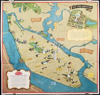
Antique City Plan And Map Of York, USA, 1830s


Item History & Price

Information:
Reference Number: Avaluer:38247Year: 1830
Type: City Map
Original Description:
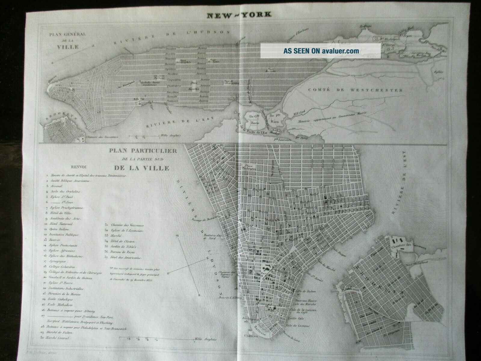
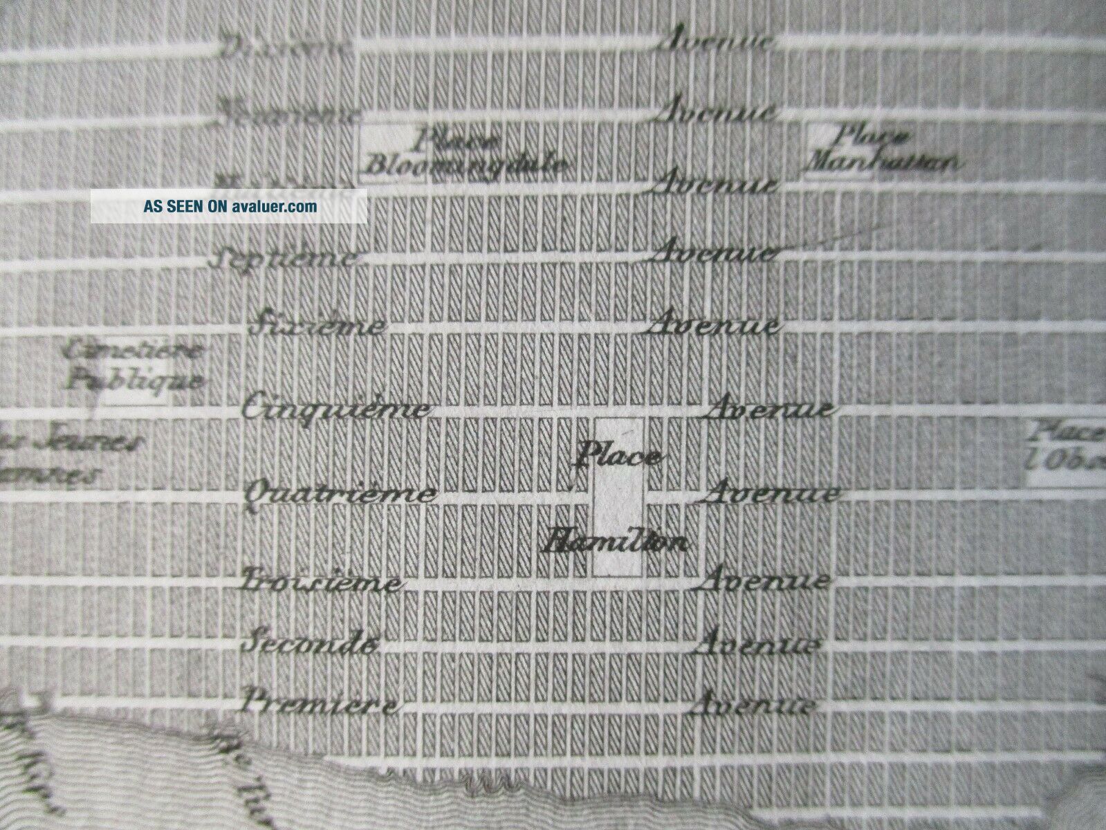
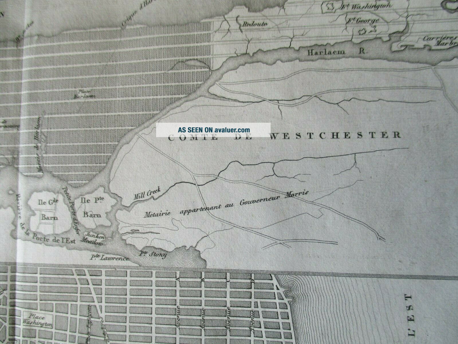
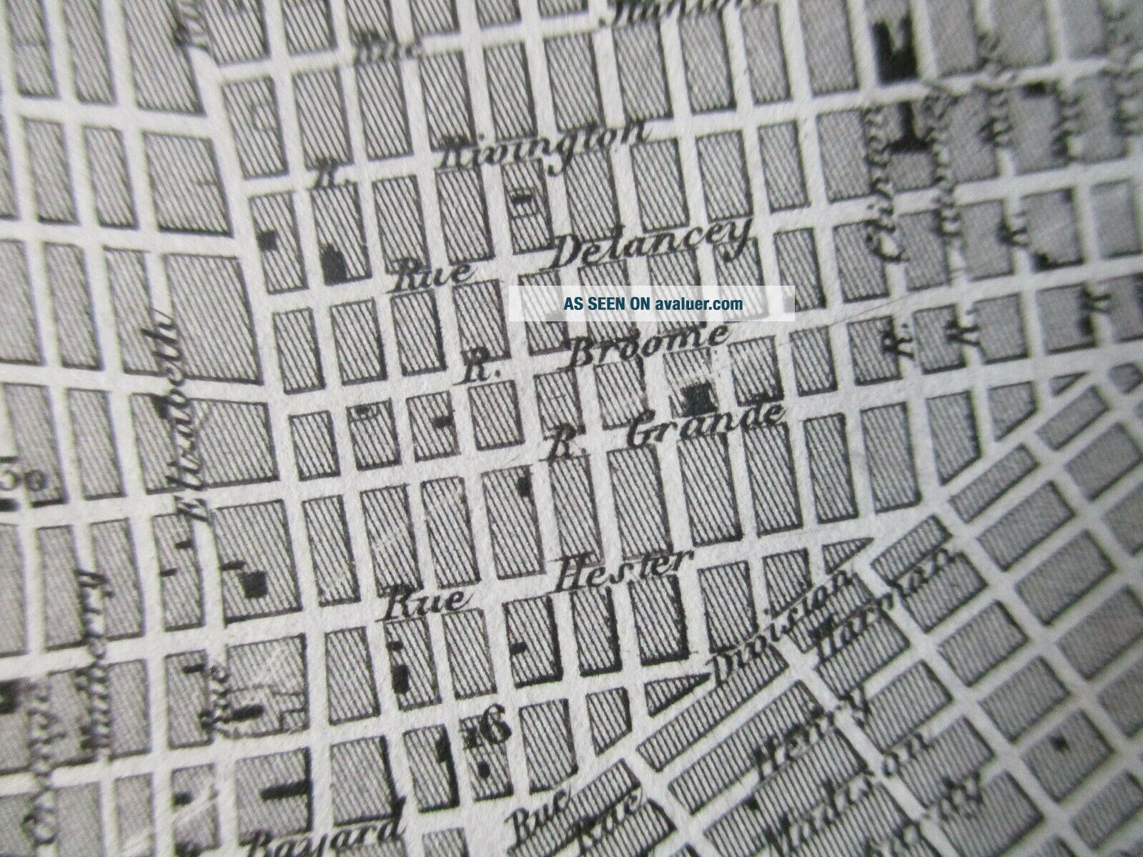
Antique city plan and map of New York, USA, 1830s. City plan of New York by Dufour, Paris, early 1830s, finely-engraved, upper frame of Manhattan and Westchester, lower frame downtown Manhattan and Brooklyn. Shows streets, docks etc., and early configurations e.g. 4th Avenue instead of Park Avenue, as well as 37-point key of city landmarks. 27cm x 22.5cm. Mint condition.


    Similar items


  • 1956 City Guide And Map Of St.  Louis

    1956 City Guide And Map Of St. Louis

  • Ny York Vintage Post Card Empire State And Map Of York

    Ny York Vintage Post Card Empire State And Map Of York

  • Vintage Manhattan Map Print Antique Wall Art - Vintage Map Of York - Nyc Map

    Vintage Manhattan Map Print Antique Wall Art - Vintage Map Of York - Nyc Map

  • York York City / / Sinclair Pictorial Map Of York York World

    York York City / / Sinclair Pictorial Map Of York York World ' S

  • Saint Louis Missouri / City Guide And Map Of St Louis This Guide Has Been 1952

    Saint Louis Missouri / City Guide And Map Of St Louis This Guide Has Been 1952

  • D.  H.  White Vintage Antique City Folding Paper Map Of Tacoma Washington Fidelity

    D. H. White Vintage Antique City Folding Paper Map Of Tacoma Washington Fidelity

  • Vintage Fox

    Vintage Fox ' S Street Reference Plan And Map Of Ealing - H A Fox

  • Vintage Fox

    Vintage Fox ' S Street Reference Plan And Map Of Watford And Rickmansworth H A Fox


    • You might also like


    • 1860 Mitchell Hand Colored Map Colorado,  Nebraska & Kansas - Civil War Era

      1860 Mitchell Hand Colored Map Colorado, Nebraska & Kansas - Civil War Era

    • 18th Century French Map Of North America

      18th Century French Map Of North America

    • Las Vegas Nevada Vintage 1967 Us Geological Survey Quadrangle Map 4 Panels

      Las Vegas Nevada Vintage 1967 Us Geological Survey Quadrangle Map 4 Panels

    • Rare Antique 1845 Maps United States Exploring Expedition Book Antartica Hawaii

      Rare Antique 1845 Maps United States Exploring Expedition Book Antartica Hawaii

    • Vintage 1926 Map Hollywood From The Best Surveys Of The Time

      Vintage 1926 Map Hollywood From The Best Surveys Of The Time

    • American Continent (western Hemisphere) 1747 Bowen Antique Copper Engraved Map

      American Continent (western Hemisphere) 1747 Bowen Antique Copper Engraved Map

    • Gulf Coast Florida Texas United States 1705 De Fer Unusual Antique Engraved Map

      Gulf Coast Florida Texas United States 1705 De Fer Unusual Antique Engraved Map

    • California As Island United States 1700 De Fer Unusual First Edition Antique Map

      California As Island United States 1700 De Fer Unusual First Edition Antique Map

Avaluer          About Us          Privacy Policy          Contact Us          UP
© 2022, avaluer.net, Inc. or its affiliates