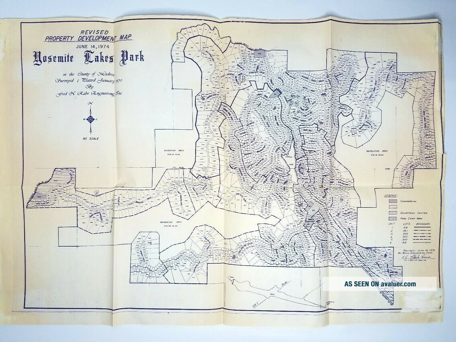
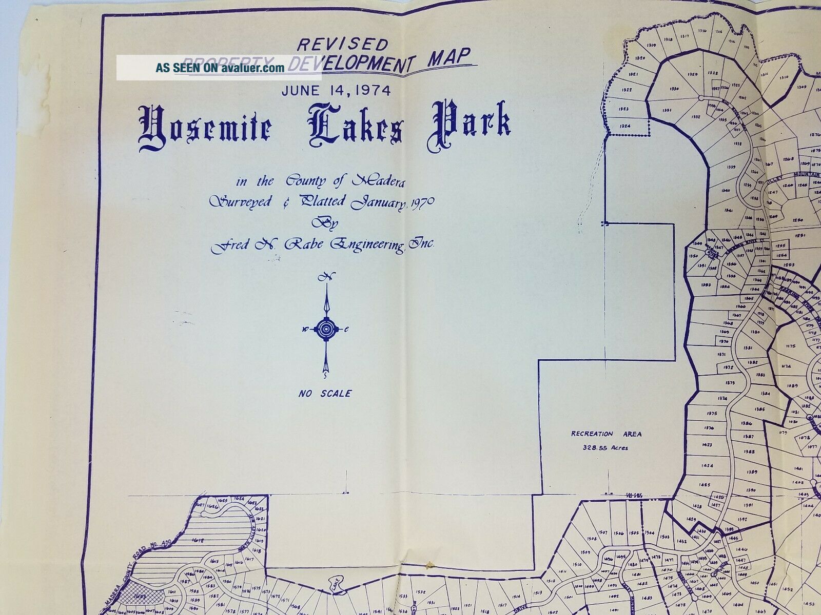
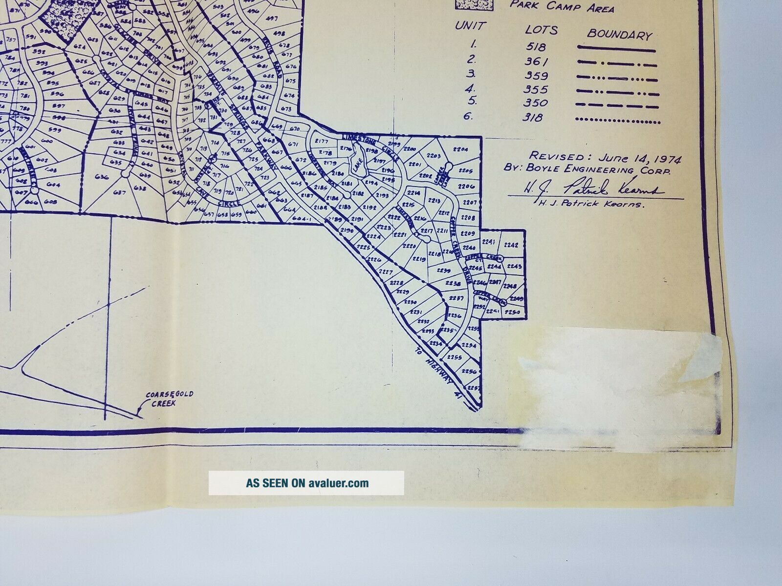
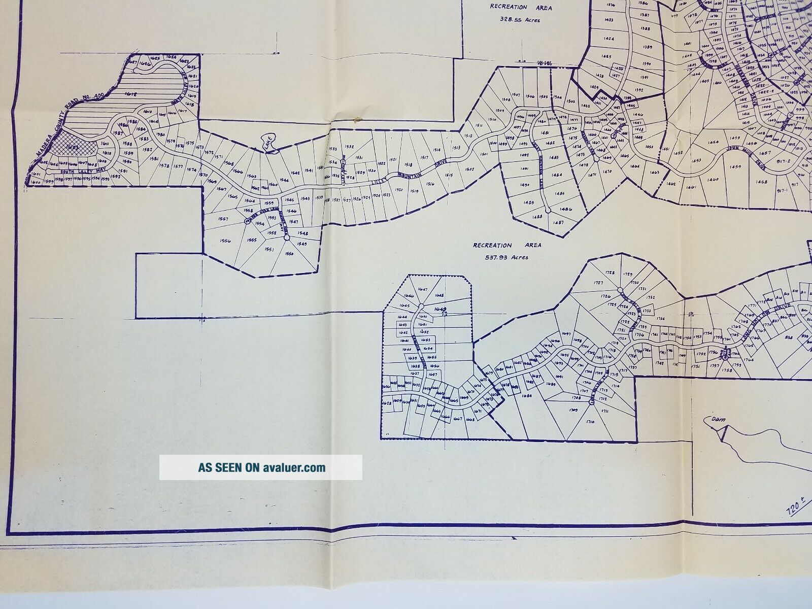
Vintage Map Of Yosemite Lakes Park 1974 Oakhurst California 2 ' X 3 ' Boyle


Item History & Price

Information:
Reference Number: Avaluer:3871916Date Range: 1970-1979
US State: CaliforniaCity: Oakhurst
Format: Sheet MapOriginal/Reproduction: Original
Type: Community MapCountry/Region: United States of America
Year: 1974
Original Description:
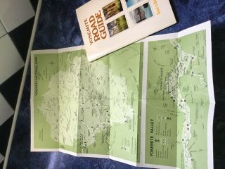
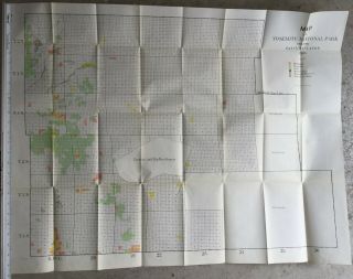
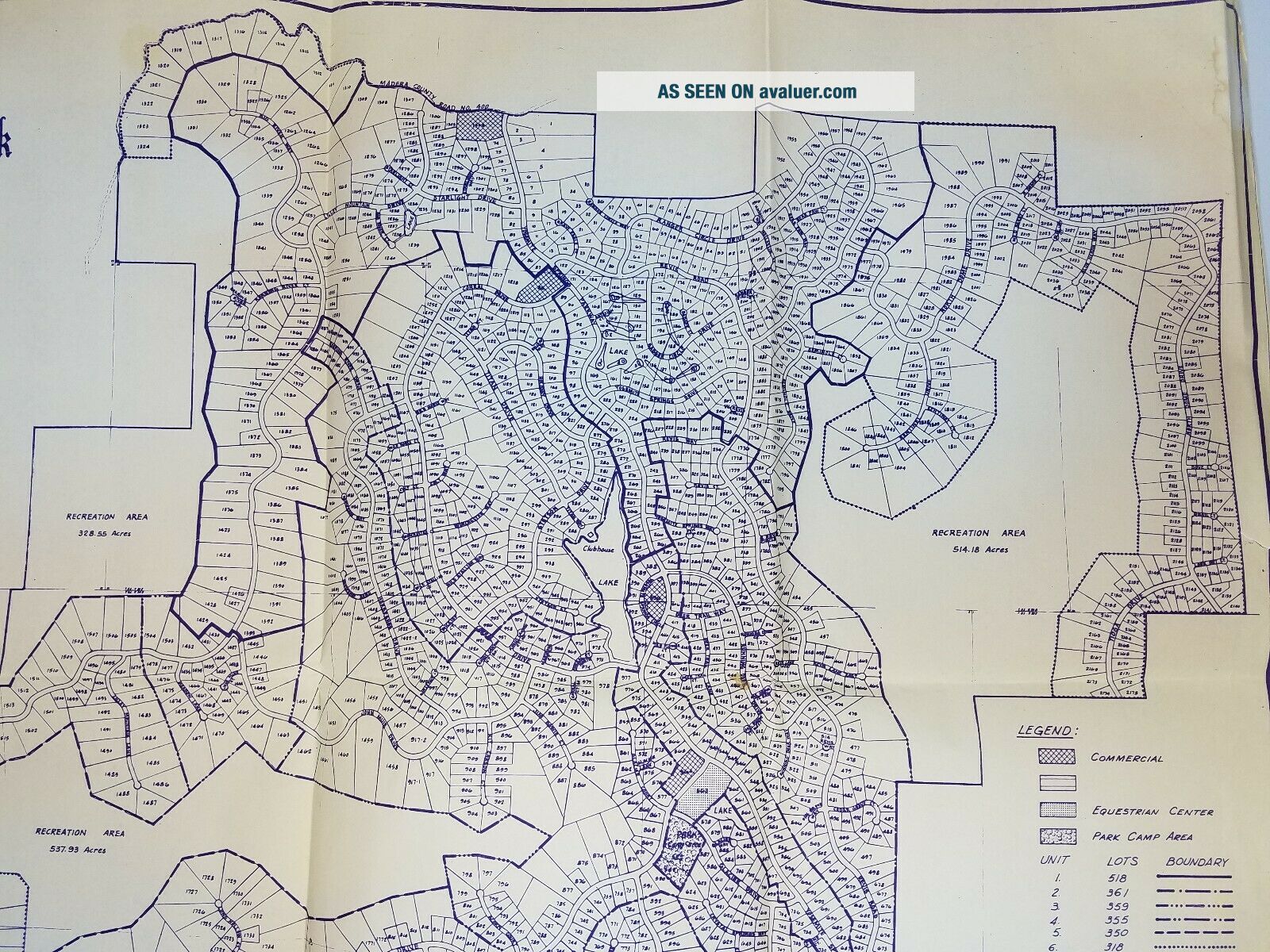
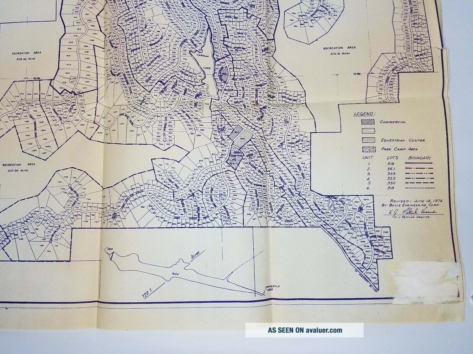
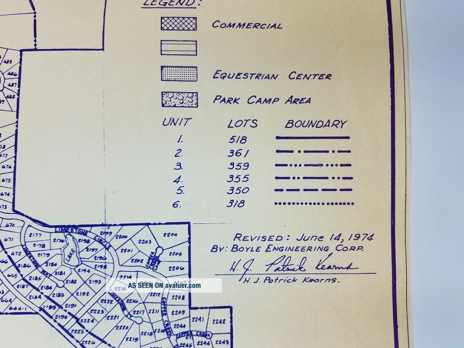
Vintage Map of Yosemite Lakes Park ~ 1974 ~Oakhurst California 2' Tall x 3' LongMap will be sent in the original fold I received it in.This is a property development map of Yosemite Lakes Park, located in Oakhurst California. This map was printed in 1974. This is not a map of Yosemite National Park.Please note the damage in the lower right hand corner from a sticker that was removed, see last pic for a close up.

Please see pictures for condition description. Comes exactly as pic...tured. Any questions please feel free to ask. USA Seller!Shipped Fresh From California!
Thanks, Ry


    Similar items


  • Vintage Hysterical Map Of Yosemite National Park By Jolly Lindgren 1948 Novelty

    Vintage Hysterical Map Of Yosemite National Park By Jolly Lindgren 1948 Novelty

  • Vintage Map Of Yosemite Valley - Yosemite Nat

    Vintage Map Of Yosemite Valley - Yosemite Nat ' L Park - Calif. 18x38 1949

  • Vintage Brochure Map Of Yosemite National Park,  Road Guide Booklet 1976

    Vintage Brochure Map Of Yosemite National Park, Road Guide Booklet 1976

  • Vintage Map Of West Lake Hangzhou Hangchow China

    Vintage Map Of West Lake Hangzhou Hangchow China

  • Map Of Yosemite National Park Showing Patented Lands 1903

    Map Of Yosemite National Park Showing Patented Lands 1903

  • 1982 3d Map Of Yosemite National Park 3d Map 3d Relief Topographical Map Hubbard

    1982 3d Map Of Yosemite National Park 3d Map 3d Relief Topographical Map Hubbard

  • Vintage Map Of Higgins Lake Michigan Souvenir History Travel Brochure Guide Cool

    Vintage Map Of Higgins Lake Michigan Souvenir History Travel Brochure Guide Cool

  • Vintage Map Of Ohio Lake Erie Island District Early Americana H.  F.  Gerold

    Vintage Map Of Ohio Lake Erie Island District Early Americana H. F. Gerold


    • You might also like


    • 1860 Mitchell Hand Colored Map Colorado,  Nebraska & Kansas - Civil War Era

      1860 Mitchell Hand Colored Map Colorado, Nebraska & Kansas - Civil War Era

    • 18th Century French Map Of North America

      18th Century French Map Of North America

    • Las Vegas Nevada Vintage 1967 Us Geological Survey Quadrangle Map 4 Panels

      Las Vegas Nevada Vintage 1967 Us Geological Survey Quadrangle Map 4 Panels

    • Rare Antique 1845 Maps United States Exploring Expedition Book Antartica Hawaii

      Rare Antique 1845 Maps United States Exploring Expedition Book Antartica Hawaii

    • Vintage 1926 Map Hollywood From The Best Surveys Of The Time

      Vintage 1926 Map Hollywood From The Best Surveys Of The Time

    • American Continent (western Hemisphere) 1747 Bowen Antique Copper Engraved Map

      American Continent (western Hemisphere) 1747 Bowen Antique Copper Engraved Map

    • Gulf Coast Florida Texas United States 1705 De Fer Unusual Antique Engraved Map

      Gulf Coast Florida Texas United States 1705 De Fer Unusual Antique Engraved Map

    • California As Island United States 1700 De Fer Unusual First Edition Antique Map

      California As Island United States 1700 De Fer Unusual First Edition Antique Map

Avaluer          About Us          Privacy Policy          Contact Us          UP
© 2022, avaluer.net, Inc. or its affiliates