ANTIQUE EARLY MAP UNITED STATES MEXICAN POSSESSIONS TERRITORIES WOODBRIDGE 1821


Item History & Price

Information:
Reference Number: Avaluer:3876988
Original Description:
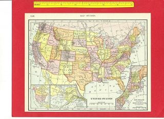
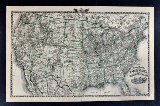
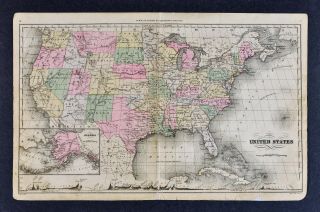
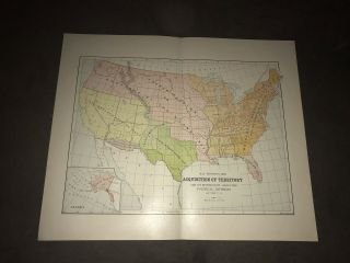
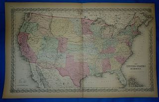
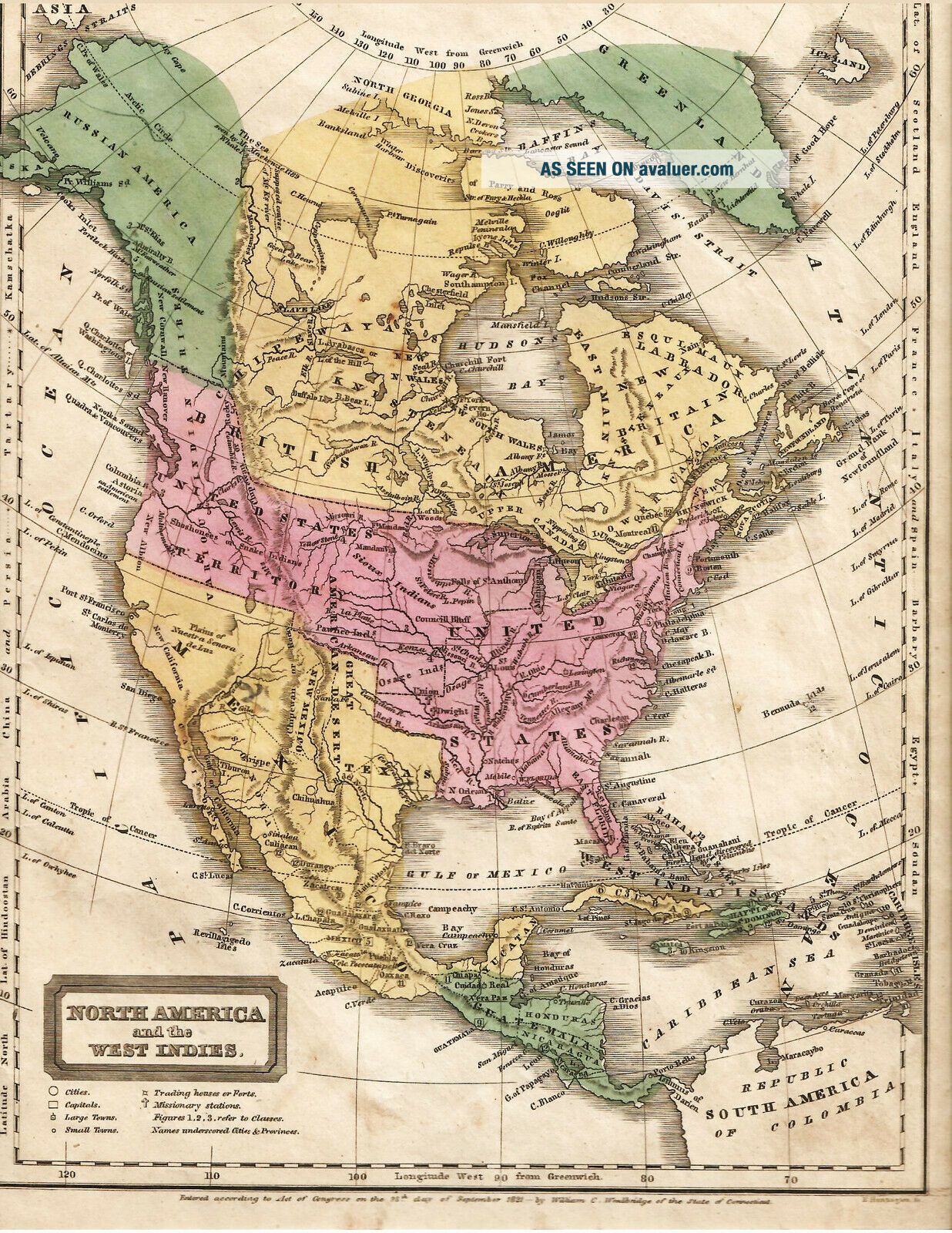
UP FOR AUCTION...WE OFFER THE FOLLOWING:THE UNITED STATES AND THE TERRITORIES1821Note: We only offer genuine period historical items, no worthless reproductions., all our items are source material. Full genuine and fully guaranteed for the life of the item.Nicely hand colored in precise detail., showing how the United States appeared in the year of 1821., map by Woodbridge, good margins., Texas shown, the huge Oregon Territory and the roaming bands of I...ndians...with the vast nation of the Sioux. The country of Guatemala takes up most of Central America at this time. Please use the magnifier to see closer up and the condition, etc.  Light toning, no odors. Measures about 9 x 12", never folded, will be shipped flat and well packed.NOTE: We will gladly combine your winning items into one shipment to save you postage costs.A FRIENDLY NOTE ON SHIPPINGPlease note that I ship items as quickly as I can, we have a packing room all set up for me., I am a bit disabled from military service., some days are good, some days are not so good. There are times I cannot manage to pack up the winning orders, so there may be a day or two delay. Just to inform is all, please do not use this against me on the Ebay "star" system. Many thanks, and, Many thanks for the bidding.We carefully wrap items in bubble wrap, peanuts, and a sturdy box with tracking. Nothing will be injured in our style of packing. NOTE: If there is advertising below and a web link, this is NOT US, and we do not endorse any item that is being offered in those links. We offer only genuine items, no worthless copies or reprints or reproductions. [ However, the movie thumb nail is indeed ours, showing other items and if any current bidding ].OVERSEAS SHIPPING INFORMATIONWe do not ship to countries that have a high rate of postal loss including Greece Italy Spain Ukraine Portugal USSR Mexico, China, and that includes all African countries.  All the Middle East with the exception of Isarel,  without a $45 shipping charge for registered, signed, insurance. There are no exceptions.  Sorry this has to be inforced, we no longer can handle the losses.


    Similar items


  • Vintage 1895 Antique Color Map United States Includes Indian Territory 7.  5 " X 9 "

    Vintage 1895 Antique Color Map United States Includes Indian Territory 7. 5 " X 9 "

  • 1876 Warner Beers Railroad Map United States & Canada Indian Territory Ok Dakota

    1876 Warner Beers Railroad Map United States & Canada Indian Territory Ok Dakota

  • C 1889 Francis Mcnally Map United States Oklahoma Indian Territory Texas Alaska

    C 1889 Francis Mcnally Map United States Oklahoma Indian Territory Texas Alaska

  • Color 1891 Map United States Acquisition Of Territory By Hunt & Eaton

    Color 1891 Map United States Acquisition Of Territory By Hunt & Eaton

  • 1859 Colton

    1859 Colton ' S Atlas Map United States - Kanzas - Colora Territory Authentic

  • Vintage 1876 Atlas Map United States W/ Western Territories Old

    Vintage 1876 Atlas Map United States W/ Western Territories Old

  • Antique 1900 The United States & Its Possession Map

    Antique 1900 The United States & Its Possession Map

  • Vintage 1885 Map United States W/ Western Territories Old Antique

    Vintage 1885 Map United States W/ Western Territories Old Antique


    • You might also like


    • 1860 Mitchell Hand Colored Map Colorado,  Nebraska & Kansas - Civil War Era

      1860 Mitchell Hand Colored Map Colorado, Nebraska & Kansas - Civil War Era

    • 18th Century French Map Of North America

      18th Century French Map Of North America

    • Las Vegas Nevada Vintage 1967 Us Geological Survey Quadrangle Map 4 Panels

      Las Vegas Nevada Vintage 1967 Us Geological Survey Quadrangle Map 4 Panels

    • Rare Antique 1845 Maps United States Exploring Expedition Book Antartica Hawaii

      Rare Antique 1845 Maps United States Exploring Expedition Book Antartica Hawaii

    • Vintage 1926 Map Hollywood From The Best Surveys Of The Time

      Vintage 1926 Map Hollywood From The Best Surveys Of The Time

    • American Continent (western Hemisphere) 1747 Bowen Antique Copper Engraved Map

      American Continent (western Hemisphere) 1747 Bowen Antique Copper Engraved Map

    • Gulf Coast Florida Texas United States 1705 De Fer Unusual Antique Engraved Map

      Gulf Coast Florida Texas United States 1705 De Fer Unusual Antique Engraved Map

    • California As Island United States 1700 De Fer Unusual First Edition Antique Map

      California As Island United States 1700 De Fer Unusual First Edition Antique Map

Avaluer          About Us          Privacy Policy          Contact Us          UP
© 2022, avaluer.net, Inc. or its affiliates