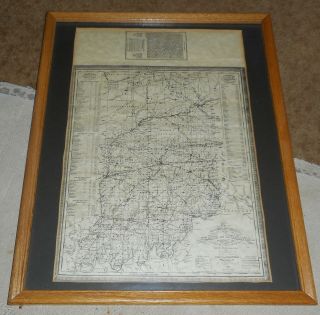
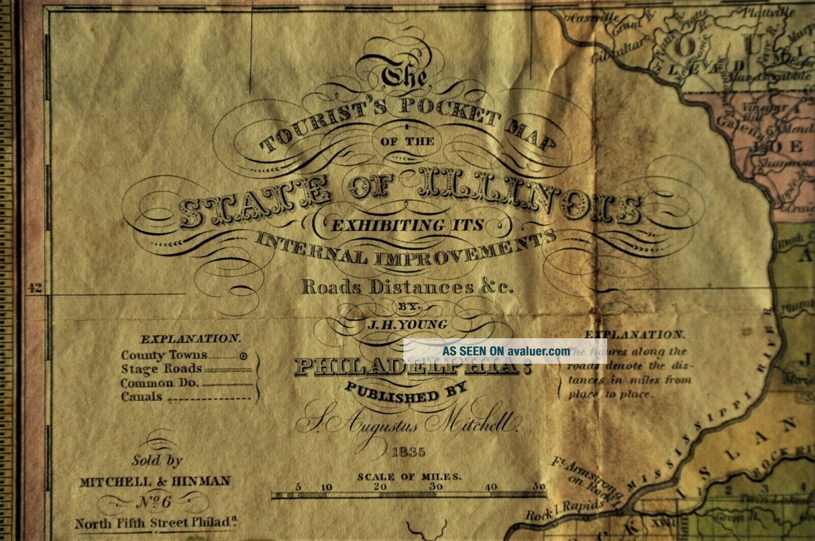
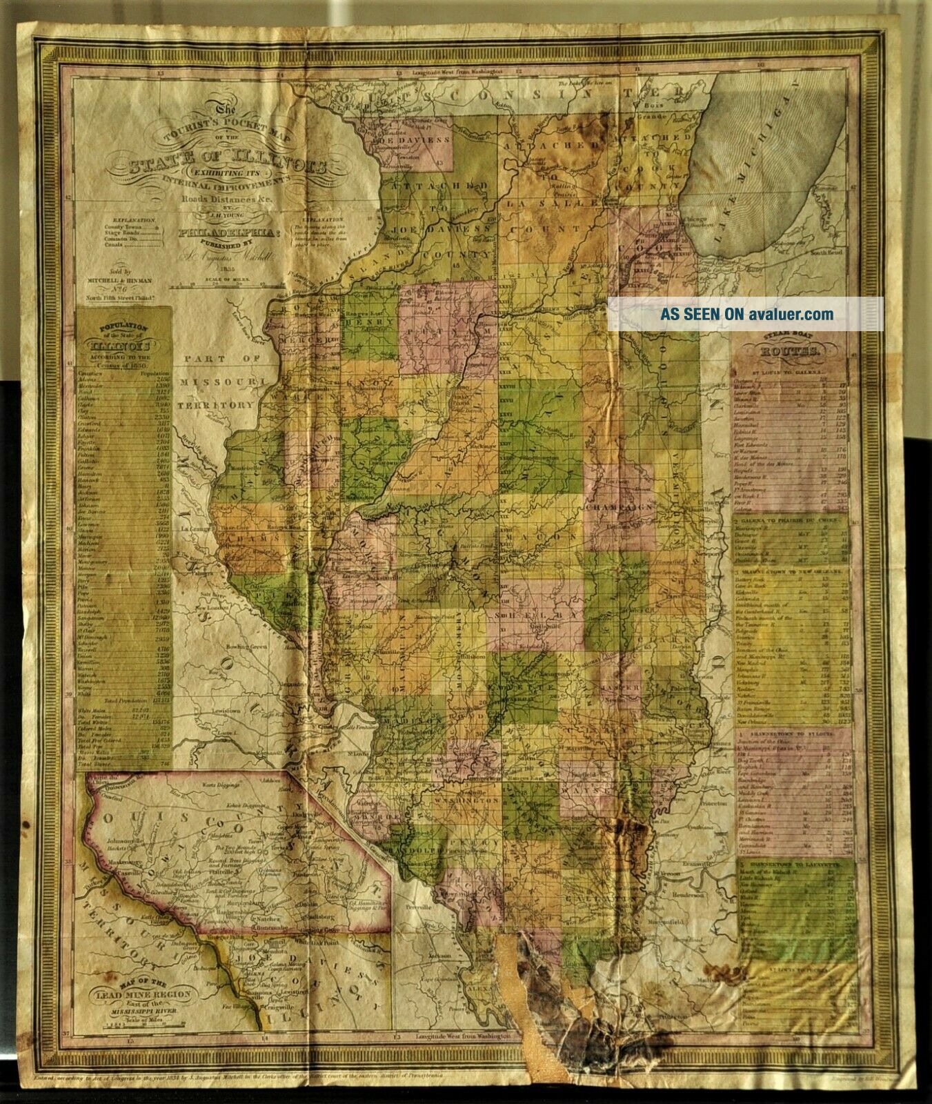
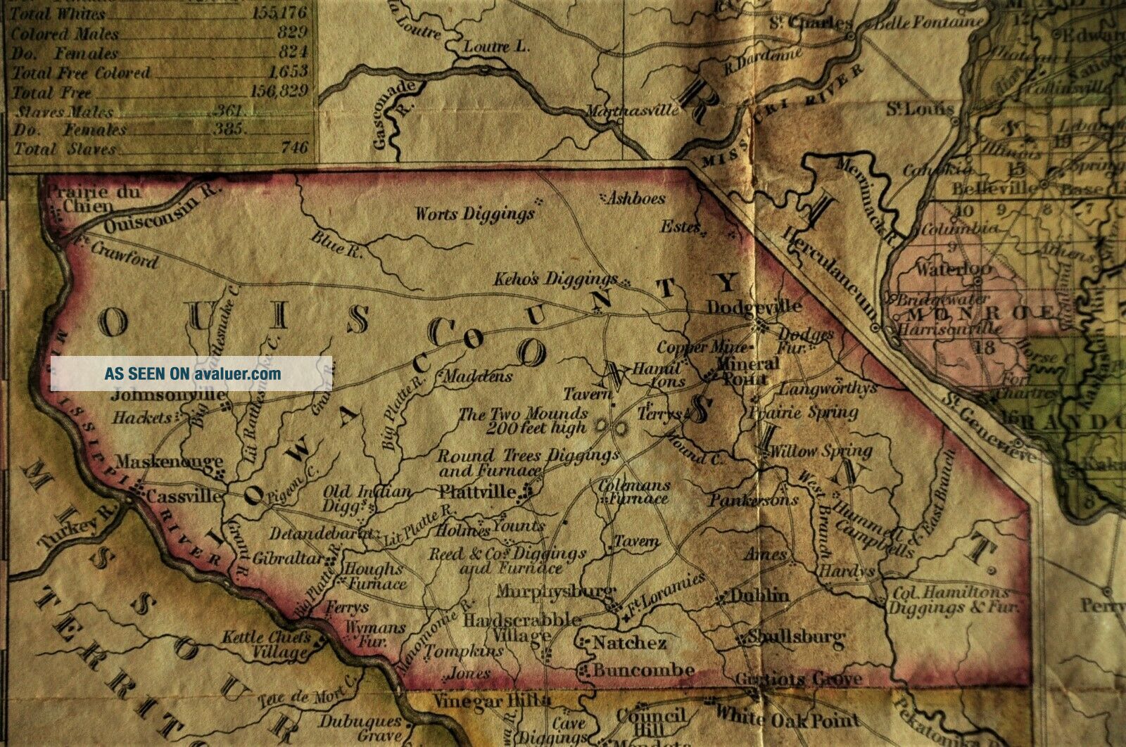
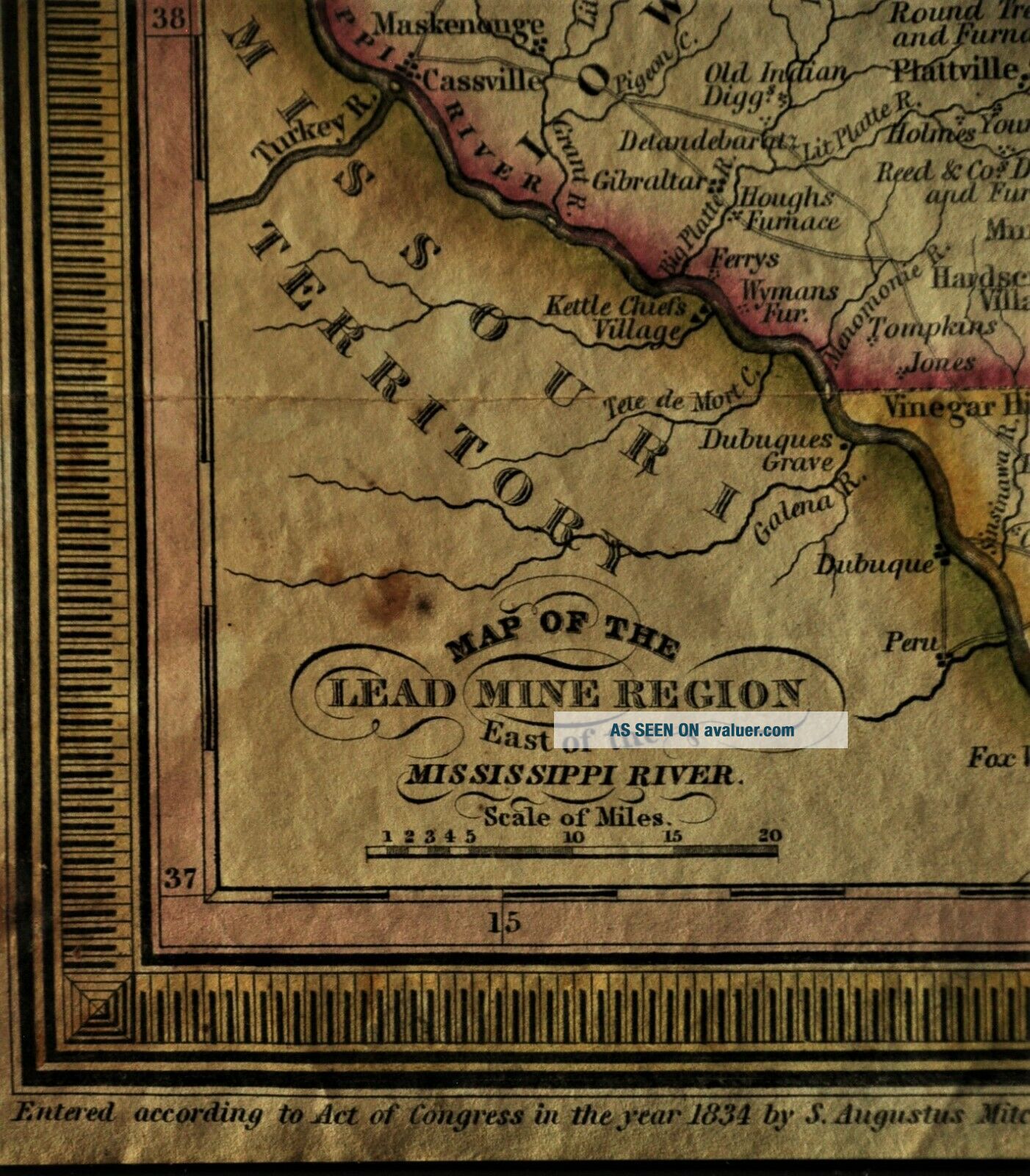
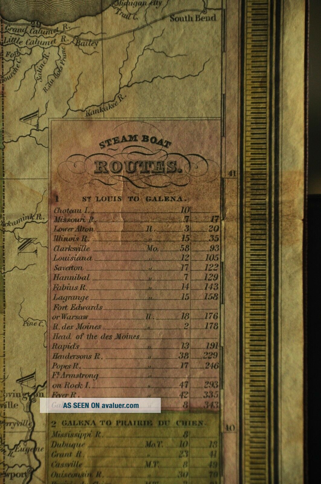
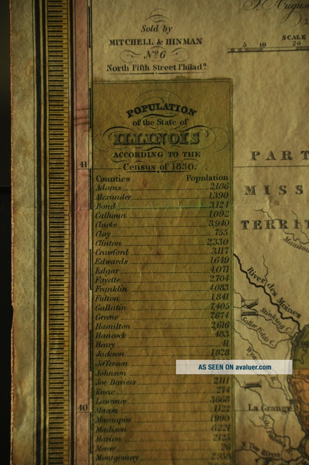
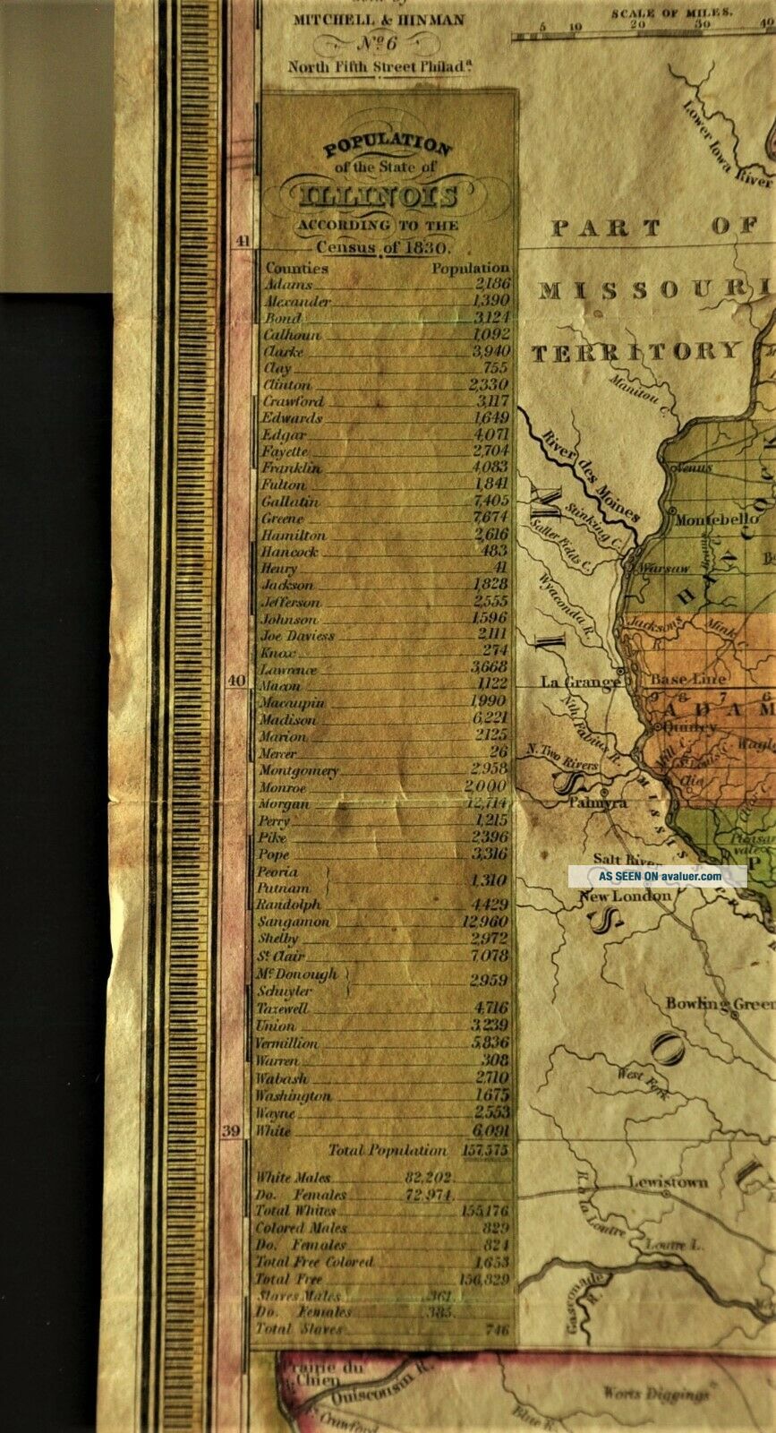
1835 Tourist ' S Pocket Map Of Illinois; Steam Boat Routes; Lead Mines; Population


Item History & Price

Information:
Reference Number: Avaluer:42125Year: 1835
Date Range: 1800-1899Type: Pocket
US State: IllinoisOriginal/Reproduction: Antique Original
Original Description:
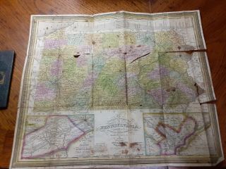
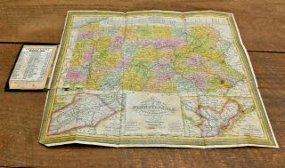
1835 Tourist's Pocket Map of Illinois; Steam Boat Routes; Lead Mines; Population. This map was used by James O Crosby when he ventured through the eastern states toward the western territories in 1850. Crosby was a respected lawyer in Garnavillo, Iowa from 1856 until his death in 1920. This map is in very good condition with some minor damage at the bottom center. See the photos for complete condition.The size of the map is 13 inches wide by 15.5 inches high.Some interesting featu...res are:Population of the state of Illinois according to the census of 1830Map of the Lead Mine Region east of the MississippiSteam Boat Routes The Wisconsin Territory is spelled Ouisconsin
The wonderful original colors are well preserved. I have tried my best to show the colors as they are in the photos above.The map has been stored away in the Garnavillo Museum for many years and would like to see the light of day in a home where it will be admired and cared for.All proceeds will go back to the museum for continuing historical projects.


    Similar items


  • 1835 Tourist

    1835 Tourist ' S Pocket Map Of The State Of Indiana J Augustus Mitchell Framed

  • Mitchell

    Mitchell ' S 1831 Tourist ' S Pocket Map Of Pennsylvania With Leather Booklet

  • L500 - Antique 1837 Tourist

    L500 - Antique 1837 Tourist ' S Pocket Map Of Pennsylvania - Published By Mitchell

  • 1910 Denny

    1910 Denny ' S Pocket Map Of Marin County / Mt. Tamalpais Folds Out To 28 ' X 33 "

  • 1905 Denny

    1905 Denny ' S Pocket Map Of Mendocino - Lake County - Ca - - Rare

  • 1933 Fisherman

    1933 Fisherman ' S Pocket Map Of River Dee - Maude Parker, Bartholomew, On Cloth

  • Scarce 1839 Tourist

    Scarce 1839 Tourist ' S Pocket Map For Michigan By J. H. Young Philadelphia

  • Mitchell

    Mitchell ' S Tourist ' S Pocket Map 1849 Pennsylvania Antique Map


    • You might also like


    • 1860 Mitchell Hand Colored Map Colorado,  Nebraska & Kansas - Civil War Era

      1860 Mitchell Hand Colored Map Colorado, Nebraska & Kansas - Civil War Era

    • 18th Century French Map Of North America

      18th Century French Map Of North America

    • Las Vegas Nevada Vintage 1967 Us Geological Survey Quadrangle Map 4 Panels

      Las Vegas Nevada Vintage 1967 Us Geological Survey Quadrangle Map 4 Panels

    • Rare Antique 1845 Maps United States Exploring Expedition Book Antartica Hawaii

      Rare Antique 1845 Maps United States Exploring Expedition Book Antartica Hawaii

    • Vintage 1926 Map Hollywood From The Best Surveys Of The Time

      Vintage 1926 Map Hollywood From The Best Surveys Of The Time

    • American Continent (western Hemisphere) 1747 Bowen Antique Copper Engraved Map

      American Continent (western Hemisphere) 1747 Bowen Antique Copper Engraved Map

    • Gulf Coast Florida Texas United States 1705 De Fer Unusual Antique Engraved Map

      Gulf Coast Florida Texas United States 1705 De Fer Unusual Antique Engraved Map

    • California As Island United States 1700 De Fer Unusual First Edition Antique Map

      California As Island United States 1700 De Fer Unusual First Edition Antique Map

Avaluer          About Us          Privacy Policy          Contact Us          UP
© 2022, avaluer.net, Inc. or its affiliates