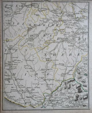
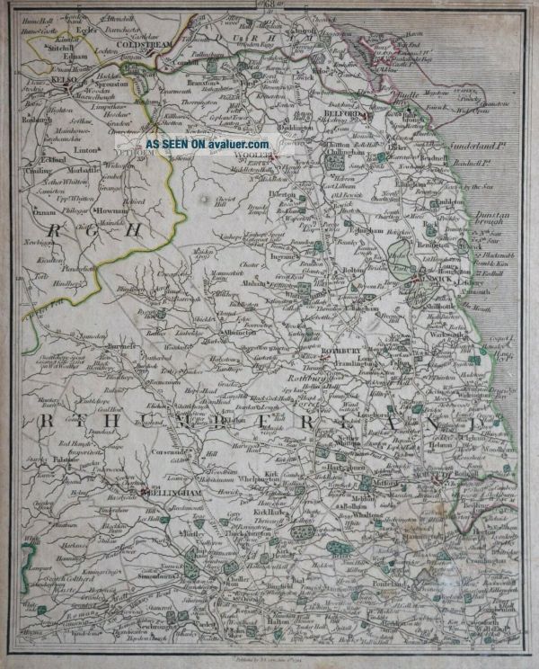
NORTHUMBERLAND - SCOTTISH BORDERS FOR CARY ' S MAP OF ENGLAND AND WALES, 1794


Item History & Price

Information:
Reference Number: Avaluer:42505013
Original Description:
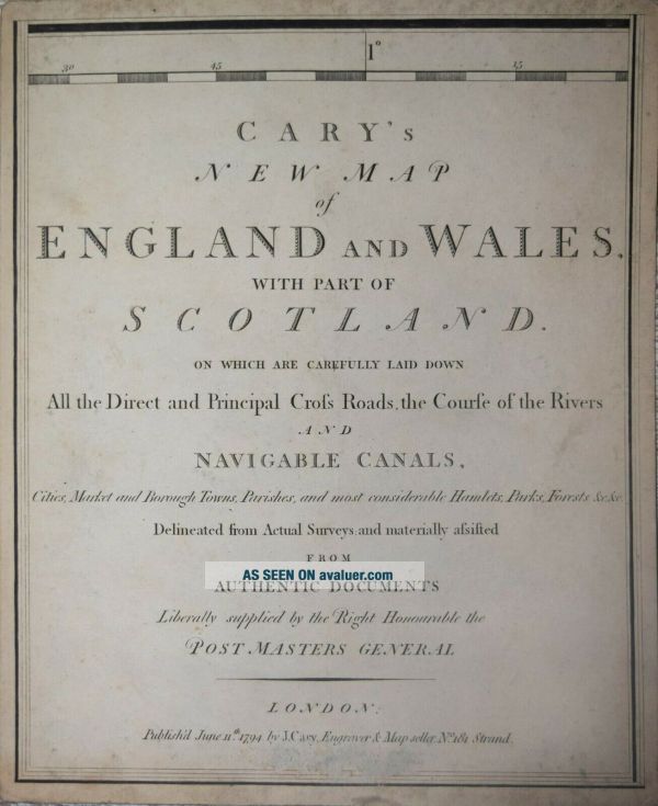
NO TITLE -  NORTHUMBERLAND - SCOTTISH BORDERS.  Detailed copper line engraving produced for Cary's "New Map of England and Wales with part of Scotland"... The present map is sheet 68. Published London 1794. A copy of the title page will be sent with the map..Measures approx. 260 x 210 mm. See photo for condition. Good condition, on heavy card. Original hand colour. A guaranteed genuine antique map.


    Similar items


  • Rare Antique Travel Book 1835 Rambles In Northumberland & Scottish Borders

    Rare Antique Travel Book 1835 Rambles In Northumberland & Scottish Borders

  • Selkirkshire - Peebles - Moffat For Cary

    Selkirkshire - Peebles - Moffat For Cary ' S Map Of England And Wales, 1794

  • Ww1 British Victory Medal Mcdonald Kia 6th King

    Ww1 British Victory Medal Mcdonald Kia 6th King ' S Own Scottish Borderers

  • Great Britain - Wwi Pair - King

    Great Britain - Wwi Pair - King ' S Own Scottish Borderers Pte. Wallace (bg117)

  • King

    King ' S Own Scottish Borderers White Metal Cap Badge Post Ww2 Qc

  • The King

    The King ' S Own Scottish Borderer ' S Regimental Brooch, Silver Plate, Wwi Or Wwii

  • 1988 Dewar

    1988 Dewar ' S White Label Scotch Ad - Scottish Border Collies

  • The King

    The King ' S Own Scottish Borderers " Sentry No 1 K. O. S. B. " Postcard


    • You might also like


    • Hungary & Romania 1579 (1584) Ortelius Unusual Antique Copper Engraved Map

      Hungary & Romania 1579 (1584) Ortelius Unusual Antique Copper Engraved Map

    • Brussels Bruxelles Belfium 1777 De Ferraris & Dupuis Large Antique Map Sheet Xxi

      Brussels Bruxelles Belfium 1777 De Ferraris & Dupuis Large Antique Map Sheet Xxi

    • 1616 Atlas Map Of Iceland.

      1616 Atlas Map Of Iceland.

    • Kazan Russia 1767 Le Clerc/lespinasse Antique Copper Engraved City View

      Kazan Russia 1767 Le Clerc/lespinasse Antique Copper Engraved City View

    • 1899 Stanford,  Folding Map Of Norwich,  Norfolk,  Arthur Collins,  Jarrold & Sons,

      1899 Stanford, Folding Map Of Norwich, Norfolk, Arthur Collins, Jarrold & Sons,

    • 1948 Vintage Linen Colour Map Geological Survey Ten Mile Of Great Britain

      1948 Vintage Linen Colour Map Geological Survey Ten Mile Of Great Britain

    • 1944 Map Flying Bombs Sussex Ww2 Newspaper Military Kent Courier German V1 V2

      1944 Map Flying Bombs Sussex Ww2 Newspaper Military Kent Courier German V1 V2

    • Dated 1638 Vellum Map Of Icklesham Sussex Showing Land Uses Owners Etc

      Dated 1638 Vellum Map Of Icklesham Sussex Showing Land Uses Owners Etc

Avaluer          About Us          Privacy Policy          Contact Us          UP
© 2022, avaluer.net, Inc. or its affiliates