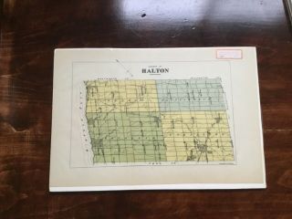
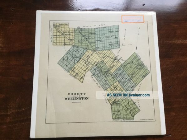
Antique Map, Burland Litho, County Of Wellington, Ontario, Canada, 1800’s


Item History & Price

Information:
Reference Number: Avaluer:42722322Canadian Province: Ontario
Year: 1800Type: County Map
Country/Region: Canada
Original Description:
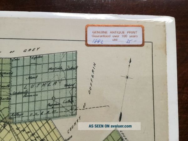
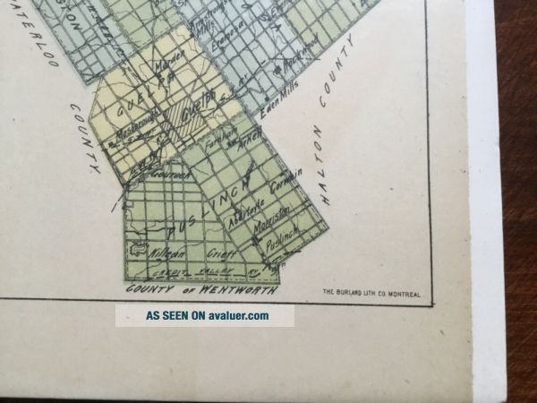
Antique lithograph By The Burland lithography Co, Montreal Canada County of WellingtonPrint is laying on a spongy type board. Wrapped in plastic.Has a couple creases and folds. Paper has yellowed. Some pages from a book detailing the time on back. Label sticker on plastic reads 1882, but I don’t know if that’s correct.Measures approx 9 1/4 by 9 3/4 inches.As seen in pictures.
Any questions please feel free to ask.Shipping is calculated by buyers location via Canad...a post.


    Similar items


  • Antique Map,  Burland Litho,  County Of Halton,  Ontario,  Canada,  1800’s

    Antique Map, Burland Litho, County Of Halton, Ontario, Canada, 1800’s

  • 1836 Moule Antique Map The English County Of Berkshire

    1836 Moule Antique Map The English County Of Berkshire

  • Antique Map 1850 England County Of Monmouthshire Map (21x27cm)

    Antique Map 1850 England County Of Monmouthshire Map (21x27cm)

  • 1742 An Antique Printed Map For The County Of Cornwall England Rare

    1742 An Antique Printed Map For The County Of Cornwall England Rare

  • 1908 Maps Showing The Counties Of Maryland,  Johns Hopkins Press 10” X 8”

    1908 Maps Showing The Counties Of Maryland, Johns Hopkins Press 10” X 8”

  • One (1) 1923 Rand Mcnally Map,  City And County Of San Francisco

    One (1) 1923 Rand Mcnally Map, City And County Of San Francisco

  • Antique Map 1875 - North Part Of Mishawaka/st.  Joseph County,  Indiana /hist Atlas

    Antique Map 1875 - North Part Of Mishawaka/st. Joseph County, Indiana /hist Atlas

  • 1673 Blome Atlas 1st Edition County Map Cornwall - England - County Of Cornwal

    1673 Blome Atlas 1st Edition County Map Cornwall - England - County Of Cornwal


    • You might also like


    • 1860 Mitchell Hand Colored Map Colorado,  Nebraska & Kansas - Civil War Era

      1860 Mitchell Hand Colored Map Colorado, Nebraska & Kansas - Civil War Era

    • 18th Century French Map Of North America

      18th Century French Map Of North America

    • Las Vegas Nevada Vintage 1967 Us Geological Survey Quadrangle Map 4 Panels

      Las Vegas Nevada Vintage 1967 Us Geological Survey Quadrangle Map 4 Panels

    • Rare Antique 1845 Maps United States Exploring Expedition Book Antartica Hawaii

      Rare Antique 1845 Maps United States Exploring Expedition Book Antartica Hawaii

    • Vintage 1926 Map Hollywood From The Best Surveys Of The Time

      Vintage 1926 Map Hollywood From The Best Surveys Of The Time

    • American Continent (western Hemisphere) 1747 Bowen Antique Copper Engraved Map

      American Continent (western Hemisphere) 1747 Bowen Antique Copper Engraved Map

    • Gulf Coast Florida Texas United States 1705 De Fer Unusual Antique Engraved Map

      Gulf Coast Florida Texas United States 1705 De Fer Unusual Antique Engraved Map

    • California As Island United States 1700 De Fer Unusual First Edition Antique Map

      California As Island United States 1700 De Fer Unusual First Edition Antique Map

Avaluer          About Us          Privacy Policy          Contact Us          UP
© 2022, avaluer.net, Inc. or its affiliates