USGS BLM Edition Topographic Map Florida GAINESVILLE NE/4 1983 - Mineral - 100K
Item History & Price
USGS BLM edition topographic map Florida GAINESVILLE NE/4 1983 - mineral - 100K
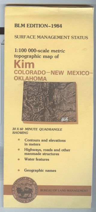
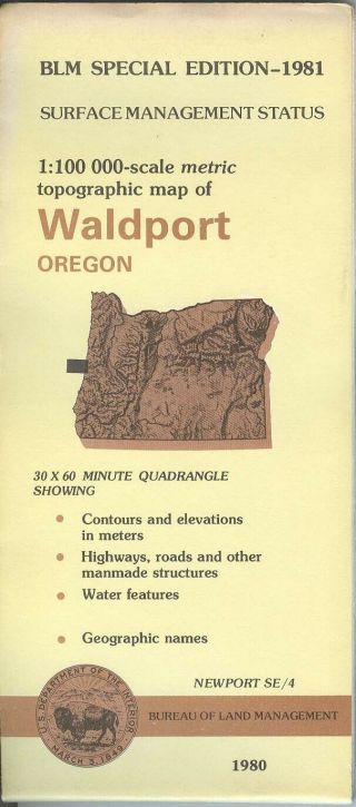
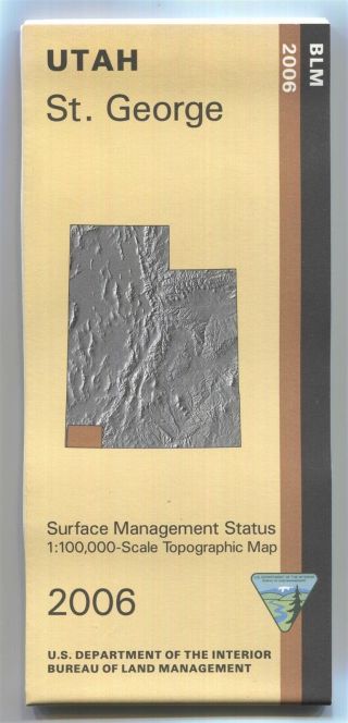
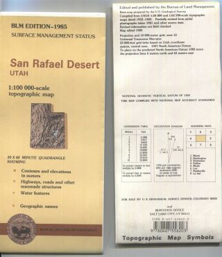
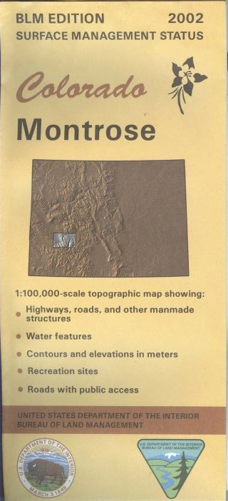
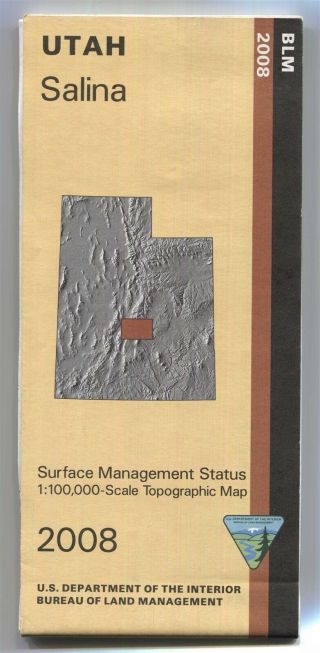
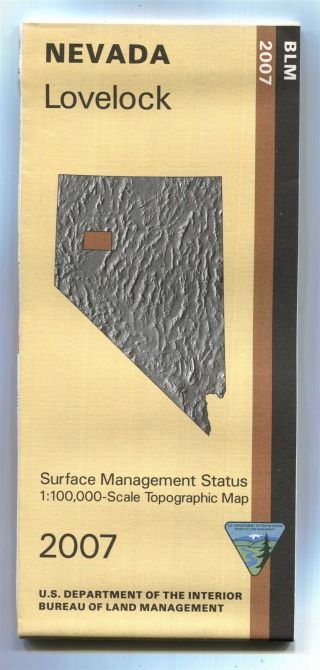
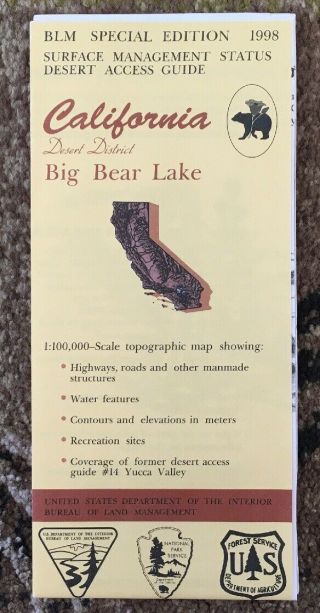
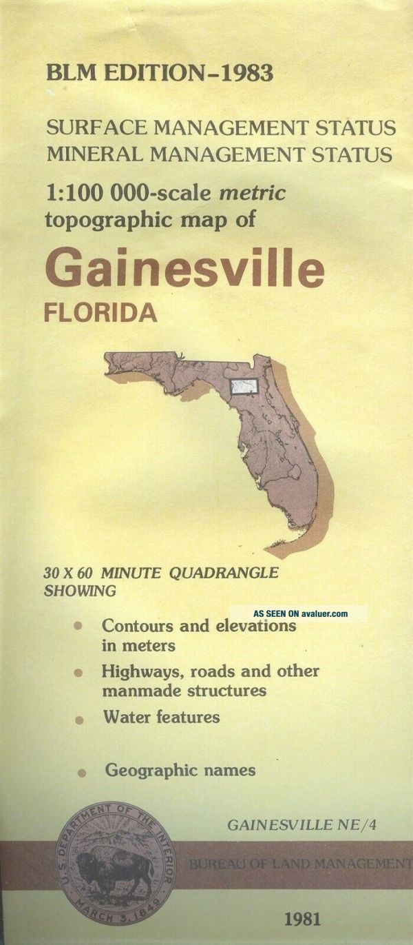
One Printed Map Sheet that is production folded. Paper Single-sidedCONDITION: Old Map Store Stock: Unsold & Unused. Bio-predation & Oxidation (aging, age discoloration).Map Publisher: United States of America Department of the Interior BUREAU OF LAND MANAGEMENT (BLM) edition from US Geological Survey (USGS) Base Map Unique Pictures of the actual item available in this listing. When folded the map... measures approximately 4 inches by 9 inches. Please note that the map name does not represent the political boundaries of that name. About a 30 X 60 minute (½° by 1° degree) Quadrangle 1:100, 00-scale topographic map showing: Contours and elevations in meters Highways, roads, and other manmade structures Water features Recreation Sites Maps are Metric, but most maps show about 5/8 inch = 1 mile In general, 1 centimeter on the map represents about 1 kilometer on the ground. Most of this maps in this BLM series also has a grid to measure feet and miles as well as metric meters and kilometers. The Bureau of Land Management describes a "SURFACE MANAGEMENT MAP" as: This series of maps distinguishes land administration by color and includes public and private lands, roads, water features, township and range, and more. These maps are helpful to hunters, target shooters, recreationists, and individuals seeking to file mining claims or conduct business on public lands. Please note that land ownership & use may have changed since the map was printed.
All of my maps are vintage. Maps are intended for historical & collection use, not for navigation.
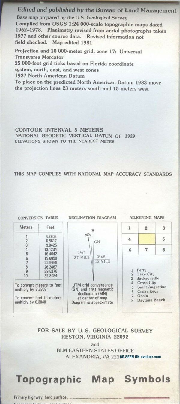
THIS ITEM IS ON-HAND AND READY TO SHIP TO THE LUCKY WINNER DIRECTLY FROM US! General Information About USGS BLM Edition Maps: Typically come in two formats: Surface Management Status (only) Surface & Mineral Management StatusOn the front title panel there is a picture of the state. There is a rectangle on that map that shows the area covered by the map. USGS topographic map usually is named for the most prominent feature within the bounds of the map, which frequently is a community, town, or city. The name given a map can be based on that or a big mountain or big creek or something else that is in the area covered by the map. Map names are not political boundaries or a geographical area name, in other words in may not cover the entire community, city, town or whatever it's named after. The map covers a specific amount of area. Map names usually don't change, but community or features names change constantly. A communities area may also change boundaries as well but the map name may not change. When a map covers multiple states a map's primary state is the state that contains the name feature, which is not always the same as the state that has most of the map area. One may need several maps to cover the desired area like a city or hiking trail. On the back of USGS maps their is usually a box that shows the map names of the adjoining maps. Typically that map at hand, the one being looked at, is in the center box. All of my USGS-BLM Edition maps are original prints from the US Government. The USGS stopped traditional methods of surveying and updating topographic maps based on aerial photography and field checks in 2008. USGS-BLM Edition maps usually are in the scale 1:100, 000 (1/100, 000). The scale 1:100, 000 (metric) - 30 minutes by 60 minutes. One centimeter on the map represents one kilometer of distance on the ground. One inch is about 1.6 miles. 1 kilometer (km) = 0.62137 miles (mi). Covers about 1, 568 to 2, 240 square miles depending up the longitude & latitude location.
The world, Earth as we know it, is not flat and not two-dimensional. It is sort of a sphere; round and three-dimensional. Printed Topographic Maps convert this sphere curvature to a flat, 2D piece of paper as a rectangular quadrangle.
The United States Geological Survey (USGS) is a bureau of the United States Department of the Interior (USDI). Latitude and Longitude along with Seconds, Minutes, and Degrees is a physical measurements. Inches, feet, miles, centimeters, . kilometers, et cetera are flat measurements. USGS maps help to co-ordinate between the two. Topographic maps have contour lines which give the elevation of the land. Some BLM maps have these, some do not. Both the Bureau of Land Mangement (BLM) and the United States Geological Survey (USGS) are under the U.S. Department of the Interior (DOI) of the US Government of the United States of America, Planet Earth. OC Map Store International Buyers & Shipping to non-USA addresses Please Note: Customs / Import duties, taxes, and charges are not included in the item price or shipping charges. These charges are the buyer’s responsibility. Please check with your country's customs office to determine what these additional costs will be prior to bidding/buying. In some situations some items are not allowed to be sent to your country because of the buyers import laws, buyers please check that an item is allowed to be sent to your country. These charges are normally collected by the shipping delivering freight company or when you pick the item up. Do not confuse them for additional shipping charges from me. The amount reported to Customs for merchandise value is the amount of the items plus the amount of shipping We do not mark merchandise values below value or mark items as "gift" - US and International government regulations prohibit such behavior. ID: map0989
Powered by SixBit's eCommerce Solution
00120
One Printed Map Sheet that is production folded. Paper Single-sidedCONDITION: Old Map Store Stock: Unsold & Unused. Bio-predation & Oxidation (aging, age discoloration).Map Publisher: United States of America Department of the Interior BUREAU OF LAND MANAGEMENT (BLM) edition from US Geological Survey (USGS) Base Map Unique Pictures of the actual item available in this listing. When folded the map... measures approximately 4 inches by 9 inches. Please note that the map name does not represent the political boundaries of that name. About a 30 X 60 minute (½° by 1° degree) Quadrangle 1:100, 00-scale topographic map showing: Contours and elevations in meters Highways, roads, and other manmade structures Water features Recreation Sites Maps are Metric, but most maps show about 5/8 inch = 1 mile In general, 1 centimeter on the map represents about 1 kilometer on the ground. Most of this maps in this BLM series also has a grid to measure feet and miles as well as metric meters and kilometers. The Bureau of Land Management describes a "SURFACE MANAGEMENT MAP" as: This series of maps distinguishes land administration by color and includes public and private lands, roads, water features, township and range, and more. These maps are helpful to hunters, target shooters, recreationists, and individuals seeking to file mining claims or conduct business on public lands. Please note that land ownership & use may have changed since the map was printed.
All of my maps are vintage. Maps are intended for historical & collection use, not for navigation.
THIS ITEM IS ON-HAND AND READY TO SHIP TO THE LUCKY WINNER DIRECTLY FROM US! General Information About USGS BLM Edition Maps: Typically come in two formats: Surface Management Status (only) Surface & Mineral Management StatusOn the front title panel there is a picture of the state. There is a rectangle on that map that shows the area covered by the map. USGS topographic map usually is named for the most prominent feature within the bounds of the map, which frequently is a community, town, or city. The name given a map can be based on that or a big mountain or big creek or something else that is in the area covered by the map. Map names are not political boundaries or a geographical area name, in other words in may not cover the entire community, city, town or whatever it's named after. The map covers a specific amount of area. Map names usually don't change, but community or features names change constantly. A communities area may also change boundaries as well but the map name may not change. When a map covers multiple states a map's primary state is the state that contains the name feature, which is not always the same as the state that has most of the map area. One may need several maps to cover the desired area like a city or hiking trail. On the back of USGS maps their is usually a box that shows the map names of the adjoining maps. Typically that map at hand, the one being looked at, is in the center box. All of my USGS-BLM Edition maps are original prints from the US Government. The USGS stopped traditional methods of surveying and updating topographic maps based on aerial photography and field checks in 2008. USGS-BLM Edition maps usually are in the scale 1:100, 000 (1/100, 000). The scale 1:100, 000 (metric) - 30 minutes by 60 minutes. One centimeter on the map represents one kilometer of distance on the ground. One inch is about 1.6 miles. 1 kilometer (km) = 0.62137 miles (mi). Covers about 1, 568 to 2, 240 square miles depending up the longitude & latitude location.
The world, Earth as we know it, is not flat and not two-dimensional. It is sort of a sphere; round and three-dimensional. Printed Topographic Maps convert this sphere curvature to a flat, 2D piece of paper as a rectangular quadrangle.
The United States Geological Survey (USGS) is a bureau of the United States Department of the Interior (USDI). Latitude and Longitude along with Seconds, Minutes, and Degrees is a physical measurements. Inches, feet, miles, centimeters, . kilometers, et cetera are flat measurements. USGS maps help to co-ordinate between the two. Topographic maps have contour lines which give the elevation of the land. Some BLM maps have these, some do not. Both the Bureau of Land Mangement (BLM) and the United States Geological Survey (USGS) are under the U.S. Department of the Interior (DOI) of the US Government of the United States of America, Planet Earth. OC Map Store International Buyers & Shipping to non-USA addresses Please Note: Customs / Import duties, taxes, and charges are not included in the item price or shipping charges. These charges are the buyer’s responsibility. Please check with your country's customs office to determine what these additional costs will be prior to bidding/buying. In some situations some items are not allowed to be sent to your country because of the buyers import laws, buyers please check that an item is allowed to be sent to your country. These charges are normally collected by the shipping delivering freight company or when you pick the item up. Do not confuse them for additional shipping charges from me. The amount reported to Customs for merchandise value is the amount of the items plus the amount of shipping We do not mark merchandise values below value or mark items as "gift" - US and International government regulations prohibit such behavior. ID: map0989
Powered by SixBit's eCommerce Solution
00120