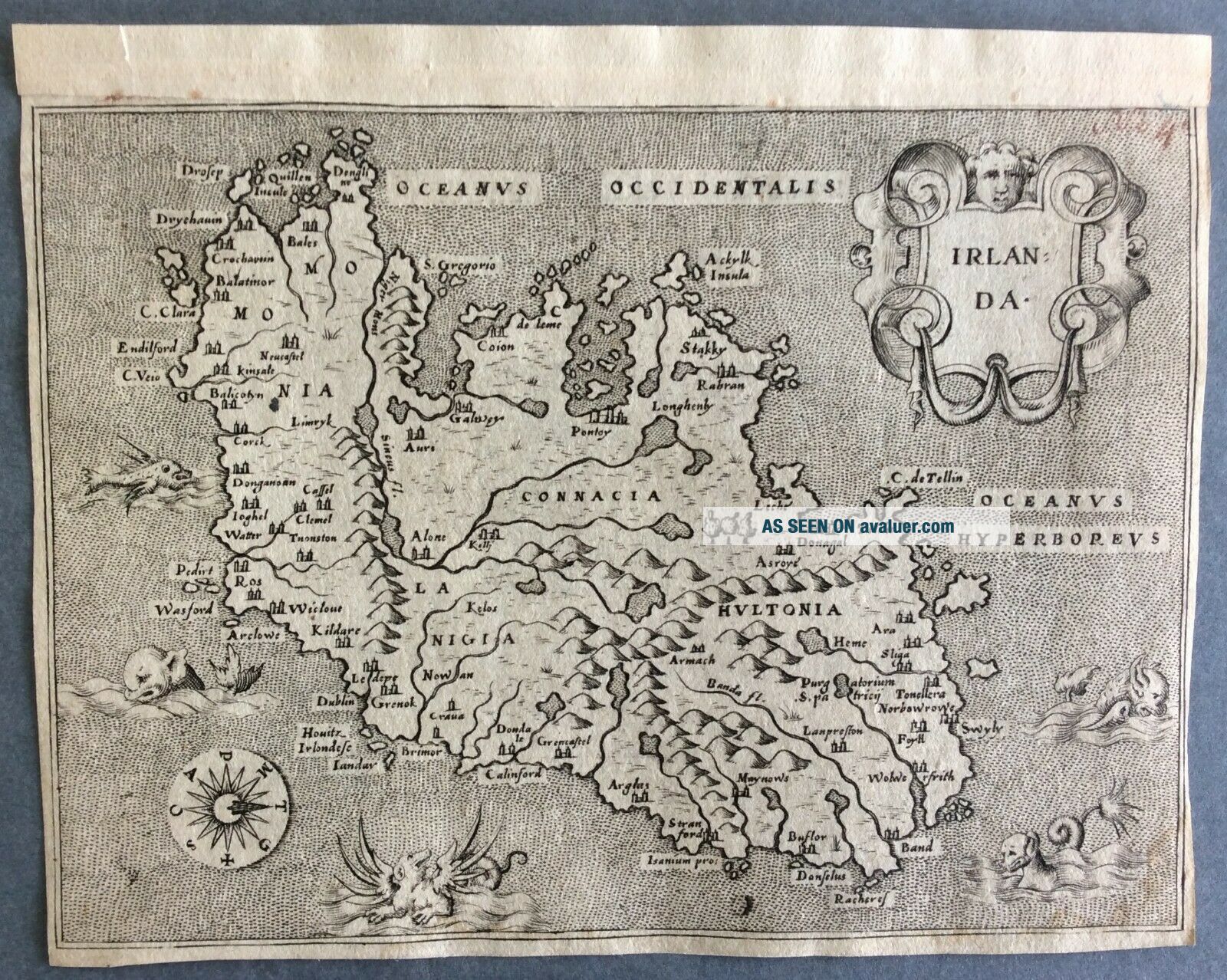
Rare C. 1572 Antique Map Of Ireland By Tomaso Porcacchi

Item History & Price
| Reference Number: Avaluer:42792 | Original/Reproduction: Antique Original |
| Country/Region: Ireland | Year: 1572 |
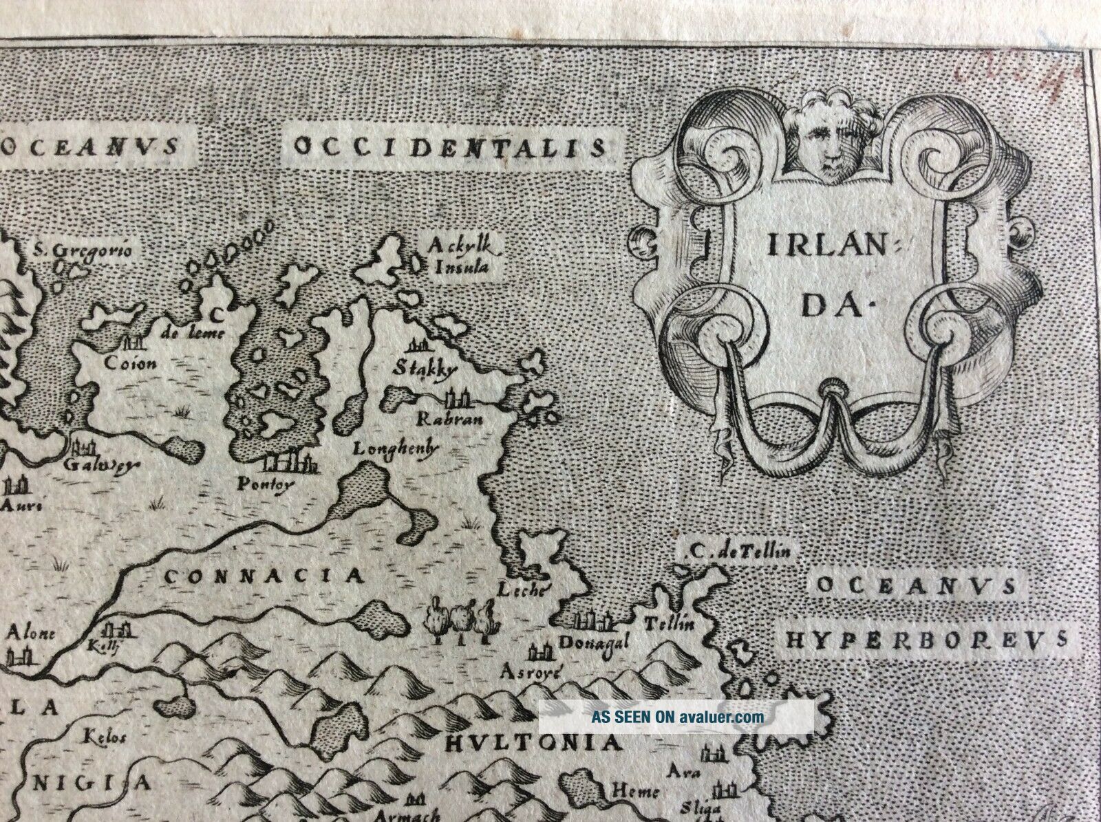
Irlanda
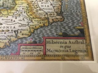
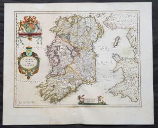
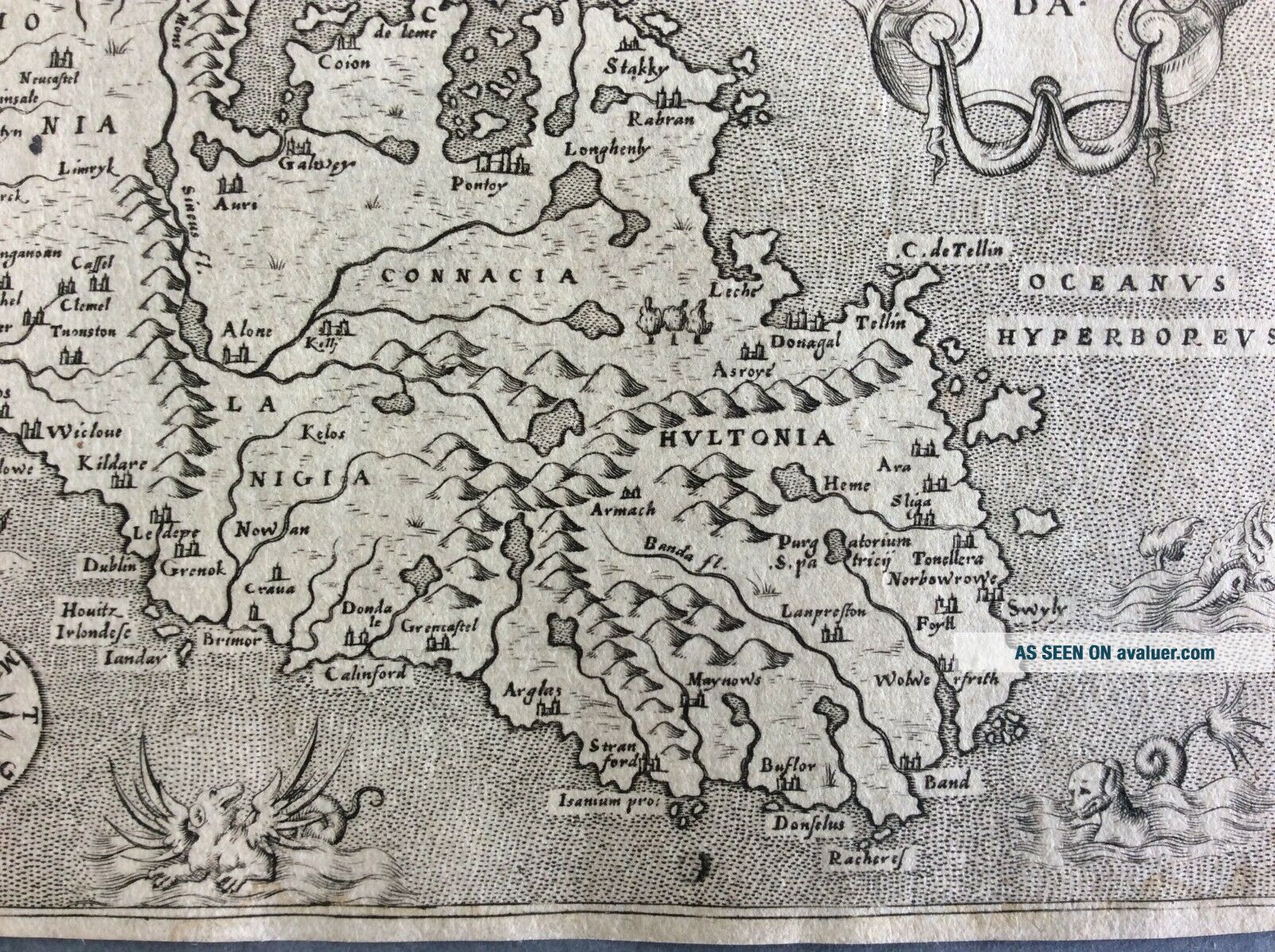
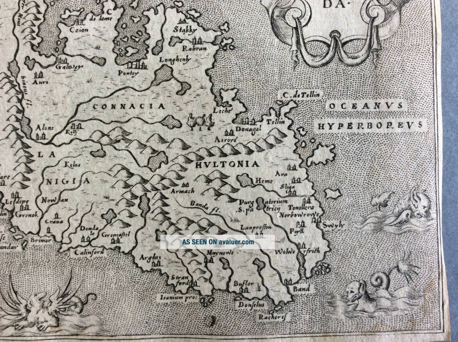
Quite beautiful small and rare antique copper engraved map of Ireland by Tomaso Porcacchi and engraved by Girolamo Porro.
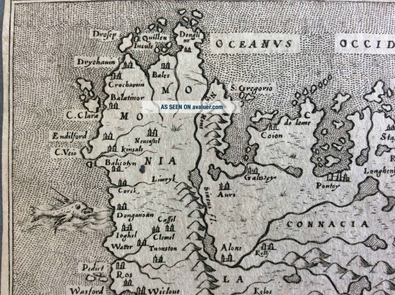
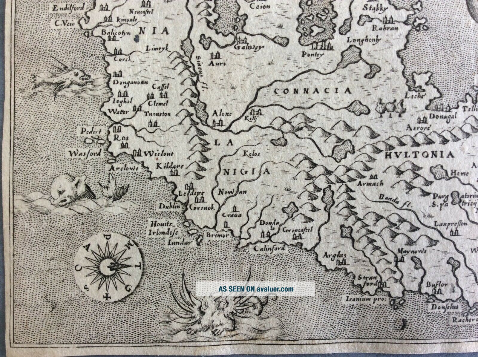
A very attractive small map of Ireland with north oriented to the right. The shape and geography of the country is quite rudimentary, with cities focused primarily along the coastline. First published in 1572 this map features a decorative title cartouche, compass rose and five sea monsters.
The map plate has been trimmed to the plate edge and has l...atin text on the verso.
Tommaso Porcacchi (1530-1585) was a prolific Italian writer, scholar, geographer and translator. Born to a poor family, Porcacchi was however able to study thanks to the patronage of Duke Cosimo I. While in Florence, Porcacchi met humanist L. Domenichi, thanks to whom he was able to publish his first works, a biography of Vergil and a translation of the Aeneid. Thanks to Domenichi's recommendations, Porcacchi became acquainted with influential publishers of the time. In 1559, he settled in Venice, where he remained until his death.
In Venice, Porcacchi published several geographical, historical and archaeological works, and also translated a number of texts from Greek to Latin. By publishing in the vernacular language as well, he showed his support for the Counter-Reformation. Among his scholarly works, most notable are his anthology of the islands (first published in 1572), a treatise on funerary practices and a collection of biographies of illustrious men.
Condition ReportIn a good/very good condition. Copper plate engraving on hand laid age toned paper. Trimmed to plate edge. Slight stain lower right hand corner. 3mm tear top left margin. Old pen marks top right and on verso. 14.3 x 11.3cm.
Quite beautiful small and rare antique copper engraved map of Ireland by Tomaso Porcacchi and engraved by Girolamo Porro.
A very attractive small map of Ireland with north oriented to the right. The shape and geography of the country is quite rudimentary, with cities focused primarily along the coastline. First published in 1572 this map features a decorative title cartouche, compass rose and five sea monsters.
The map plate has been trimmed to the plate edge and has l...atin text on the verso.
Tommaso Porcacchi (1530-1585) was a prolific Italian writer, scholar, geographer and translator. Born to a poor family, Porcacchi was however able to study thanks to the patronage of Duke Cosimo I. While in Florence, Porcacchi met humanist L. Domenichi, thanks to whom he was able to publish his first works, a biography of Vergil and a translation of the Aeneid. Thanks to Domenichi's recommendations, Porcacchi became acquainted with influential publishers of the time. In 1559, he settled in Venice, where he remained until his death.
In Venice, Porcacchi published several geographical, historical and archaeological works, and also translated a number of texts from Greek to Latin. By publishing in the vernacular language as well, he showed his support for the Counter-Reformation. Among his scholarly works, most notable are his anthology of the islands (first published in 1572), a treatise on funerary practices and a collection of biographies of illustrious men.
Condition ReportIn a good/very good condition. Copper plate engraving on hand laid age toned paper. Trimmed to plate edge. Slight stain lower right hand corner. 3mm tear top left margin. Old pen marks top right and on verso. 14.3 x 11.3cm.