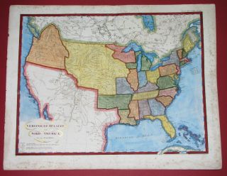
1803 Map AMERICAS Louisiana Florida Mexico United States Cuba Patagonia


Item History & Price
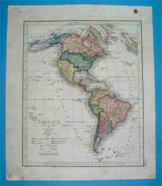
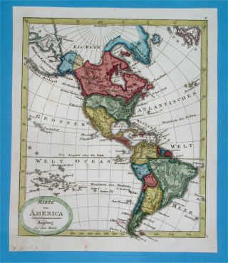
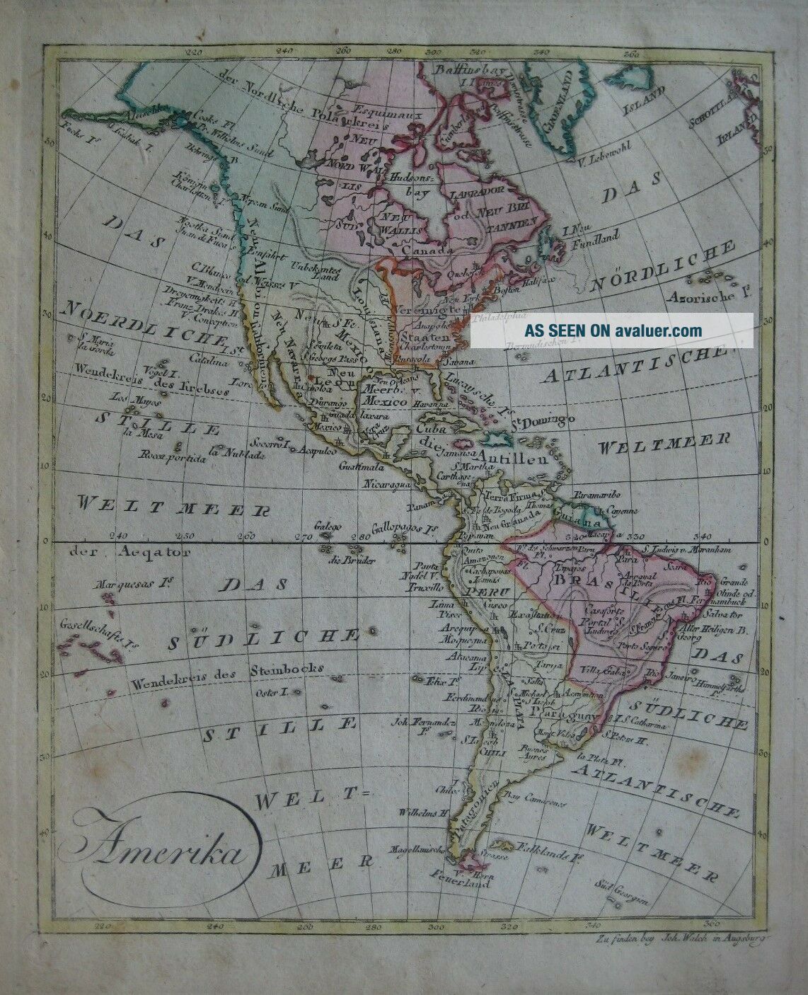
Antiquecopperplate engraved 1803 map of North and South America, in original hand color.The image area measures 22x 18 cm[8¾" x 7¼"], and the map is titled Amerikain decorativeswash lettering.
It depicts the United States prior to the LouisianaPurchase, with its western borderat the Mississippi River.
Florida is under control of Spain, Texas is part ofMexico, and a large areanorth of Missouri River is labeled "Unknown Land."
On the west coast the map labels New A...lbion, BajaCalifornia, and Catalina Island.
Named places and features in the West Indies and Centraland South America include the island of Santo Domingo, Patagonia, Cuba, Peru, Brazil, Guiana, Havana, Paraguay, New Granada, and Jamaica.
It also locates Bermuda, Greenland, a scattering of tiny islands in the Pacific Ocean, and Eskimo lands north of Hudson's Bay.
The map is printed on a sheet which measures 22 x 26.5 cm[8¾" x 10½"] and is blank on the back, with no printing on the reverse side.
It waspublished by Johann Walch, in his rare Allgemeiner Atlas Nachden bewährsten Hülfsmitteln…, Augsburg, Germany, 1803.
Condition: It is in very goodcondition, with no rips or tears. There are acouple of light spots and somefaint marginal soiling.Please see the scans, which include front and back views of the fullsheet, and feel free to ask anyquestions.
This is an original, authentic antique map, nota reproduction or modern reprint, and it is fully guaranteed to begenuine.
It would make a very handsome display in your den oroffice.It would also make a perfect gift, and we'll include our helpfulframing tips for your reference.
Buy with confidence! We are always happy to combineshipping onthe purchase of multiple items — just make sure to pay for everythingat one time, not individually.
Powered by SixBit's eCommerce Solution
01264