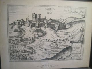
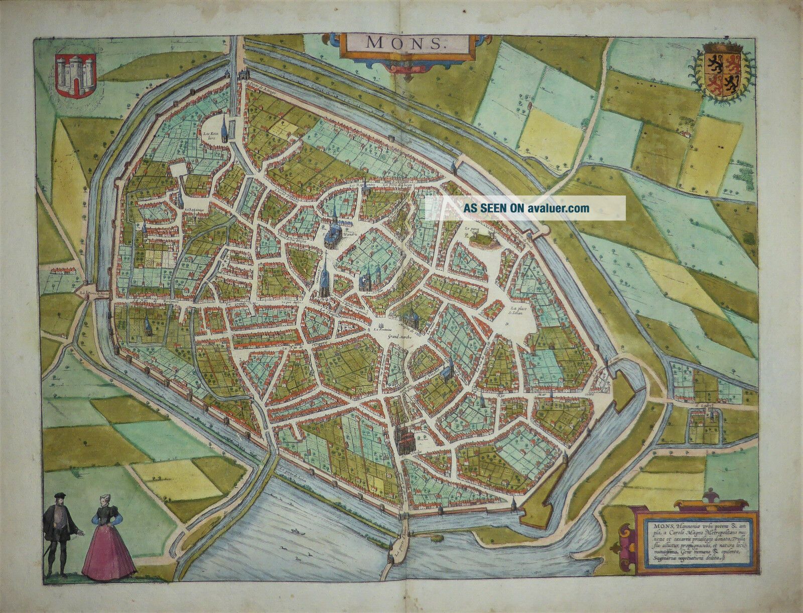
Birds Eye View Of Mons In Belgium By Georg Braun & Franz Hogenberg C1585


Item History & Price

Information:
Reference Number: Avaluer:43101Cartographer/Publisher: Georg Braun & Franz Hogenberg
Year: 1585Printing Technique: Copper Plate
City: MonsOriginal/Reproduction: Antique Original
Country/Region: Belgium
Original Description:
Fulltitles: Mons, Hannonia Urbs potens & ampla, a Carolo Magno, Metropolitano muneze et caesareis privilegijs donata, ByGeorg Braun, and Franz Hogenberg Publishedin Cologne 1585 Agenuine antique map over 430 years old Afine copper engraved map of the city of Mons in Belgium, the capitalof the province of Hainaut from Braun & Hogenberg’s “CivitatesOrbis Terrarum."
This bird's-eye view of the city is from thesouth.
Translation of the cartouche text: Mons, the powerful ...andwealthy city in Hainaut was endowed with imperial privileges byCharlemagne, the River Trulla flows around it; it is well protectedby its fortifications and natural setting; the civilised and affluentpopulation trades mostly in livestock.
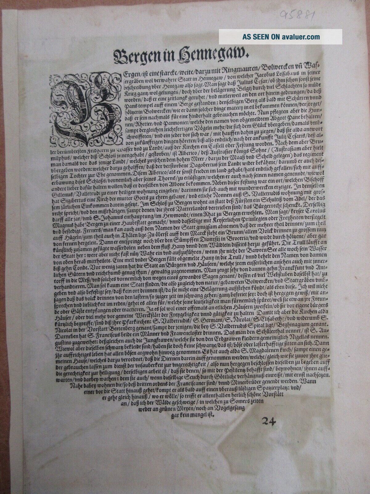
German text to verso.
Verygood condition, with wide original margins, Mapsize 350x 460 mm. sheet size 405 x 535 mmPostedrolled in a plan tube for extra protection

d2


    Similar items


  • Map Of Birds Eye View Of Eger In Hungary By Braun & Hogenberg - Framed

    Map Of Birds Eye View Of Eger In Hungary By Braun & Hogenberg - Framed

  • 1907 Birds Eye View Of Borden In Pub.  By Sentinel Borden Indiana Postcard

    1907 Birds Eye View Of Borden In Pub. By Sentinel Borden Indiana Postcard

  • Jersey Photo Postcard:birds Eye View Of Sparta,  Nj Pub By Nicholls

    Jersey Photo Postcard:birds Eye View Of Sparta, Nj Pub By Nicholls

  • 1892 London Birds Eye Views Of Principal Streets Book By Herbert Fry - Kd 5453

    1892 London Birds Eye Views Of Principal Streets Book By Herbert Fry - Kd 5453

  • 1860s Utah Cdv Birds Eye View Of Salt Lake City By Mormon Photographer Cr Savage

    1860s Utah Cdv Birds Eye View Of Salt Lake City By Mormon Photographer Cr Savage

  • A Birds - Eye View Of Our Civil War By Theodore Dodge.  Maps / Charts 1897

    A Birds - Eye View Of Our Civil War By Theodore Dodge. Maps / Charts 1897

  • A Early " Birds - Eye View Of Brooklyn.  Mich. ) Rppc By Roberson Bros.  & Cobb

    A Early " Birds - Eye View Of Brooklyn. Mich. ) Rppc By Roberson Bros. & Cobb

  • Old Virginia Postcard Of Bird Eye View Of Hurly Virginia Published By Mullins Wv

    Old Virginia Postcard Of Bird Eye View Of Hurly Virginia Published By Mullins Wv


    • You might also like


    • Hungary & Romania 1579 (1584) Ortelius Unusual Antique Copper Engraved Map

      Hungary & Romania 1579 (1584) Ortelius Unusual Antique Copper Engraved Map

    • Brussels Bruxelles Belfium 1777 De Ferraris & Dupuis Large Antique Map Sheet Xxi

      Brussels Bruxelles Belfium 1777 De Ferraris & Dupuis Large Antique Map Sheet Xxi

    • 1616 Atlas Map Of Iceland.

      1616 Atlas Map Of Iceland.

    • Kazan Russia 1767 Le Clerc/lespinasse Antique Copper Engraved City View

      Kazan Russia 1767 Le Clerc/lespinasse Antique Copper Engraved City View

    • 1899 Stanford,  Folding Map Of Norwich,  Norfolk,  Arthur Collins,  Jarrold & Sons,

      1899 Stanford, Folding Map Of Norwich, Norfolk, Arthur Collins, Jarrold & Sons,

    • 1948 Vintage Linen Colour Map Geological Survey Ten Mile Of Great Britain

      1948 Vintage Linen Colour Map Geological Survey Ten Mile Of Great Britain

    • 1944 Map Flying Bombs Sussex Ww2 Newspaper Military Kent Courier German V1 V2

      1944 Map Flying Bombs Sussex Ww2 Newspaper Military Kent Courier German V1 V2

    • Dated 1638 Vellum Map Of Icklesham Sussex Showing Land Uses Owners Etc

      Dated 1638 Vellum Map Of Icklesham Sussex Showing Land Uses Owners Etc

Avaluer          About Us          Privacy Policy          Contact Us          UP
© 2022, avaluer.net, Inc. or its affiliates