1778 Claude Buffier Miniature Map GREECE Albania Macedonia Crete Turkey
Item History & Price
| Reference Number: Avaluer:43358 | Date of Origin: 1778 |
| Country: Greece | Region: Balkans |
| UPC: Does not apply |
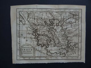
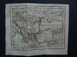
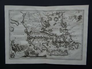
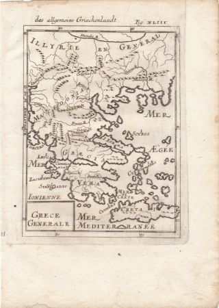
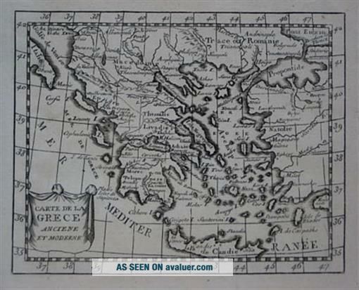
Original 1778 Claude Buffier Miniature Map GREECE Albania Macedonia Crete TurkeyHandsome original antique engraved map of Greece, printed more than 233 years ago.
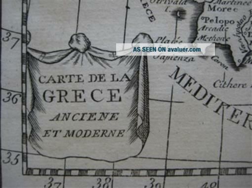
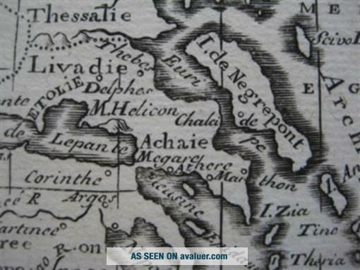
The coverage area extends from the Gulf of Venice to the Black Sea, south to the island of Crete, including western Turkey, Albania, Macedonia, and part of Romania. A decorative cartouche displays the map's title: Carte de la Grece anciene et moderne. The scans below give a closer look:
This map was drawn by Cla...ude Buffier, who produced some of the most beautiful small maps of the mid- to late 18th century. It was published in his Géographie universelle, d'un traité sur la sphère, Paris: Chez la Veuve J. Dessain, 1778. The image area measures 13.7 x 17.5 cm [5-1/2" x 7"].
Condition: This map is in excellent condition, bright and clean, with no marks, rips, or tears. It has a bold crisp impression, and is blank on the back, with no printing on the reverse side. The left margin has been reinforced.
This is an original, authentic antique map, not a reproduction or modern reprint, and it is fully guaranteed to be genuine. It would make an impressive display in your den or office. It would also make a perfect gift, and we'll include our helpful framing tips for your reference.
Claude Buffier was a French philosopher, historian and cartographer, born in Poland to French parents. He was educated at the Rouen Jesuit college, and after a short stay in Rome he relocated to France and spent the rest of his years at the college of the Jesuits, Paris. We are pleased to offer this striking original map withour unconditional, money-back guarantee.
Powered by SixBit's eCommerce Solution
01793