1852 AMSTERDAM Plan Of The City Hand Coloured Antique MAP SDUK COX


Item History & Price
~~~~~~~~~~~~~~
~~~~~~~~~~~~~~ Title Amsterdam _____________________ Original Antique Engraved Map ~ Hand Coloured ____________________ Author George Cox ______________________ Year of Publication 1852 __________________________ Publisher London: George Cox ______________________________
For full description see below - after all photographs
...>
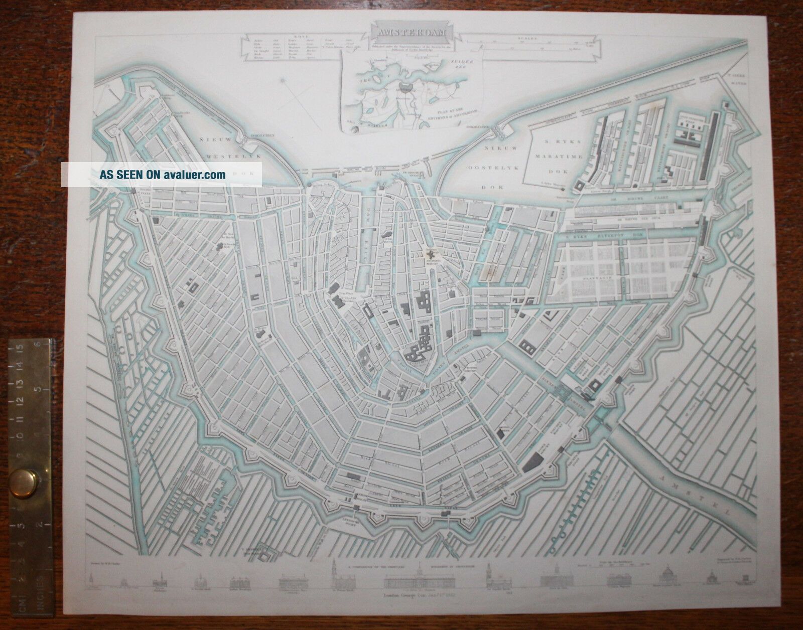
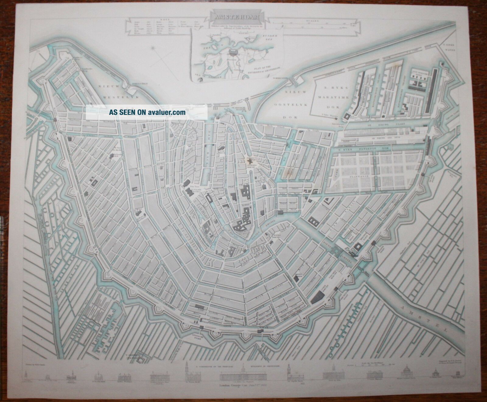
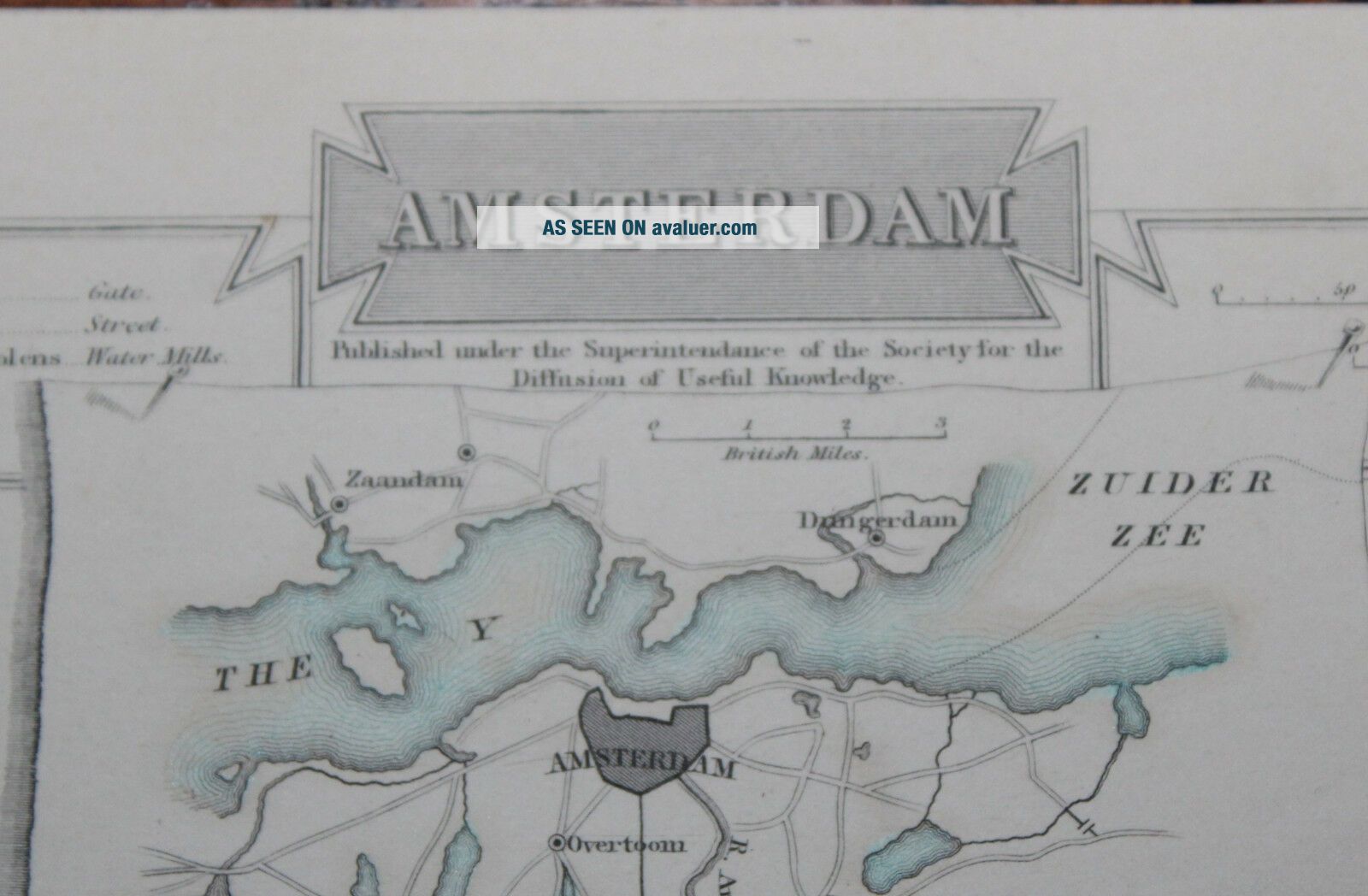
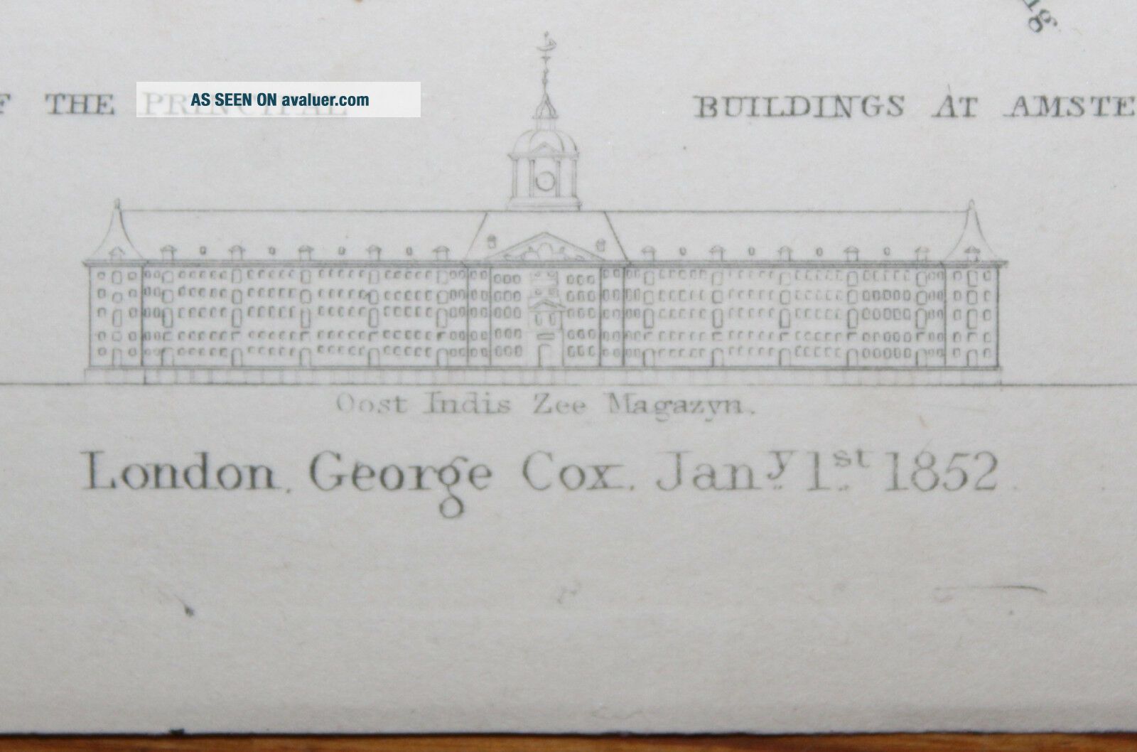
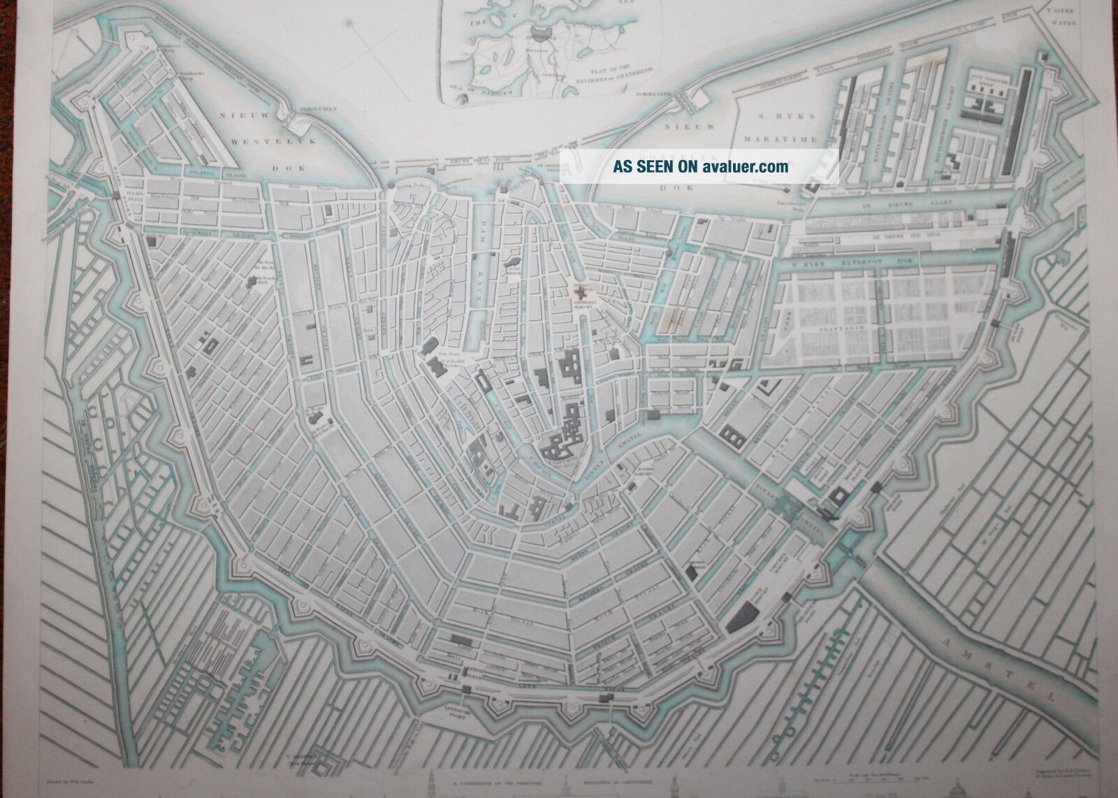
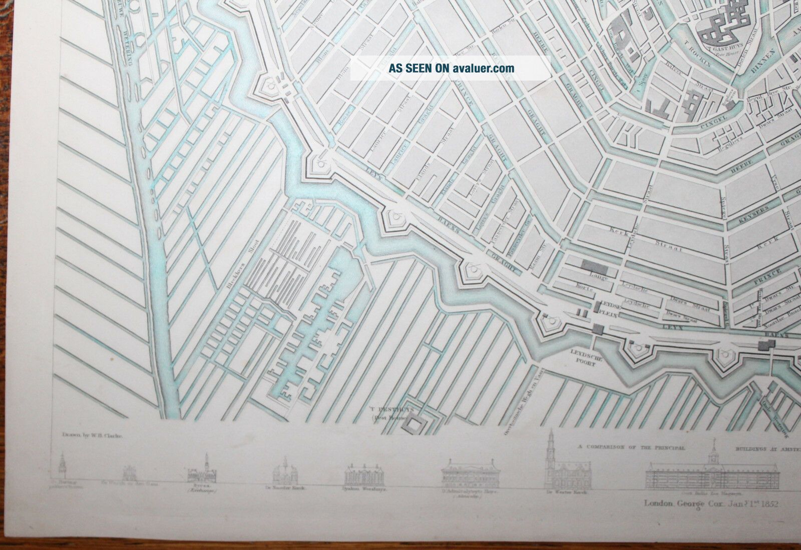
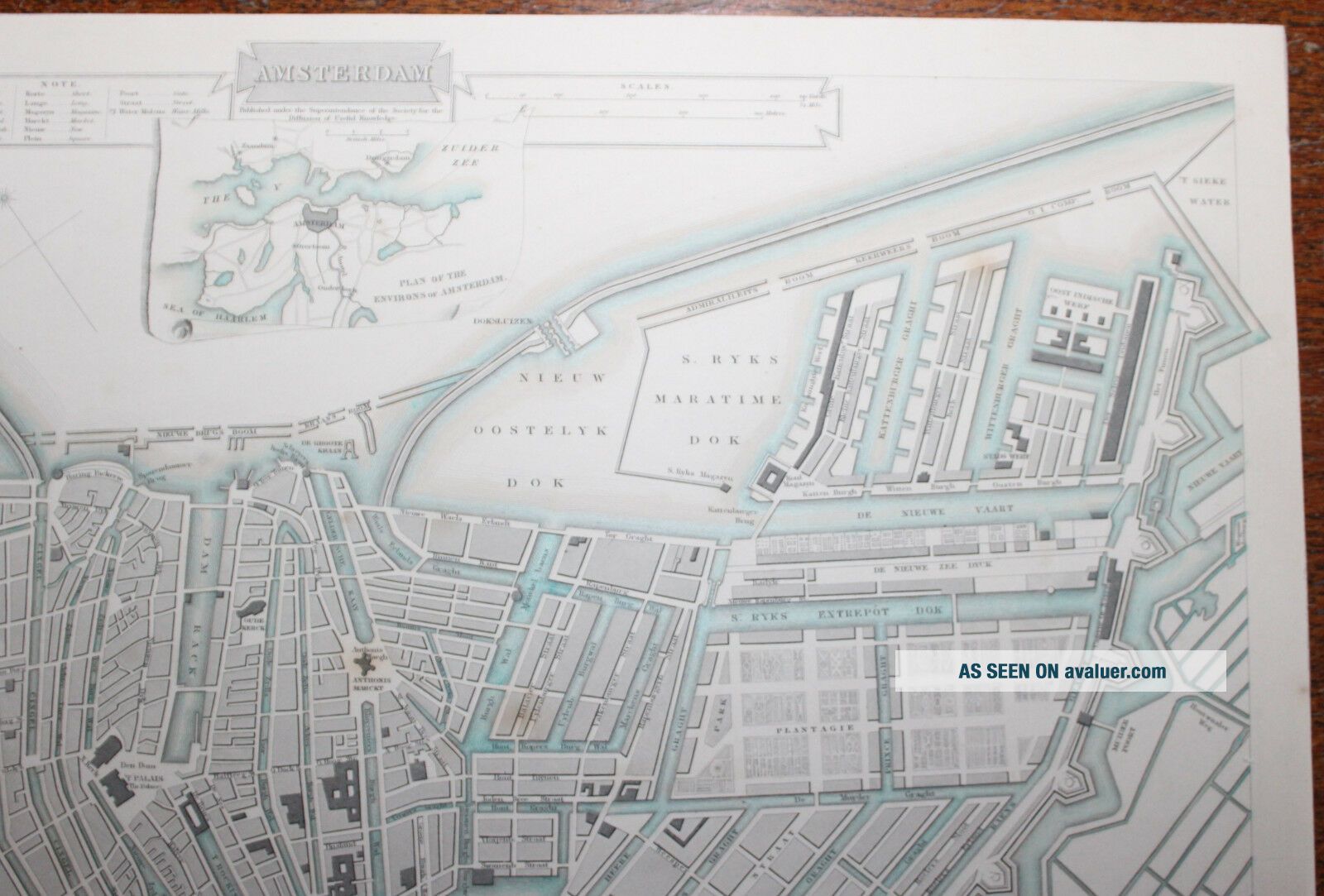
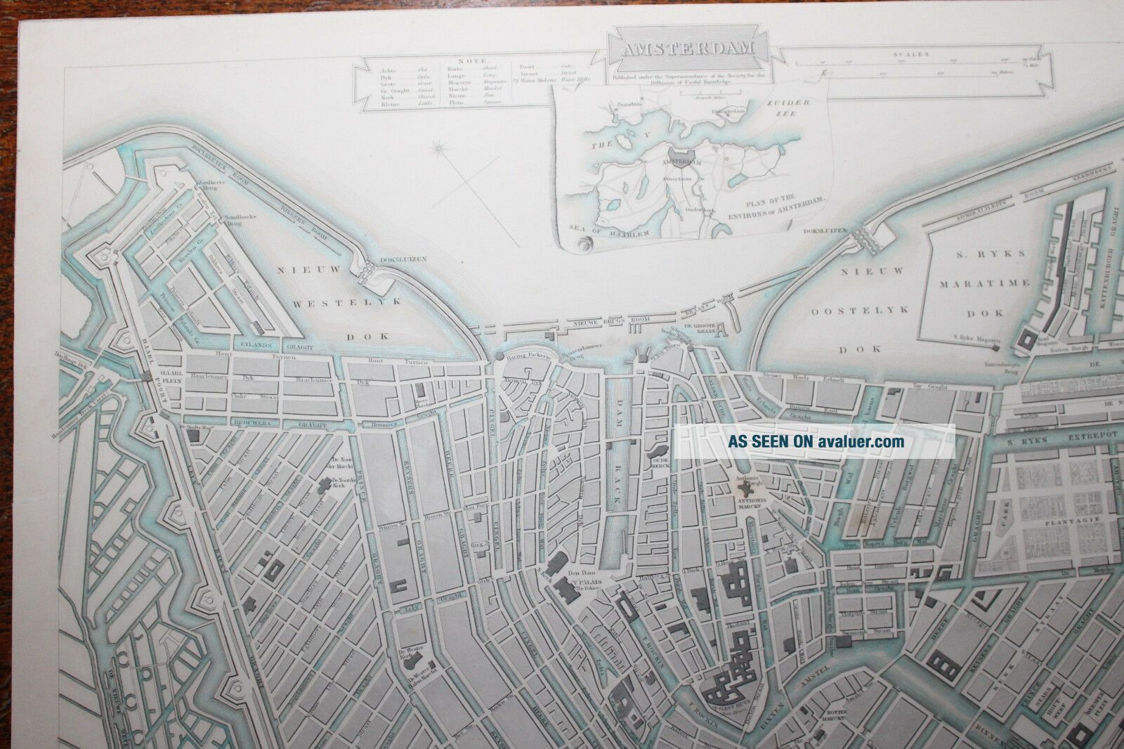
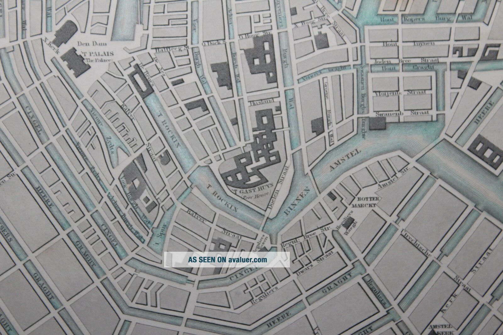
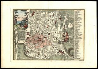
___________________________________________ Description: London: George Cox, 1852. 1852 edition map or plan of the city of Amsterdam, Netherlands prepared for publication by the Society for the Diffusion of Useful Knowledge, or S.D.U.K. The capital city of the Netherlands depicting the entire city in detail with canals, major streets, parks and important buildings noted. There is an inset plan, at top centre, of the great Amsterdam area. The lower border depicts the many important monuments and buildings in profile. This map was drawn by W. B. Clarke, engraved by B.R. Davies and issued by the Society for the Diffusion of Useful Knowledge. See photos for the layout. A pretty map in good condition. Size: 16 ½” x 13 ¼ inches. Condition Report Externally See above and photos. Internally See above and photos. Publisher: See above.
Publication Date: 1852
Binding: Hardback _________________________________________ Please e-mail me for extra photographs and with any questions you may have Ruler in picture is 6 inches long! ---------------------------- Please Browse all other books and prints in my Shop: LOUIS ‘88 Books
~~~~~~~~~~~~~~ Title Amsterdam _____________________ Original Antique Engraved Map ~ Hand Coloured ____________________ Author George Cox ______________________ Year of Publication 1852 __________________________ Publisher London: George Cox ______________________________
For full description see below - after all photographs
___________________________________________ Description: London: George Cox, 1852. 1852 edition map or plan of the city of Amsterdam, Netherlands prepared for publication by the Society for the Diffusion of Useful Knowledge, or S.D.U.K. The capital city of the Netherlands depicting the entire city in detail with canals, major streets, parks and important buildings noted. There is an inset plan, at top centre, of the great Amsterdam area. The lower border depicts the many important monuments and buildings in profile. This map was drawn by W. B. Clarke, engraved by B.R. Davies and issued by the Society for the Diffusion of Useful Knowledge. See photos for the layout. A pretty map in good condition. Size: 16 ½” x 13 ¼ inches. Condition Report Externally See above and photos. Internally See above and photos. Publisher: See above.
Publication Date: 1852
Binding: Hardback _________________________________________ Please e-mail me for extra photographs and with any questions you may have Ruler in picture is 6 inches long! ---------------------------- Please Browse all other books and prints in my Shop: LOUIS ‘88 Books

![1593 Natal Master Engraving - Parable Of The Servent - Hand Coloured [1620]](https://pic.avaluer.net/imgstmb/a/z/p/w/y/-1593_natal_master_engraving___parable_of_the_servent___hand_coloured_1620-1_39_tmb.jpg)