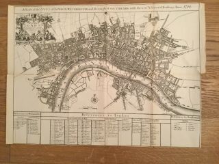
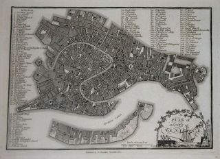
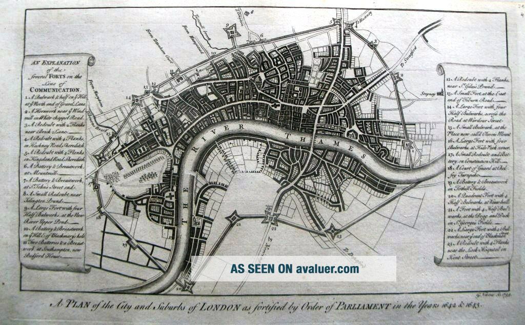
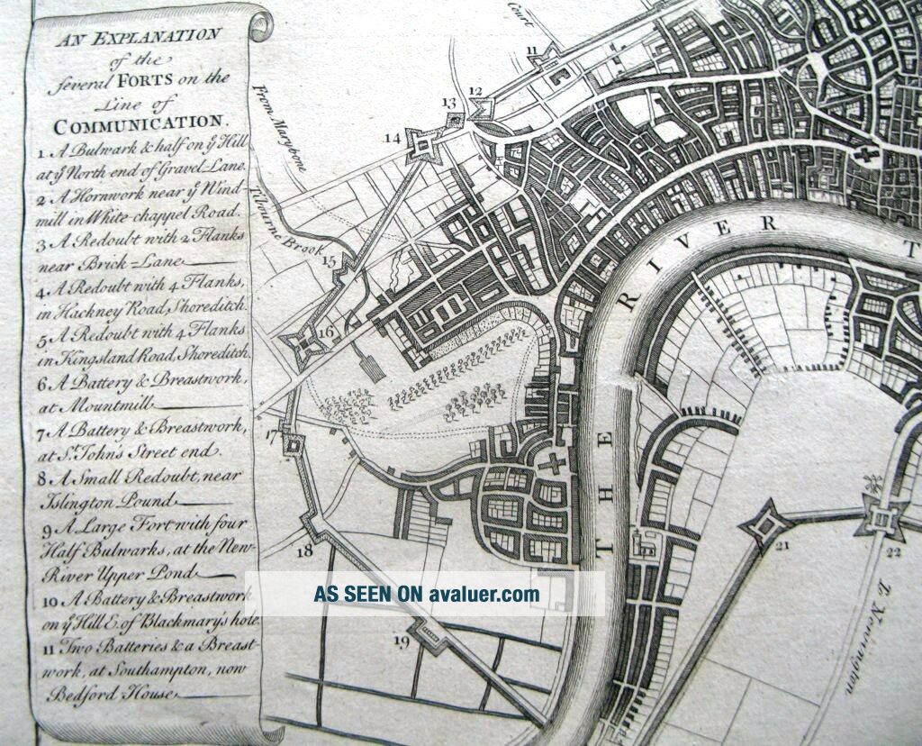
Antique Map, A Plan Of The City And Suburbs Of London

Item History & Price
| Reference Number: Avaluer:52780 | Format: Sheet Map |
| Map Type: City, Geological/ Terrain, Historical/ Political, Roads/ Trails/ Travel | Region: UK |
| Antique/ Modern: Antique |
Description:FULL TITLE:A plan of the City and suburbs of London as fortified by order of Parliament in the years 1642 & 1643A fascinating and important map of London as it was at the time of the Civil War and before the Great Fire. The engraving was originally prepared by G. Vertue in 1738 and later published with Maitland's History of London in 1756. This map shows the City of London and the various defences erected by Parliament during the Civil War against King Charles I during the ...1640's. Two panels give an explanation of the 23 forts on the lines of defence. Publication: Maitland's History of LondonFrom an article by David Flintham, 1999:'London was of vital importance to both sides during the Civil Wars, and by fleeing the capital in January 1642, Charles I placed his cause at a distinct disadvantage. Parliament was in no doubt that the Royalists would attempt to win back London and it was the threat of this, by military action, which led Parliament, in August 1642, to issue ‘Directions for the Defence of London’. This contained provision for the fortification of the capital and specified troops for its defence. Little more was progressed with the fortifications until around the time of the Battle of Edgehill (23 October 1642) when instructions were issued to: 'take a speedy cause to put the City into a posture of defence, to resist and oppose all such force, to fortifie all the passages into same, suburbs and places adjoining whether the same be within the said City and Libertie;' The area which was to be included within these fortifications was larger than the area then called ‘London’, i.e. that covered by the ‘Bills of Mortality’ and much of this area was probably included for no more reason than strategic grounds. Even so, this area was the largest definition of London made to date.' Conditon: GGCartographer: VertueDate: 1738Technique: Copper EngravingColour: UncolouredWidth (cms) x Height (cms): 33.8 x 19.5Ref: JJB0491
Powered by eBay Turbo Lister
Powered by eBay Turbo Lister