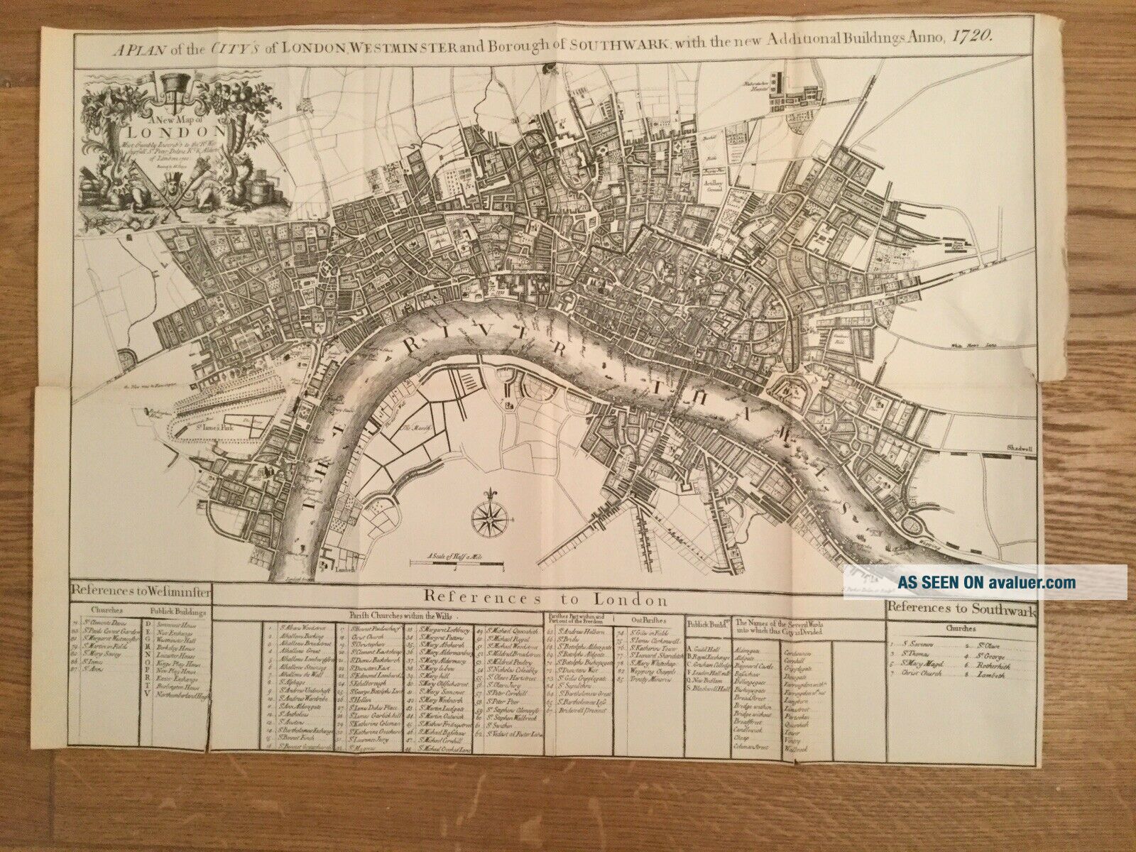
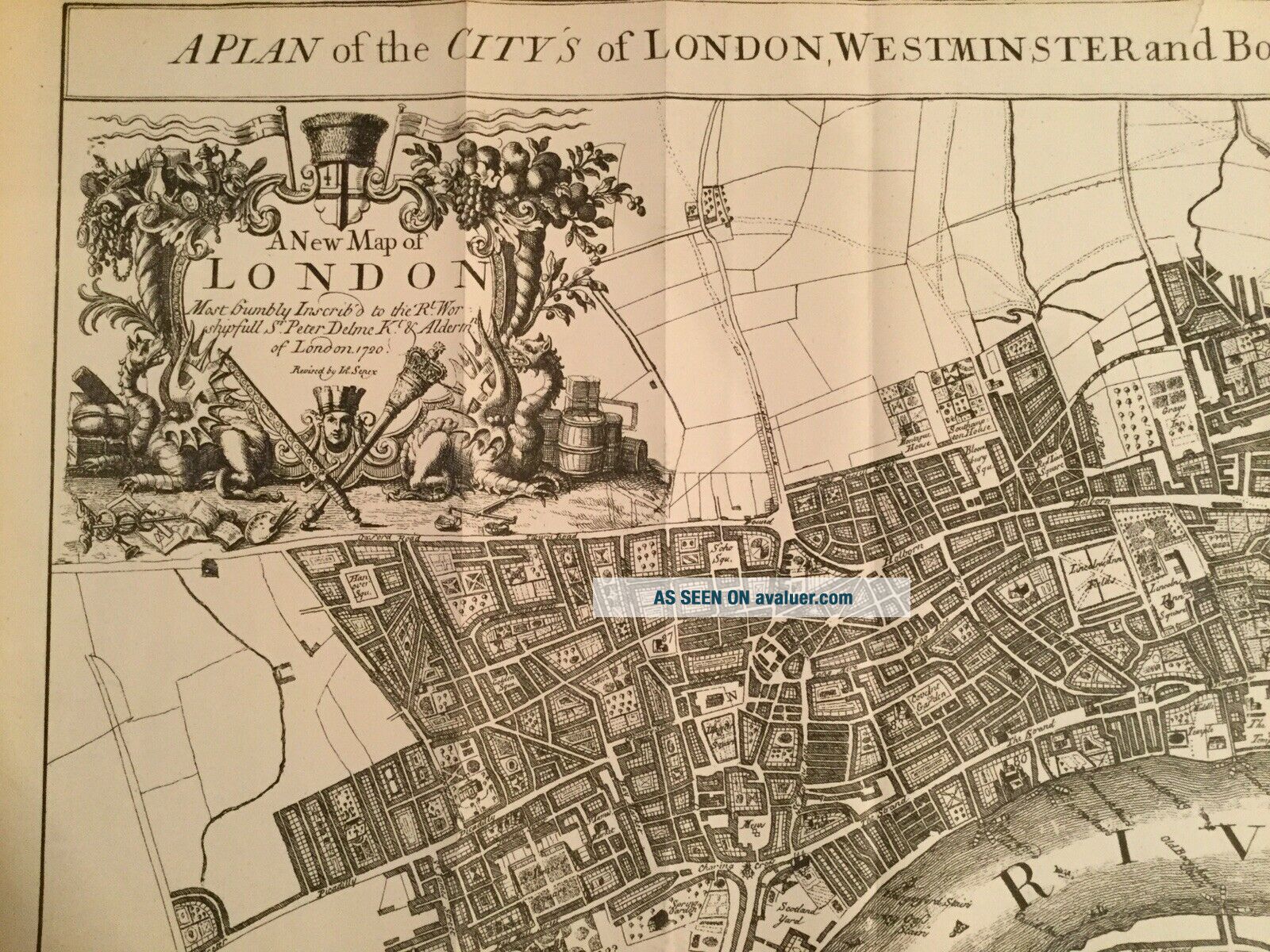
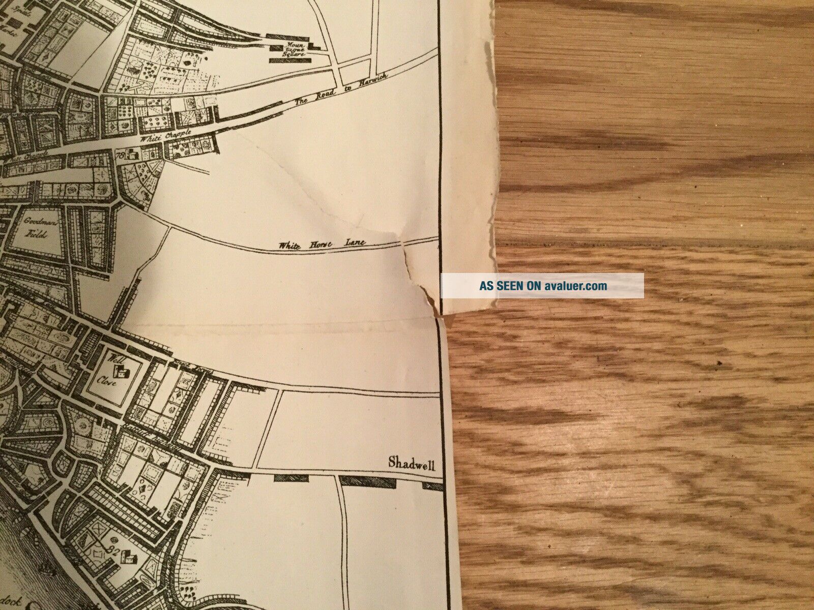
Rare, A Plan Of The City’s Of London, Westminster And The Borough Of Southwark


Item History & Price

Information:
Reference Number: Avaluer:52631
Original Description:
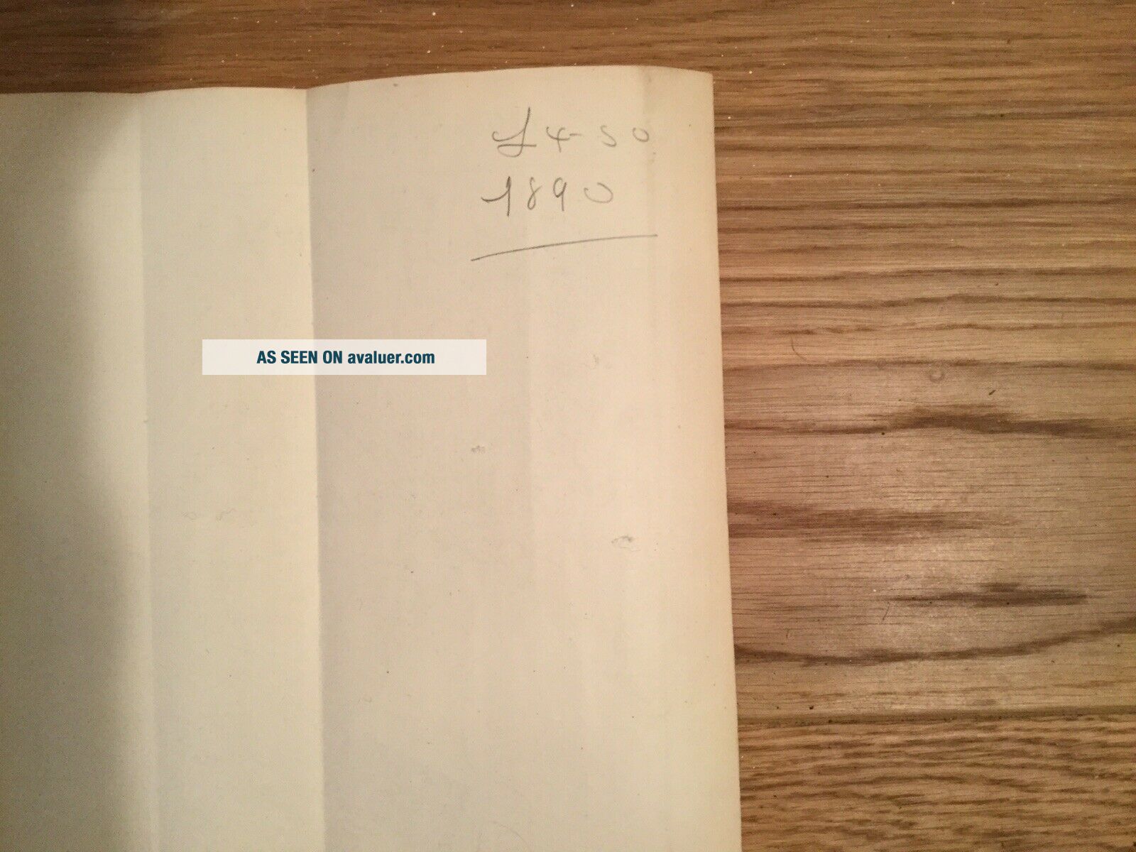
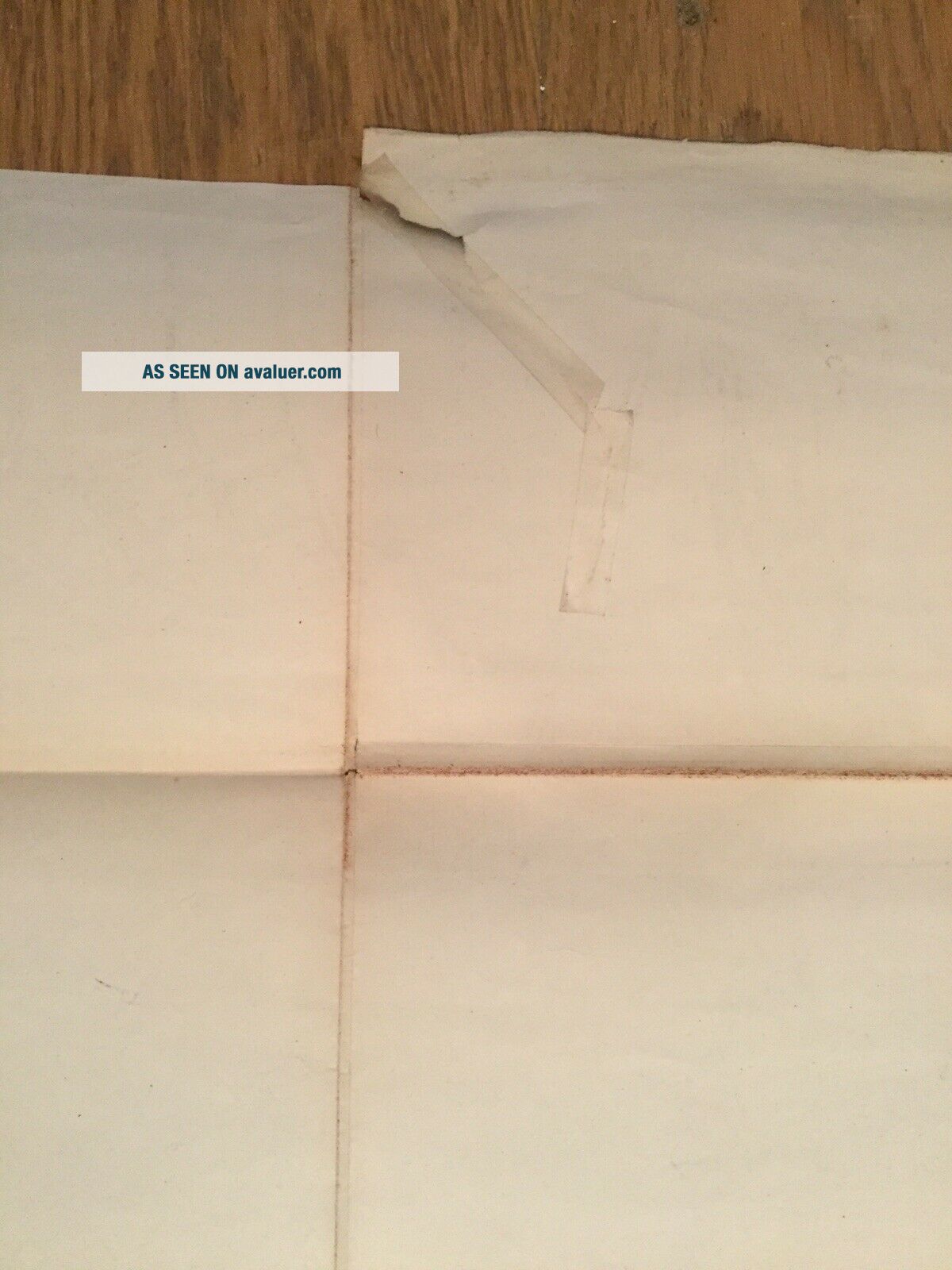
This map, originally published in 1720 by John Senex, was drawn on stone by Edward S Weller and engraved on copper plates by Samuel Parker. It is fulsomely dedicated to Sir Peter Delmé. Measuring approximately 69 x 51cm, this copy was published in 1860 in part 8 of the “People’s Weekly Edition of Cassell’s Old & New London”. There are some small tears and one ancient sellotape mend on the back, all of which I have tried to show in the photos. Pencil date on reverse 1890 and pr...ice £4.50, but unsure about the relevance. Very rare, rather fragile, and I cannot house it with the care it needs, hence competitive price. I would prefer interested parties to come and see it, I’m in Barnet, but realise this may not be practical for everyone.


    Similar items


  • 1938 Habana,  Cuba Cancel On A Cover Advertising The City

    1938 Habana, Cuba Cancel On A Cover Advertising The City ' S Hotel Parkview

  • 1933 Iona,  Michigan Cancel On A Cover Advertising The City

    1933 Iona, Michigan Cancel On A Cover Advertising The City ' S Reed Inn Hotel

  • 1950 La Salle,  Illinois Cancel On A Cover Advertising The City

    1950 La Salle, Illinois Cancel On A Cover Advertising The City ' S Hotel Kaskaskia

  • 1934 Elyria,  Ohio Cancel On A Cover Advertising The City

    1934 Elyria, Ohio Cancel On A Cover Advertising The City ' S Hotel Newell

  • Discovering Vintage Las Vegas : A Guide To The City

    Discovering Vintage Las Vegas : A Guide To The City ' S Timeless Shops, .

  • Discovering Vintage San Francisco : A Guide To The City

    Discovering Vintage San Francisco : A Guide To The City ' S Timeless Shops, Bars,

  • Young Leeds A Picture Of Life In The City

    Young Leeds A Picture Of Life In The City ' S Schools And Colleges 1949 Book Rare

  • Rare 1775 Antique Map Of A Plan Of The Town & Chart Of The Harbour Of Boston

    Rare 1775 Antique Map Of A Plan Of The Town & Chart Of The Harbour Of Boston


    • You might also like


    • Hungary & Romania 1579 (1584) Ortelius Unusual Antique Copper Engraved Map

      Hungary & Romania 1579 (1584) Ortelius Unusual Antique Copper Engraved Map

    • Brussels Bruxelles Belfium 1777 De Ferraris & Dupuis Large Antique Map Sheet Xxi

      Brussels Bruxelles Belfium 1777 De Ferraris & Dupuis Large Antique Map Sheet Xxi

    • 1616 Atlas Map Of Iceland.

      1616 Atlas Map Of Iceland.

    • Kazan Russia 1767 Le Clerc/lespinasse Antique Copper Engraved City View

      Kazan Russia 1767 Le Clerc/lespinasse Antique Copper Engraved City View

    • 1899 Stanford,  Folding Map Of Norwich,  Norfolk,  Arthur Collins,  Jarrold & Sons,

      1899 Stanford, Folding Map Of Norwich, Norfolk, Arthur Collins, Jarrold & Sons,

    • 1948 Vintage Linen Colour Map Geological Survey Ten Mile Of Great Britain

      1948 Vintage Linen Colour Map Geological Survey Ten Mile Of Great Britain

    • 1944 Map Flying Bombs Sussex Ww2 Newspaper Military Kent Courier German V1 V2

      1944 Map Flying Bombs Sussex Ww2 Newspaper Military Kent Courier German V1 V2

    • Dated 1638 Vellum Map Of Icklesham Sussex Showing Land Uses Owners Etc

      Dated 1638 Vellum Map Of Icklesham Sussex Showing Land Uses Owners Etc

Avaluer          About Us          Privacy Policy          Contact Us          UP
© 2022, avaluer.net, Inc. or its affiliates