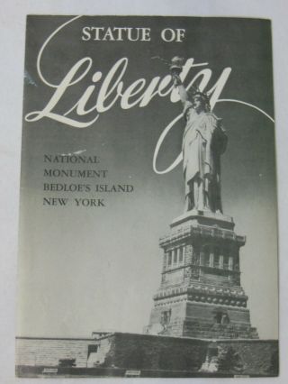
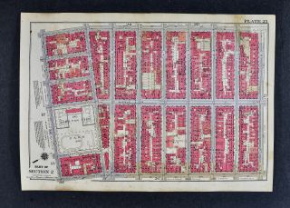
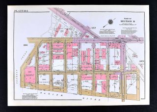
Rare Antique York City Map Manhattan Island 1898 Geological Leonard Graether
Item History & Price
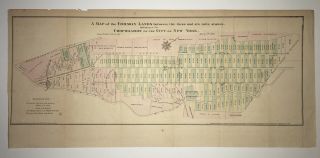
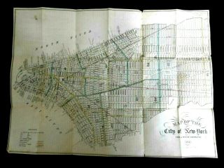
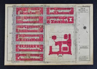
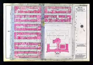
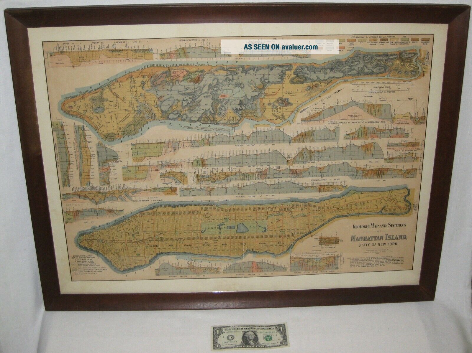
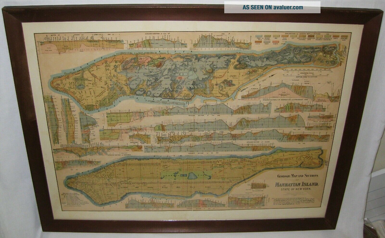
GENUINE ANTIQUE MANHATTAN ISLAND MAP
Rare, Authentic, Genuine Antique Map.
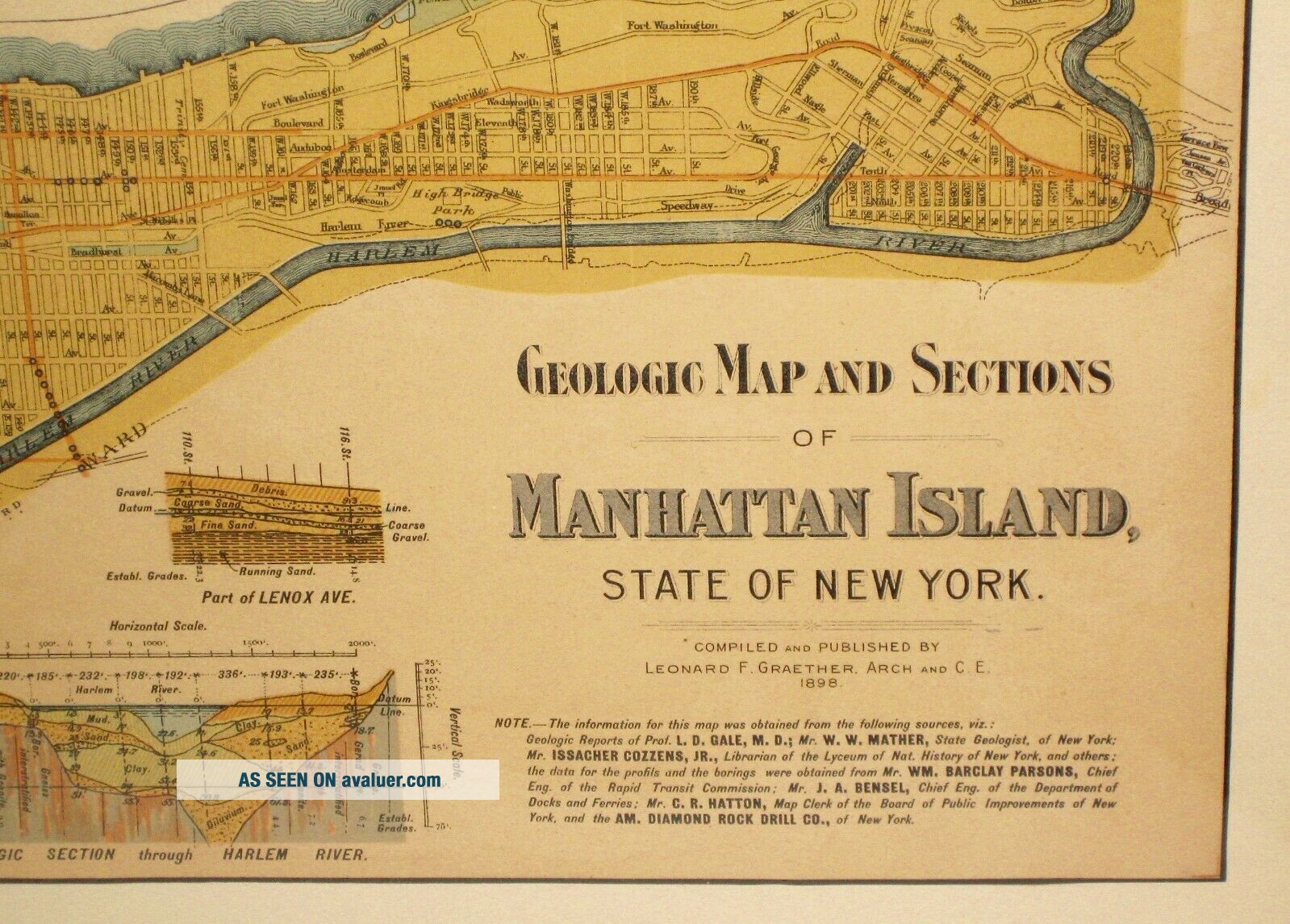
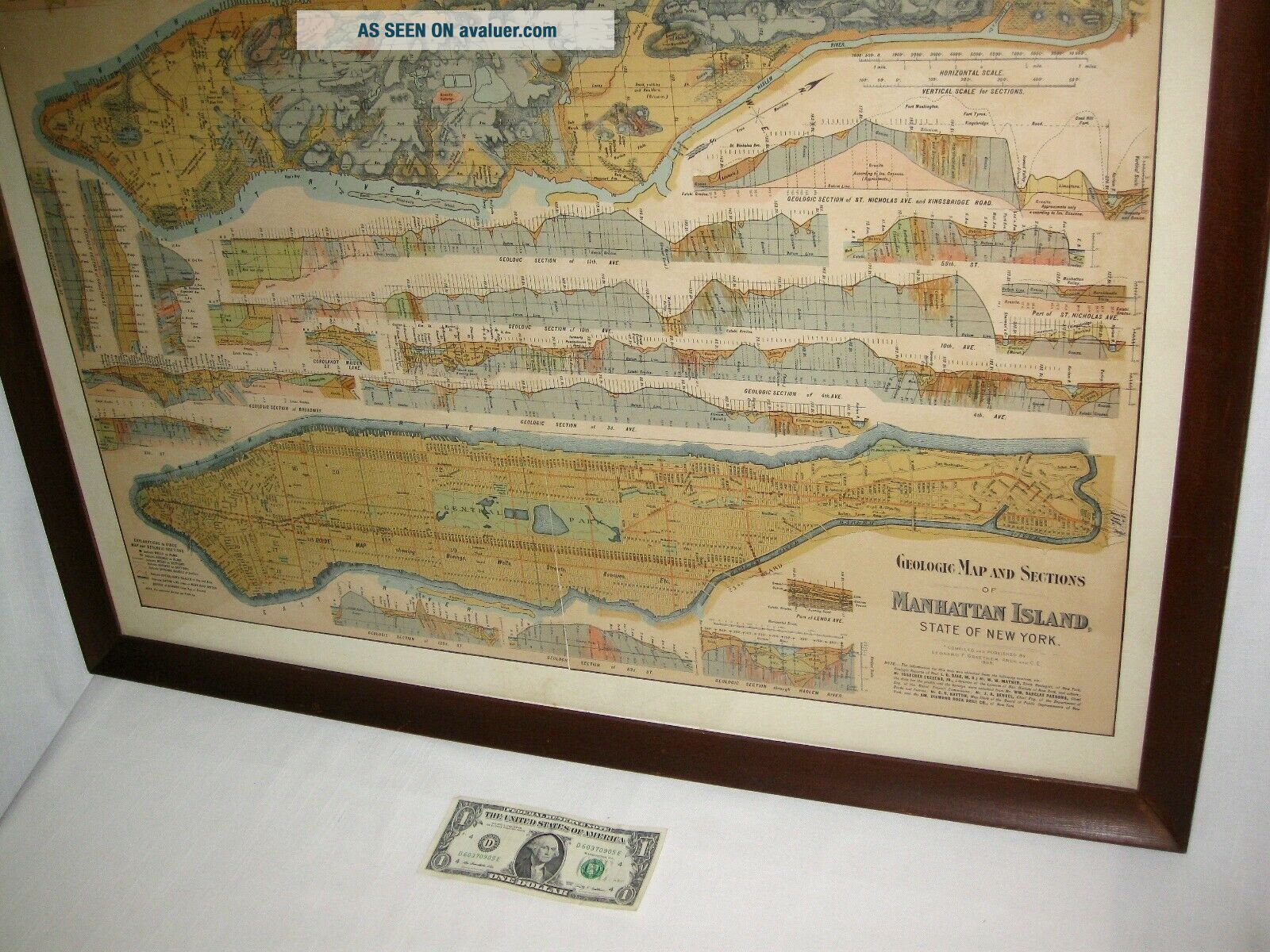
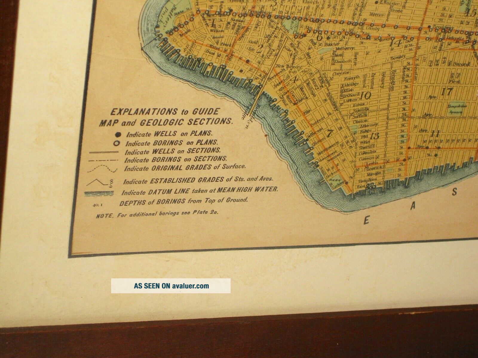
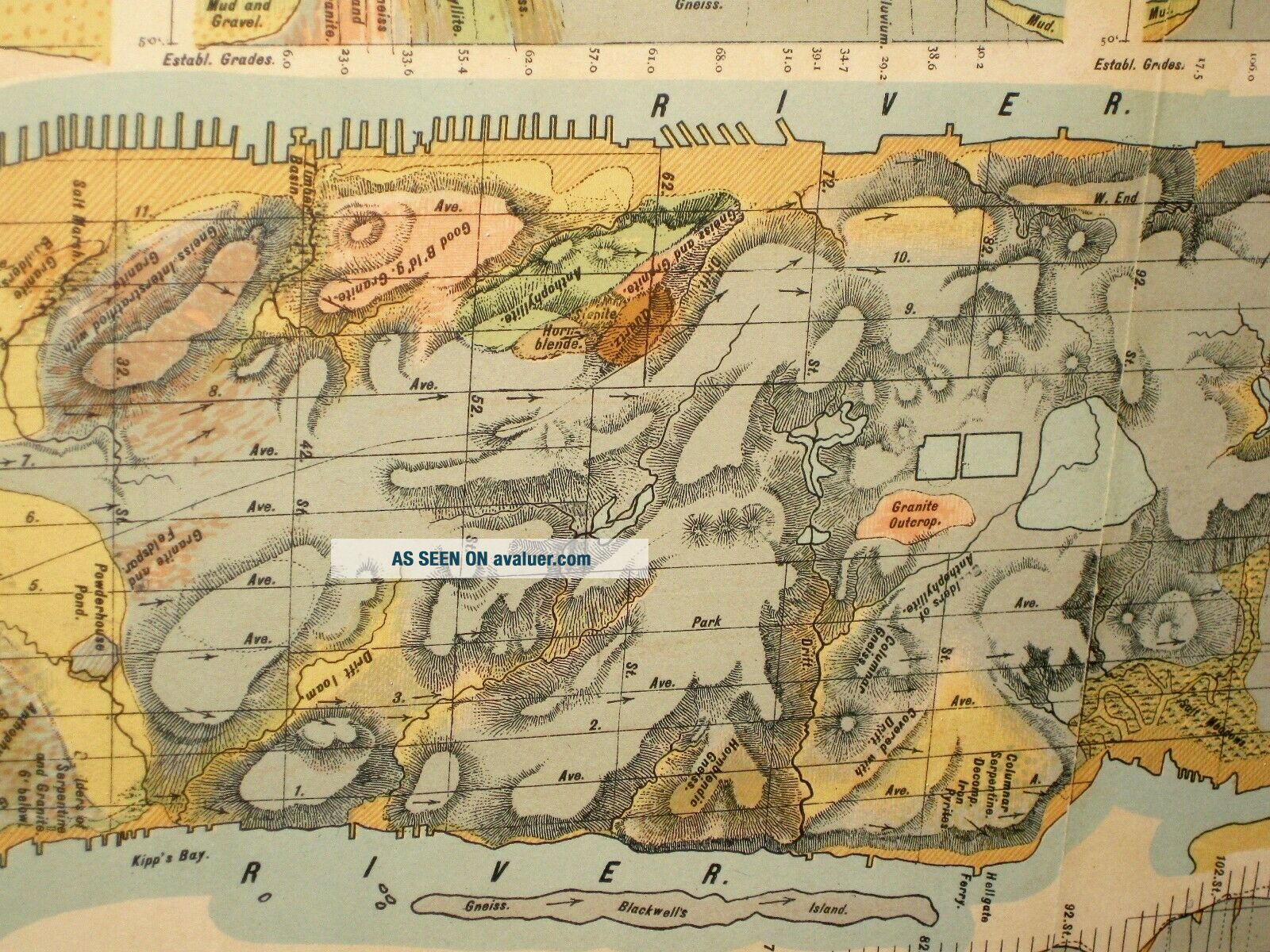
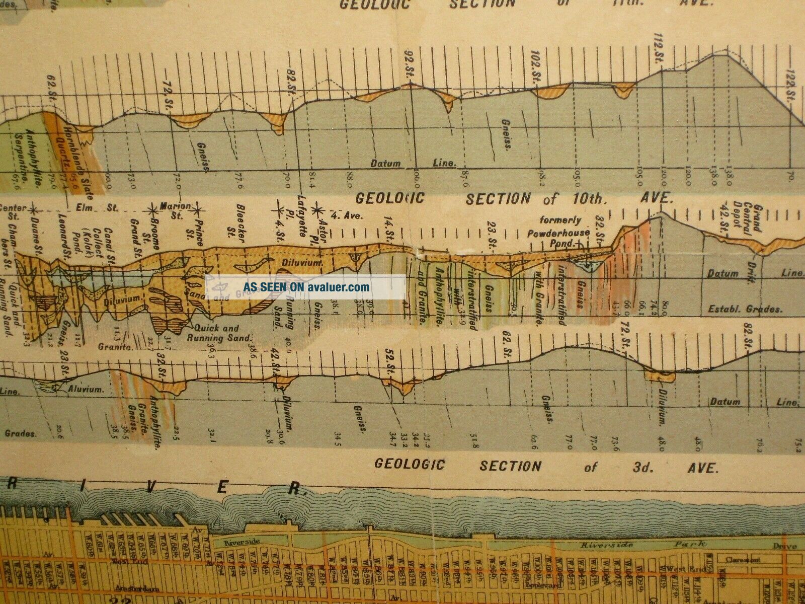
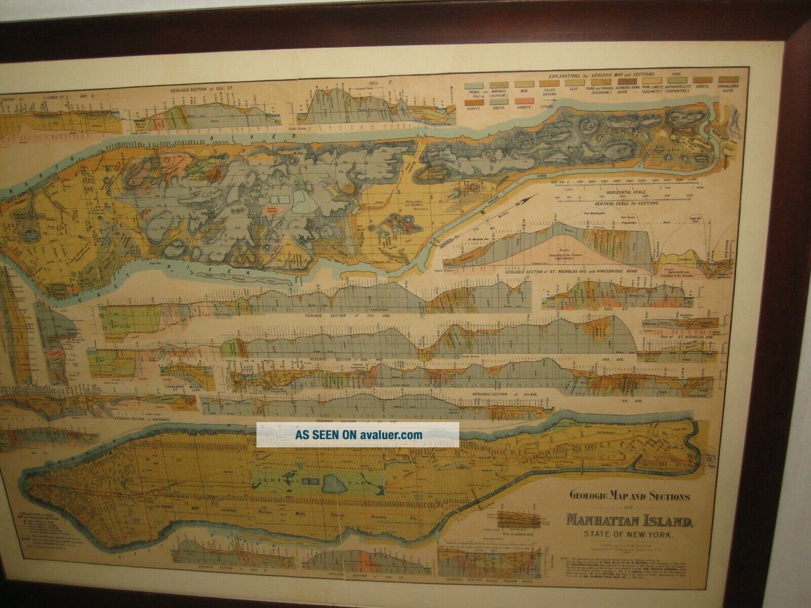
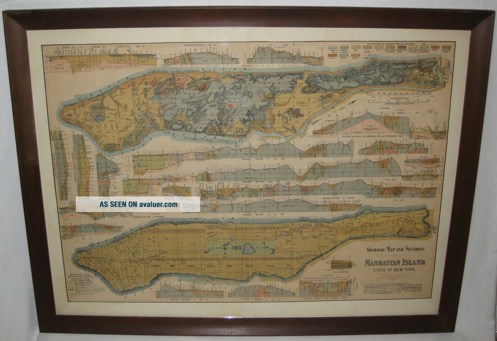
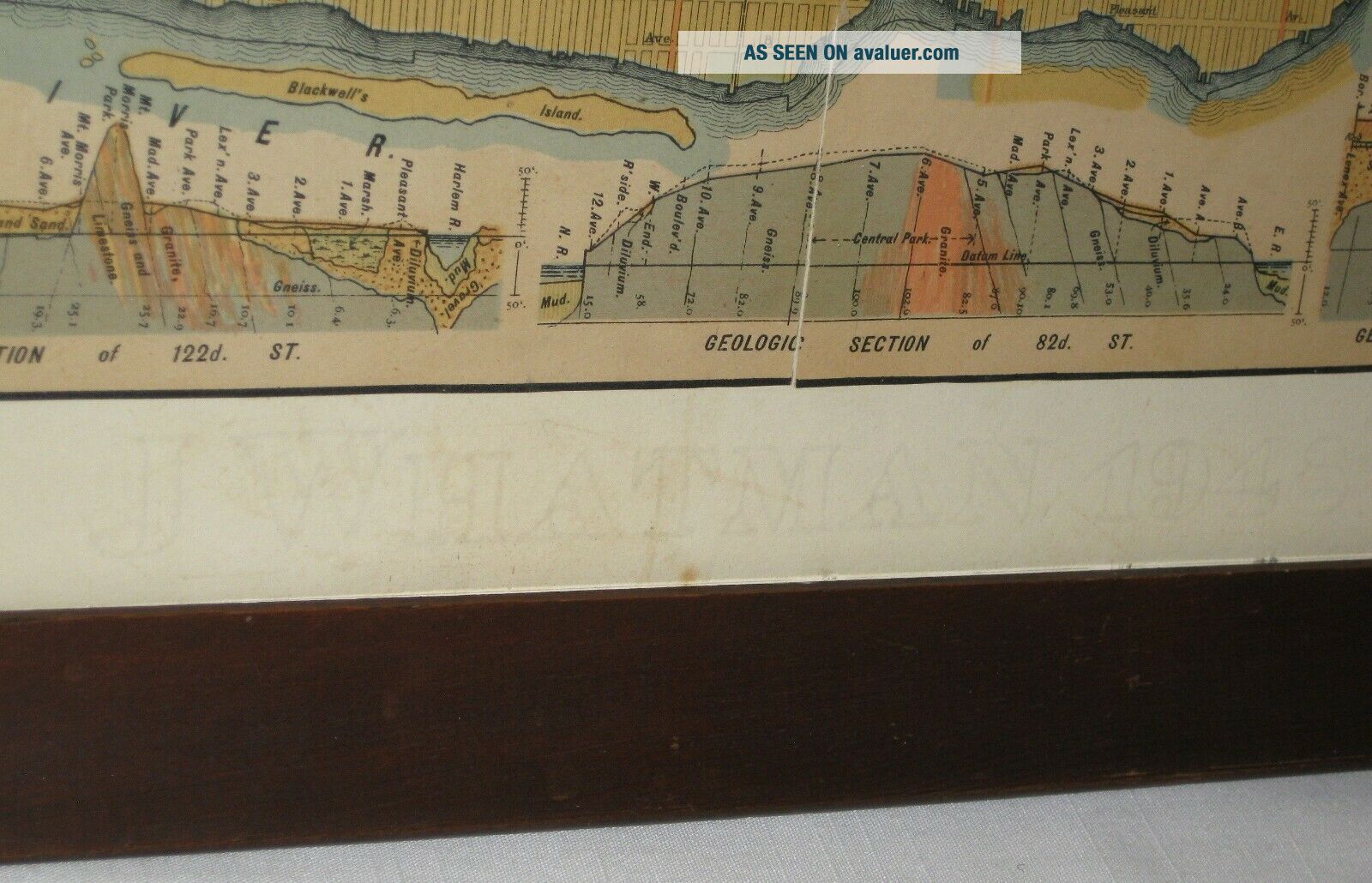
Manhattan Island, Geological Map of 1898.
Published by Leonard F. Graether.
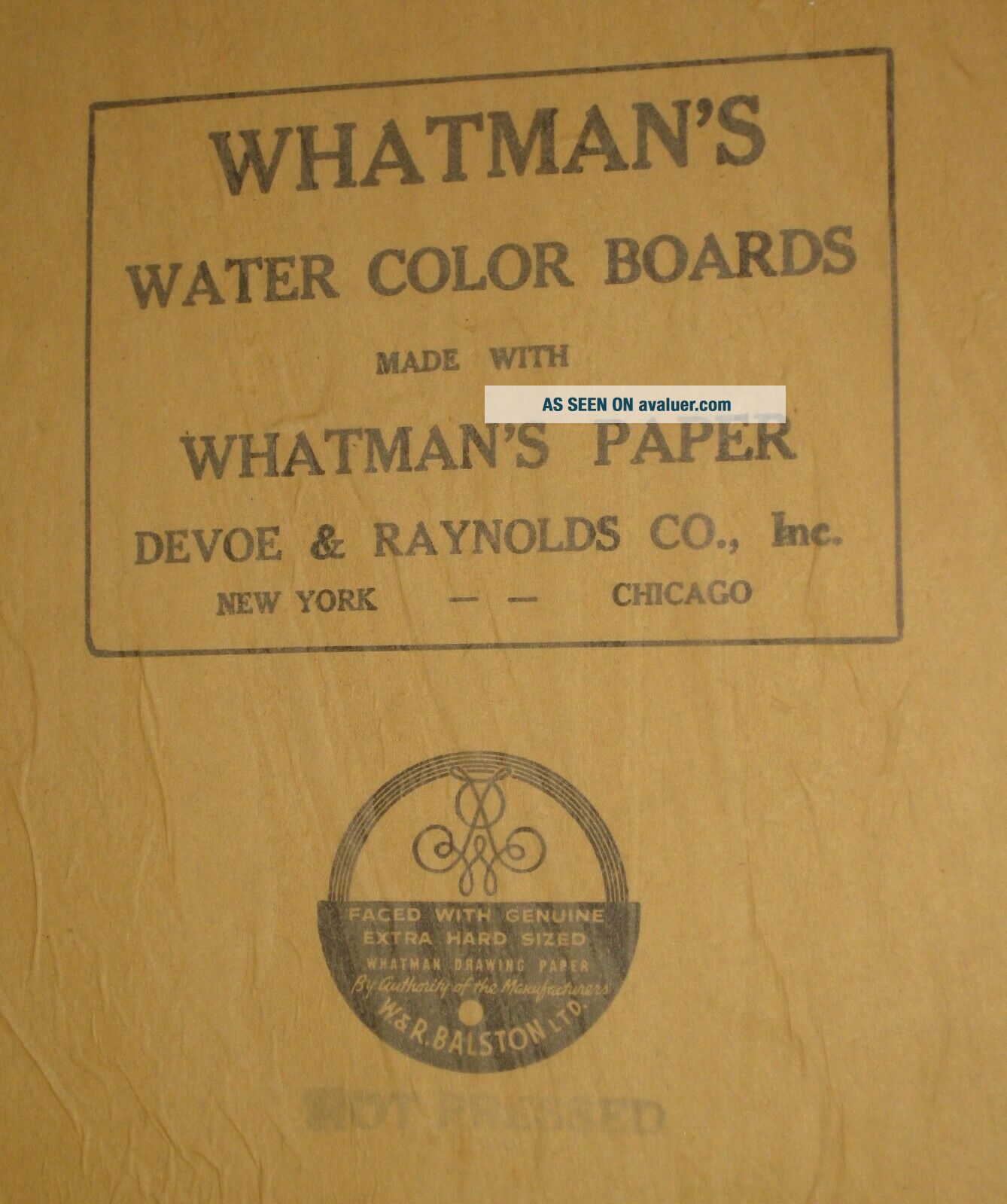
Professionally matted and framed in 1948,
with J.Whatman's Board and Paper, Hot Pressed.
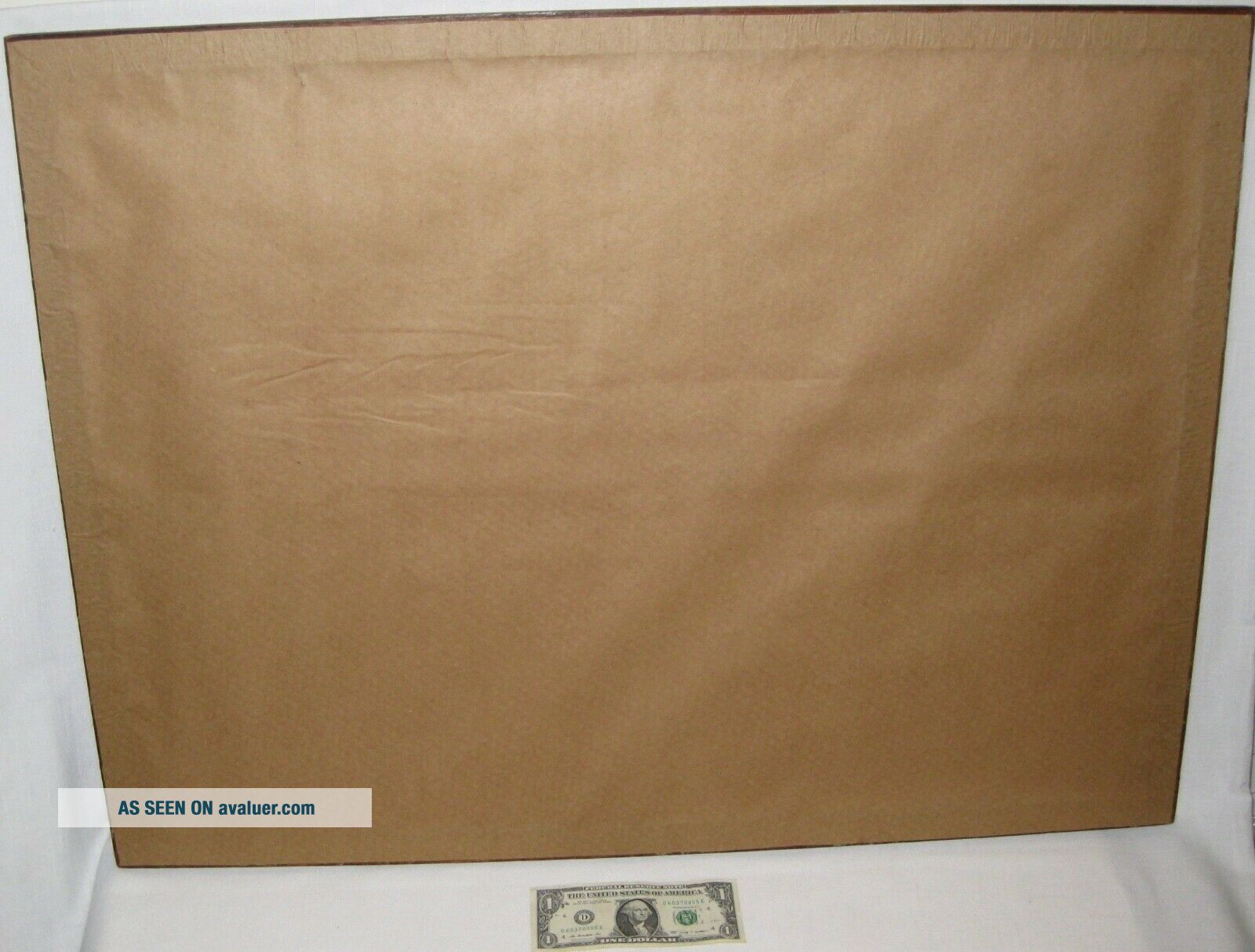
The paper backing on the back of frame, was torn, so it was replaced.
Ready for display or to be on a wall.
Wood frame, with glass.
Measures 24" x 32" x 1".
This is not a copy, it's an authentic printed map, I... assume it must be a litho.
Obtained from a Geologist's estate.
Pics are of actual item being sold.
Local Pickup Preferred.
Item needs to be professionally and securely packed.
I do not clean vintage or antique items.
That decision is left for the buyer.
Please consider; items I sell might need cleaning,
restoration, repair, maintenance, and/or adjustments.
Wear from storage and/or use, consistent with age,
unless described otherwise.
They are sold as is, as found, all sales final.
With exceptions if listed, such as certain articles of clothing including,
but not limited to, new footwear, brand new sealed items,
are returnable within time period stated, if unworn or unopened.
Buyer's responsibility to read complete auction text
and accept seller's policy before placing bids or making purchase.
Seller is not responsible for end user application of items.
ITEMS ARE ALSO AVAILABLE FOR LOCAL PICK-UP.
Winning bidders of more than one auction can save on shipping.
(Certain restrictions may apply.)
Buyers outside the USA pay shipping via Postal Service.
Seller will not be held responsible for any loss or
damages if buyer choosesuninsured shipping service.
Insured amount must match declared value on custom form.
Buyer's responsibility to pay customs fees, duties, import taxes, and related charges.
Purchasing this item and remitment of payment is an acceptance of these terms.PayPal accepted.Any questions?
Please contact me for more information.
00059
Rare, Authentic, Genuine Antique Map.
Manhattan Island, Geological Map of 1898.
Published by Leonard F. Graether.
Professionally matted and framed in 1948,
with J.Whatman's Board and Paper, Hot Pressed.
The paper backing on the back of frame, was torn, so it was replaced.
Ready for display or to be on a wall.
Wood frame, with glass.
Measures 24" x 32" x 1".
This is not a copy, it's an authentic printed map, I... assume it must be a litho.
Obtained from a Geologist's estate.
Pics are of actual item being sold.
Local Pickup Preferred.
Item needs to be professionally and securely packed.
I do not clean vintage or antique items.
That decision is left for the buyer.
Please consider; items I sell might need cleaning,
restoration, repair, maintenance, and/or adjustments.
Wear from storage and/or use, consistent with age,
unless described otherwise.
They are sold as is, as found, all sales final.
With exceptions if listed, such as certain articles of clothing including,
but not limited to, new footwear, brand new sealed items,
are returnable within time period stated, if unworn or unopened.
Buyer's responsibility to read complete auction text
and accept seller's policy before placing bids or making purchase.
Seller is not responsible for end user application of items.
ITEMS ARE ALSO AVAILABLE FOR LOCAL PICK-UP.
Winning bidders of more than one auction can save on shipping.
(Certain restrictions may apply.)
Buyers outside the USA pay shipping via Postal Service.
Seller will not be held responsible for any loss or
damages if buyer choosesuninsured shipping service.
Insured amount must match declared value on custom form.
Buyer's responsibility to pay customs fees, duties, import taxes, and related charges.
Purchasing this item and remitment of payment is an acceptance of these terms.PayPal accepted.Any questions?
Please contact me for more information.
00059