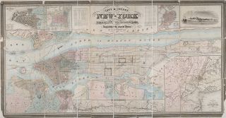
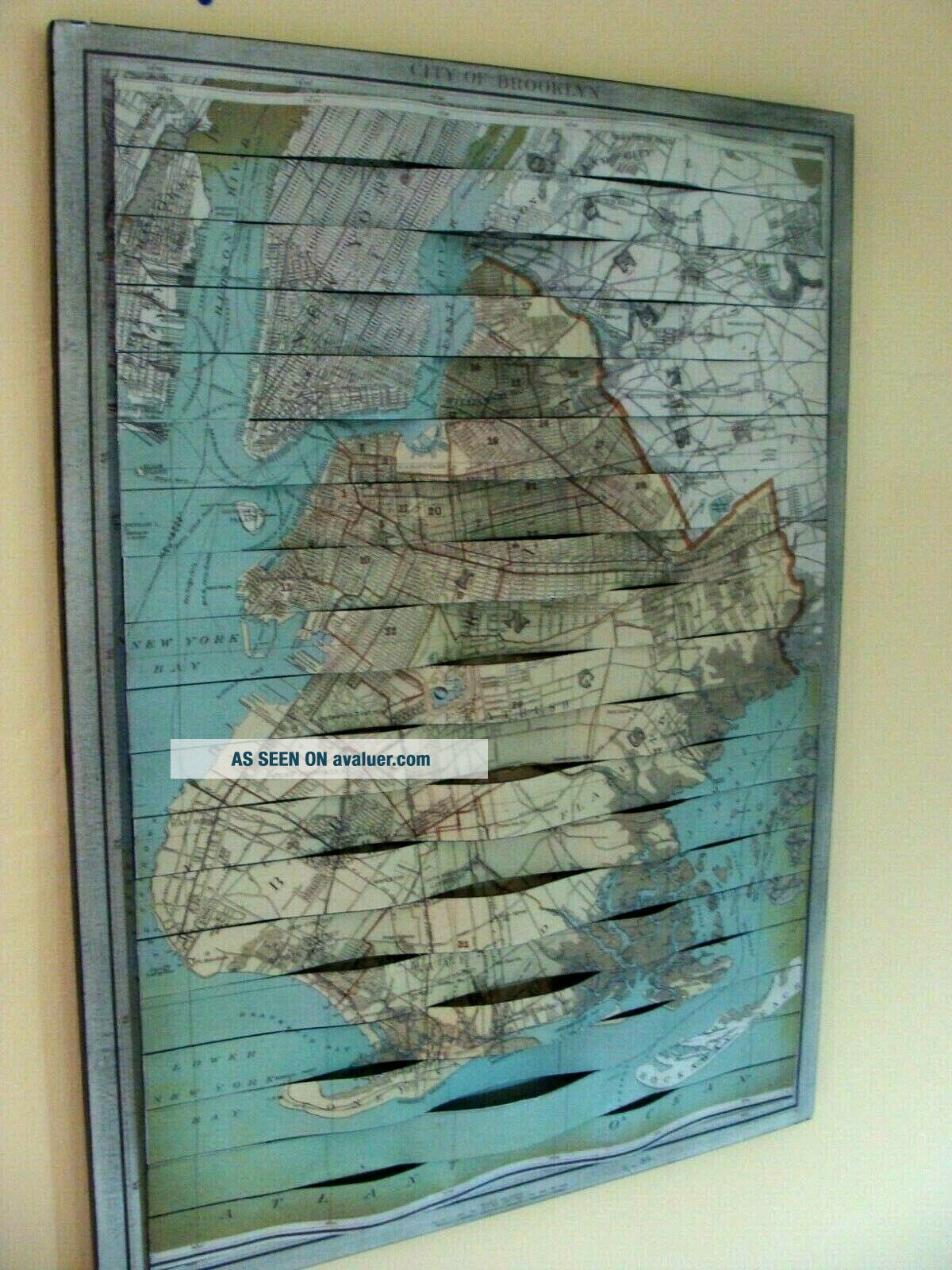
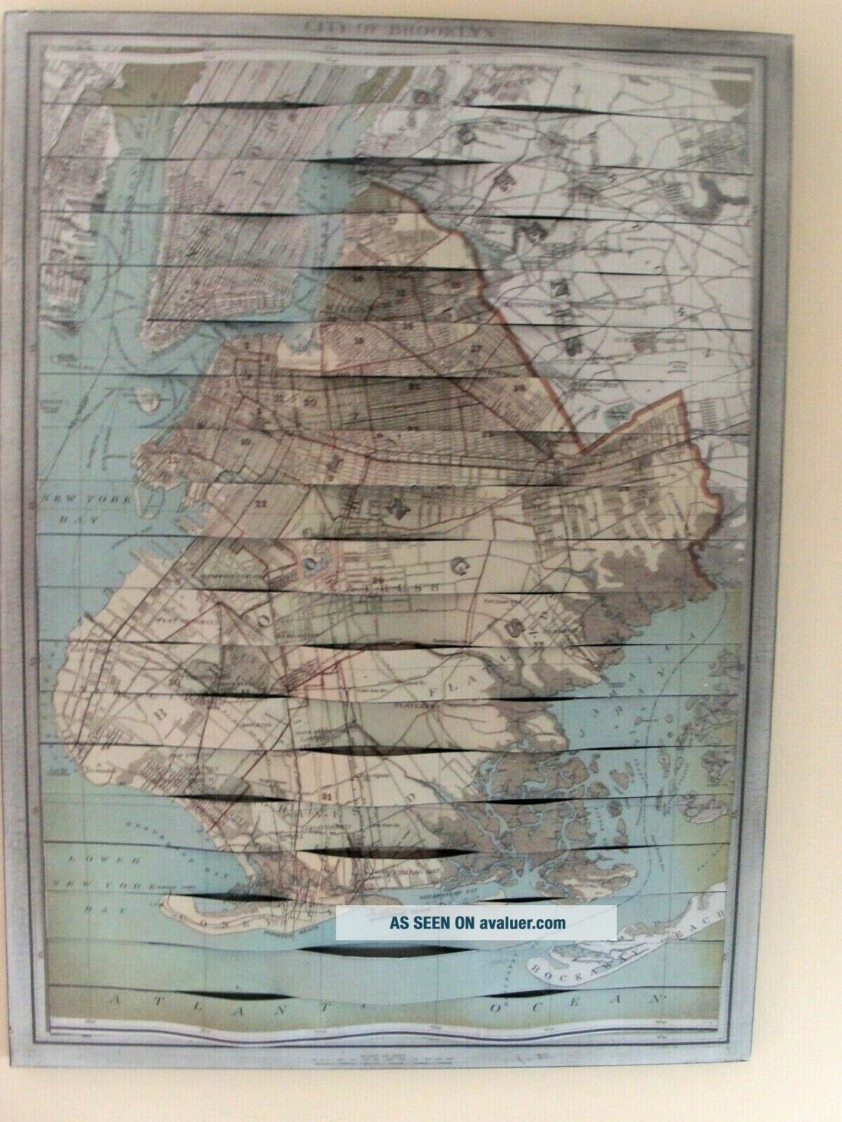
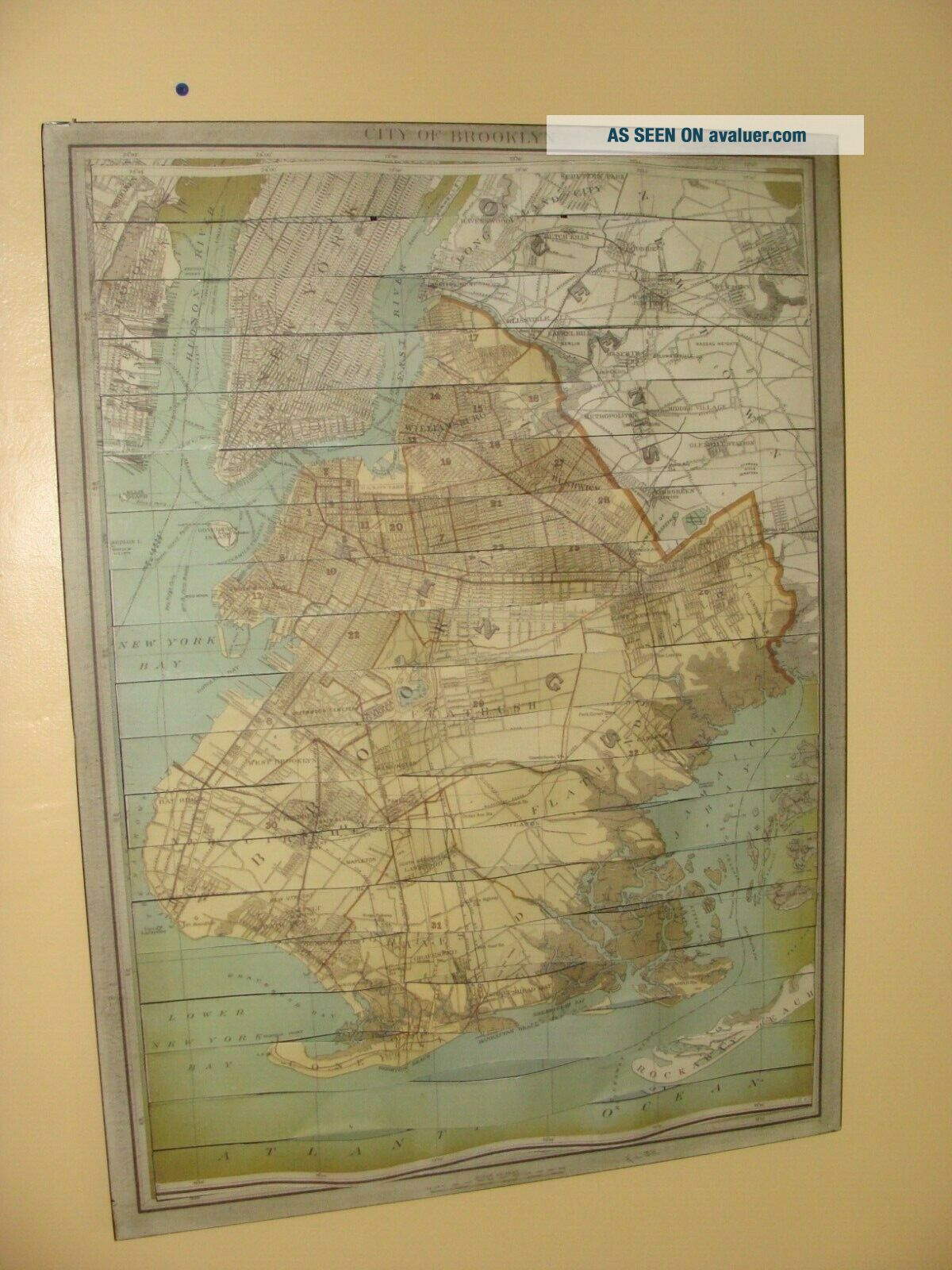
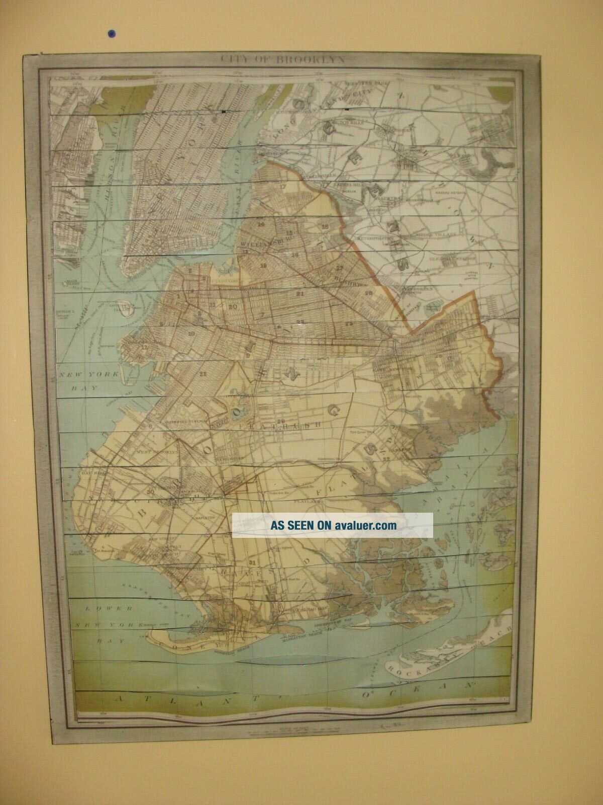
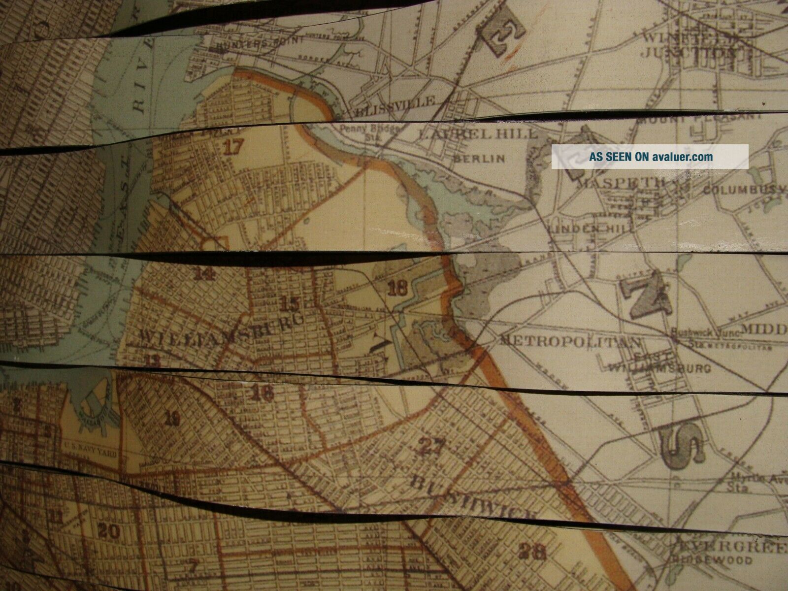
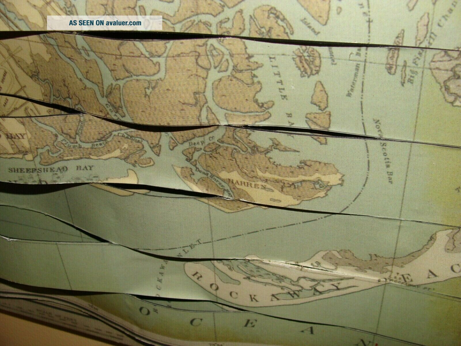
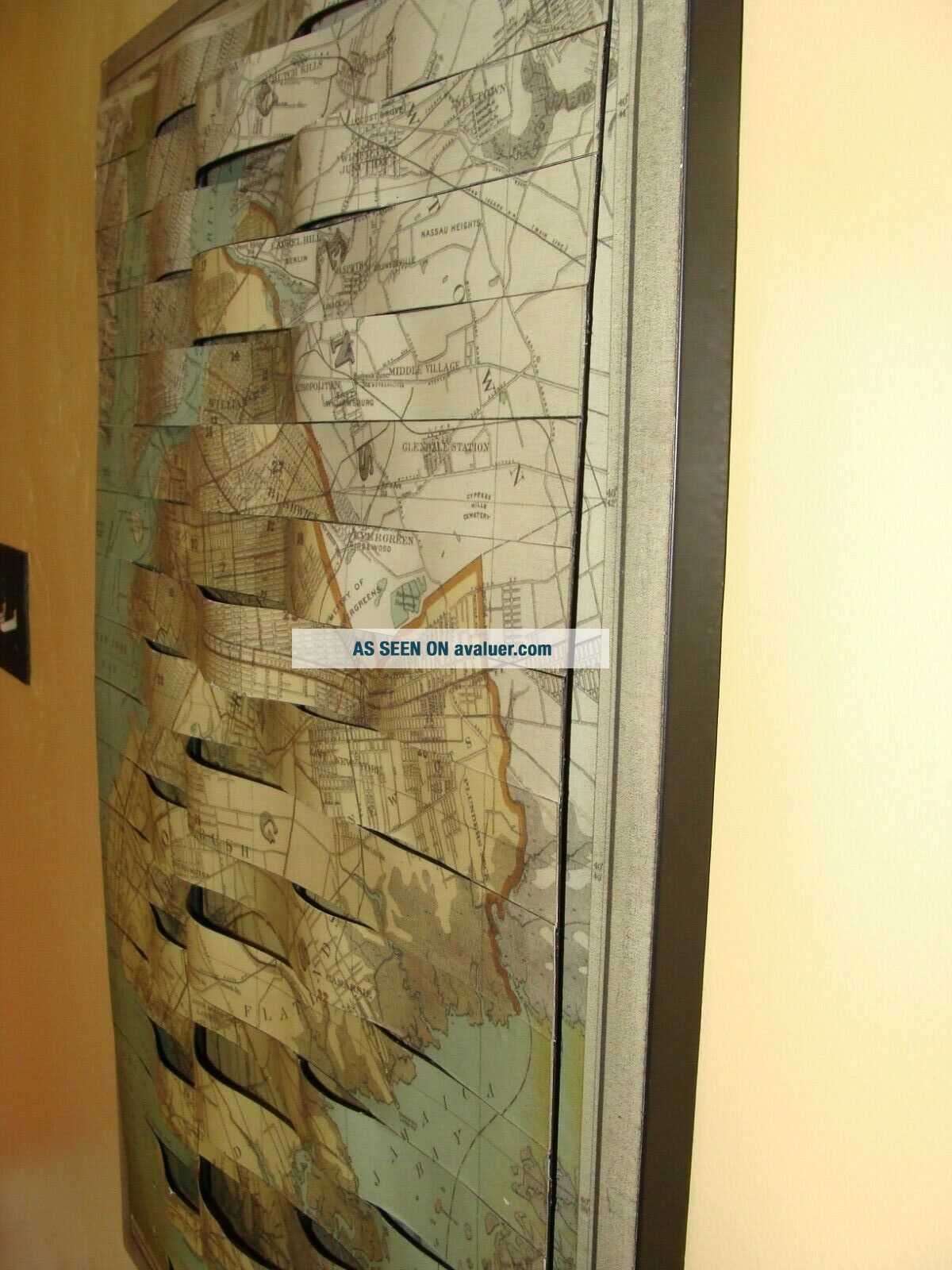
Map York Brooklyn GEOLOGICAL LARGE WALL SIZE Metal 3D Rare Vintage 24 " X 34 "


Item History & Price

Information:
Reference Number: Avaluer:44599Cartographer/Publisher: fuller
Year: 1913Printing Technique: Lithography
US State: New YorkOriginal/Reproduction: Antique Original
Date Range: 1980-1989City: brooklyn
Format: Sheet MapCountry/Region: United States of America
Type: map
Original Description:
PLEASE READ THIS ! On eBay, if you make an offer and that offer is accepted,  it is a commitment to buy.So please only make an offer when you are prepared to BUY. USA ONLY!We accept ALL reasonable offers and it can happen FAST! Be ready! Ships Same/next day payment is received and payment is due immediately please.USA only but God Bless us ALL!This piece is on sale locally and this listing will END when sold - good luck!Be ready as payment is due immediately - GOD BLESS!A nic...e piece unique metal 3d handmade art wall hanging beast - it weighs 10 pounds - not some hipster poser shite - this is the real deal...


    Similar items


  • 1857 Map York Brooklyn Williamsburgh Jersey City County Wall Poster Office

    1857 Map York Brooklyn Williamsburgh Jersey City County Wall Poster Office

  • 4 Road Maps Touring Club Italiano 1983 Large Wall Size When Opened Vintage

    4 Road Maps Touring Club Italiano 1983 Large Wall Size When Opened Vintage

  • Plumas National Forest Map Usfs 2001 Large Wall Size Fold - Out

    Plumas National Forest Map Usfs 2001 Large Wall Size Fold - Out

  • Brooklyn Brewery Large Tin Tacker Metal Beer Sign

    Brooklyn Brewery Large Tin Tacker Metal Beer Sign

  • Brooklyn Brewery Large Tin Tacker Metal Beer Sign

    Brooklyn Brewery Large Tin Tacker Metal Beer Sign

  • Brooklyn Brewery Large Tin Tacker Metal Beer Sign 12”

    Brooklyn Brewery Large Tin Tacker Metal Beer Sign 12”

  • Hot Girls Calendar 2020 Large Wall Size

    Hot Girls Calendar 2020 Large Wall Size

  • O

    O ' Keefe Extra Old Stock Tin Beer Sign Hi - Test Large Wall Decor Metal


    • You might also like


    • 1860 Mitchell Hand Colored Map Colorado,  Nebraska & Kansas - Civil War Era

      1860 Mitchell Hand Colored Map Colorado, Nebraska & Kansas - Civil War Era

    • 18th Century French Map Of North America

      18th Century French Map Of North America

    • Las Vegas Nevada Vintage 1967 Us Geological Survey Quadrangle Map 4 Panels

      Las Vegas Nevada Vintage 1967 Us Geological Survey Quadrangle Map 4 Panels

    • Rare Antique 1845 Maps United States Exploring Expedition Book Antartica Hawaii

      Rare Antique 1845 Maps United States Exploring Expedition Book Antartica Hawaii

    • Vintage 1926 Map Hollywood From The Best Surveys Of The Time

      Vintage 1926 Map Hollywood From The Best Surveys Of The Time

    • American Continent (western Hemisphere) 1747 Bowen Antique Copper Engraved Map

      American Continent (western Hemisphere) 1747 Bowen Antique Copper Engraved Map

    • Gulf Coast Florida Texas United States 1705 De Fer Unusual Antique Engraved Map

      Gulf Coast Florida Texas United States 1705 De Fer Unusual Antique Engraved Map

    • California As Island United States 1700 De Fer Unusual First Edition Antique Map

      California As Island United States 1700 De Fer Unusual First Edition Antique Map

Avaluer          About Us          Privacy Policy          Contact Us          UP
© 2022, avaluer.net, Inc. or its affiliates