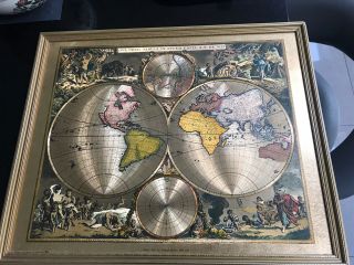
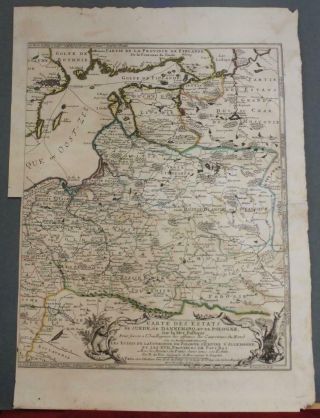
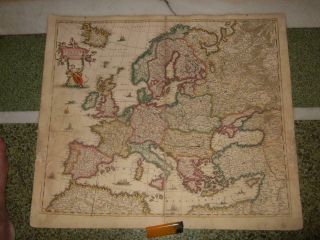
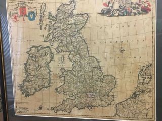
RUSSIA MOSCOVIA 1680 FREDERIK DE WIT UNUSUAL LARGE UNUSUAL ANTIQUE MAP 17TH C


Item History & Price

Information:
Reference Number: Avaluer:44700811Cartographer/Publisher: Frederik de Wit
Year: 1680Printing Technique: Copper Plate
Date Range: 1600-1699Original/Reproduction: Antique Original
Country/Region: RussiaTopic: Maps
Original Description:

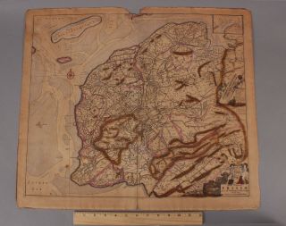
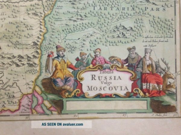
Title of the map:"TABULA RUSSIA Vulgo MOSCOVIA"
Unusual large antique copper engraved map of Russia, by Frederik DE WIT (1630-1706), a famous Dutch cartographer.The map is very decorative, with a ornemental title cartouche.The map is engraved by Lhuilier.

Frederik De Wit, also written Frederic, Frederico and Fredericus. His surname is also written as De Witt and De Widt. He was born in Gouda and died in Amsterdam. He was the company founder. He edited his first atlas... "atlas maior" around 1662. He published a nautical atlas in 1675. In 1695 he began to published a town atlas of the Netherlands after he acquired some city plans at the auction of the famous Blaeu publishing firm's printing plates. After his death, his wife continued to hold the firm. His son liquidated the firm and most of the maps went to Pierre Mortier who worked after with Covens and founded the firm Covens et Mortier, one of the most famous publishing maps and views of XVIIIe century.

Size with margins : 58, 5 x 52, 4 cm / 22, 8 x 20, 4 inches

Condition : very good condition, old colors, on strong paper.Edition : Amsterdam, 1690, XVIIe Century.

If you buy more than one item, you have to pay only one shipping cost.All shipments are insured.
WE DON'T SELL LASER AND COPIES MAPS, ALL WE SELL IS ORIGINAL AND ANTIQUEDue to the age an type of paper, some imperfections are to be expected. Please examine the images provided carefully, and if you have any questions please ask and we will be happy to help you


    Similar items


  • 17thc Antique 1680 Amsterdam,  Friesland Frederik De Wit Engraved Map

    17thc Antique 1680 Amsterdam, Friesland Frederik De Wit Engraved Map

  • Malta Map By Frederik De Wit 1680

    Malta Map By Frederik De Wit 1680

  • Asian Continent 1680ca De Wit Unusual Antique Copper Engraved Map

    Asian Continent 1680ca De Wit Unusual Antique Copper Engraved Map

  • Old World Map Frederik De Wit | Woven Tapestry Wall Art Hanging W/ Rod | 53x38

    Old World Map Frederik De Wit | Woven Tapestry Wall Art Hanging W/ Rod | 53x38

  • 2 Framed Pictures Frederik De Wit Orbis Tabvla & Moses Pitt 1681 World Map

    2 Framed Pictures Frederik De Wit Orbis Tabvla & Moses Pitt 1681 World Map

  • Lithuania Poland Latvia Russia 1700 De Fer Unusual Antique Copper Engraved Map

    Lithuania Poland Latvia Russia 1700 De Fer Unusual Antique Copper Engraved Map

  • 1660s,  Xl - De Wit,  Europe,  Italy Romania Poland Spain Russia Sweden Finland Iceland

    1660s, Xl - De Wit, Europe, Italy Romania Poland Spain Russia Sweden Finland Iceland

  • Frederick De Wit Nova Totius Angliae Scotiae Et Hiberniae British Isles 1680

    Frederick De Wit Nova Totius Angliae Scotiae Et Hiberniae British Isles 1680


    • You might also like


    • Hungary & Romania 1579 (1584) Ortelius Unusual Antique Copper Engraved Map

      Hungary & Romania 1579 (1584) Ortelius Unusual Antique Copper Engraved Map

    • Brussels Bruxelles Belfium 1777 De Ferraris & Dupuis Large Antique Map Sheet Xxi

      Brussels Bruxelles Belfium 1777 De Ferraris & Dupuis Large Antique Map Sheet Xxi

    • 1616 Atlas Map Of Iceland.

      1616 Atlas Map Of Iceland.

    • Kazan Russia 1767 Le Clerc/lespinasse Antique Copper Engraved City View

      Kazan Russia 1767 Le Clerc/lespinasse Antique Copper Engraved City View

    • 1899 Stanford,  Folding Map Of Norwich,  Norfolk,  Arthur Collins,  Jarrold & Sons,

      1899 Stanford, Folding Map Of Norwich, Norfolk, Arthur Collins, Jarrold & Sons,

    • 1948 Vintage Linen Colour Map Geological Survey Ten Mile Of Great Britain

      1948 Vintage Linen Colour Map Geological Survey Ten Mile Of Great Britain

    • 1944 Map Flying Bombs Sussex Ww2 Newspaper Military Kent Courier German V1 V2

      1944 Map Flying Bombs Sussex Ww2 Newspaper Military Kent Courier German V1 V2

    • Dated 1638 Vellum Map Of Icklesham Sussex Showing Land Uses Owners Etc

      Dated 1638 Vellum Map Of Icklesham Sussex Showing Land Uses Owners Etc

Avaluer          About Us          Privacy Policy          Contact Us          UP
© 2022, avaluer.net, Inc. or its affiliates