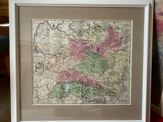
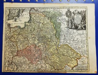
1744 Georg Mattaus Seutter Antique Map Of Poland, Lithuania & Baltic Countries

Item History & Price
| Reference Number: Avaluer:44824751 |
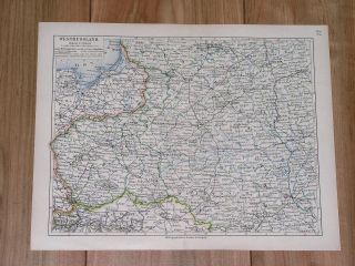
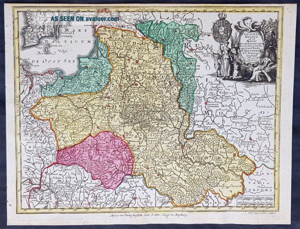
contact us ebay profile ebay storePolonia Regnum ul et Magni Ducat Lithuania........a Matth. Seutteri...T C Lotter, Geogr.Cartographer : - Seutter, Georg Matthaus 1678 - 1757 Date: - 1744 Size: - 11in x 8 1/2in (280mm x 215mm) Ref#: - 93400 Condition: - (A+) Fine ConditionDescription:
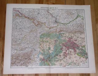
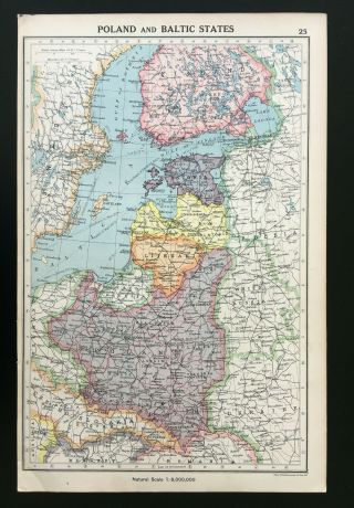
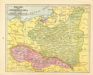
This beautifully hand coloured original copper-plate engraved antique map of Poland, Lithuania & the Baltic Countries was engraved by Tobias Lotter and was published in the 1744 edition of GM Seutters Atlas ...Minor Prae cipua Orbis Terrarum Imperia Regna et Provincias...., Augsburg, Germany.General Definitions:
Paper thickness and quality: - Heavy and stable
Paper color : - off white
Age of map color: - Original
Colors used: - Yellow, green, blue, pink
General color appearance: - Authentic
Paper size: - 11in x 8 1/2in (280mm x 215mm)
Plate size: - 10 1/2in x 8in (265mm x 205mm)
Margins: - Min 1/4in (5mm)Imperfections:
Margins: - None
Plate area: - None
Verso: - NoneBackground:
Atlas Minor was a series of beautiful maps of all parts of the world. Georg Matthäus Seutter was one of the most and important of the German cartographers of the 18th century, being appointed as the Geographer to the Imperial Court. His son, Albrecht Carl, joined Matthäus and eventually inherited the business. The maps from Atlas Minor were drawn by the two Seutters and engraved by Tobias Conrad Lotte. These maps are highly detailed and engraved with a bold hand with equally strong original hand color in the body of the map as was the 18th century German style. The cartouches were left uncolored in order to emphasize the elaborately detailed illustrations for which German maps are especially prized. These are some of the most decorative and interesting maps of the eighteenth century.Seutter, Georg Matthaus 1678 - 1757
Seutter was one of the most important and prolific German map publishers of the 18th century. Seutter started his career as an apprentice brewer. Apparently uninspired by the beer business, Seutter left his apprenticeship and moved to Nuremberg where he apprenticed as an engraver under the tutelage of the prominent J. B. Homann. Sometime in the early 18th century Seutter left Homann to establish his own independent cartographic publishing firm in Augsburg. Though he struggled in the early years of his independence, Seutters engraving skill and commitment to diversified map production eventually gained him a substantial following. Most of Seutters maps were heavily based upon, if not copies of, earlier work done by the Homann and Delisle firms.
By 1732 Seutter was one of the most prolific publishers of his time and was honored by the German Emperor Charles VI with the title of Imperial Geographer. Seutter continued to publish until his death, at the height of his career, in 1757. The Seutter firm continued under Seutters wastrel son Albrecht Carl until his death in 1762. Following Albrechts death, the firm was divided between the established Probst firm and the emerging firm of Tobias Conrad Lotter. Lotter, Seutters son in law, was a master engraver and worked on behalf of the Seutter firm. Lotter would eventually become one of the most prominent cartographers of his day.
Please note all items auctioned are genuine, we do not sell reproductions. A Certificate of Authenticity (COA) can be issued on request.
What is an Antique MapThe word Antique in the traditional sense refers to an item that is more than a hundred years old. In the past maps were sold in two forms, as a single sheet (broadsheet) or bound in an atlas or book. The majority of antique maps for sale today come from books or atlases and have survived due to the protection offered by the hardback covers.When considering a purchase The first thing to determine when staring a collection or purchasing an item, is what is important to you. Most collectors prefer to build their collections around a theme. You may decide to collect maps from one region or country, charting its development through time. Similarly you could collect maps of one particular period in time, by type (i.e. sea or celestial charts) or by cartographer. The collector might also want to consider the theme of cartographical misconceptions such as California as an island or Australia as Terra Australis or the Great Southern Land.
The subject is so wide that any would-be-collector has almost endless possibilities to find his own little niche within the field, and thereby build a rewarding collection.Starting a collection & pricingPricing is based on a number of different factors, the most important of which is regional. In any series of maps the most valuable are usually the World Map and the America/North America. The World because it is usually the most decorative and America because it has the strongest regional market. Other factors that come into play re: price is rarity, age, size, historical importance, decorative value (colour) and overall condition and quality of paper it is printed on.
As specialised dealers, we frequently work with first time map buyers who are just starting their collection. Guiding new collectors on their first antique map purchase and helping new collectors to focus their interests is one of the most rewarding aspects of being an rare map dealer. So please do not hesitate to contact us and we will be happy to help with any questions you may have.Payment, Shipping & Return OptionsPlease click on the \"Shipping and Payments\" Tab above for shipping, payment and return detailsAbout USClassical Images was founded 1998 and has built an excellent reputation for supplying high quality original antiquarian maps, historical atlases, antique books and prints. We carry an extensive inventory of antiquarian collectibles from the 15th to 19th century. Our collection typically includes rare books and decorative antique maps and prints by renowned cartographers, authors and engravers. Specific items not listed may be sourced on request.
Classical Images adheres to the Codes of Ethics outlined by the Antiquarian Booksellers Association of America (ABAA).
We are a primarily an online based enterprise, however our inventory may be viewed by appointment. Please call or email to arrange a viewing.