RARE 1908 Surveyor Map Of Ocean City Gardens Jersey NJ PLAN NO. 1


Item History & Price
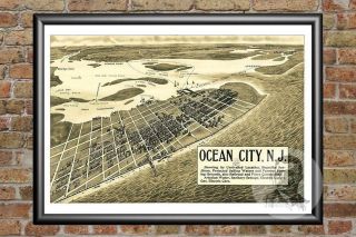
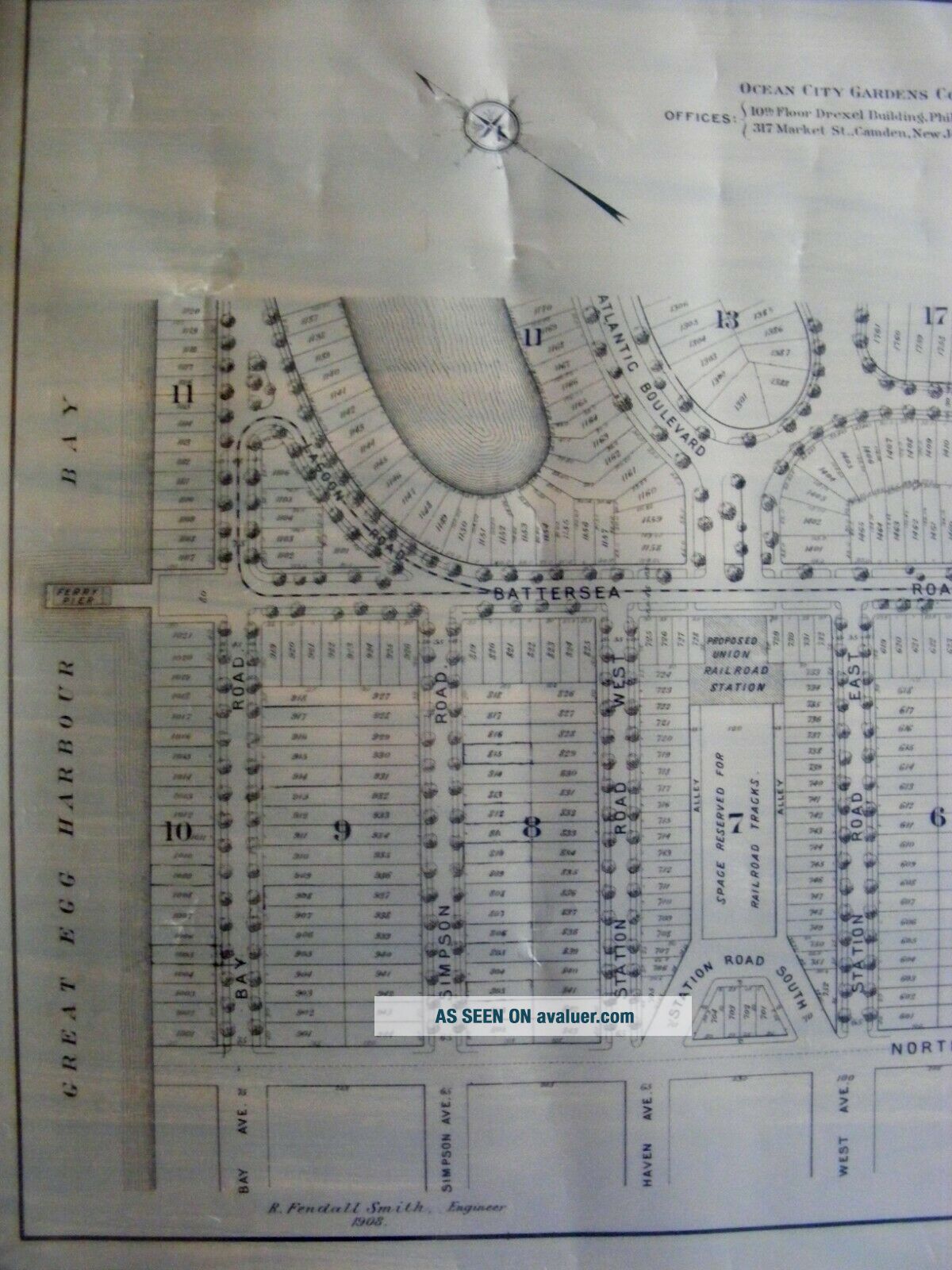
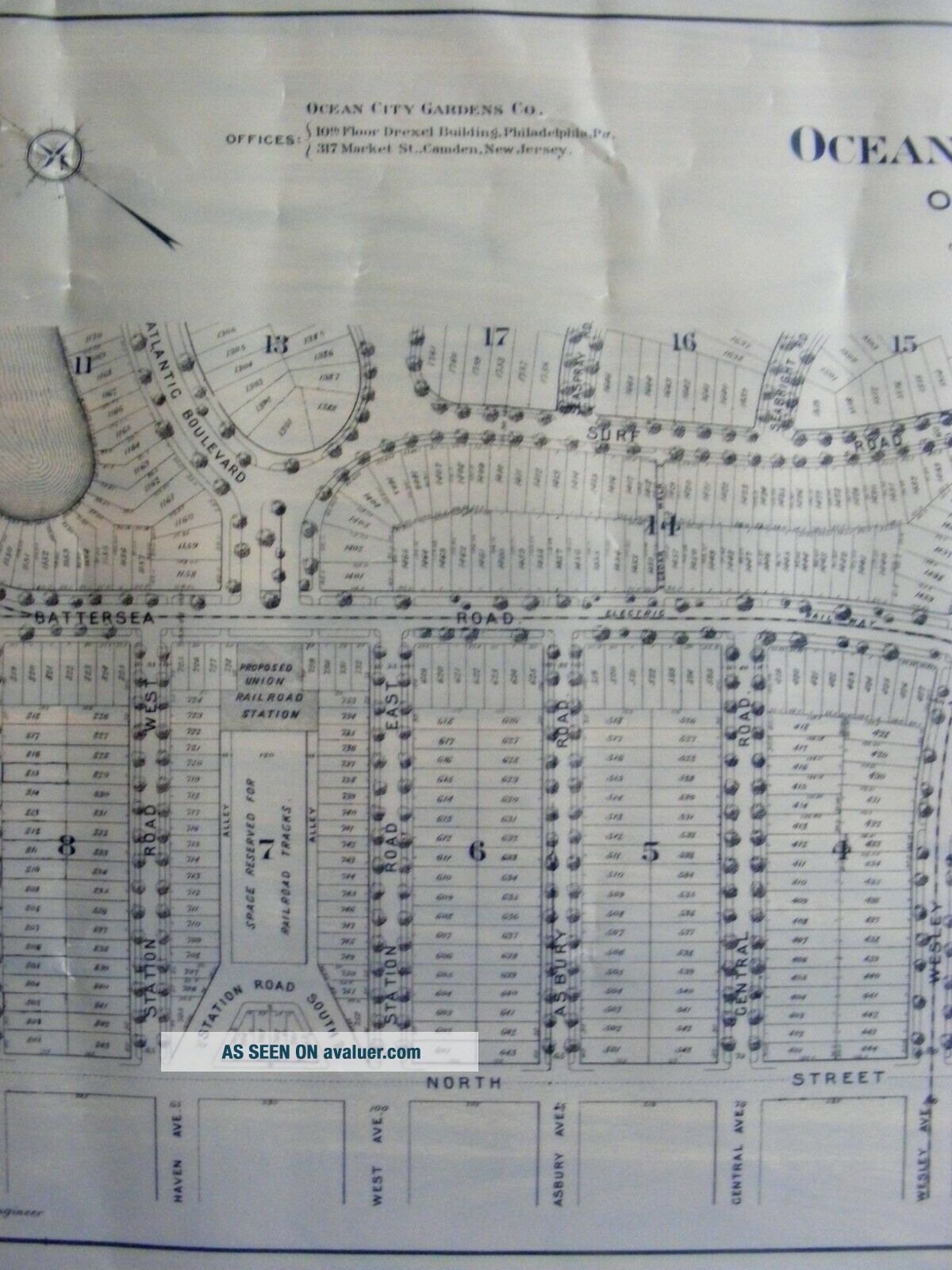
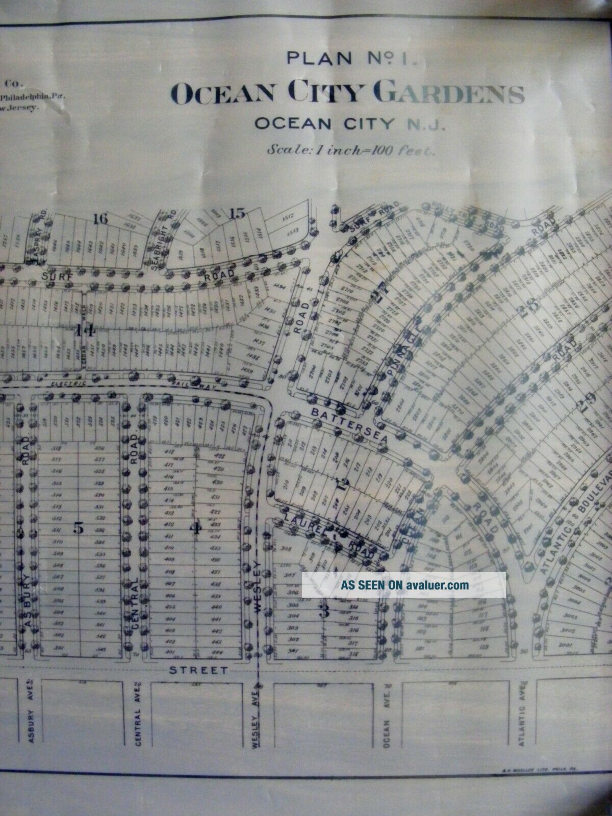
Ocean City Gardens New Jersey Surveyor Map.
Size Approx: 32-1/2 x 22-1/2 in.
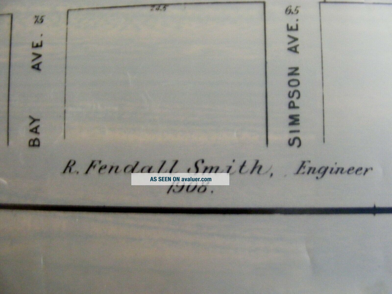
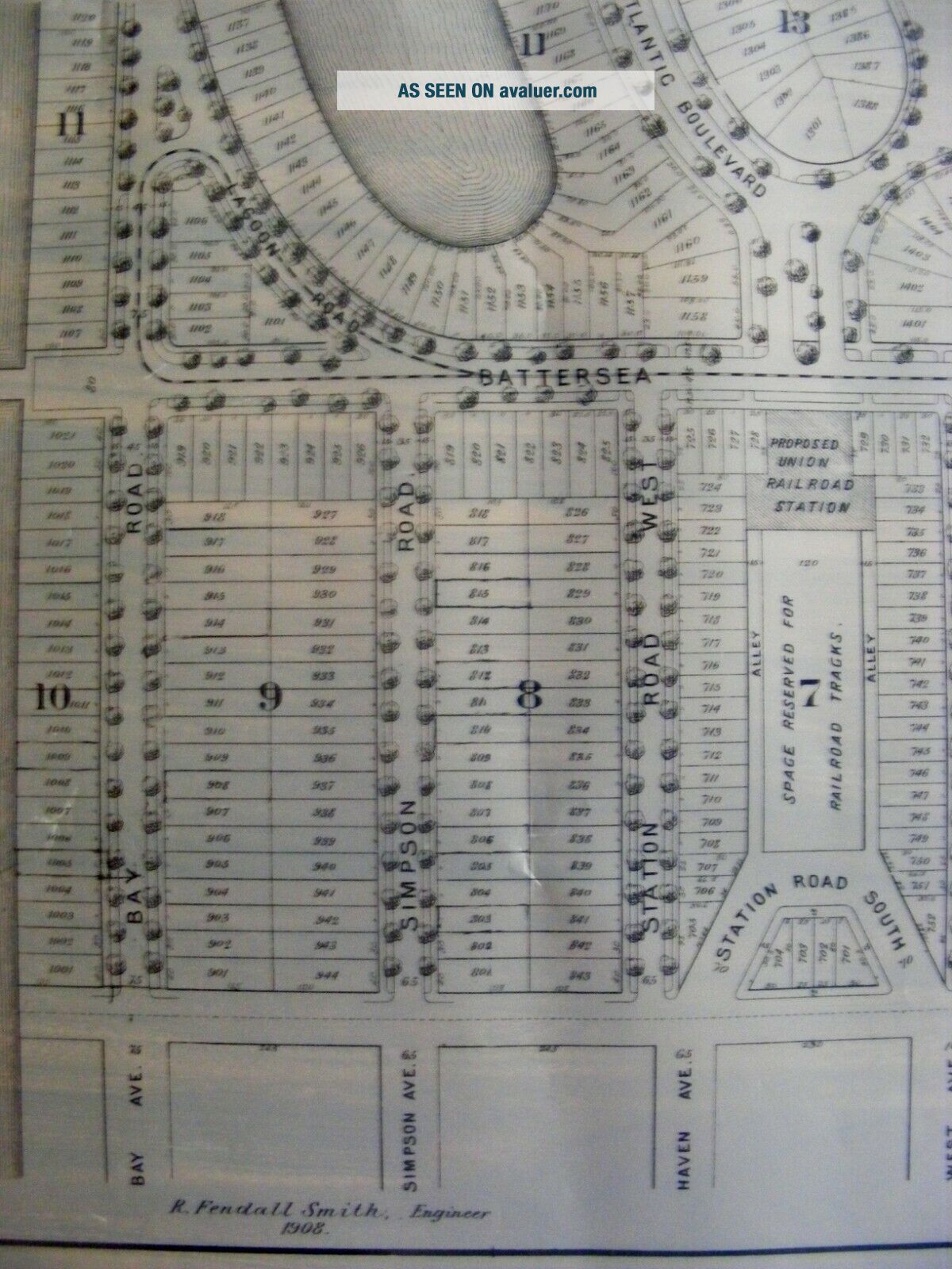
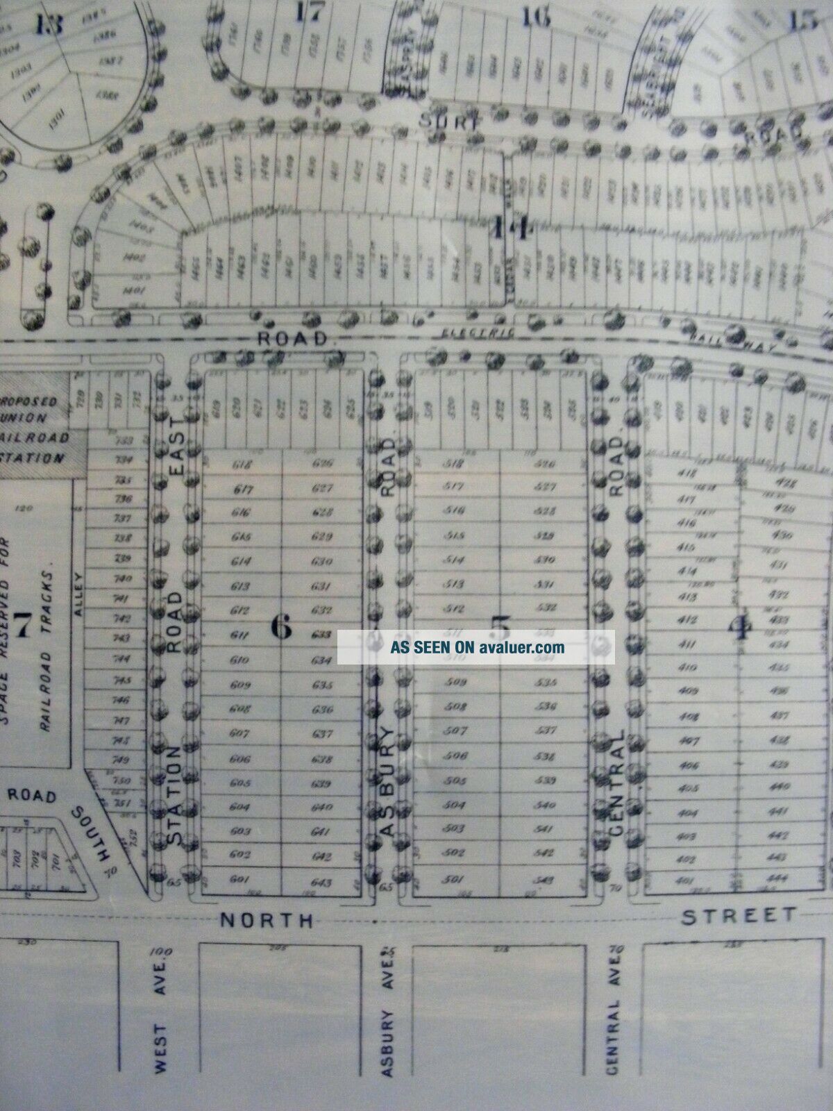
You are bidding on a RARE antique (circa, 1908) original Ocean City Gardens, Ocean City, N.J. surveyor map. The map is of proposed city plan number 1 by Ocean City Gardens Company of Philadelphia/New Jersey, published by A.H. Mueller and engineered by R. Fendall Smith. The map in constructed of what appears to be a semi-translucent heavy wax-type paper as seen in photos. ~The Gardens Area of O...cean City boasts one of the most exclusive and desirable areas in all of, Ocean City. The Ocean City Gardens Company began selling Garden lots in 1911. They described the area as a "high class residential section". Experiencing a real estate boom by 1922, in just 3 weeks time, 388 of 449 available lots sold. Buyers were described as high class Philadelphians interested in a family resort~Overall condition is very good. Some surface wear, staining, creasing and fading as shown, dirty/dusty from years of storage, needs cleaning. More photos on request!
00013
Size Approx: 32-1/2 x 22-1/2 in.
You are bidding on a RARE antique (circa, 1908) original Ocean City Gardens, Ocean City, N.J. surveyor map. The map is of proposed city plan number 1 by Ocean City Gardens Company of Philadelphia/New Jersey, published by A.H. Mueller and engineered by R. Fendall Smith. The map in constructed of what appears to be a semi-translucent heavy wax-type paper as seen in photos. ~The Gardens Area of O...cean City boasts one of the most exclusive and desirable areas in all of, Ocean City. The Ocean City Gardens Company began selling Garden lots in 1911. They described the area as a "high class residential section". Experiencing a real estate boom by 1922, in just 3 weeks time, 388 of 449 available lots sold. Buyers were described as high class Philadelphians interested in a family resort~Overall condition is very good. Some surface wear, staining, creasing and fading as shown, dirty/dusty from years of storage, needs cleaning. More photos on request!
00013