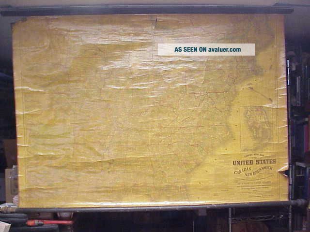
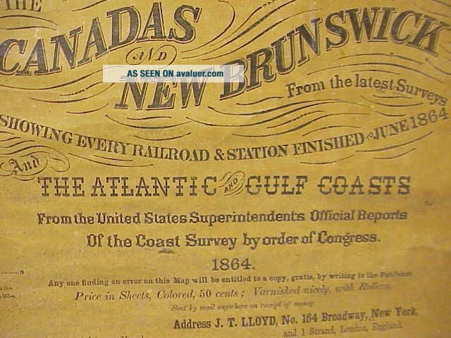
LLOYD ' S 1864 WALL MAP US CANADAS BRUNSWICK SHOWS EVERY RAILROAD STATION


Item History & Price

Information:
Reference Number: Avaluer:45269
Original Description:
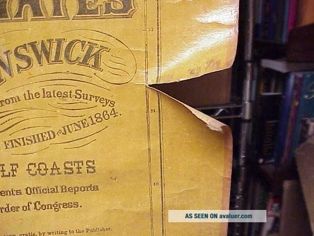
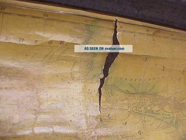
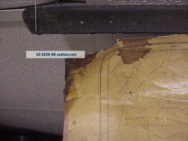
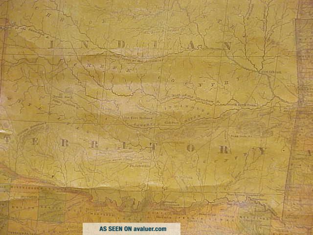
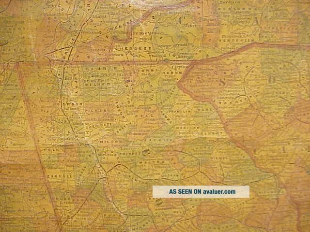
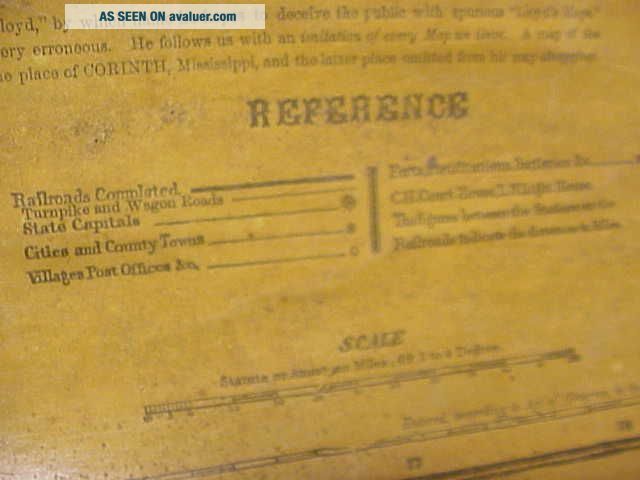
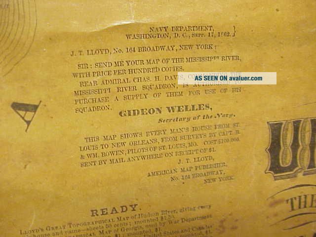
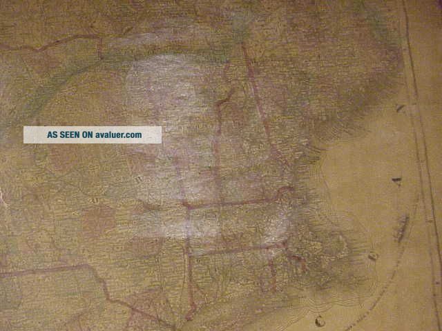
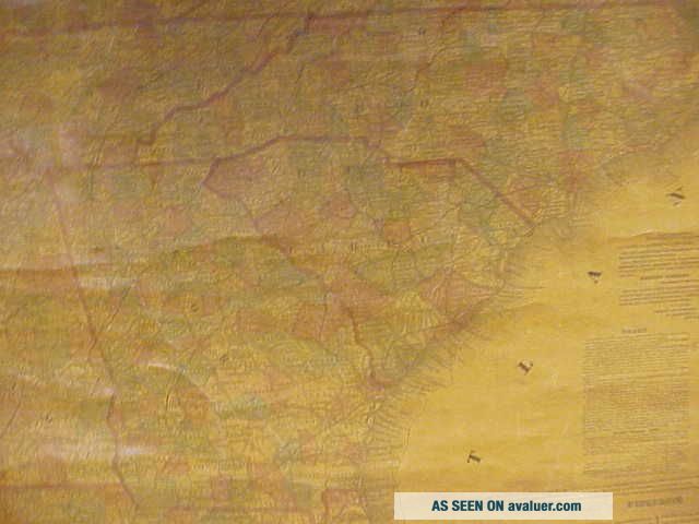
YOU ARE BIDDING ON THIS ANTIQUE U.S. MAP BY LLOYD'S. SAYS SHOWS EVERY RAILROAD STATION FINISHED BY JUNE 1864. CHECK OUT THE INDIAN TERRITORY. HAS A FEW ISSUES, (SEE PICS). MAP MEASURES APPROX 52 1/2" X 37 ". SORRY ABOUT THE GLARE. I BELIEVE THIS ONE IS PAPER. I HAVE ANOTHER EARLY ONE UP FOR AUCTION TOO.  PLEASE SEE PICS TO HELP WITH DESCRIPTION.  I HAVEN'T TRIED TO CLEAN OR POLISH.  WILL COMBINE SHIP WHEN POSSIBLE.  INTERNATIONAL WIN...NERS MUST USE THE GLOBAL SHIPPING PROGRAM UNLESS OK'D BY ME. MAKE SURE YOUR COUNTRY IS ON THEIR LIST BEFORE BIDDING.  THANKS FOR LOOKING, BID ON.
Powered by eBay Turbo Lister
The free listing tool. List your items fast and easy and manage your active items.

00055


    Similar items


  • Forrest Fenn

    Forrest Fenn ' S Treasure Wall Map Xl And 2019 Searcher Coin

  • 1985 Vintage Hammond

    1985 Vintage Hammond ' S Road Atlas America Us Canada Mexico

  • National Geographic: Earth

    National Geographic: Earth ' S Moon Wall Map February 1969 (read For Details)

  • Vintage 1957 Rand Mcnally Road Atlas X.  S.  Smith Advert Cover Us Canada Mexico

    Vintage 1957 Rand Mcnally Road Atlas X. S. Smith Advert Cover Us Canada Mexico

  • A Map Of Long Island " Ny 1930s Historic Wall Map - 24x36

    A Map Of Long Island " Ny 1930s Historic Wall Map - 24x36

  • Vintage Deer Hunter

    Vintage Deer Hunter ' S Prayer Wall Plaque, Vancouver Canada, 3d Buck Sign, Cabin

  • French Colonial 1721 S Liard In France Us Canada Inv 7332

    French Colonial 1721 S Liard In France Us Canada Inv 7332

  • Africa & Southern Europe Map 1926 - Bacon

    Africa & Southern Europe Map 1926 - Bacon ' S Excelsior Wall Map - 95 X 75cm


    • You might also like


    • 1860 Mitchell Hand Colored Map Colorado,  Nebraska & Kansas - Civil War Era

      1860 Mitchell Hand Colored Map Colorado, Nebraska & Kansas - Civil War Era

    • 18th Century French Map Of North America

      18th Century French Map Of North America

    • Las Vegas Nevada Vintage 1967 Us Geological Survey Quadrangle Map 4 Panels

      Las Vegas Nevada Vintage 1967 Us Geological Survey Quadrangle Map 4 Panels

    • Rare Antique 1845 Maps United States Exploring Expedition Book Antartica Hawaii

      Rare Antique 1845 Maps United States Exploring Expedition Book Antartica Hawaii

    • Vintage 1926 Map Hollywood From The Best Surveys Of The Time

      Vintage 1926 Map Hollywood From The Best Surveys Of The Time

    • American Continent (western Hemisphere) 1747 Bowen Antique Copper Engraved Map

      American Continent (western Hemisphere) 1747 Bowen Antique Copper Engraved Map

    • Gulf Coast Florida Texas United States 1705 De Fer Unusual Antique Engraved Map

      Gulf Coast Florida Texas United States 1705 De Fer Unusual Antique Engraved Map

    • California As Island United States 1700 De Fer Unusual First Edition Antique Map

      California As Island United States 1700 De Fer Unusual First Edition Antique Map

Avaluer          About Us          Privacy Policy          Contact Us          UP
© 2022, avaluer.net, Inc. or its affiliates