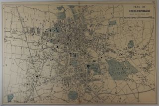
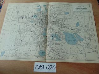
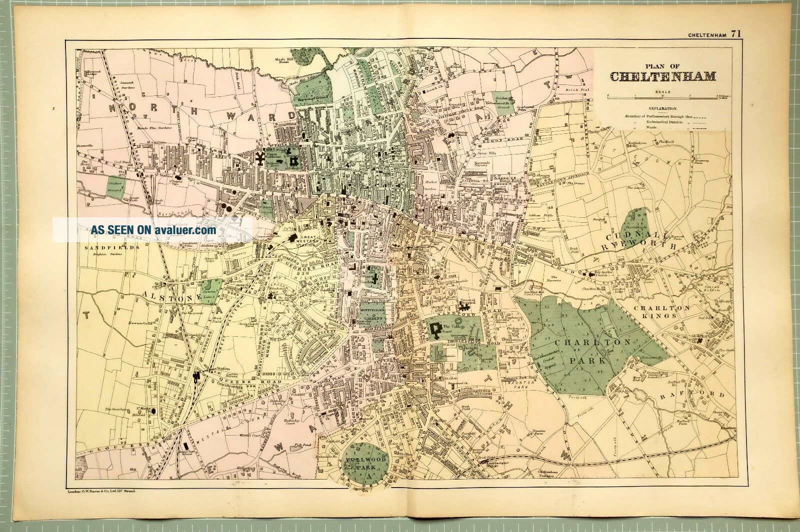
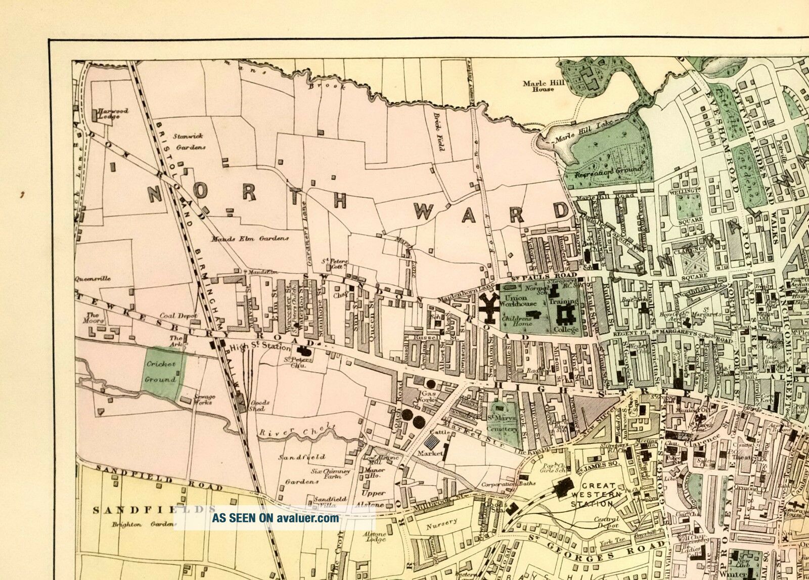
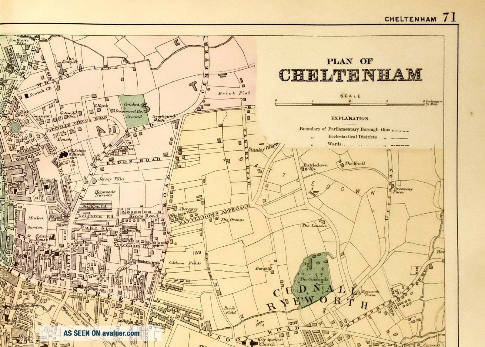
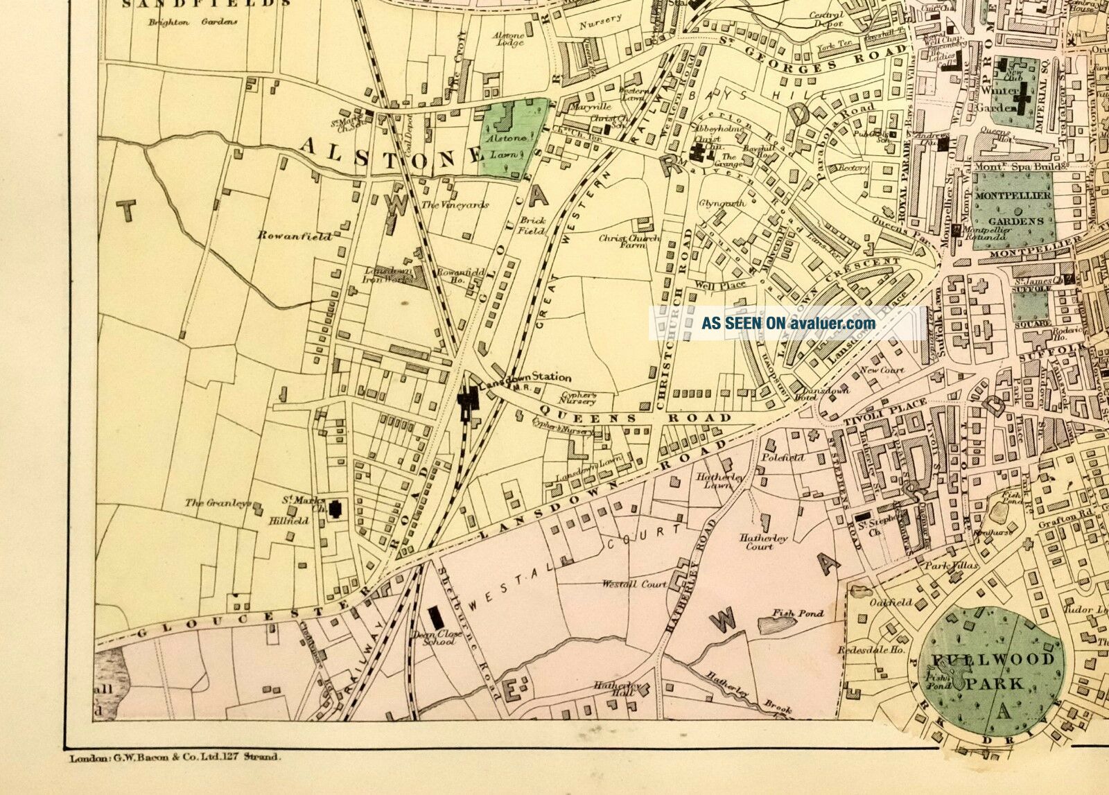
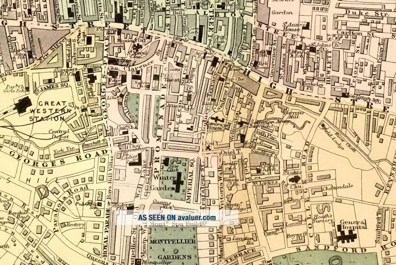
1895 MAP PLAN OF CHELTENHAM WINTER GARDEN CHARLTON PARK STATIONS ALSTONE COLLEGE


Item History & Price

Information:
Reference Number: Avaluer:45388Cartographer/Publisher: Bacon
Year: 1895Original/Reproduction: Antique Original
Original Description:
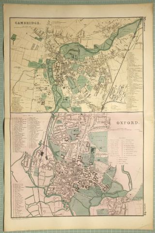
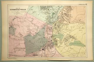
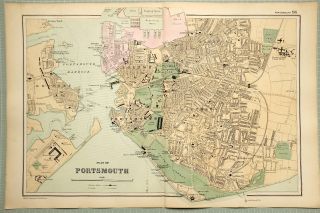
This antique map is one of a series produced for:
The Commercial and Library Atlas of the British Isles
Publisher: G.W. Bacon & Co. Ltd, London
Publication Date: 1895
This listing is for the single map shown
Approximate size of fold-out sheet20 1/2 inches x 13 1/2 inches
****CONDITION VERY GOOD****
PLEASE VIEW IMAGES TO SEE ANY MINOR HANDLING/AGE MARKS Please message with any questions regarding this item
1895-BF


    Similar items


  • Antique Colored Map - Plan Of Cheltenham - Lithograph - C1875

    Antique Colored Map - Plan Of Cheltenham - Lithograph - C1875

  • 1895 Map Plan Of Cambridge Colleges Oxford Churches Halls University

    1895 Map Plan Of Cambridge Colleges Oxford Churches Halls University

  • 1895 Map Plan Of Tunbridge Wells The Common Pump Room Churches Brewery

    1895 Map Plan Of Tunbridge Wells The Common Pump Room Churches Brewery

  • 1895 Map Plan Of Portsmouth Harbour Dock Yard Pier School Church Stations

    1895 Map Plan Of Portsmouth Harbour Dock Yard Pier School Church Stations

  • 19th Century 1889 Antique Bacon Map Plan Of Cheltenham 69

    19th Century 1889 Antique Bacon Map Plan Of Cheltenham 69

  • Sketch Plan Of The Zoological Gardens,  London,  1953 Vintage Map,

    Sketch Plan Of The Zoological Gardens, London, 1953 Vintage Map,

  • 1895 Map Environs Of Dundee Perth Plan Fife Alyth Forfar Montrose Arbroath

    1895 Map Environs Of Dundee Perth Plan Fife Alyth Forfar Montrose Arbroath

  • 1895 Antique Map - Plan Of Birmingham

    1895 Antique Map - Plan Of Birmingham


    • You might also like


    • Hungary & Romania 1579 (1584) Ortelius Unusual Antique Copper Engraved Map

      Hungary & Romania 1579 (1584) Ortelius Unusual Antique Copper Engraved Map

    • Brussels Bruxelles Belfium 1777 De Ferraris & Dupuis Large Antique Map Sheet Xxi

      Brussels Bruxelles Belfium 1777 De Ferraris & Dupuis Large Antique Map Sheet Xxi

    • 1616 Atlas Map Of Iceland.

      1616 Atlas Map Of Iceland.

    • Kazan Russia 1767 Le Clerc/lespinasse Antique Copper Engraved City View

      Kazan Russia 1767 Le Clerc/lespinasse Antique Copper Engraved City View

    • 1899 Stanford,  Folding Map Of Norwich,  Norfolk,  Arthur Collins,  Jarrold & Sons,

      1899 Stanford, Folding Map Of Norwich, Norfolk, Arthur Collins, Jarrold & Sons,

    • 1948 Vintage Linen Colour Map Geological Survey Ten Mile Of Great Britain

      1948 Vintage Linen Colour Map Geological Survey Ten Mile Of Great Britain

    • 1944 Map Flying Bombs Sussex Ww2 Newspaper Military Kent Courier German V1 V2

      1944 Map Flying Bombs Sussex Ww2 Newspaper Military Kent Courier German V1 V2

    • Dated 1638 Vellum Map Of Icklesham Sussex Showing Land Uses Owners Etc

      Dated 1638 Vellum Map Of Icklesham Sussex Showing Land Uses Owners Etc

Avaluer          About Us          Privacy Policy          Contact Us          UP
© 2022, avaluer.net, Inc. or its affiliates