1600 Matthias QUAD Atlas Map BELGIUM - NETHERLANDS - Germania Inferior


Item History & Price

Information:
Reference Number: Avaluer:45446Printing Technique: Copper Plate
Year: 1600Original/Reproduction: Antique Original
Date Range: 1600-1699
Original Description:
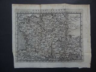
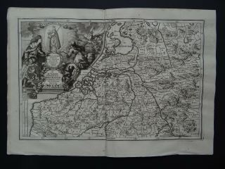
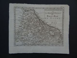
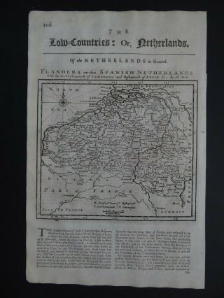
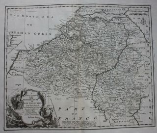
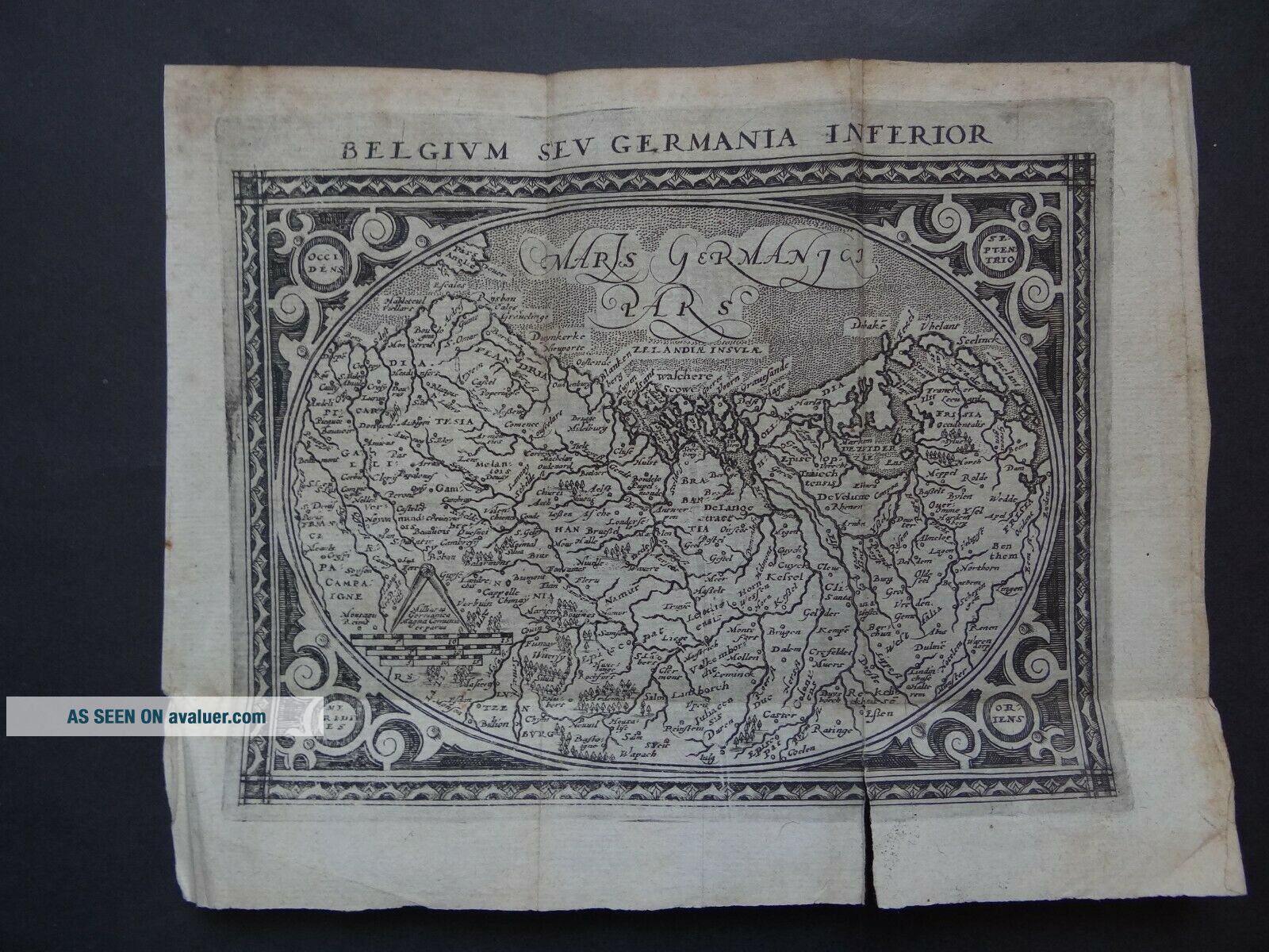
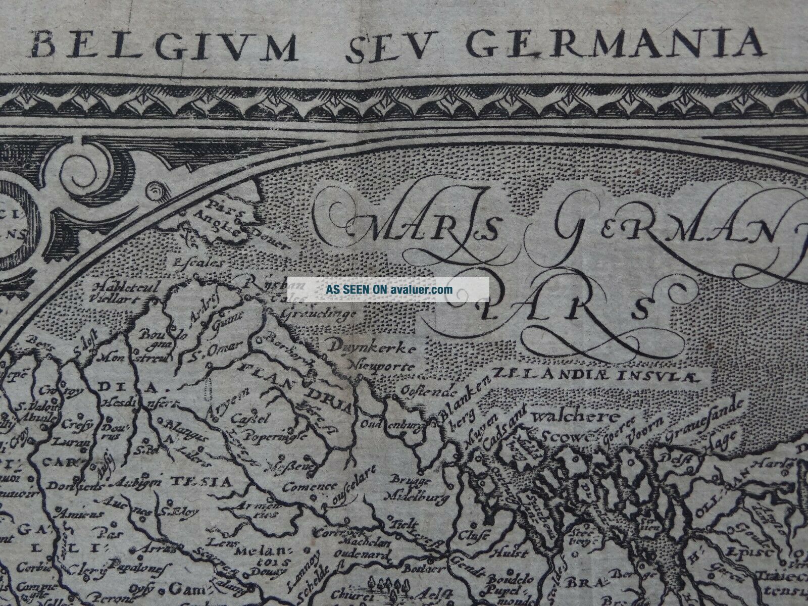
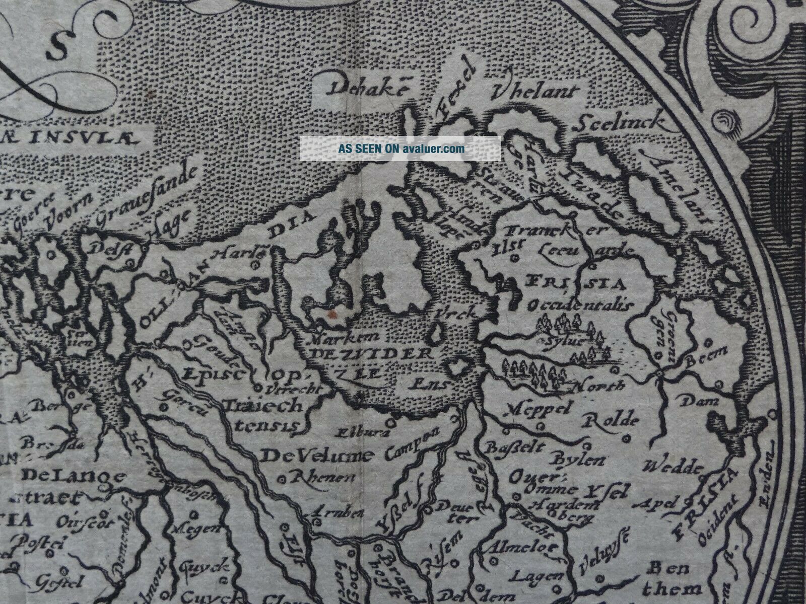
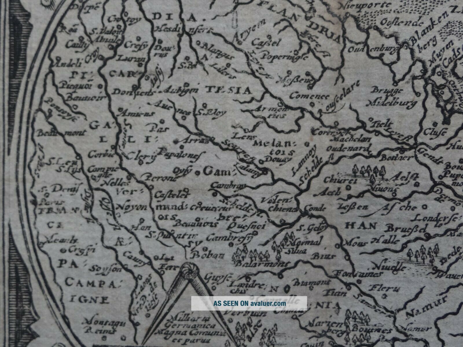
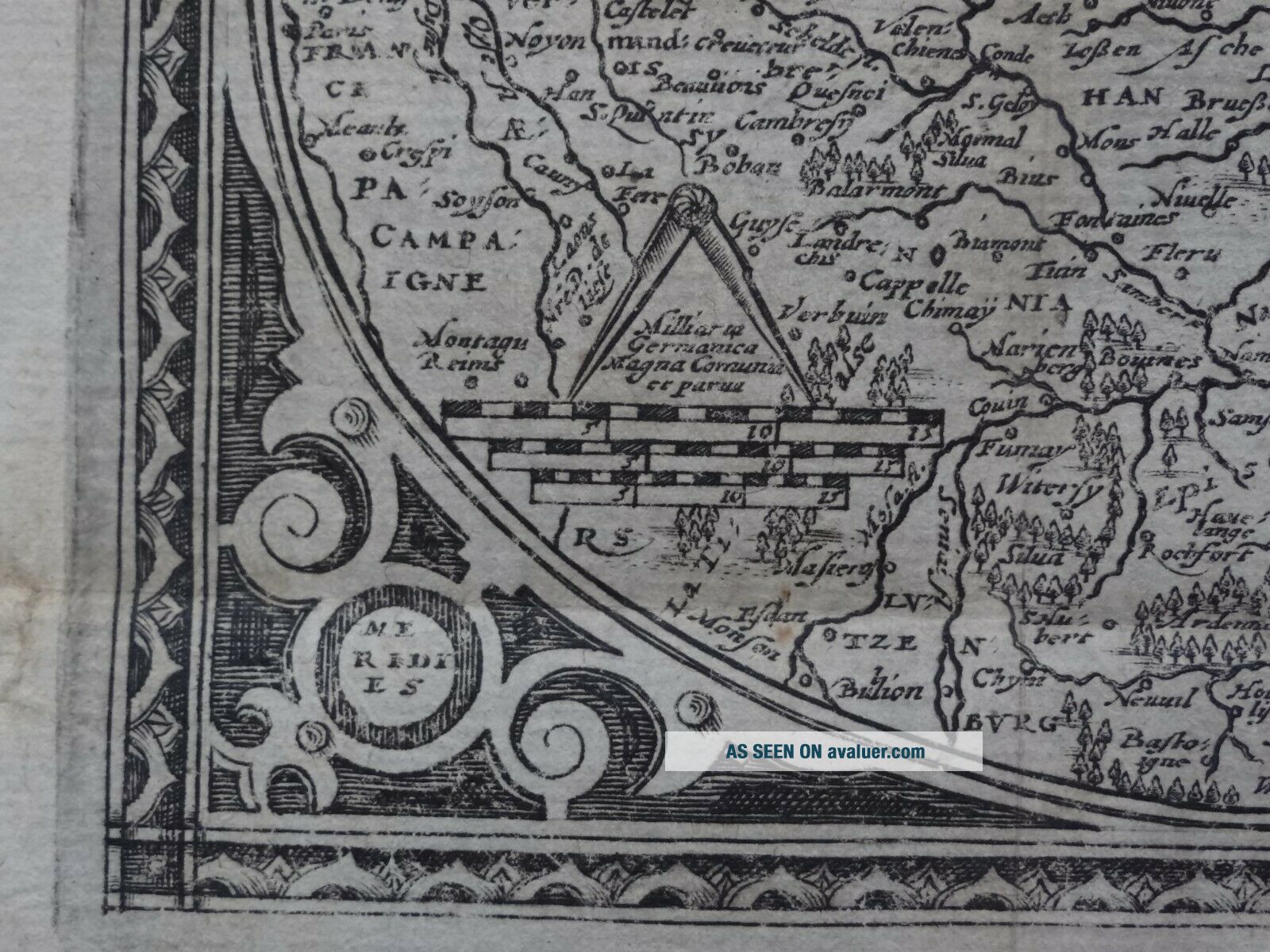
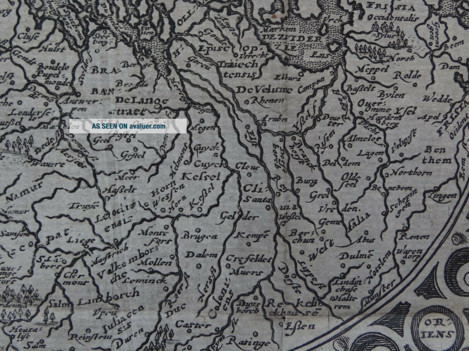
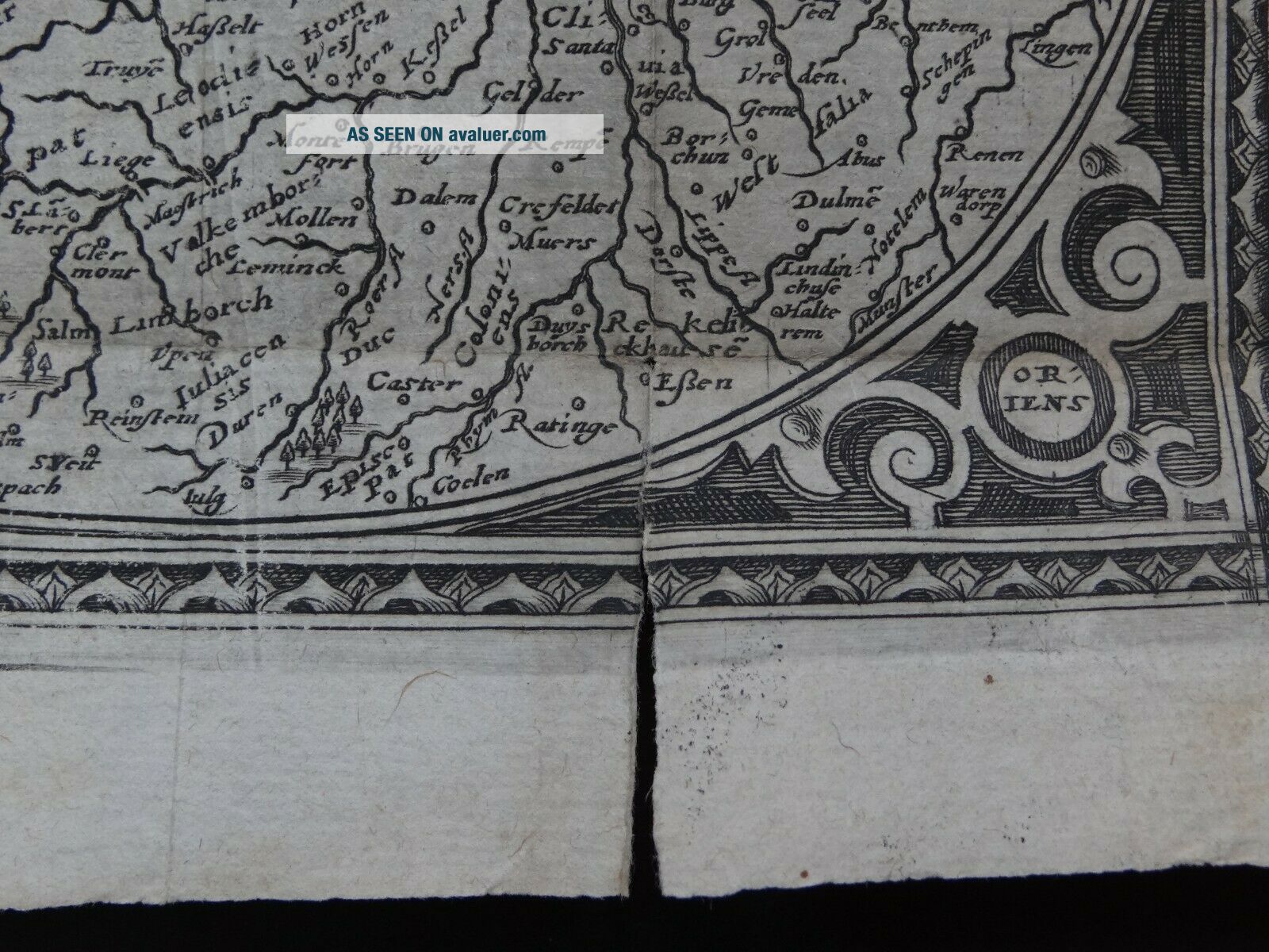
Map title:Belgium sev Germania Inferior
A rare copper engraved antique folding map of Belgium and the Netherlandsby Matthias Quad1600

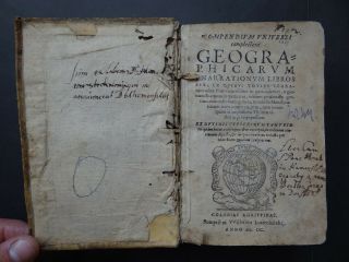
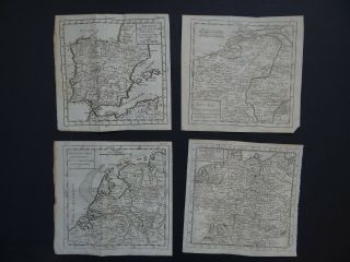
Map is from the book:Compendium universi complectens geographicarum enarrationum librosMatthiam Quadum1600 See pictures
Page size 20 x 16 cmMap is in good condition for its age, engravings are clearPaper has some browning and handling marks which is mostly marginalsome misfolding around page edges and small 3.5cm tear on lower part of r...ight fold lineText in LatinBlank on reverseUncoloured

Payments by Paypal please.UK postage £4.99Europe £9.99Worldwide £10.50

00035


    Similar items


  • 1600 Matthias Quad Atlas Map France - Gallia Regnum

    1600 Matthias Quad Atlas Map France - Gallia Regnum

  • 1600 Matthias Quad Atlas Universi Complectens Geographicarum Matthiam Quadum

    1600 Matthias Quad Atlas Universi Complectens Geographicarum Matthiam Quadum

  • 1737 Scherer Atlas Map Belgium - Netherlands - In Belgio Foederato 1699

    1737 Scherer Atlas Map Belgium - Netherlands - In Belgio Foederato 1699

  • 1755 Bossuet Atlas Map Belgium - Netherlands - 17 Provinces Unies Du Pays Bas

    1755 Bossuet Atlas Map Belgium - Netherlands - 17 Provinces Unies Du Pays Bas

  • 1722 Herman Moll Atlas Map Belgium - Low Countries - Netherlands

    1722 Herman Moll Atlas Map Belgium - Low Countries - Netherlands

  • 1750 - 1782 Vaugondy 4 X Atlas Maps Spain - Netherlands - Belgium - Germany

    1750 - 1782 Vaugondy 4 X Atlas Maps Spain - Netherlands - Belgium - Germany

  • 1982 Aaa France & Benelux Countries Road Map Belgium Netherlands Luxembourg Old

    1982 Aaa France & Benelux Countries Road Map Belgium Netherlands Luxembourg Old

  • Antique Map Belgium,

    Antique Map Belgium, ' Netherlands Or Low Countries ', E. Bowen, 1747


    • You might also like


    • Hungary & Romania 1579 (1584) Ortelius Unusual Antique Copper Engraved Map

      Hungary & Romania 1579 (1584) Ortelius Unusual Antique Copper Engraved Map

    • Brussels Bruxelles Belfium 1777 De Ferraris & Dupuis Large Antique Map Sheet Xxi

      Brussels Bruxelles Belfium 1777 De Ferraris & Dupuis Large Antique Map Sheet Xxi

    • 1616 Atlas Map Of Iceland.

      1616 Atlas Map Of Iceland.

    • Kazan Russia 1767 Le Clerc/lespinasse Antique Copper Engraved City View

      Kazan Russia 1767 Le Clerc/lespinasse Antique Copper Engraved City View

    • 1899 Stanford,  Folding Map Of Norwich,  Norfolk,  Arthur Collins,  Jarrold & Sons,

      1899 Stanford, Folding Map Of Norwich, Norfolk, Arthur Collins, Jarrold & Sons,

    • 1948 Vintage Linen Colour Map Geological Survey Ten Mile Of Great Britain

      1948 Vintage Linen Colour Map Geological Survey Ten Mile Of Great Britain

    • 1944 Map Flying Bombs Sussex Ww2 Newspaper Military Kent Courier German V1 V2

      1944 Map Flying Bombs Sussex Ww2 Newspaper Military Kent Courier German V1 V2

    • Dated 1638 Vellum Map Of Icklesham Sussex Showing Land Uses Owners Etc

      Dated 1638 Vellum Map Of Icklesham Sussex Showing Land Uses Owners Etc

Avaluer          About Us          Privacy Policy          Contact Us          UP
© 2022, avaluer.net, Inc. or its affiliates