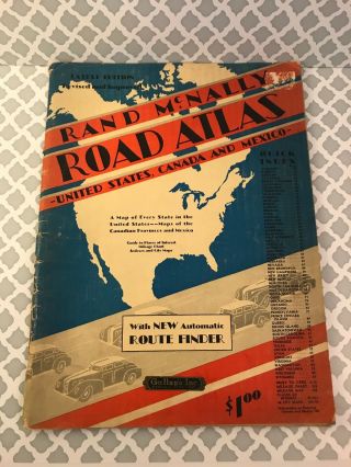
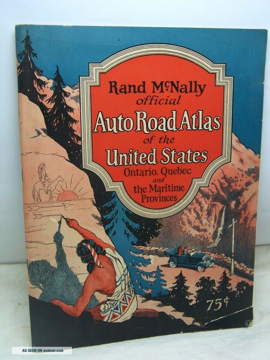
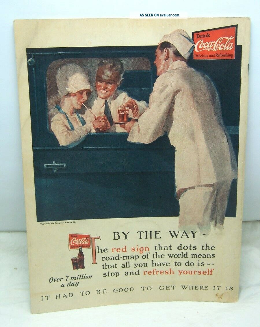
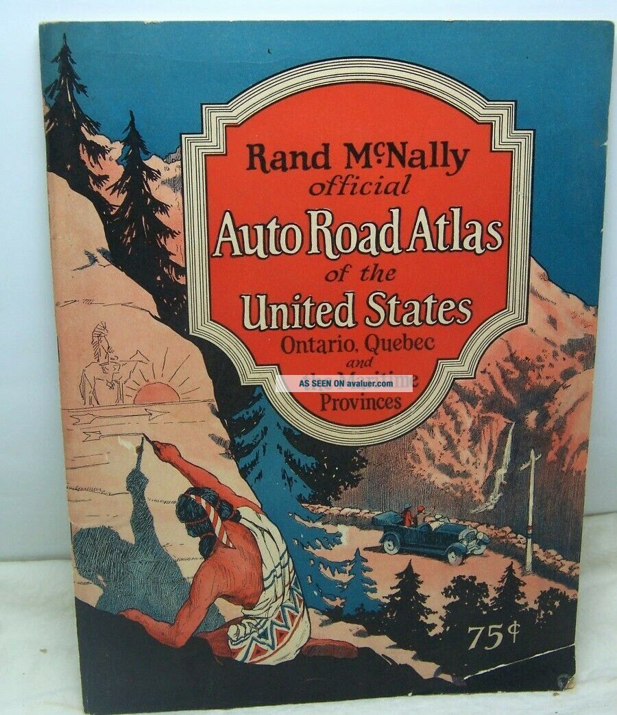
1927 United States Road Atlas By Rand McNally Great Cover Art


Item History & Price

Information:
Reference Number: Avaluer:45680
Original Description:
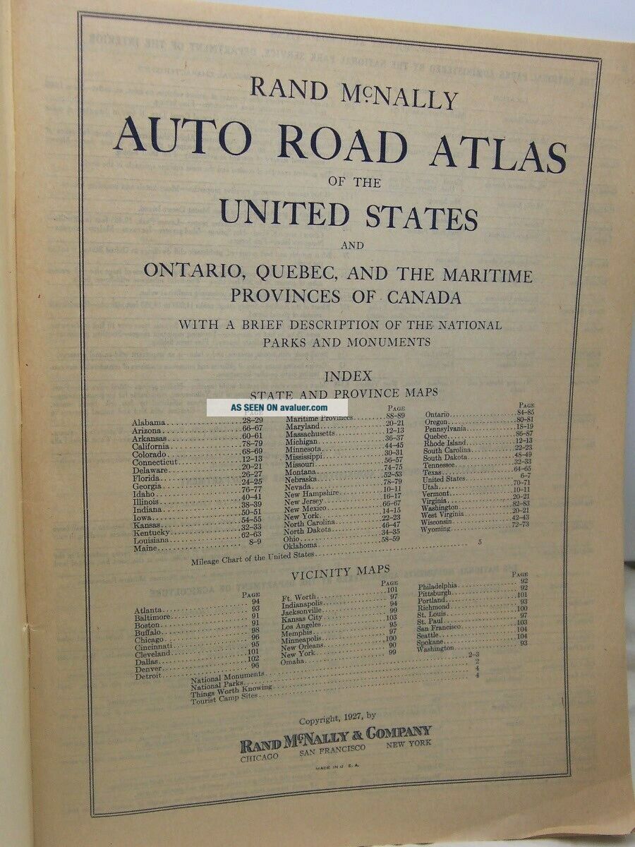
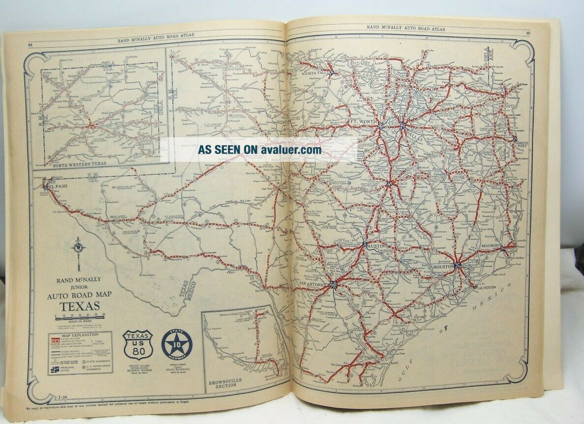
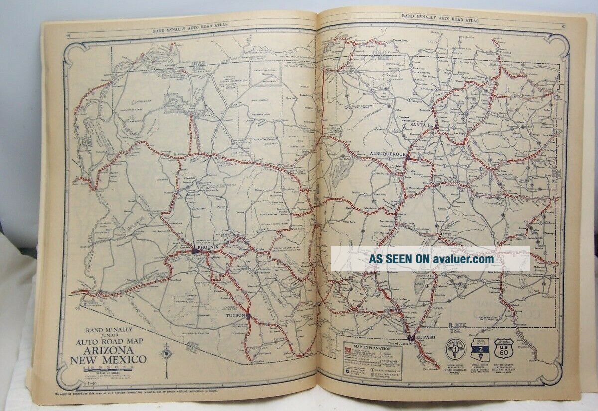
I am offering for sale, a 1927, Rand McNally Official Auto Road Atlas of the United States, Canada. It is in Very Good Condition, Original, 9 1/4 x 12 1/4 inches, 104 pages, tape on inside lower right corner, great cover art. Detailed maps of every state and provinces in Canada. Very clean contents, little if no use.I am selling this week, a Very Nice Selection of Vintage Paper, including Photographs, Advertising and Historical. I will combine shipping and a...ccept other methods of payment. Thanks for looking.


    Similar items


  • Vintage 1942 United States,  Canada,  Mexico Road Map Atlas By Rand Mcnally

    Vintage 1942 United States, Canada, Mexico Road Map Atlas By Rand Mcnally

  • Vintage Road Atlas State Farm United States Mexico Canada 1996 Rand Mcnally

    Vintage Road Atlas State Farm United States Mexico Canada 1996 Rand Mcnally

  • Vintage Big Road Atlas State Farm United States Mexico Canada 1985 Rand Mcnally

    Vintage Big Road Atlas State Farm United States Mexico Canada 1985 Rand Mcnally

  • Vintage Big Road Atlas State Farm United States Mexico Canada 1996 Rand Mcnally

    Vintage Big Road Atlas State Farm United States Mexico Canada 1996 Rand Mcnally

  • Vintage Rand Mcnally United States Road Atlas And Radio Guide 1952 Omaha Ne Ad

    Vintage Rand Mcnally United States Road Atlas And Radio Guide 1952 Omaha Ne Ad

  • Vintage Big Road Atlas State Farm United States Mexico Canada 1991 Rand Mcnally

    Vintage Big Road Atlas State Farm United States Mexico Canada 1991 Rand Mcnally

  • Vintage1960 Road Atlas United States Canada Mexico Sponsored By Centralab

    Vintage1960 Road Atlas United States Canada Mexico Sponsored By Centralab

  • Handy Railroad Atlas Of The United States 1982 Railroad Maps Rand Mcnally H

    Handy Railroad Atlas Of The United States 1982 Railroad Maps Rand Mcnally H


    • You might also like


    • 1860 Mitchell Hand Colored Map Colorado,  Nebraska & Kansas - Civil War Era

      1860 Mitchell Hand Colored Map Colorado, Nebraska & Kansas - Civil War Era

    • 18th Century French Map Of North America

      18th Century French Map Of North America

    • Las Vegas Nevada Vintage 1967 Us Geological Survey Quadrangle Map 4 Panels

      Las Vegas Nevada Vintage 1967 Us Geological Survey Quadrangle Map 4 Panels

    • Rare Antique 1845 Maps United States Exploring Expedition Book Antartica Hawaii

      Rare Antique 1845 Maps United States Exploring Expedition Book Antartica Hawaii

    • Vintage 1926 Map Hollywood From The Best Surveys Of The Time

      Vintage 1926 Map Hollywood From The Best Surveys Of The Time

    • American Continent (western Hemisphere) 1747 Bowen Antique Copper Engraved Map

      American Continent (western Hemisphere) 1747 Bowen Antique Copper Engraved Map

    • Gulf Coast Florida Texas United States 1705 De Fer Unusual Antique Engraved Map

      Gulf Coast Florida Texas United States 1705 De Fer Unusual Antique Engraved Map

    • California As Island United States 1700 De Fer Unusual First Edition Antique Map

      California As Island United States 1700 De Fer Unusual First Edition Antique Map

Avaluer          About Us          Privacy Policy          Contact Us          UP
© 2022, avaluer.net, Inc. or its affiliates