2 Waterbury Connecticut Antique Map Beers 1868 13”x16”


Item History & Price
| Reference Number: Avaluer:48225583 | US State: Connecticut |
| Type: Map | Year: 1868 |
| Maker: Beers | Original/Reproduction: Original |

| Reference Number: Avaluer:48225583 | US State: Connecticut |
| Type: Map | Year: 1868 |
| Maker: Beers | Original/Reproduction: Original |
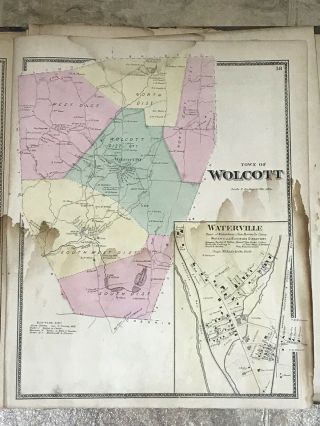
Wolcott Connecticut Antique Map Beers 1868 13”x16”
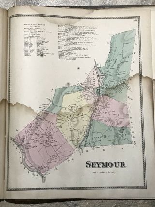
Seymour Connecticut Antique Map Beers 1868 13”x16”
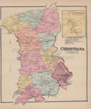
Christiana Delaware Antique Map Beers 1868

Antique Map - Town Of Patterson York Antique Map Beers 1868

1839 Smith ' S Atlas " Map No. 2, Eastern States ", Mass. , Rhode Island, Connecticut
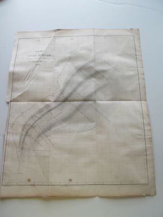
1854 E. & G. W. Blunt Chart " Gulf Stream By A D Bache " 13 - 1/2 " By 16 "
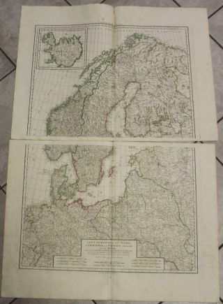
Scandinavia & Northern Europe 1792 Delamarche Wall 2 Sheet Composite Antique Map

Vintage Teeny Tiny Tin 30s Pre - 1935 World Globe On Bent Wire Stand 2 " Tall Rare

1860 Mitchell Hand Colored Map Colorado, Nebraska & Kansas - Civil War Era

18th Century French Map Of North America

Las Vegas Nevada Vintage 1967 Us Geological Survey Quadrangle Map 4 Panels

Rare Antique 1845 Maps United States Exploring Expedition Book Antartica Hawaii

Vintage 1926 Map Hollywood From The Best Surveys Of The Time

American Continent (western Hemisphere) 1747 Bowen Antique Copper Engraved Map

Gulf Coast Florida Texas United States 1705 De Fer Unusual Antique Engraved Map

California As Island United States 1700 De Fer Unusual First Edition Antique Map