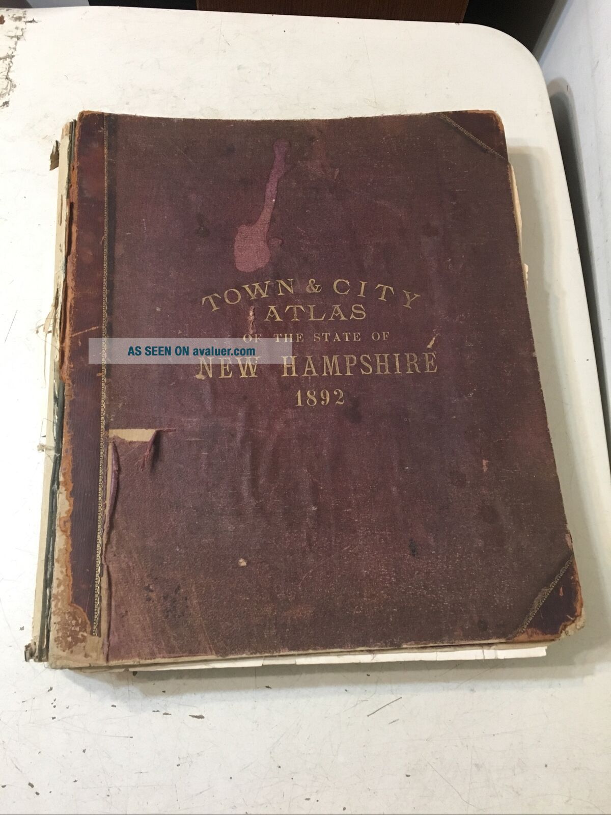
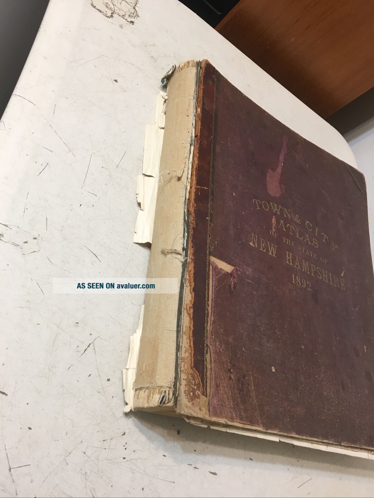
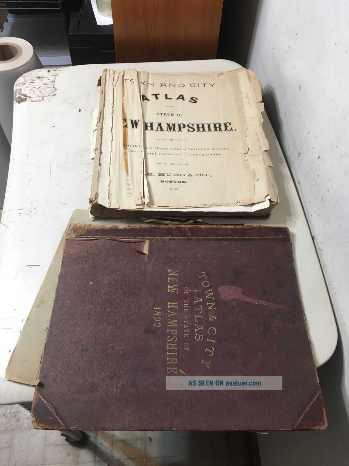
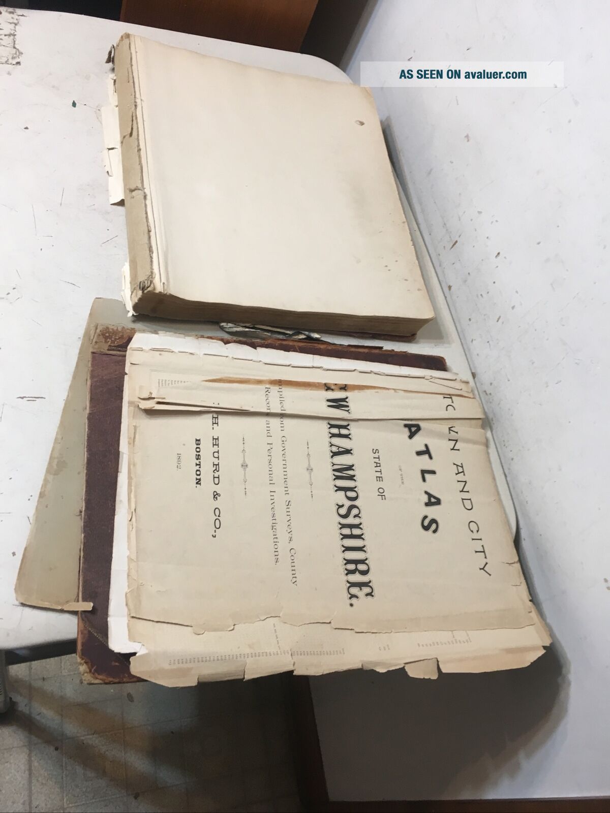
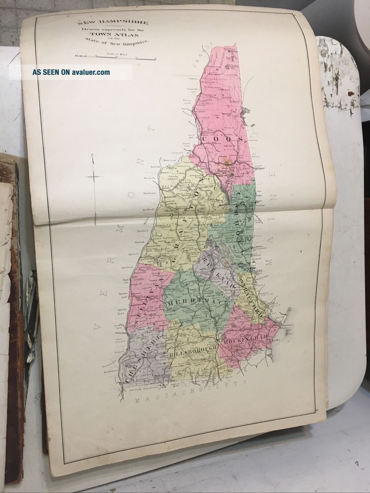
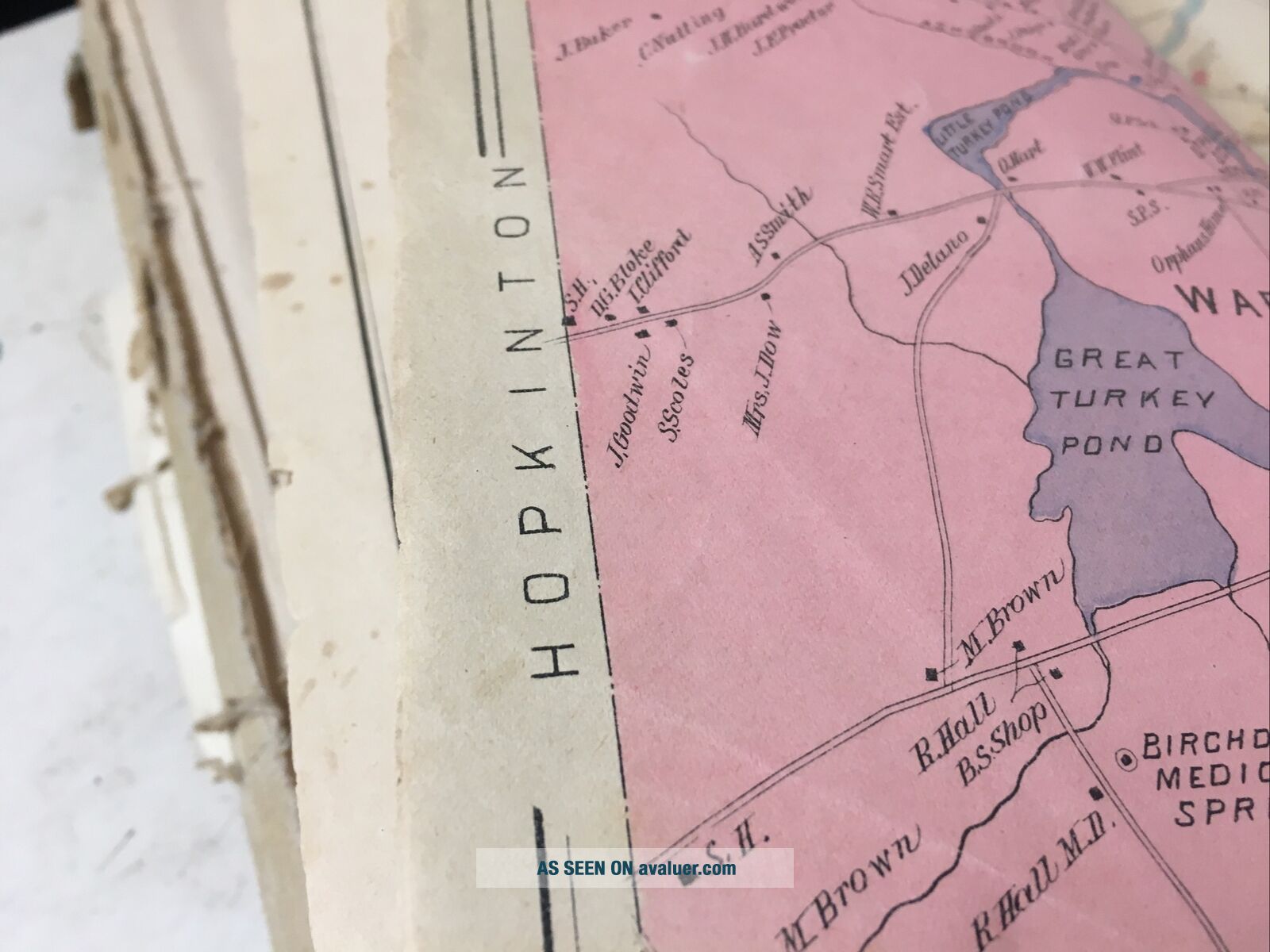
Antique 1892 Hurd’s Atlas Of Hanpshire With Illustrations Homes & Businesses


Item History & Price

Information:
Reference Number: Avaluer:48233694Format: Atlas
Year: 1892
Original Description:
Up for sale is this Antique 1892 Hurd’s Atlas Of New Hanpshire With Illustrations of Homes & Businesses including factories and hotels. Condition is a mixed bag. Both covers or loose and detached, first few pages are loose and rough. Sheet (4 pages) With Maps Of Bradford, Epsom, Loudon, Warner & Davisville is loose and rough. The last handful of pages are rough and tattered, those are the pages with text about the towns, no maps. The rest of it is fairly good, some edge tears, a few ...creased pages, some light soiling. I verified that all the maps are present, I did not verify all the views. The photos show almost exclusively flaws, there are plenty of great maps and views. Measures about 18” x 15”. Please view all twelve photos to help judge condition.


    Similar items


  • Antique 1892 King

    Antique 1892 King ' S Handbook Of United States Illustrated & 51 Colored Maps

  • 1857 Colton

    1857 Colton ' S Atlas Of America With Hand Coloured Plates Rare

  • 1868 Rare Antique Howden & Odbert

    1868 Rare Antique Howden & Odbert ' S Atlas Of Warren County - Pennsylvania

  • Antique 1875 Gray

    Antique 1875 Gray ' S Atlas Of The United States Large Folio Color Maps Complete

  • Antique 1892 Shepp’s Photographs Of The World Hardcover Book

    Antique 1892 Shepp’s Photographs Of The World Hardcover Book

  • Antique 1916 Hammond’s Atlas Of York City & The Metropolitan District - Vg,

    Antique 1916 Hammond’s Atlas Of York City & The Metropolitan District - Vg,

  • Antique 1887 Alden

    Antique 1887 Alden ' S Atlas Of The World

  • Antique & 1874 Mitchell

    Antique & 1874 Mitchell ' S Atlas Of United States And Territories


    • You might also like


    • 1860 Mitchell Hand Colored Map Colorado,  Nebraska & Kansas - Civil War Era

      1860 Mitchell Hand Colored Map Colorado, Nebraska & Kansas - Civil War Era

    • 18th Century French Map Of North America

      18th Century French Map Of North America

    • Las Vegas Nevada Vintage 1967 Us Geological Survey Quadrangle Map 4 Panels

      Las Vegas Nevada Vintage 1967 Us Geological Survey Quadrangle Map 4 Panels

    • Rare Antique 1845 Maps United States Exploring Expedition Book Antartica Hawaii

      Rare Antique 1845 Maps United States Exploring Expedition Book Antartica Hawaii

    • Vintage 1926 Map Hollywood From The Best Surveys Of The Time

      Vintage 1926 Map Hollywood From The Best Surveys Of The Time

    • American Continent (western Hemisphere) 1747 Bowen Antique Copper Engraved Map

      American Continent (western Hemisphere) 1747 Bowen Antique Copper Engraved Map

    • Gulf Coast Florida Texas United States 1705 De Fer Unusual Antique Engraved Map

      Gulf Coast Florida Texas United States 1705 De Fer Unusual Antique Engraved Map

    • California As Island United States 1700 De Fer Unusual First Edition Antique Map

      California As Island United States 1700 De Fer Unusual First Edition Antique Map

Avaluer          About Us          Privacy Policy          Contact Us          UP
© 2022, avaluer.net, Inc. or its affiliates