Antique Hand Colored MAP - 1776 MAP OF THE THIRTEEN COLONIES - 1880
Item History & Price
| Reference Number: Avaluer:48252871 | Original/Reproduction: Antique Original |
| Date Range: 1800-1899 | Format: Atlas Map |
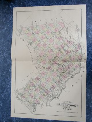
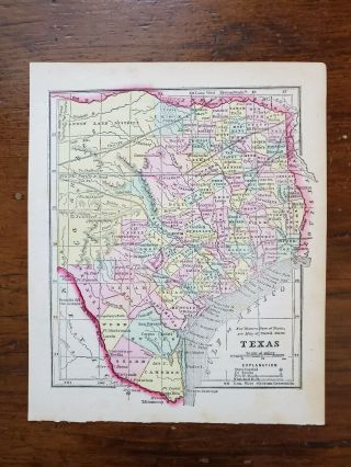
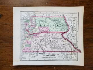
Up for sale is a great, original, hand-colored, ANTIQUE MAP from MITCHELL'S NEW GENERAL ATLAS - 1880.
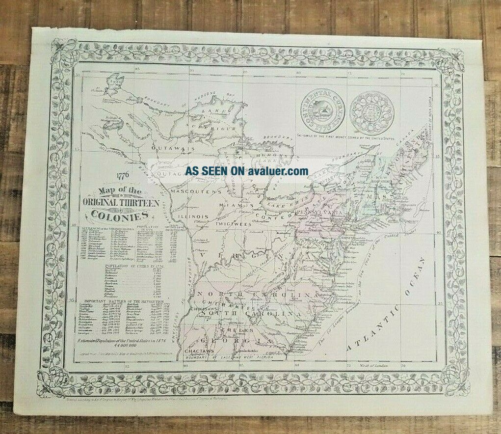
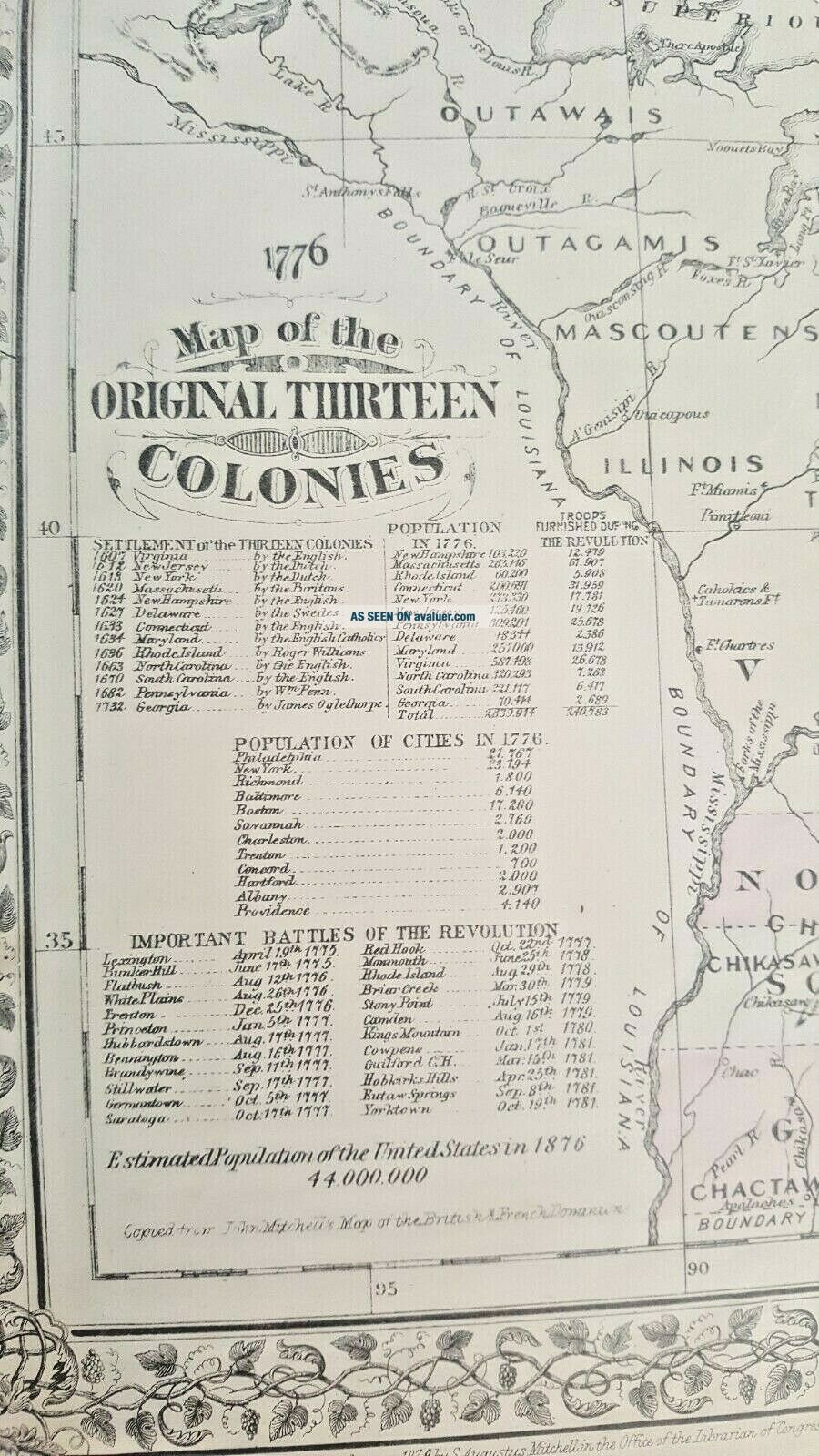
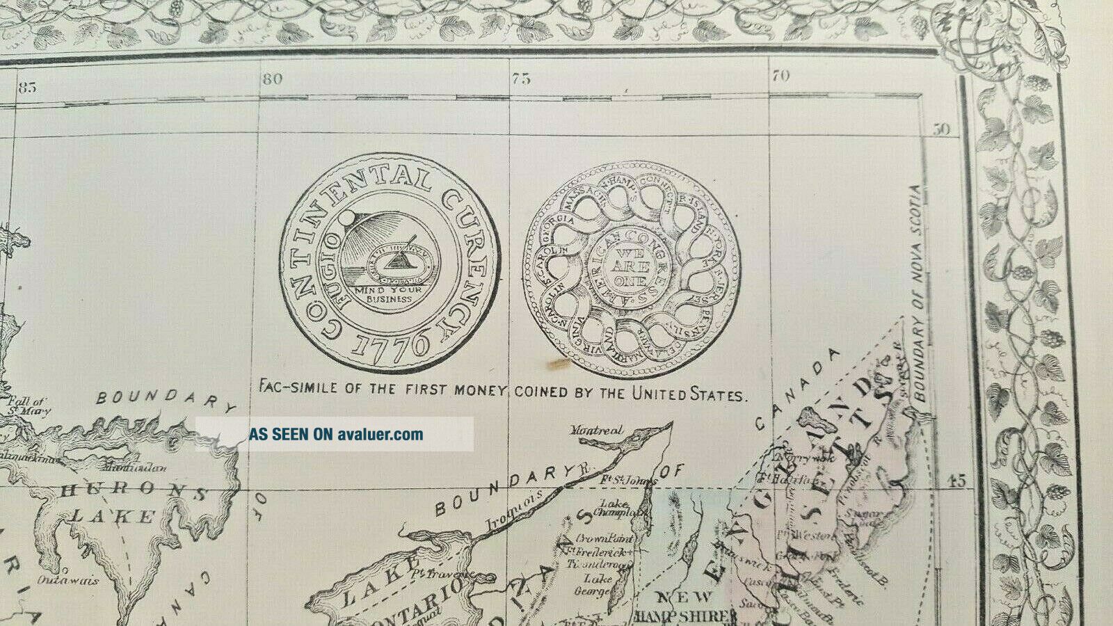
TITLE: 1776 MAP OF THE ORIGINAL THIRTEEN COLONIES.
It is blank on the reverse side.
It is a detailed map measuring approximately 15" x 12 1/2", including the border area. There are some tears across the bottom border form where it was originally bound.
This map is from "MITCHELL'S NEW GENERAL ATLAS" - Containing Maps of the Various Countries of the World, ...Plans of Cities, Etc., Embraced In Ninety-Three Quarto Maps. Forming A Series of One Hundred and Forty-seven Maps and Plans. Published by S. Augustus Mitchell, Philadelphia: 1880. It is generally in Good Condition. There is some age related browning and toning and some light spotting. It has some nicks and chips (and a few small tears) around the edges. Folds in the corners. Other dings here and there, as well.
This map would be a great addition to any collection and will look very nice when framed!
Please note that while I have included a picture of the Title Page of the Atlas that this map was taken from, it is NOT included in the sale, as it is a reference piece to determine authenticity for other maps/engravings.
Please see my store for other great items.
00139