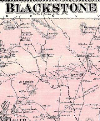
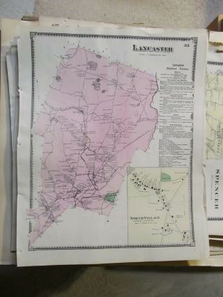
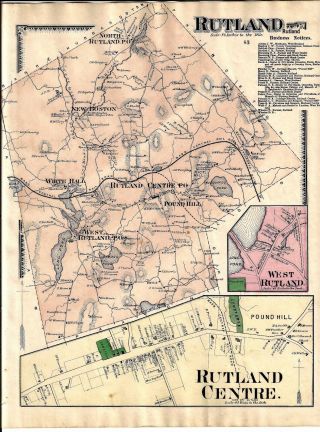
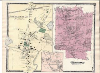
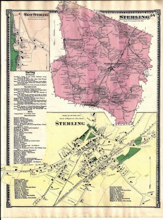
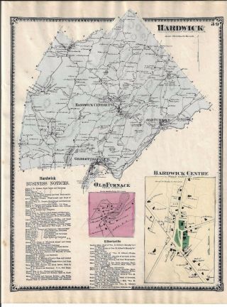
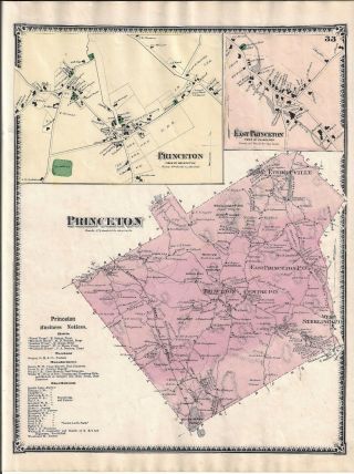
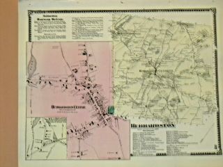
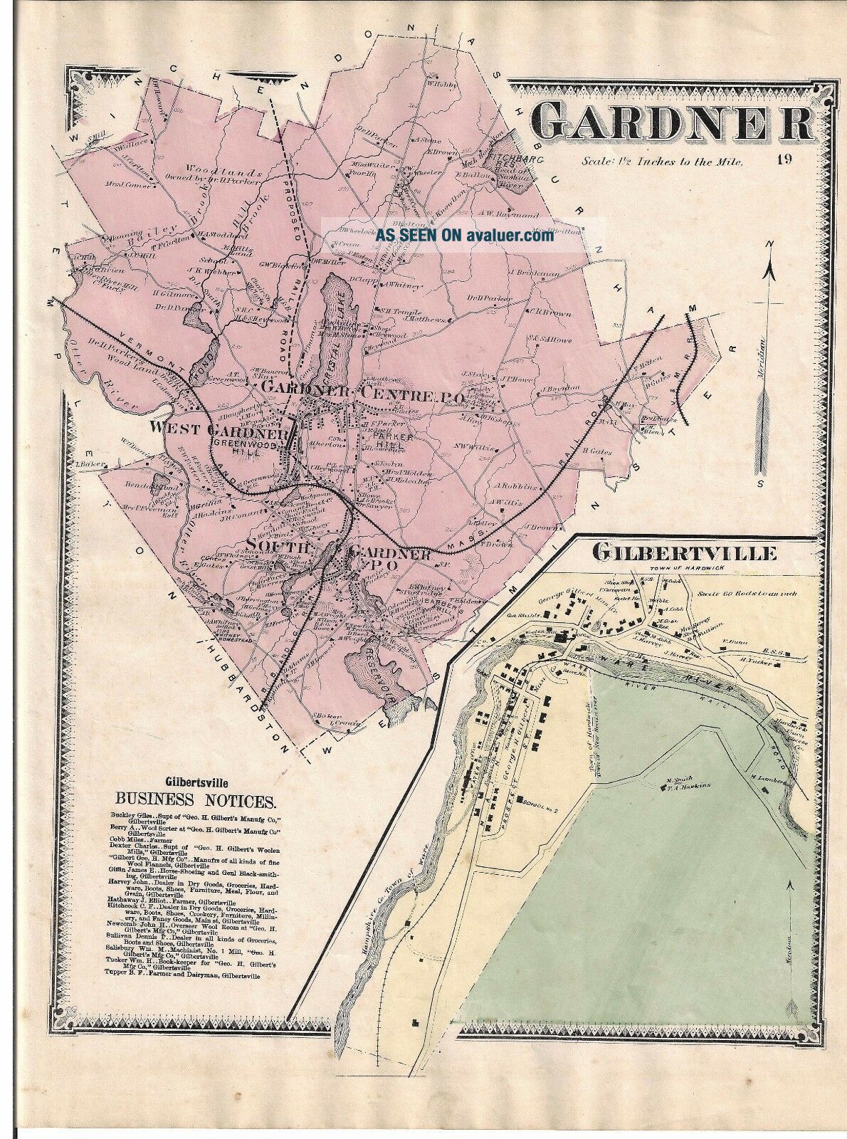
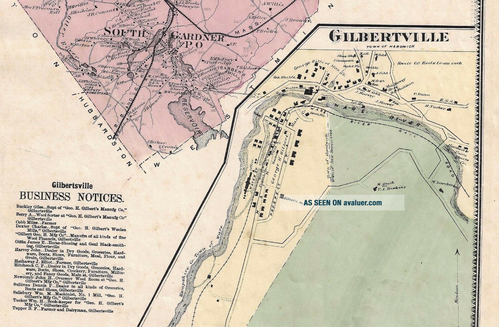
VINTAGE 1870 GARDNER, MA. MAP THAT WAS REMOVED FROM THE BEER ' S 1870 ATLAS


Item History & Price

Information:
Reference Number: Avaluer:48260729Publication Year: 1870
Type: ORIGINAL 1870 TOWN MAPTopic: Atlases
Year: 1870Original/Reproduction: Antique Original
US State: MassachusettsFormat: Atlas Map
Country/Region: MASSACHUSETTS
Original Description:
NICE CLEAN MAP IN GOOD CONDITION. I WAS UNABLE TO SCAN THE COMPLETE MAP, A LITTLE OF THE BORDER AREA IS NOT SHOWN. THE MAP IS COMPLETE AND IN GREAT CONDITION. IT MEASURES ABOUT 14X11 INCHES PLUS THE BLANK BORDER AREA. THIS IS AN ORIGINAL 1870 VINTAGE MAP, NOT A COPY OR REPRINT. MAP WILL SHOW ROADS, HOME LOCATION & OWNERS NAME IN 1870 PLUS LOTS OF OTHER INFORMATION. I HAVE ALL THE MAPS FROM THIS 1870 WORCESTER COUNTY BEER'S ATLAS, LET ME KNOW WHAT TOWN YOU NEED & I WILL PLACE IT... ON EBAY FOR YOU.


    Similar items


  • Vintage 1870 Blackstone,  Ma.  Map That Was Removed From The Beer

    Vintage 1870 Blackstone, Ma. Map That Was Removed From The Beer ' S 1870 Atlas

  • Vintage 1870 Lancaster,  Ma.  Map That Was Removed From The Beer

    Vintage 1870 Lancaster, Ma. Map That Was Removed From The Beer ' S 1870 Atlas

  • Vintage 1870 Rutland,  Ma.  Map That Was Removed From The Beer

    Vintage 1870 Rutland, Ma. Map That Was Removed From The Beer ' S 1870 Atlas

  • Vintage 1870 Grafton,  Ma.  Map That Was Removed From The Beer

    Vintage 1870 Grafton, Ma. Map That Was Removed From The Beer ' S 1870 Atlas

  • Vintage 1870 Sterling,  Ma.  Map That Was Removed From The Beer

    Vintage 1870 Sterling, Ma. Map That Was Removed From The Beer ' S 1870 Atlas

  • Vintage 1870 Hardwick,  Ma.  Map That Was Removed From The Beer

    Vintage 1870 Hardwick, Ma. Map That Was Removed From The Beer ' S 1870 Atlas

  • Vintage 1870 Princeton,  Ma.  Map That Was Removed From The Beer

    Vintage 1870 Princeton, Ma. Map That Was Removed From The Beer ' S 1870 Atlas

  • Vintage 1870 Hubbardston,  Ma. ,  Map That Was Removed From The Beer

    Vintage 1870 Hubbardston, Ma. , Map That Was Removed From The Beer ' S 1870 Atlas


    • You might also like


    • 1860 Mitchell Hand Colored Map Colorado,  Nebraska & Kansas - Civil War Era

      1860 Mitchell Hand Colored Map Colorado, Nebraska & Kansas - Civil War Era

    • 18th Century French Map Of North America

      18th Century French Map Of North America

    • Las Vegas Nevada Vintage 1967 Us Geological Survey Quadrangle Map 4 Panels

      Las Vegas Nevada Vintage 1967 Us Geological Survey Quadrangle Map 4 Panels

    • Rare Antique 1845 Maps United States Exploring Expedition Book Antartica Hawaii

      Rare Antique 1845 Maps United States Exploring Expedition Book Antartica Hawaii

    • Vintage 1926 Map Hollywood From The Best Surveys Of The Time

      Vintage 1926 Map Hollywood From The Best Surveys Of The Time

    • American Continent (western Hemisphere) 1747 Bowen Antique Copper Engraved Map

      American Continent (western Hemisphere) 1747 Bowen Antique Copper Engraved Map

    • Gulf Coast Florida Texas United States 1705 De Fer Unusual Antique Engraved Map

      Gulf Coast Florida Texas United States 1705 De Fer Unusual Antique Engraved Map

    • California As Island United States 1700 De Fer Unusual First Edition Antique Map

      California As Island United States 1700 De Fer Unusual First Edition Antique Map

Avaluer          About Us          Privacy Policy          Contact Us          UP
© 2022, avaluer.net, Inc. or its affiliates