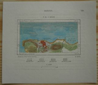
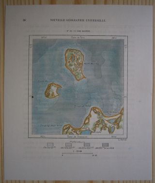
1884 Perron Map LIMASSOL & AKROTIRI PENINSULA, CYPRUS (120)
Item History & Price
| Reference Number: Avaluer:48260853 | Year: 1884 |
| Topic: Maps | Country/Region: Cyprus |
| Publication Year: 1884 |
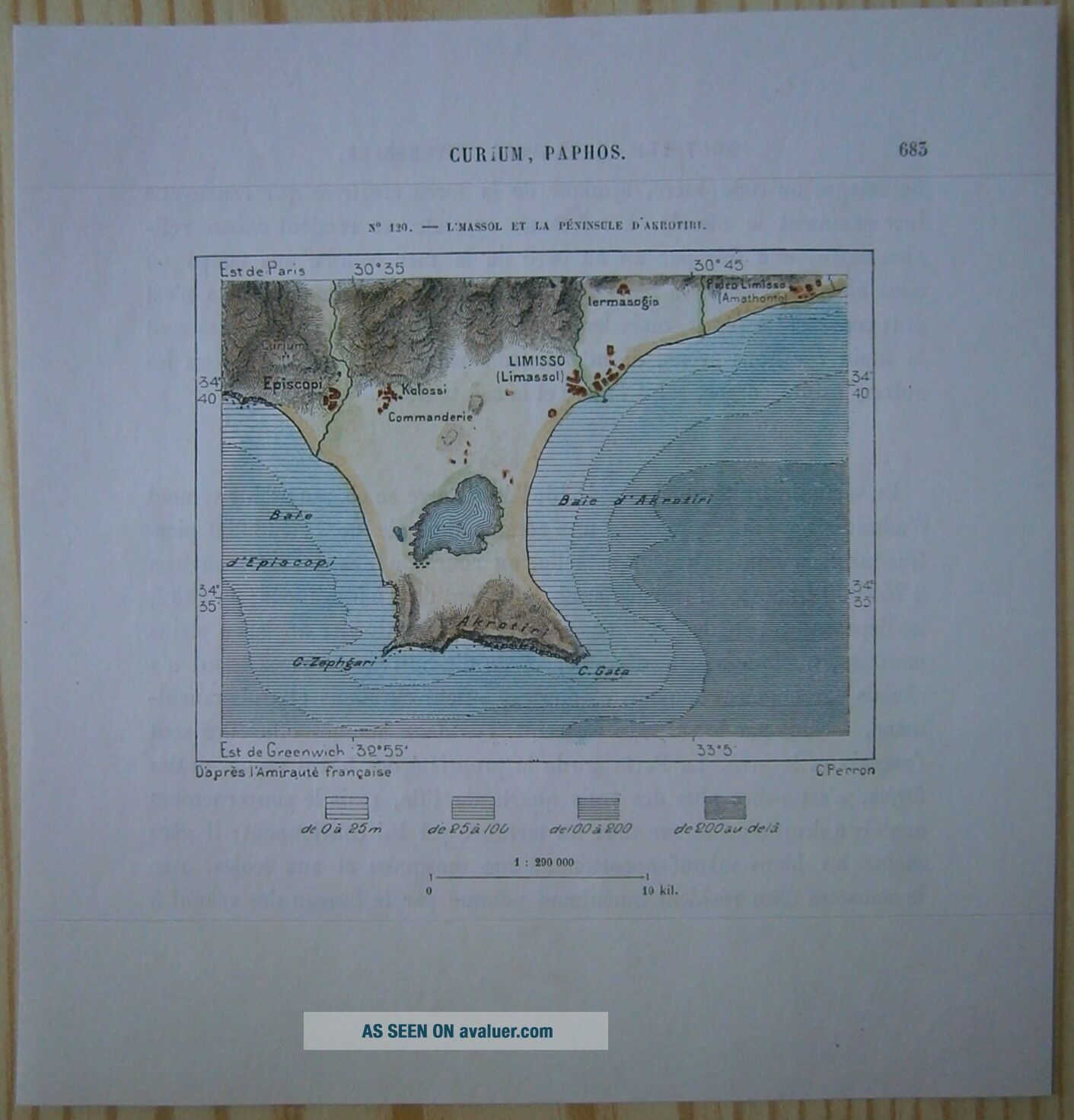
Perron09_120 1884 Perron map LIMASSOL & AKROTIRI PENINSULA, CYPRUS (#120)Nice small map titled Limassol et la peninsule d'Akrotiri, from wood engraving with fine detail and clear impression, nice hand coloring. Overall size approx. 16.5 x 16 cm, image sizeapprox. 9.5 x 7 cm. From La Nouvelle Géographie universelle, la terre et les hommes, 19 vol. (1875-94), great work ofElisee Reclus. Cartographer is Charles Perron.Limass...ol
Greek Lemesós, Turkish Limasol, city and chiefport of the Republic of Cyprus. The city lies on Akrotiri Bay, onthe southern coast, southwest of Nicosia; it is the island'ssecond largest city and is also its chief tourist centre.
Limassol's rise from a humble market town between the ancientsettlements of Amathus and Curium took place at the end of theByzantine Empire, when Richard I the Lion-Heart landed there in1191 and was married to Berengaria of Navarre in the chapel of acastle fortress, now a regional museum and one of only twosurviving buildings of the period. After the Genoese seizure ofFamagusta in 1372, the port's fortunes increased; but damage fromnumerous incursions between 1414 and 1426, the Turkish invasionof 1570, and a disastrous earthquake had reduced its populationto 150 by 1815. Its resurgence dates from the end of the 19thcentury, when the island came under British administration.
Limassol's harbour facilities, which were extended in the 1960sto improve its shallow-water location, were increased by a newport (operational in 1974) that was able to provide berthingspaces for large vessels. The Turkish intervention (1974) innorthern Cyprus and the closing of the island's main port atFamagusta made Limassol the chief port of the Republic of Cyprus.The port has also taken over much of the trade that once passedthrough Beirut. In the 1970s and '80s Limassol also became hometo many thousands of prosperous Arab refugees from Lebanon andimmigrants from Saudi Arabia and Kuwait. Limassol's bustling portexports wines, beverages, fruits, and vegetables. Bricks, tiles, shoes, textiles, furniture, cement, buttons, and soft drinks aremanufactured; fruit is canned; and chrome and asbestos areprocessed. Legumes, vegetables, oranges, lemons, grapefruits, nuts, and apples are grown on the adjacent coastal plain, andgoats and cattle are raised as well. The Troodos Mountains lieinland from the plain. Limassol city is linked by roads with Moni, Akrotíri, and Episkopi. Pop. (1982) city, 74, 782; (1989 est.)metropolitan area, 120, 000.Akrotiri
British military enclave in south-central Cyprus that wasretained as a “sovereign base area” by the United Kingdomunder the London Agreement of 1959 granting the independence ofCyprus. Located southwest of Limassol, the enclave comprisesAkrotiri Peninsula, the southernmost part of the island, and asmall coastal area north of Episkopi Bay. The enclave has ahospital, a weather station, and an airfield. Akrotiri and Dhekéliasovereign base to the northeast (together totaling 99 squaremiles [256 square km]) are used as British training facilitiesand staging areas between Britain and southern Asia and the FarEast. They are also support areas for United Nations forces onCyprus. In the late 1970s, controversy arose in Cyprus over thereported use of Akrotiri by the United States as a station formonitoring Soviet activities.
00208