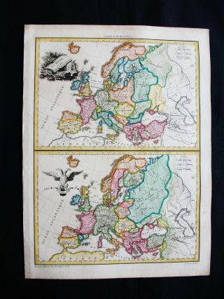
1812 LAPIE - Rare 2 Maps Of EUROPE, PORTUGAL, POLAND, SPAIN, NORWAY, FINLANDIA


Item History & Price

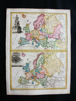
1810 Lapie - Rare 2 Maps Of Europe, Scandinavia, Norway, Denmark, Iceland Sweden
1810 Lapie - Rare 2 Maps Of Europe, Portugal, Poland, Spain, Norway, Finlandia

Rare A Map Of Europe Antique 1721 John Senex Hand Colored Engraved 25x20
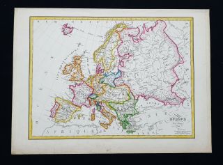
1812 Lapie - Rare Map Of Europe, European Empire, Scandinavia, Poland, Lithuania
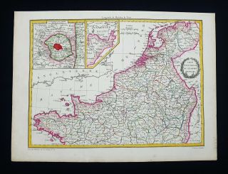
1812 Lapie - Rare Map Of France North, Brittany, Tours, Paris, Picardy, Dijon.
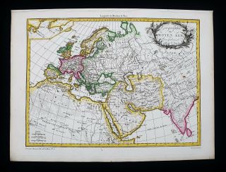
1812 Lapie - Rare Map Of The Ancient World Map, Asia, Europe, Africa, World Map
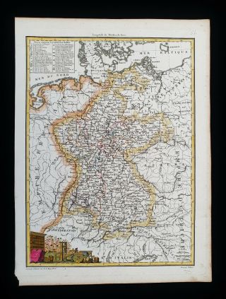
1812 Lapie - Rare Map: Germany, Deutschland, Circle Of The Rhine, Cologne, Bonn
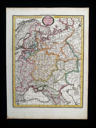
1812 Lapie - Rare Map Of Russia In Europe, Ukraine, Finland, Romania, Georgia.

Hungary & Romania 1579 (1584) Ortelius Unusual Antique Copper Engraved Map

Brussels Bruxelles Belfium 1777 De Ferraris & Dupuis Large Antique Map Sheet Xxi

1616 Atlas Map Of Iceland.

Kazan Russia 1767 Le Clerc/lespinasse Antique Copper Engraved City View

1899 Stanford, Folding Map Of Norwich, Norfolk, Arthur Collins, Jarrold & Sons,

1948 Vintage Linen Colour Map Geological Survey Ten Mile Of Great Britain

1944 Map Flying Bombs Sussex Ww2 Newspaper Military Kent Courier German V1 V2

Dated 1638 Vellum Map Of Icklesham Sussex Showing Land Uses Owners Etc