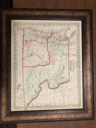
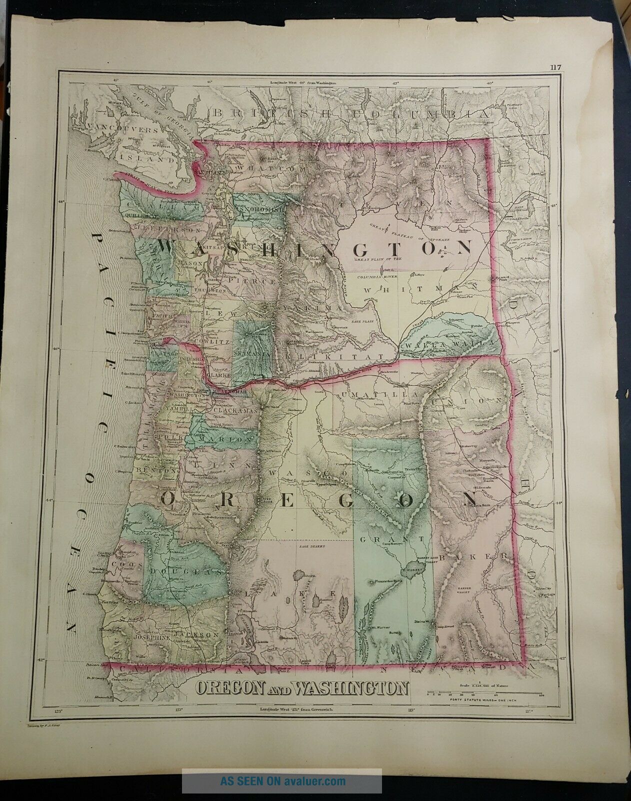
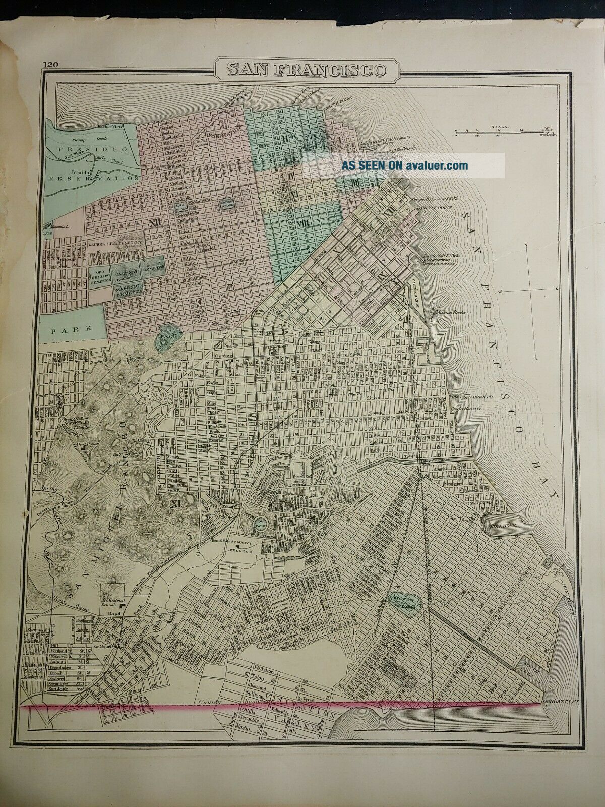
1876 Map Of Washington And Oregon


Item History & Price

Information:
Reference Number: Avaluer:48266099US State: Oregon, Washington
Cartographer/Publisher: O.W. GrayYear: 1876
Type: World AtlasCity: Baltimore
Original/Reproduction: Antique OriginalFormat: Sheet Map
Country/Region: United States of America
Original Description:
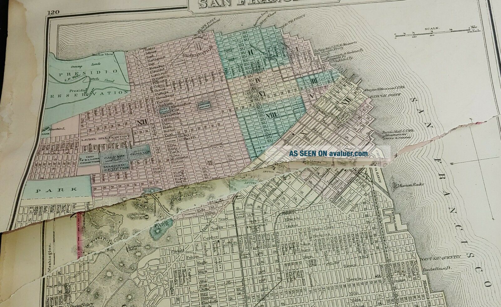
This is an original hand tinted map from Grays Atlas of the World published in 1876. This sheet includes three maps. One side includes California and Nevada, the other has smaller maps of Washington and Oregon and San Francisco. The page with San Francisco is badly damaged which also impacts the California map. The Washington and Oregon map is intact.Entire map is 28"x17" and would be beautiful framed. Shipped flat, USPS Priority Mail.


    Similar items


  • 1969 Union 76 Road Map Of Washington And Oregon

    1969 Union 76 Road Map Of Washington And Oregon

  • 1956 Signal Gas Road Map Of Washington And Oregon W/ Sign & Pump

    1956 Signal Gas Road Map Of Washington And Oregon W/ Sign & Pump

  • 2005 Gm Johnson Road Map Of Washington And Oregon Coast

    2005 Gm Johnson Road Map Of Washington And Oregon Coast

  • Rare,  J.  H.  Colton Framed Atlas Map Of Washington And Oregon 1853

    Rare, J. H. Colton Framed Atlas Map Of Washington And Oregon 1853

  • The Brix Logging Story In The Woods Of Washington And Oregon 1900 And Up Steam

    The Brix Logging Story In The Woods Of Washington And Oregon 1900 And Up Steam

  • Donald C Miller / Ghost Towns Of Washington And Oregon First Edition 1977

    Donald C Miller / Ghost Towns Of Washington And Oregon First Edition 1977

  • Mid 1950

    Mid 1950 ' S Metsker ' S Map Of Washington County Oregon

  • 1876 Map Of California And Southern Pacific Railroad - 24x36

    1876 Map Of California And Southern Pacific Railroad - 24x36


    • You might also like


    • 1860 Mitchell Hand Colored Map Colorado,  Nebraska & Kansas - Civil War Era

      1860 Mitchell Hand Colored Map Colorado, Nebraska & Kansas - Civil War Era

    • 18th Century French Map Of North America

      18th Century French Map Of North America

    • Las Vegas Nevada Vintage 1967 Us Geological Survey Quadrangle Map 4 Panels

      Las Vegas Nevada Vintage 1967 Us Geological Survey Quadrangle Map 4 Panels

    • Rare Antique 1845 Maps United States Exploring Expedition Book Antartica Hawaii

      Rare Antique 1845 Maps United States Exploring Expedition Book Antartica Hawaii

    • Vintage 1926 Map Hollywood From The Best Surveys Of The Time

      Vintage 1926 Map Hollywood From The Best Surveys Of The Time

    • American Continent (western Hemisphere) 1747 Bowen Antique Copper Engraved Map

      American Continent (western Hemisphere) 1747 Bowen Antique Copper Engraved Map

    • Gulf Coast Florida Texas United States 1705 De Fer Unusual Antique Engraved Map

      Gulf Coast Florida Texas United States 1705 De Fer Unusual Antique Engraved Map

    • California As Island United States 1700 De Fer Unusual First Edition Antique Map

      California As Island United States 1700 De Fer Unusual First Edition Antique Map

Avaluer          About Us          Privacy Policy          Contact Us          UP
© 2022, avaluer.net, Inc. or its affiliates