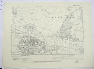
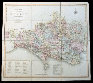
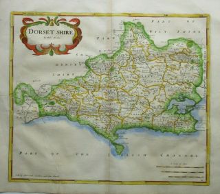
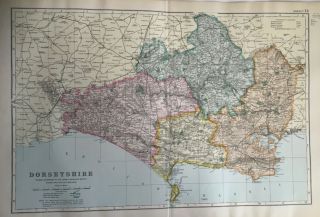
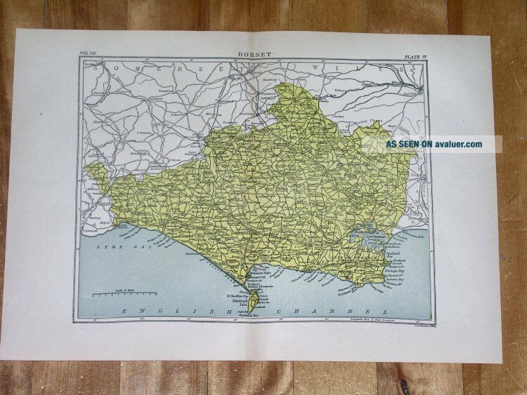
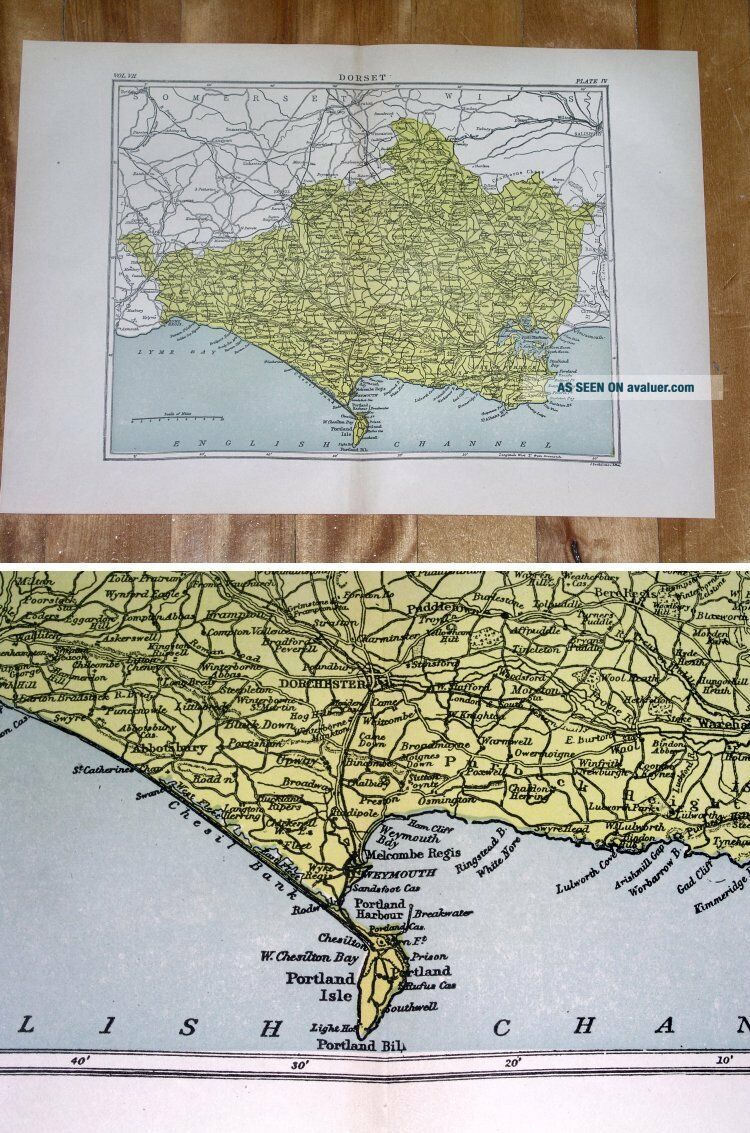
1880 ANTIQUE MAP OF COUNTY OF DORSET DORCHESTER / ENGLAND


Item History & Price

Information:
Reference Number: Avaluer:48277450
Original Description:
ORIGIN OF THE MAP: "Encyclopedia Britannica", Ninth Edition, Chicago, USA.

DATE OF ISSUE: 1880.

SIZE: The whole sheet (margins INCLUDED) measures 14 1/2" x 10" (37 x 26 cm).

Most of maps we sell come from ancient atlases that were damaged and beyond repair. The maps have often a canvas or paper binding tape mounted on back along the centerfold. If you have ANY PROBLEM with the purchase, it is essential you CONTACT US BEFORE LEAVING FEEDBACK TO GIVE US THE CHANCE T...O RESOLVE IT.

SHIPPED FROM CANADA in secure tubes or bubble mailers. PLEASE NOTE, THAT THE SHIPPING FROM QUEBEC TO THE U.S. TAKES 10 DAYS / WORLD 18 DAYS.

We combine shipping costs for multiple items. The HIGHEST VALUE SHIPPING FEE WILL APPLY FIRST and each subsequent item will be shipped FOR FREE.

00020


    Similar items


  • 1930 Os 6 Inches To A Mile Map Of Dorset – Dorchester & Stinsford Xlse

    1930 Os 6 Inches To A Mile Map Of Dorset – Dorchester & Stinsford Xlse

  • Georgian Antique Map Of Dorset John Cary Y.  1794 Poole & Dorchester Framed 18thc

    Georgian Antique Map Of Dorset John Cary Y. 1794 Poole & Dorchester Framed 18thc

  • Georgian Antique Map Of Dorset By C Smith,  1804 With Slip Case

    Georgian Antique Map Of Dorset By C Smith, 1804 With Slip Case

  • Antique Map Of Dorset By Robert Morden 1753

    Antique Map Of Dorset By Robert Morden 1753

  • Large Antique Map Of Dorset C1907 By G Bacon

    Large Antique Map Of Dorset C1907 By G Bacon

  • 1880 Antique Map Of The Republic Of San Marino

    1880 Antique Map Of The Republic Of San Marino

  • 1880s Antique Map Of Environs Liverpool Bacon Atlas Of The British Isles

    1880s Antique Map Of Environs Liverpool Bacon Atlas Of The British Isles

  • 1880s Antique Map Of Isle Of Wight By Bacon Atlas Of The British Isles

    1880s Antique Map Of Isle Of Wight By Bacon Atlas Of The British Isles


    • You might also like


    • Hungary & Romania 1579 (1584) Ortelius Unusual Antique Copper Engraved Map

      Hungary & Romania 1579 (1584) Ortelius Unusual Antique Copper Engraved Map

    • Brussels Bruxelles Belfium 1777 De Ferraris & Dupuis Large Antique Map Sheet Xxi

      Brussels Bruxelles Belfium 1777 De Ferraris & Dupuis Large Antique Map Sheet Xxi

    • 1616 Atlas Map Of Iceland.

      1616 Atlas Map Of Iceland.

    • Kazan Russia 1767 Le Clerc/lespinasse Antique Copper Engraved City View

      Kazan Russia 1767 Le Clerc/lespinasse Antique Copper Engraved City View

    • 1899 Stanford,  Folding Map Of Norwich,  Norfolk,  Arthur Collins,  Jarrold & Sons,

      1899 Stanford, Folding Map Of Norwich, Norfolk, Arthur Collins, Jarrold & Sons,

    • 1948 Vintage Linen Colour Map Geological Survey Ten Mile Of Great Britain

      1948 Vintage Linen Colour Map Geological Survey Ten Mile Of Great Britain

    • 1944 Map Flying Bombs Sussex Ww2 Newspaper Military Kent Courier German V1 V2

      1944 Map Flying Bombs Sussex Ww2 Newspaper Military Kent Courier German V1 V2

    • Dated 1638 Vellum Map Of Icklesham Sussex Showing Land Uses Owners Etc

      Dated 1638 Vellum Map Of Icklesham Sussex Showing Land Uses Owners Etc

Avaluer          About Us          Privacy Policy          Contact Us          UP
© 2022, avaluer.net, Inc. or its affiliates