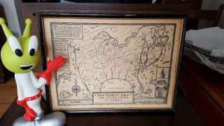
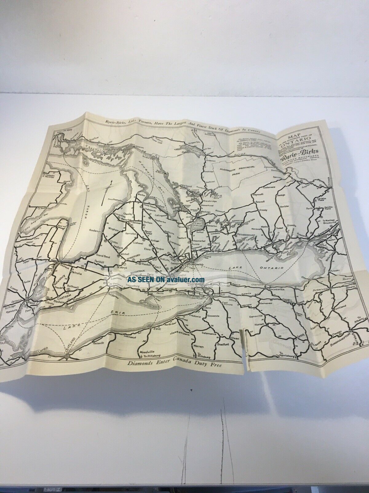
Rare 1920 ' S, Map Of The Southern Part Of Ontario Canada


Item History & Price

Information:
Reference Number: Avaluer:48282953Original/Reproduction: Antique Original
City: OntarioCanadian Province: Ontario
Date Range: 1920-1929Type: Physical Map
Country/Region: CanadaYear: 1920
Original Description:
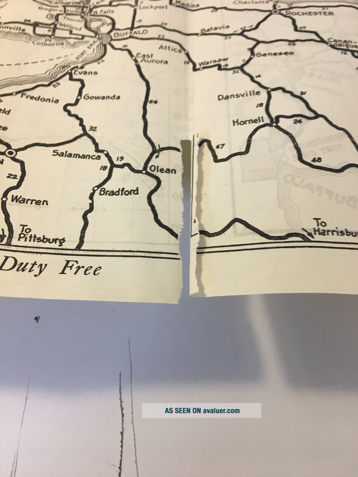
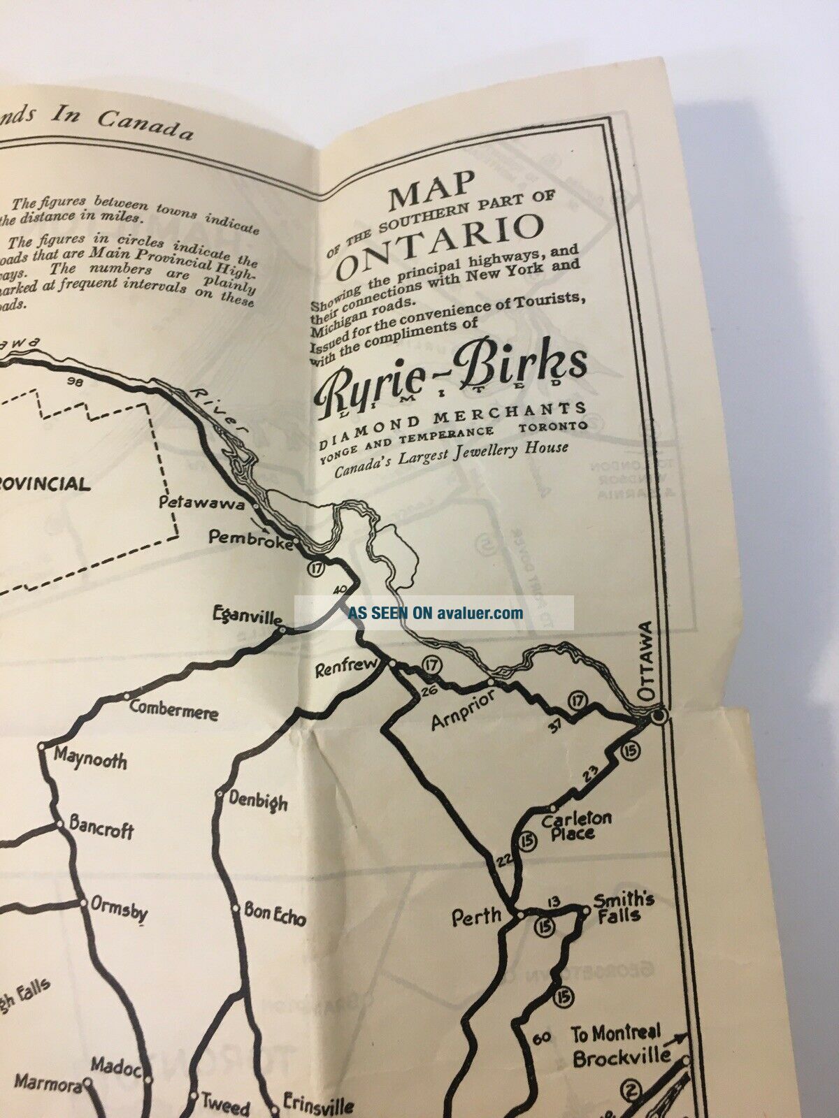
Rare 1920's, Map Of The Southern Part Of Ontario Canada.

This is in good used condition, considering the age, hard to imagine many of these out there.

Map advertising includes a local jeweler

There is a small tear on the bottom, and this has been folded.

Please view all photos for detail, and please reach out if there are any questions. Thank you. 
Full disclosure, the paper was found in a smokers home, however, with baking soda and Linen sheets,... I was able to get most of if not all the odor out. Just want to be up front with this.


    Similar items


  • Rare Mccormick’s Map Of The World Spices Spice Routes Flags Poster Orig Envelope

    Rare Mccormick’s Map Of The World Spices Spice Routes Flags Poster Orig Envelope

  • Vintage Rare Pollock’s Dictionary Of The Clyde 1888 Exhibition Supplement 6 Maps

    Vintage Rare Pollock’s Dictionary Of The Clyde 1888 Exhibition Supplement 6 Maps

  • Rare Yorker

    Rare Yorker ' S Idea Of The United States Of America Pictorial Map Wallingford

  • Rare Vintage Mccormick

    Rare Vintage Mccormick ' S Map Of The World Spices Flags Large Fold Out Map

  • 1960 Rare Advertising Mccormick

    1960 Rare Advertising Mccormick ' S Map Of The World Spices Extracts Teas Coffee

  • 1920

    1920 ' S Map Of Missouri 1920 Census Figures, The Trenton Times, City Populations

  • Rare Italian Edition Of Bellin

    Rare Italian Edition Of Bellin ' S Map Of The Northeast And England Region

  • Rare Vintage Mccormick

    Rare Vintage Mccormick ' S Map Of The World Spices Flags Large Fold Out Map


    • You might also like


    • 1860 Mitchell Hand Colored Map Colorado,  Nebraska & Kansas - Civil War Era

      1860 Mitchell Hand Colored Map Colorado, Nebraska & Kansas - Civil War Era

    • 18th Century French Map Of North America

      18th Century French Map Of North America

    • Las Vegas Nevada Vintage 1967 Us Geological Survey Quadrangle Map 4 Panels

      Las Vegas Nevada Vintage 1967 Us Geological Survey Quadrangle Map 4 Panels

    • Rare Antique 1845 Maps United States Exploring Expedition Book Antartica Hawaii

      Rare Antique 1845 Maps United States Exploring Expedition Book Antartica Hawaii

    • Vintage 1926 Map Hollywood From The Best Surveys Of The Time

      Vintage 1926 Map Hollywood From The Best Surveys Of The Time

    • American Continent (western Hemisphere) 1747 Bowen Antique Copper Engraved Map

      American Continent (western Hemisphere) 1747 Bowen Antique Copper Engraved Map

    • Gulf Coast Florida Texas United States 1705 De Fer Unusual Antique Engraved Map

      Gulf Coast Florida Texas United States 1705 De Fer Unusual Antique Engraved Map

    • California As Island United States 1700 De Fer Unusual First Edition Antique Map

      California As Island United States 1700 De Fer Unusual First Edition Antique Map

Avaluer          About Us          Privacy Policy          Contact Us          UP
© 2022, avaluer.net, Inc. or its affiliates