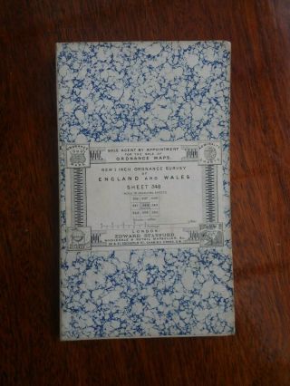
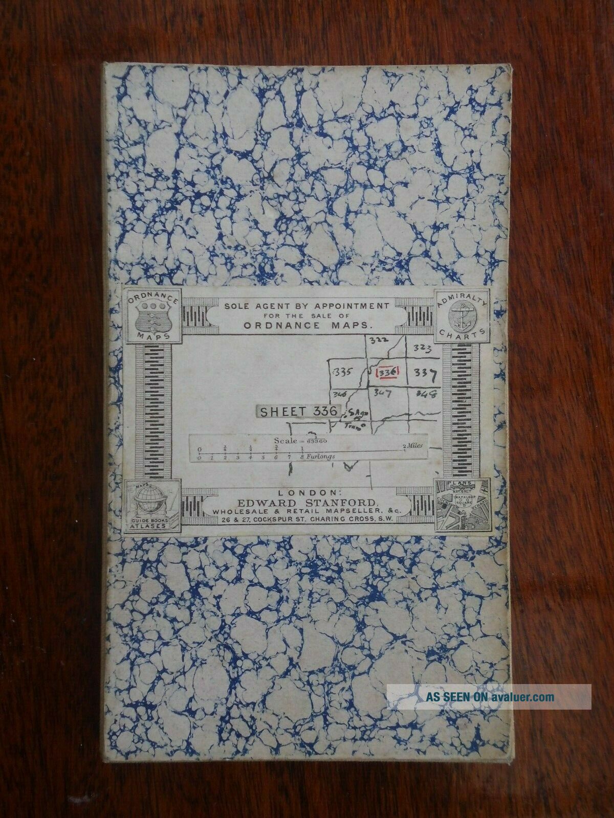
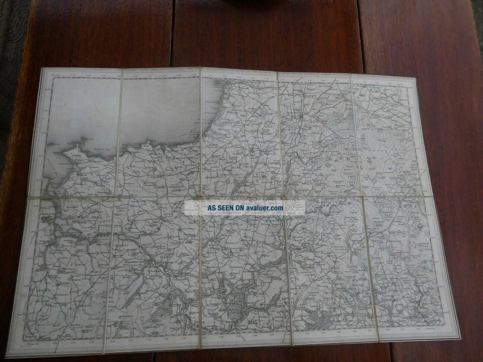
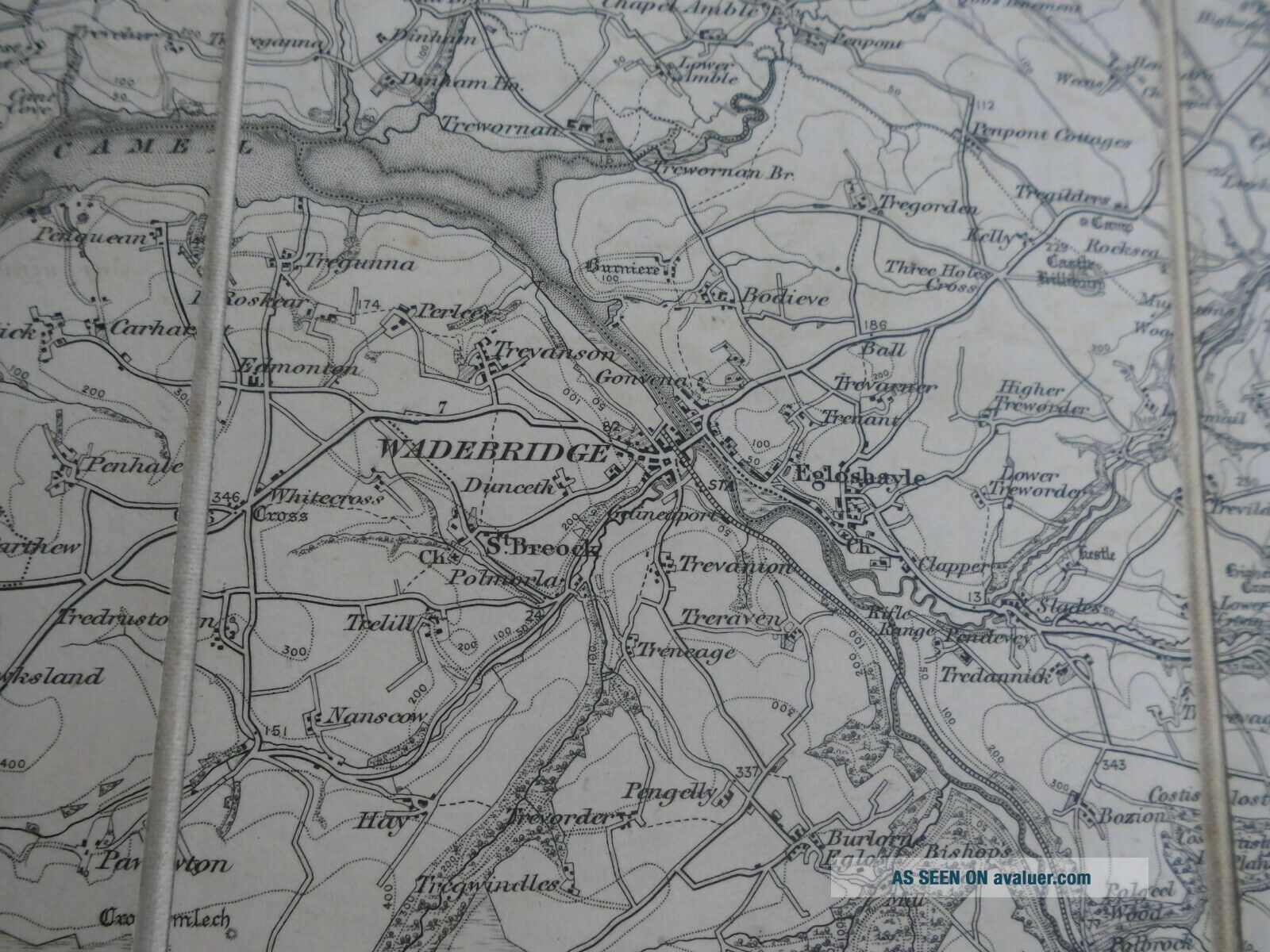
1 INCH ORDNANCE SURVEY SHEET 336 EDWARD STANFORD MAP PORT ISAAC CORNWALL C1890


Item History & Price

Information:
Reference Number: Avaluer:48291762County: Cornwall
Type: Ordnance Survey MapOriginal/Reproduction: Antique Original
Year: 1890Format: Sheet Map
Date Range: 1800-1899
Original Description:


 Condition: Good with some rubbing and wear .Overall size 13 X 20 inches .


    Similar items


  • 1 Inch Ordnance Survey Sheet 352 Edward Stanford Map Falmouth Cornwall C1890

    1 Inch Ordnance Survey Sheet 352 Edward Stanford Map Falmouth Cornwall C1890

  • 1 Inch Ordnance Survey Sheet 347 Edward Stanford Map St Austell Cornwall C1890

    1 Inch Ordnance Survey Sheet 347 Edward Stanford Map St Austell Cornwall C1890

  • 1 Inch Ordnance Survey Sheet 337 Edward Stanford Map Callington Cornwall C1890

    1 Inch Ordnance Survey Sheet 337 Edward Stanford Map Callington Cornwall C1890

  • 1 Inch Ordnance Survey Sheet 351 Edward Stanford Map Penzance Cornwall C1890

    1 Inch Ordnance Survey Sheet 351 Edward Stanford Map Penzance Cornwall C1890

  • 1 Inch Ordnance Survey Sheet 348 By Edward Stanford Map Plymouth Devon 1890

    1 Inch Ordnance Survey Sheet 348 By Edward Stanford Map Plymouth Devon 1890

  • 1 Inch Ordnance Survey Sheet 310 By Edward Stanford Map Tiverton Devon C1890

    1 Inch Ordnance Survey Sheet 310 By Edward Stanford Map Tiverton Devon C1890

  • Ordnance Survey Sheet 40 Edward Stanford Map Kent Margate Hastings 1 " Mile 1914

    Ordnance Survey Sheet 40 Edward Stanford Map Kent Margate Hastings 1 " Mile 1914

  • Ordnance Survey Sheet 30 Edward Stanford Map Essex Colchester Southend 1915

    Ordnance Survey Sheet 30 Edward Stanford Map Essex Colchester Southend 1915


    • You might also like


    • Hungary & Romania 1579 (1584) Ortelius Unusual Antique Copper Engraved Map

      Hungary & Romania 1579 (1584) Ortelius Unusual Antique Copper Engraved Map

    • Brussels Bruxelles Belfium 1777 De Ferraris & Dupuis Large Antique Map Sheet Xxi

      Brussels Bruxelles Belfium 1777 De Ferraris & Dupuis Large Antique Map Sheet Xxi

    • 1616 Atlas Map Of Iceland.

      1616 Atlas Map Of Iceland.

    • Kazan Russia 1767 Le Clerc/lespinasse Antique Copper Engraved City View

      Kazan Russia 1767 Le Clerc/lespinasse Antique Copper Engraved City View

    • 1899 Stanford,  Folding Map Of Norwich,  Norfolk,  Arthur Collins,  Jarrold & Sons,

      1899 Stanford, Folding Map Of Norwich, Norfolk, Arthur Collins, Jarrold & Sons,

    • 1948 Vintage Linen Colour Map Geological Survey Ten Mile Of Great Britain

      1948 Vintage Linen Colour Map Geological Survey Ten Mile Of Great Britain

    • 1944 Map Flying Bombs Sussex Ww2 Newspaper Military Kent Courier German V1 V2

      1944 Map Flying Bombs Sussex Ww2 Newspaper Military Kent Courier German V1 V2

    • Dated 1638 Vellum Map Of Icklesham Sussex Showing Land Uses Owners Etc

      Dated 1638 Vellum Map Of Icklesham Sussex Showing Land Uses Owners Etc

Avaluer          About Us          Privacy Policy          Contact Us          UP
© 2022, avaluer.net, Inc. or its affiliates