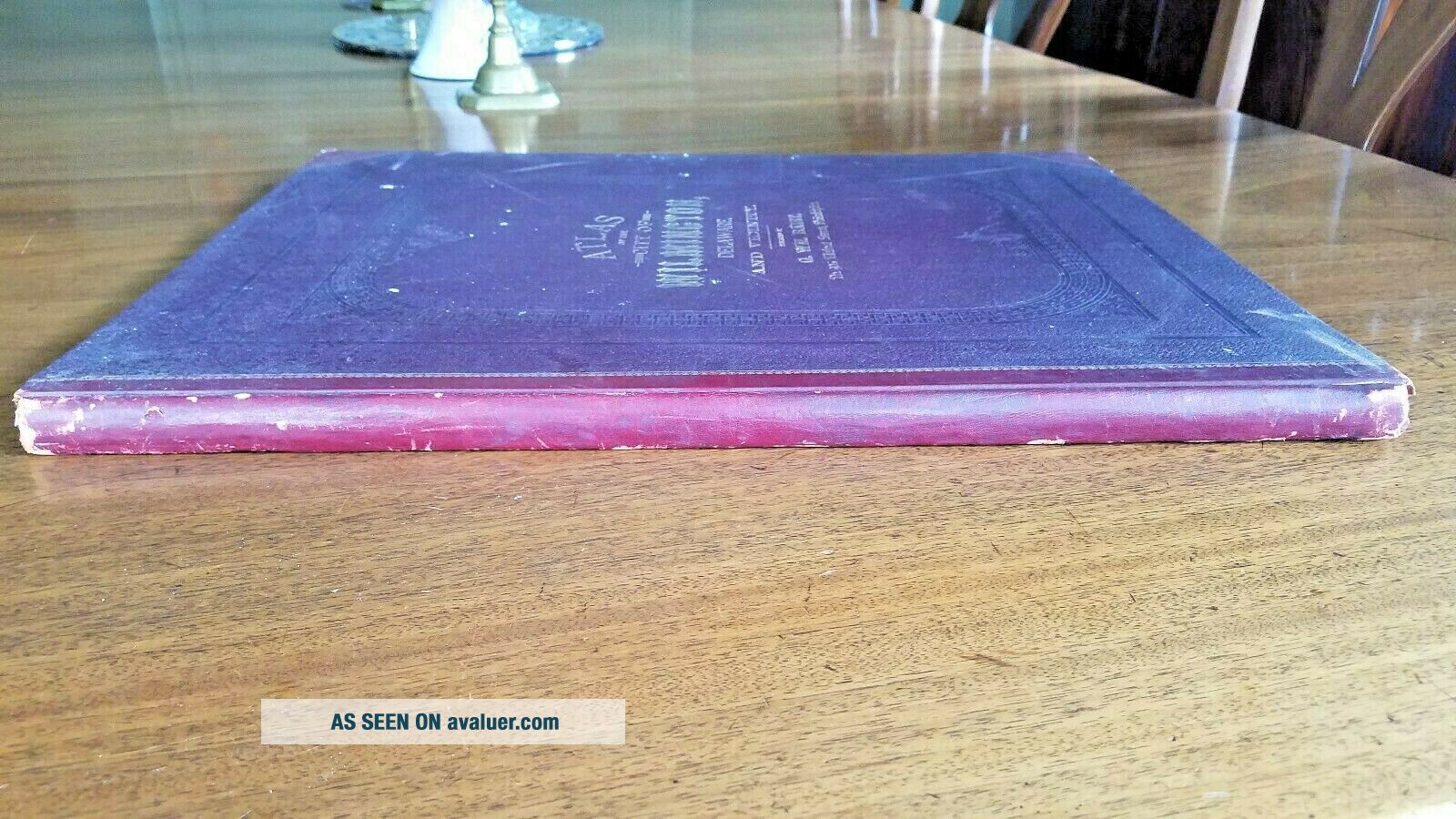
1887 GW Baist Antique Large Atlas Of The City Of Wilmington Delaware & Vicinity


Item History & Price

Information:
Reference Number: Avaluer:48619Year: 1887
Original/Reproduction: Antique OriginalFormat: 19.5 X 15"
US State: DelawareCartographer/Publisher: G. WM. Baist
Country/Region: Wilmington Delaware USAType: Atlas/maps
Original Description:
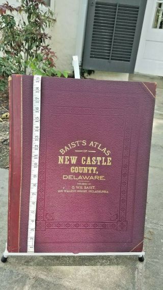
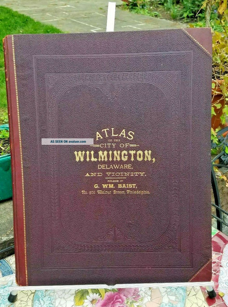
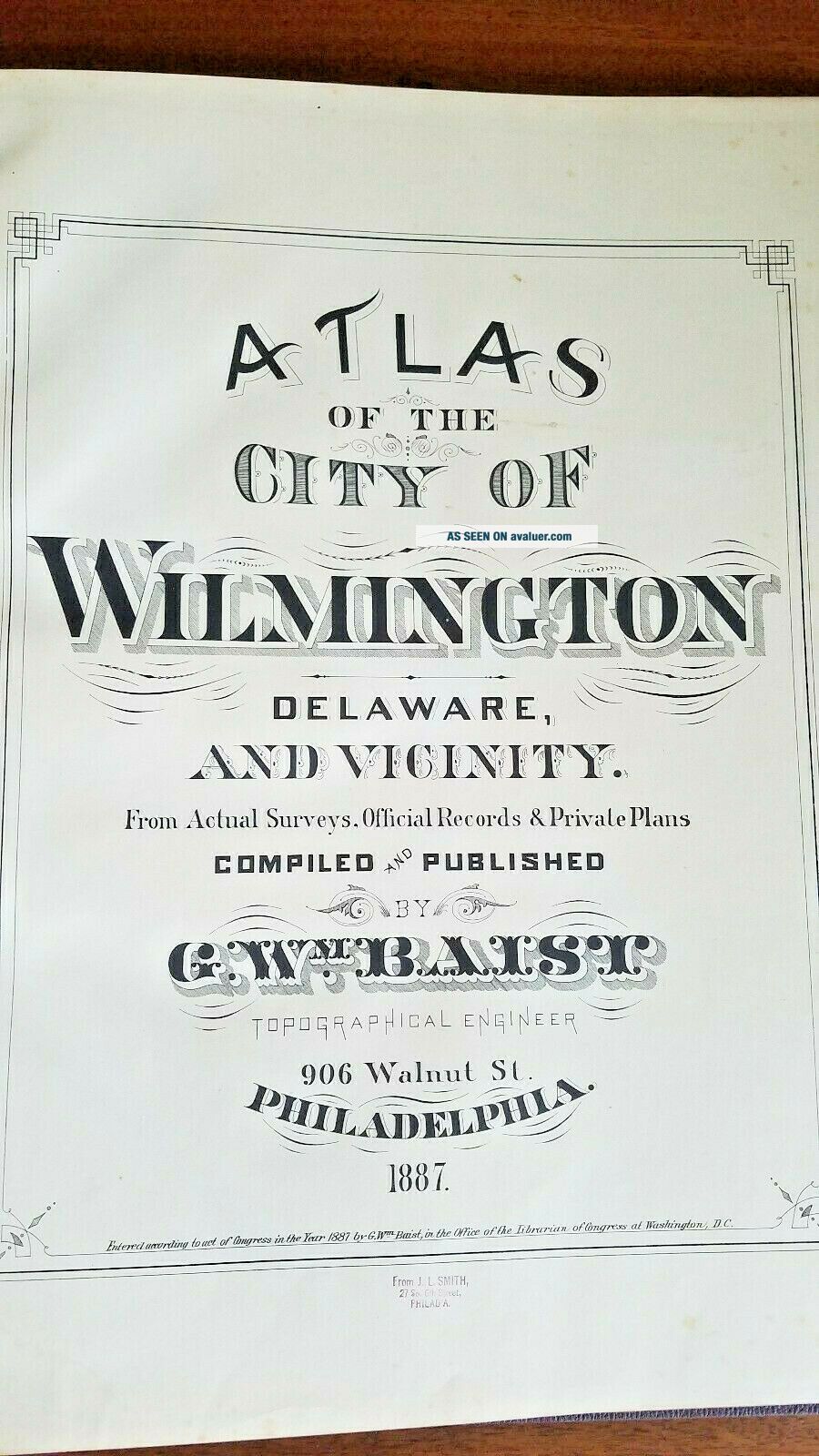
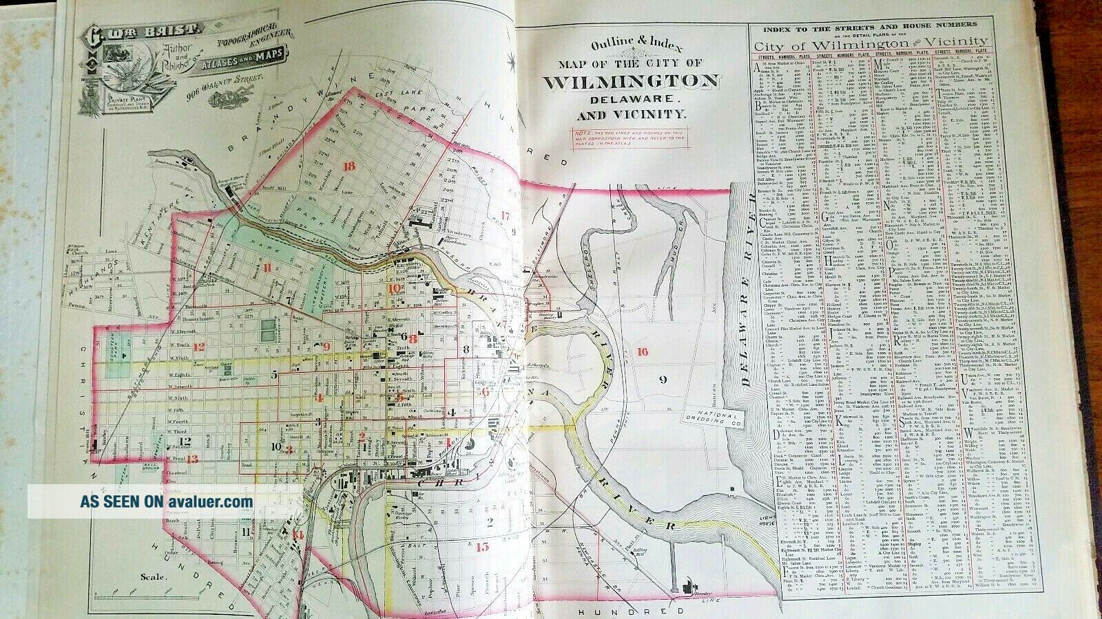
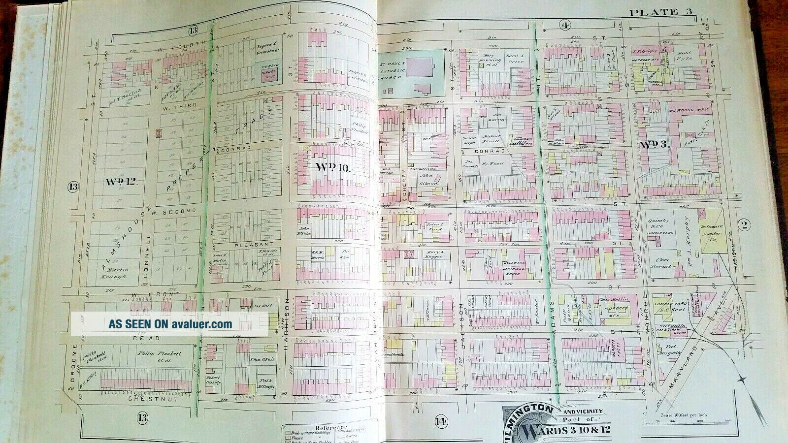
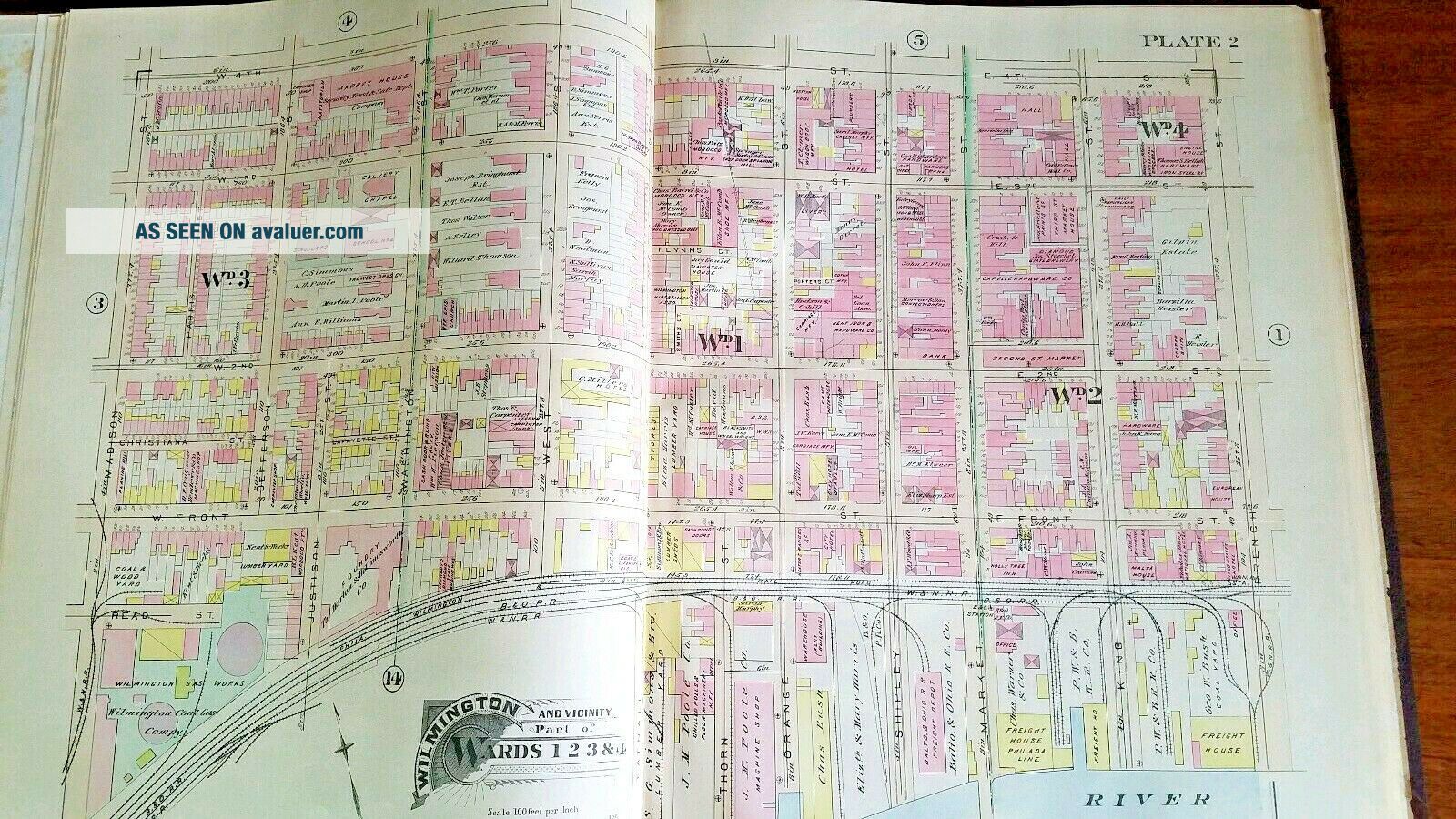
Atlas of the City of Wilmington Delaware and Vicinity
Published by G. WM. BaistNo. 906 Walnut Street, PhiladelphiaTopographical engineer1887
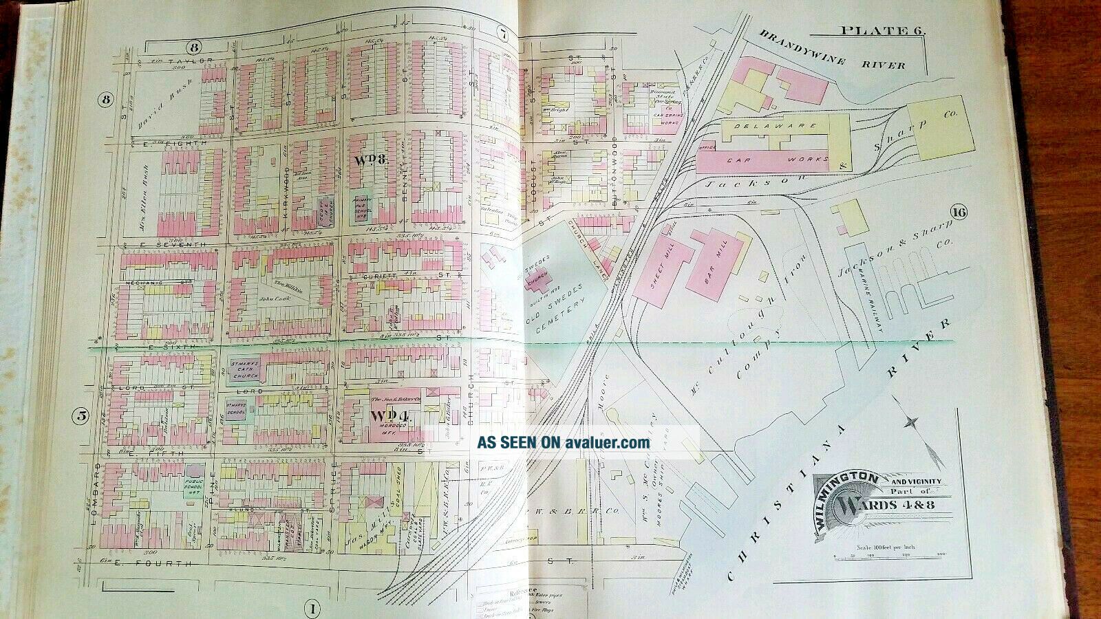
This atlas of Wilmington Delaware includes 18 plates.
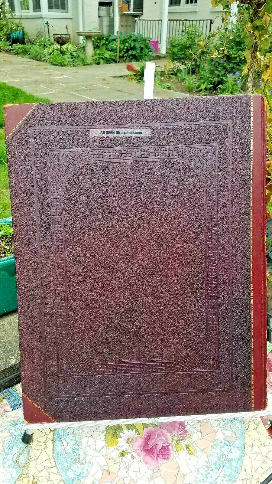
Please see pictures, I am not an antiquarian book expert.
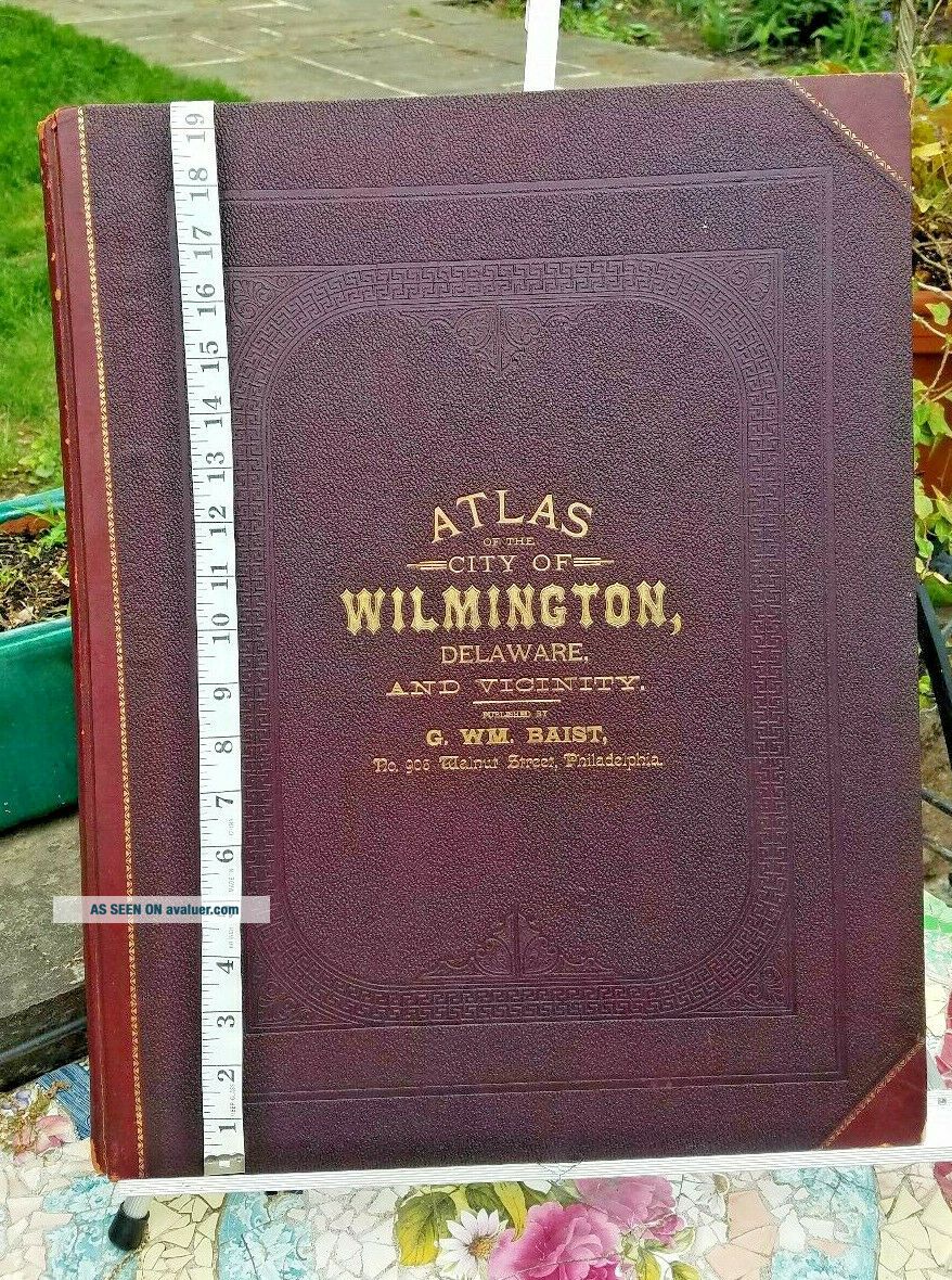
Condition:Relatively good condition.The plates are in good condition and pages pretty strong and tight.Among the flaws I notices some foxing, mostly on first and last pages and not on plates, some yellowing, and some shelf we...ar, essentially on the spine.
sales are final, don't hesitate to ask me any questions prior to bidding, I will be happy to answer them to the best of my capability.
Thanks for looking!


    Similar items


  • 1893 Gwm Baist Antique Large Atlas Of Castle County Delaware

    1893 Gwm Baist Antique Large Atlas Of Castle County Delaware

  • Antique 1887 1st Edition Alens Home Atlas Of The World 96 Pages Of Color Maps

    Antique 1887 1st Edition Alens Home Atlas Of The World 96 Pages Of Color Maps

  • 1887 Gaskell’s Popular Family Atlas Of The World (complete) Ships 2 Us

    1887 Gaskell’s Popular Family Atlas Of The World (complete) Ships 2 Us

  • 1885 Large

    1885 Large ' Atlas Of The City Of Binghamton ' G. M. Hopkins / Complete & Exc

  • Antique Physical Atlas Of The Dominion Of Canada By J.  B.  Hurlbert 1880

    Antique Physical Atlas Of The Dominion Of Canada By J. B. Hurlbert 1880

  • Antique - Geological Atlas Of The U.  S - Alexandra South Dakota Folio - 1903

    Antique - Geological Atlas Of The U. S - Alexandra South Dakota Folio - 1903

  • Antique Large Top Of The Line Brass Heavy Tassel Finial For Shade Light Fixture

    Antique Large Top Of The Line Brass Heavy Tassel Finial For Shade Light Fixture

  • 1887 Cram

    1887 Cram ' S Unrivaled Family Atlas Of The World Book / Indexed /


    • You might also like


    • 1860 Mitchell Hand Colored Map Colorado,  Nebraska & Kansas - Civil War Era

      1860 Mitchell Hand Colored Map Colorado, Nebraska & Kansas - Civil War Era

    • 18th Century French Map Of North America

      18th Century French Map Of North America

    • Las Vegas Nevada Vintage 1967 Us Geological Survey Quadrangle Map 4 Panels

      Las Vegas Nevada Vintage 1967 Us Geological Survey Quadrangle Map 4 Panels

    • Rare Antique 1845 Maps United States Exploring Expedition Book Antartica Hawaii

      Rare Antique 1845 Maps United States Exploring Expedition Book Antartica Hawaii

    • Vintage 1926 Map Hollywood From The Best Surveys Of The Time

      Vintage 1926 Map Hollywood From The Best Surveys Of The Time

    • American Continent (western Hemisphere) 1747 Bowen Antique Copper Engraved Map

      American Continent (western Hemisphere) 1747 Bowen Antique Copper Engraved Map

    • Gulf Coast Florida Texas United States 1705 De Fer Unusual Antique Engraved Map

      Gulf Coast Florida Texas United States 1705 De Fer Unusual Antique Engraved Map

    • California As Island United States 1700 De Fer Unusual First Edition Antique Map

      California As Island United States 1700 De Fer Unusual First Edition Antique Map

Avaluer          About Us          Privacy Policy          Contact Us          UP
© 2022, avaluer.net, Inc. or its affiliates