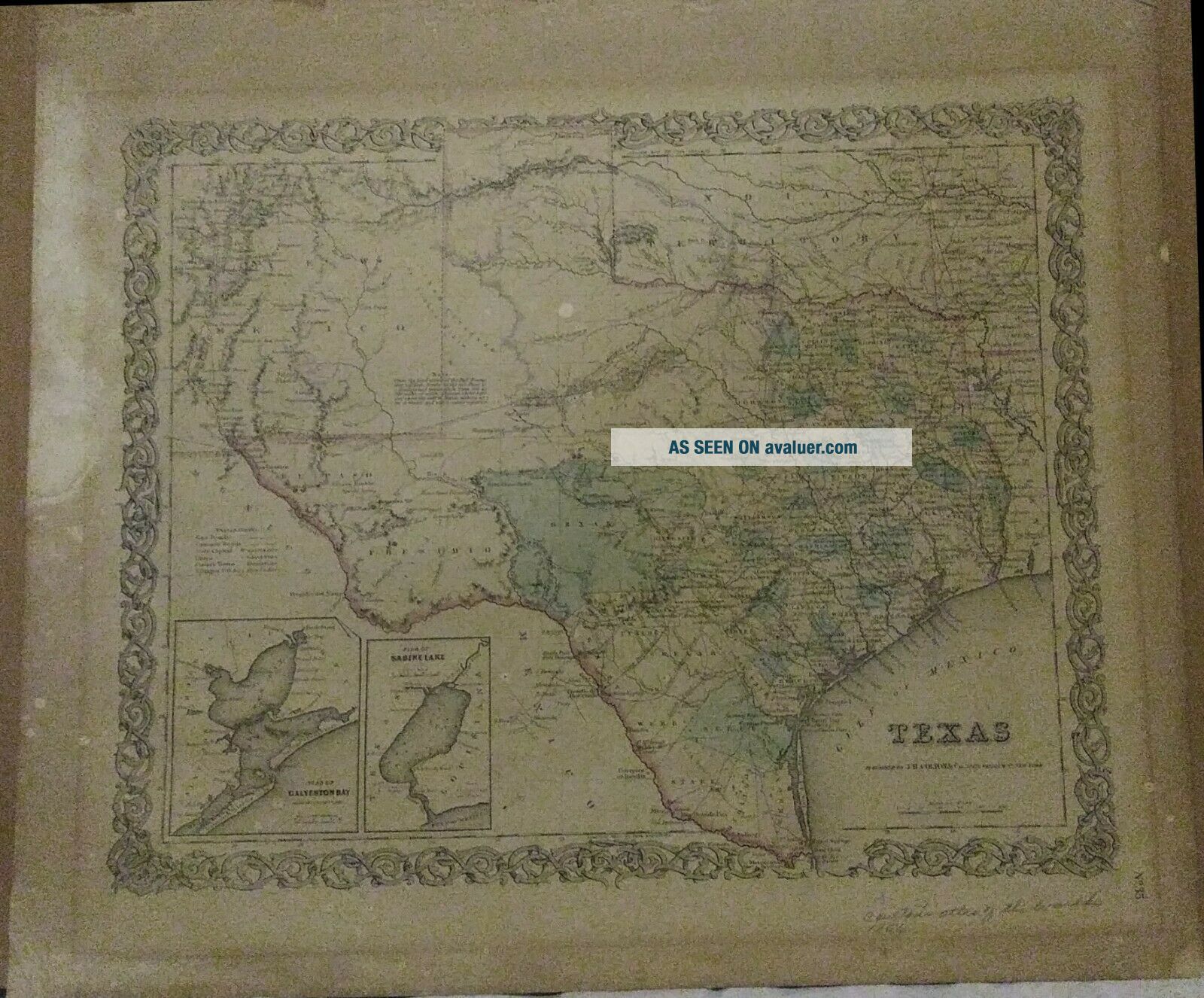
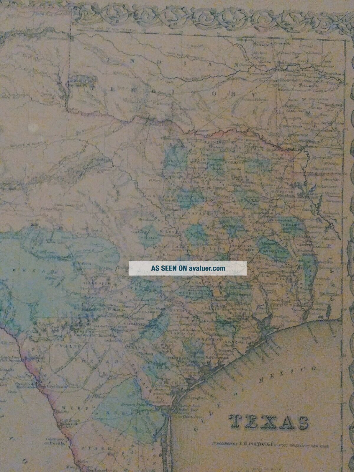
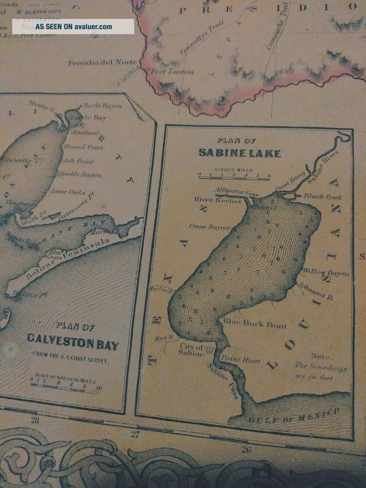
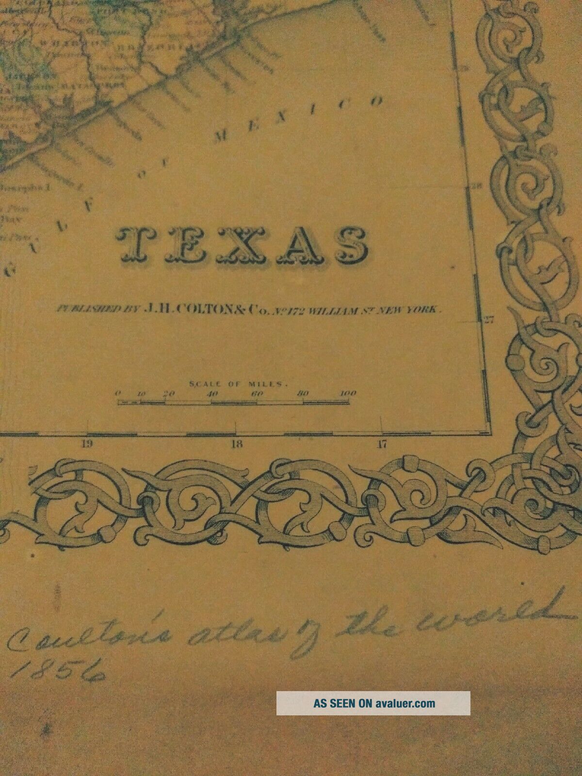
1856 Coltons Atlas Page Of Texas Hand Colored


Item History & Price

Information:
Reference Number: Avaluer:49635US State: Texas
Original Description:
These pages are from coltons atlas they usually go for 4-600 dollars.1856 Coltons Atlas Page Of Texas.. Shipped with USPS Retail Ground.


    Similar items


  • 1872 Atlas Of The State Of Pennsylvania - - Hand - Color Maps Of Counties,  Cities

    1872 Atlas Of The State Of Pennsylvania - - Hand - Color Maps Of Counties, Cities

  • Antique Bible Atlas 1832 With 8 Hand Colored Maps & Descent Of Christ From Adam

    Antique Bible Atlas 1832 With 8 Hand Colored Maps & Descent Of Christ From Adam

  • 1856 Colton Atlas Map Territories Of Oregon - Washington Old Antique

    1856 Colton Atlas Map Territories Of Oregon - Washington Old Antique

  • J.  H.  Colton & Co.  Antique 1855 Map Of Iowa - Hand Colored - Framed

    J. H. Colton & Co. Antique 1855 Map Of Iowa - Hand Colored - Framed

  • 1836 Burritt Atlas Designed To Illustrate Geography Of Heavens Hand Colored

    1836 Burritt Atlas Designed To Illustrate Geography Of Heavens Hand Colored

  • 1856 Colton Atlas Map Empire Of Brazil - Guayana Old Antique

    1856 Colton Atlas Map Empire Of Brazil - Guayana Old Antique

  • 1883 Colton

    1883 Colton ' S Sectional Map Of Florida Hand Colored Folding Pocket 24 " X 31. 5 "

  • 1832 Atlas To Marshall

    1832 Atlas To Marshall ' S Life Of Washington Hand - Colored Maps Revolutionary War


    • You might also like


    • 1860 Mitchell Hand Colored Map Colorado,  Nebraska & Kansas - Civil War Era

      1860 Mitchell Hand Colored Map Colorado, Nebraska & Kansas - Civil War Era

    • 18th Century French Map Of North America

      18th Century French Map Of North America

    • Las Vegas Nevada Vintage 1967 Us Geological Survey Quadrangle Map 4 Panels

      Las Vegas Nevada Vintage 1967 Us Geological Survey Quadrangle Map 4 Panels

    • Rare Antique 1845 Maps United States Exploring Expedition Book Antartica Hawaii

      Rare Antique 1845 Maps United States Exploring Expedition Book Antartica Hawaii

    • Vintage 1926 Map Hollywood From The Best Surveys Of The Time

      Vintage 1926 Map Hollywood From The Best Surveys Of The Time

    • American Continent (western Hemisphere) 1747 Bowen Antique Copper Engraved Map

      American Continent (western Hemisphere) 1747 Bowen Antique Copper Engraved Map

    • Gulf Coast Florida Texas United States 1705 De Fer Unusual Antique Engraved Map

      Gulf Coast Florida Texas United States 1705 De Fer Unusual Antique Engraved Map

    • California As Island United States 1700 De Fer Unusual First Edition Antique Map

      California As Island United States 1700 De Fer Unusual First Edition Antique Map

Avaluer          About Us          Privacy Policy          Contact Us          UP
© 2022, avaluer.net, Inc. or its affiliates