Antique Civil War Map June 30, 1864 USA Union & Confederate Boundaries
Item History & Price
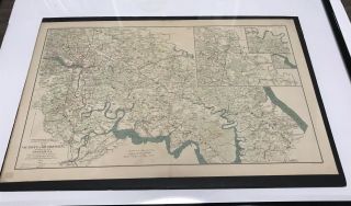
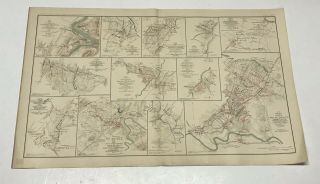
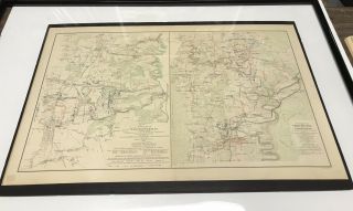
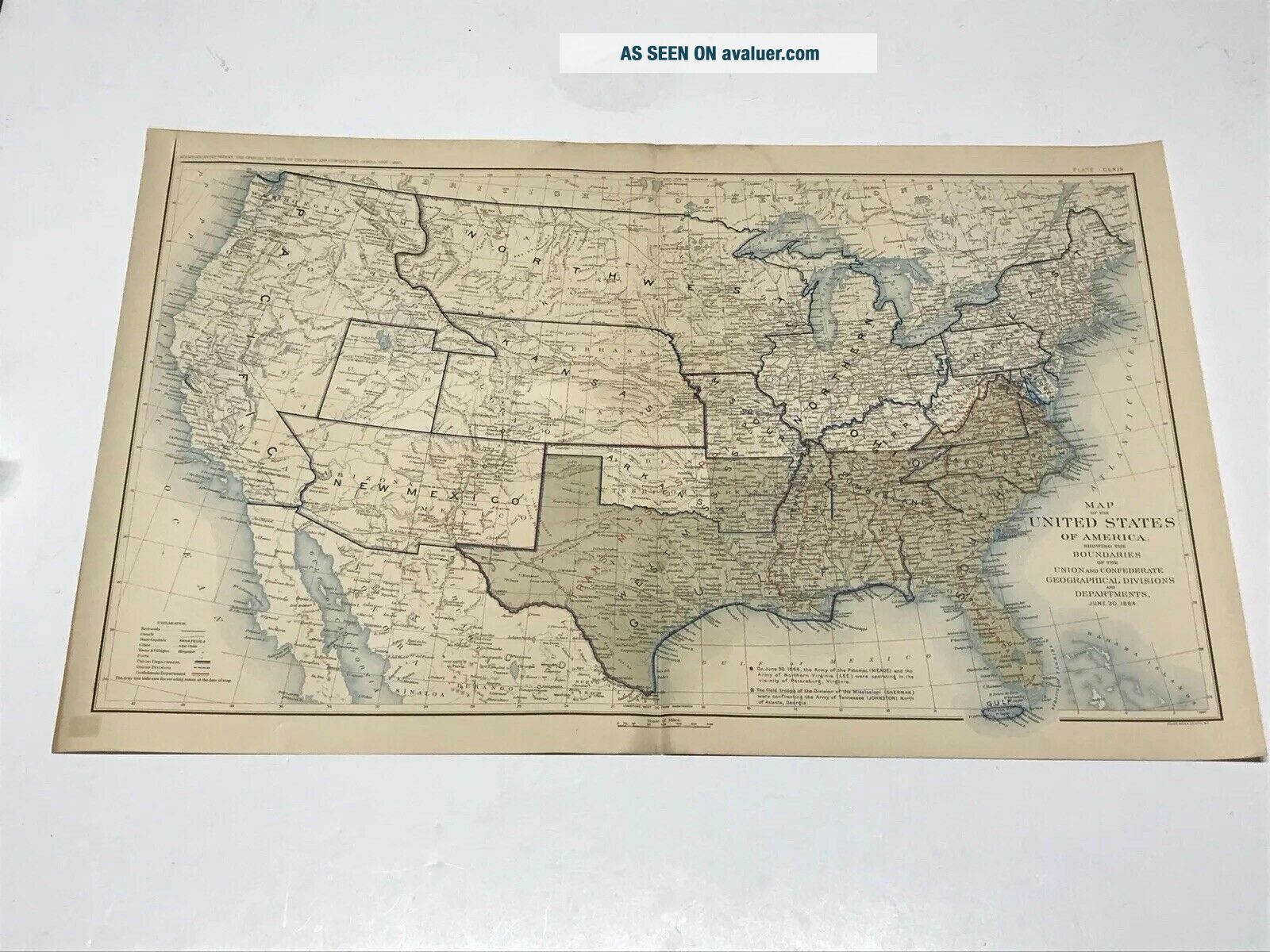
Original Plates from "Atlas to Accompany The Official Records of The Union and Confederate Armies"Not Reproductions
• Maps are over 125 years old.• Created by a resolution of Congress in 1864• Lithographs Engraved by Julius Bien• 19" x 29 1/2" Bi-Fold• Not available to the public, released to Universities and Museums over a five year period from 1891 - 1895The maps have held up well for being over 125 years old. No issues with the fold. No tack holes, No additional creas...es. May have minor edge or corner wear ( check photos), lower left corner may have small bleed thru toning from plate label that had been applied to back of map. The maps were stored flat and never hung.
Maps will be shipped flat with single fold as created. Shipping in the USA will be only $10.00 with balance to be paid by the seller.Please check our other listings for additional antiques civil war maps.
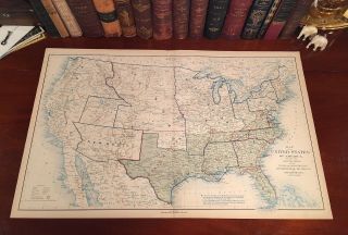
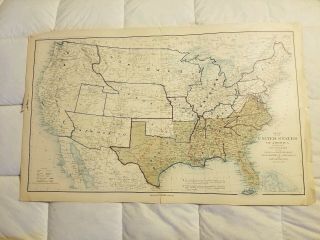
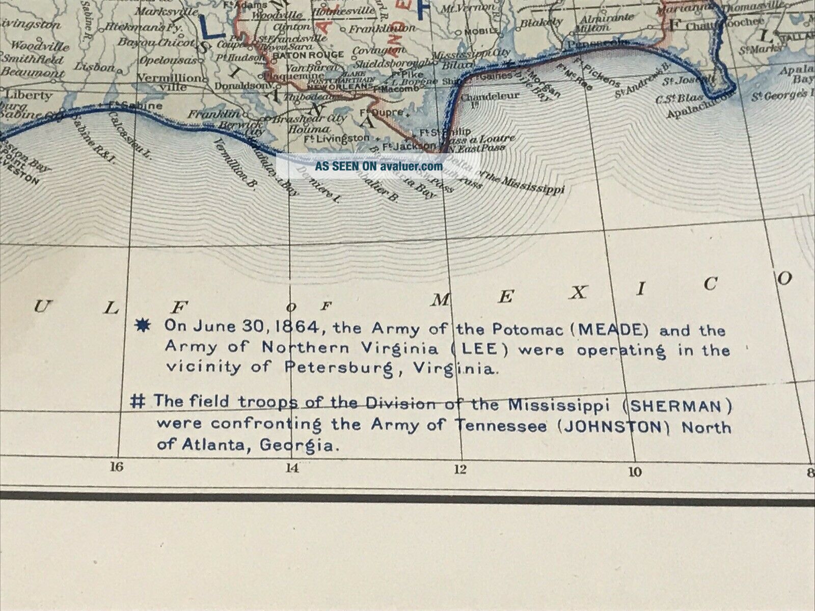
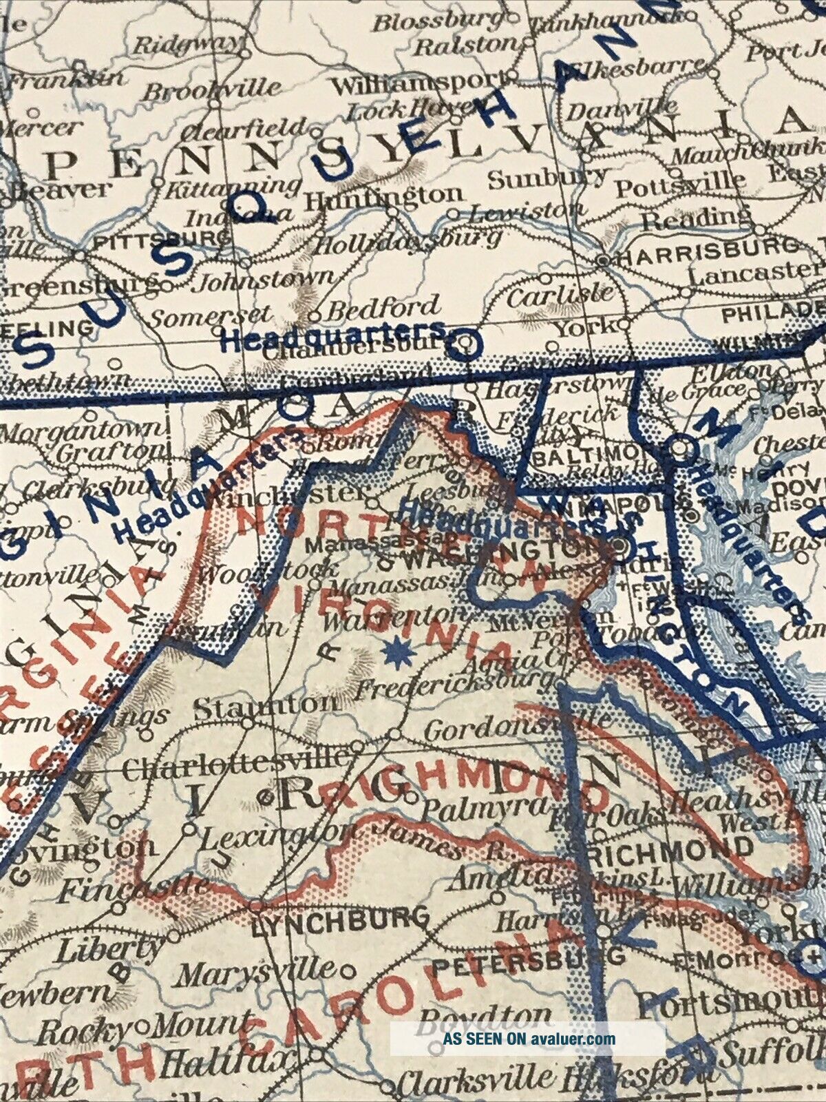
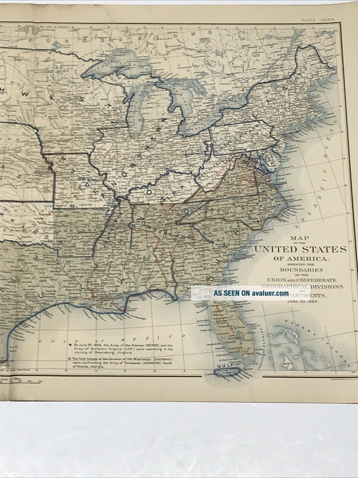
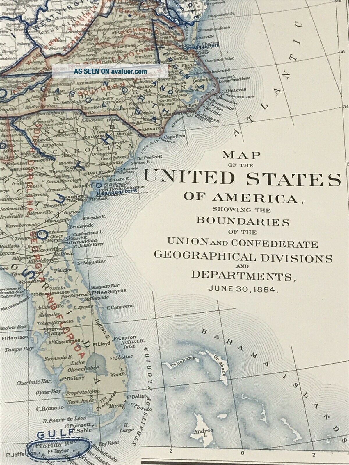
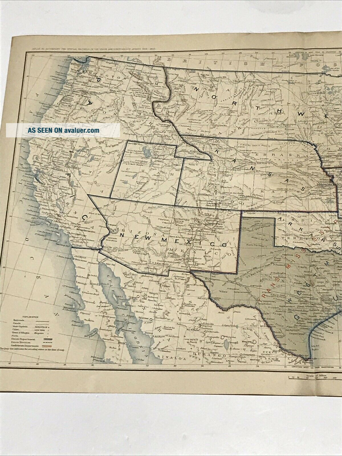
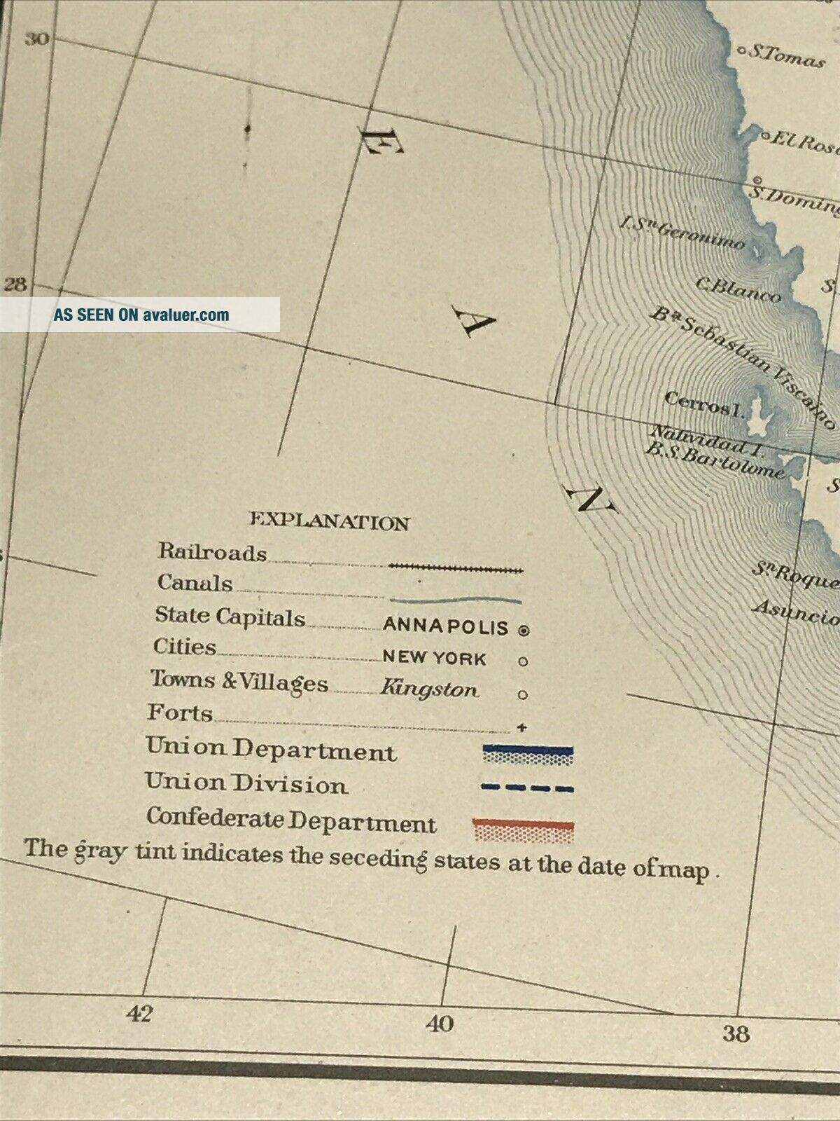
Plate No. 169 Map of The United States Of AmericaShowing boundaries of the Union and Confederate Geographical Divisions and Departments as of June 30, 1864Beautiful map. Would look great framed.
• Maps are over 125 years old.• Created by a resolution of Congress in 1864• Lithographs Engraved by Julius Bien• 19" x 29 1/2" Bi-Fold• Not available to the public, released to Universities and Museums over a five year period from 1891 - 1895The maps have held up well for being over 125 years old. No issues with the fold. No tack holes, No additional creas...es. May have minor edge or corner wear ( check photos), lower left corner may have small bleed thru toning from plate label that had been applied to back of map. The maps were stored flat and never hung.
Maps will be shipped flat with single fold as created. Shipping in the USA will be only $10.00 with balance to be paid by the seller.Please check our other listings for additional antiques civil war maps.
Plate No. 169 Map of The United States Of AmericaShowing boundaries of the Union and Confederate Geographical Divisions and Departments as of June 30, 1864Beautiful map. Would look great framed.