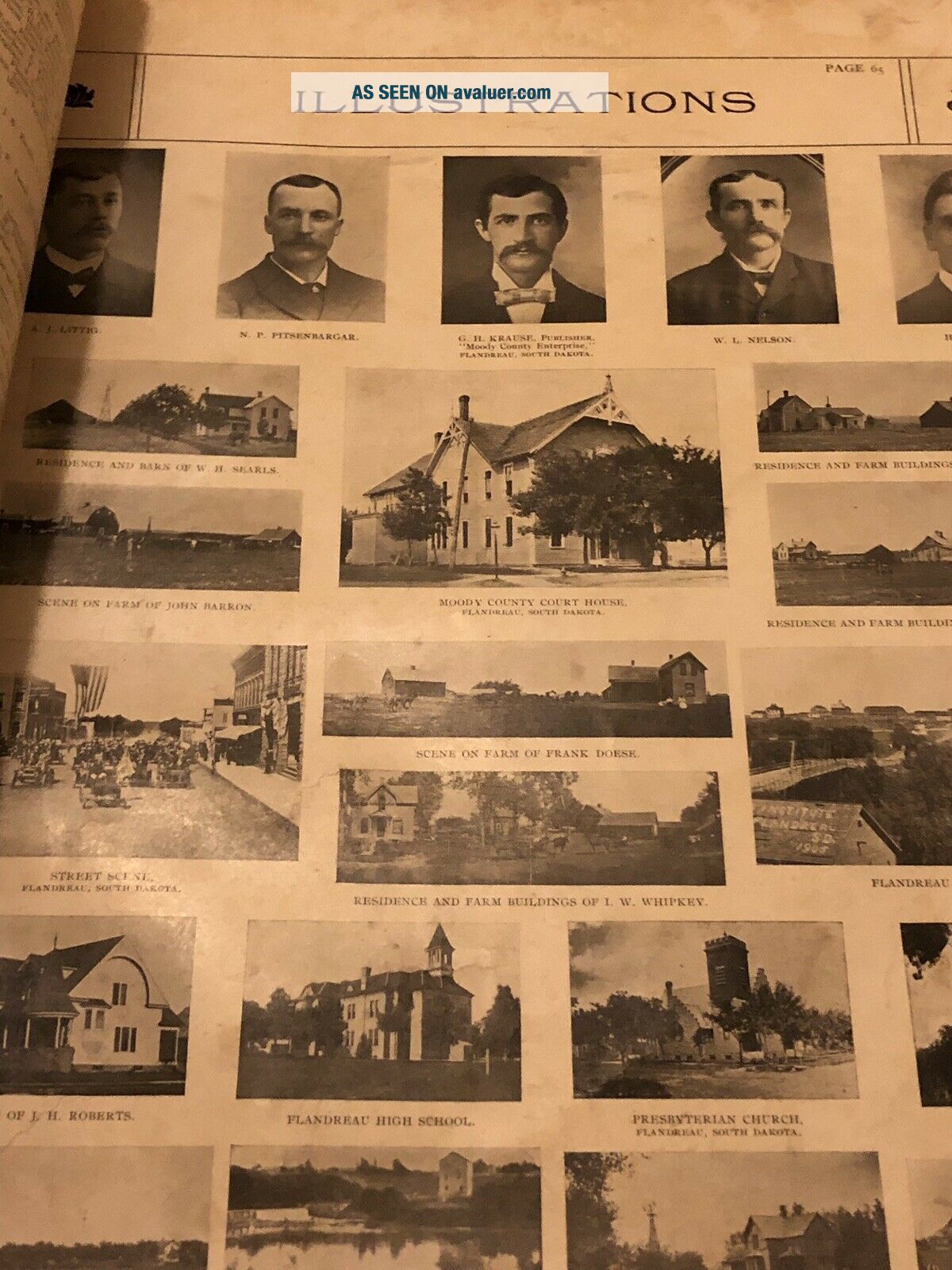
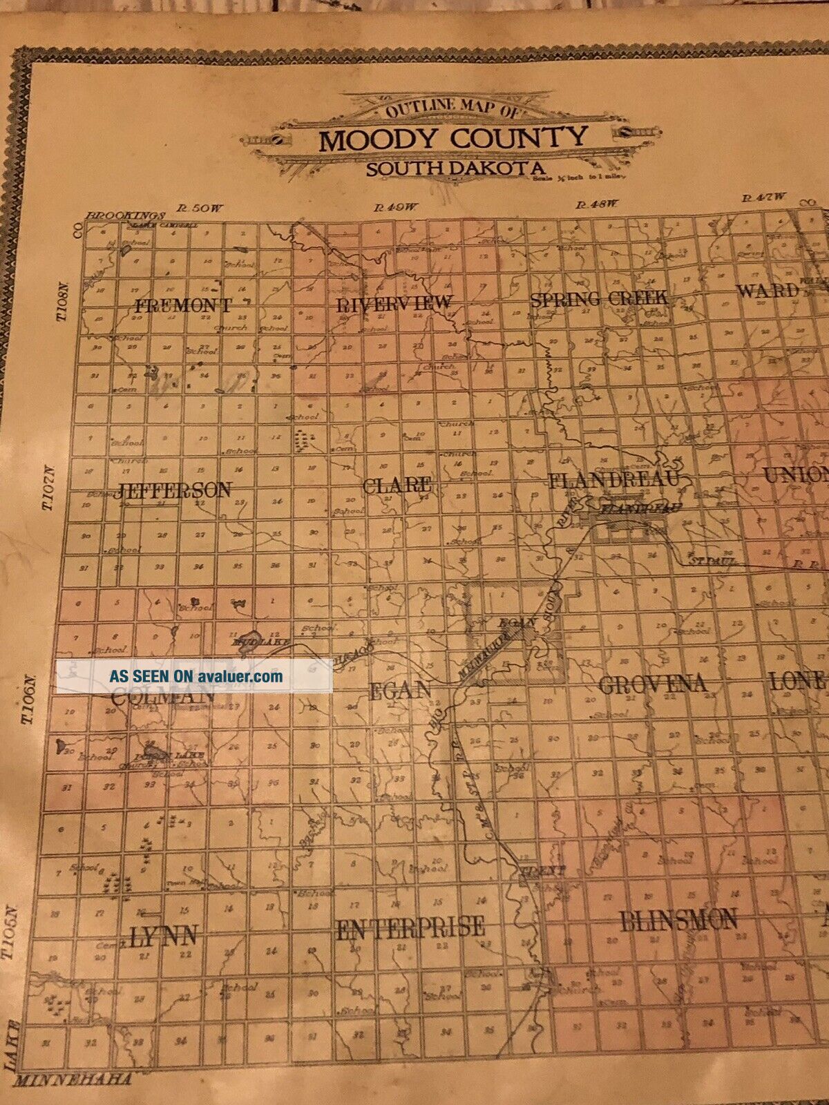
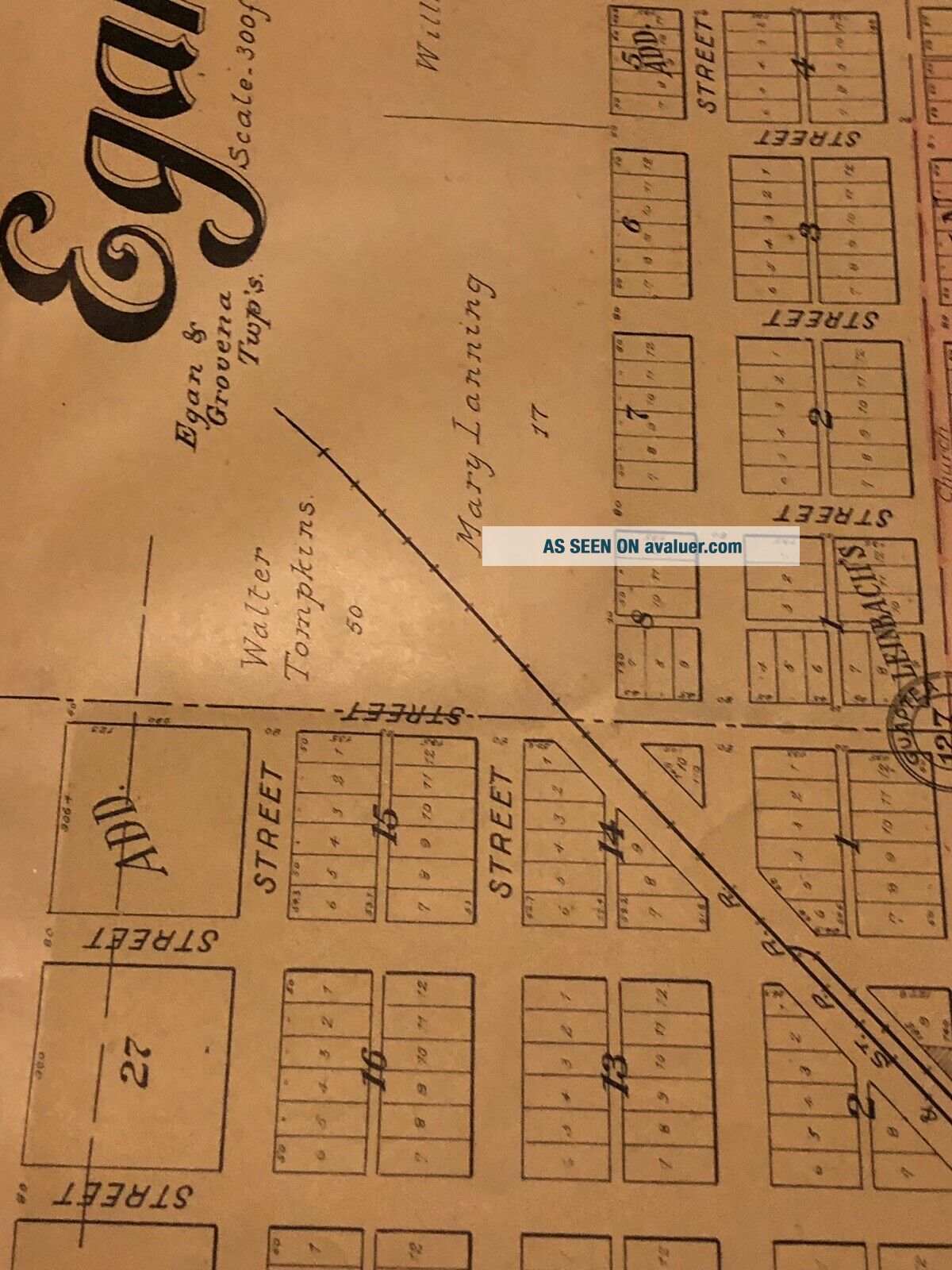
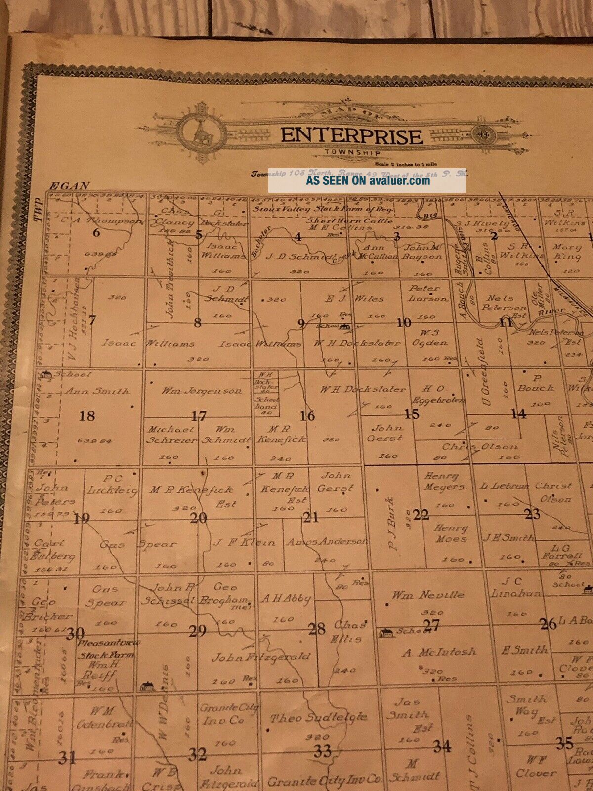
1909 STANDARD ATLAS PLAT BOOK MOODY COUNTY SOUTH DAKOTA SD OGLE ILLUSTRATIONS


Item History & Price

Information:
Reference Number: Avaluer:57279Publication Year: 1910
US State: South Dakota
Original Description:
1909 STANDARD ATLAS PLAT BOOK HANSON COUNTY SOUTH DAKOTA SD OGLE with ILLUSTRATIONS. Amazing piece of history. Pretty good shape. Most pages are intact with minimal foxing or damage. One really bad page. I put as many pics as I could. Really neat book. These old county plat map atlas books are getting harder & harder to find. Priced to sell!


    Similar items


  • Antique 1921 Standard Atlas & Plat Book Laporte County Indiana

    Antique 1921 Standard Atlas & Plat Book Laporte County Indiana

  • 1896 Standard Atlas & Plat Book Monroe County Michigan

    1896 Standard Atlas & Plat Book Monroe County Michigan

  • Standard Atlas Plat Book 1919 Harper County Kansas

    Standard Atlas Plat Book 1919 Harper County Kansas

  • Antique 1917 Standard Atlas & Plat Book Of Jackson County Arkansas Newport Diaz

    Antique 1917 Standard Atlas & Plat Book Of Jackson County Arkansas Newport Diaz

  • Land Atlas & Plat Book Washburn County Wisconsin Map Vtg 1980 1980s History

    Land Atlas & Plat Book Washburn County Wisconsin Map Vtg 1980 1980s History

  • Land Atlas & Plat Book Barron County Index To Owners Wisconsin 1972 Maps Towns

    Land Atlas & Plat Book Barron County Index To Owners Wisconsin 1972 Maps Towns

  • Vintage 1979 Land Atlas & Plat Book Portage County Wisconsin Map

    Vintage 1979 Land Atlas & Plat Book Portage County Wisconsin Map

  • 1978 Land Atlas & Plat Book Trempealeau County Wisconsin Map

    1978 Land Atlas & Plat Book Trempealeau County Wisconsin Map


    • You might also like


    • 1860 Mitchell Hand Colored Map Colorado,  Nebraska & Kansas - Civil War Era

      1860 Mitchell Hand Colored Map Colorado, Nebraska & Kansas - Civil War Era

    • 18th Century French Map Of North America

      18th Century French Map Of North America

    • Las Vegas Nevada Vintage 1967 Us Geological Survey Quadrangle Map 4 Panels

      Las Vegas Nevada Vintage 1967 Us Geological Survey Quadrangle Map 4 Panels

    • Rare Antique 1845 Maps United States Exploring Expedition Book Antartica Hawaii

      Rare Antique 1845 Maps United States Exploring Expedition Book Antartica Hawaii

    • Vintage 1926 Map Hollywood From The Best Surveys Of The Time

      Vintage 1926 Map Hollywood From The Best Surveys Of The Time

    • American Continent (western Hemisphere) 1747 Bowen Antique Copper Engraved Map

      American Continent (western Hemisphere) 1747 Bowen Antique Copper Engraved Map

    • Gulf Coast Florida Texas United States 1705 De Fer Unusual Antique Engraved Map

      Gulf Coast Florida Texas United States 1705 De Fer Unusual Antique Engraved Map

    • California As Island United States 1700 De Fer Unusual First Edition Antique Map

      California As Island United States 1700 De Fer Unusual First Edition Antique Map

Avaluer          About Us          Privacy Policy          Contact Us          UP
© 2022, avaluer.net, Inc. or its affiliates