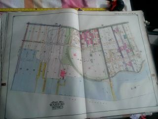
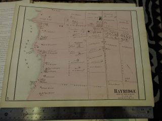
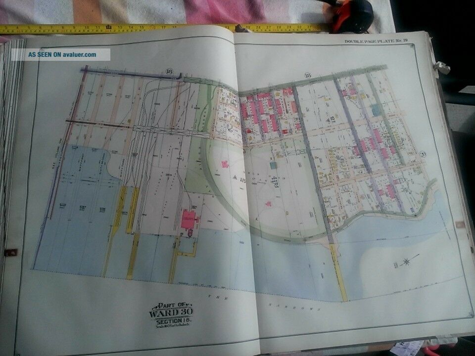
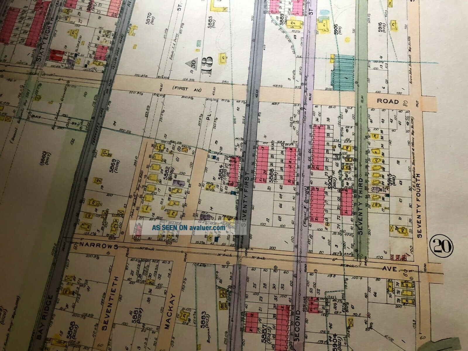
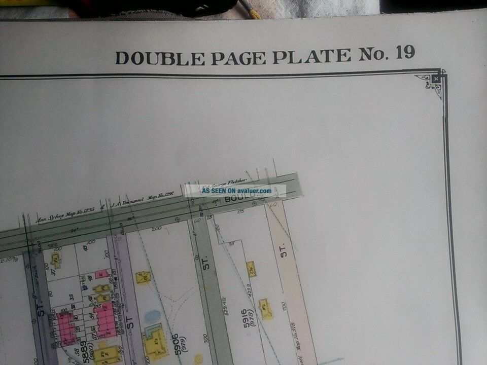
1917 Brooklyn Sunset Park Bay Ridge 60th - 74th Street NY Owls Head Park Atlas Map


Item History & Price

Information:
Reference Number: Avaluer:58917081
Original Description:
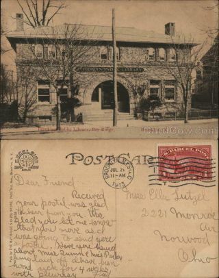
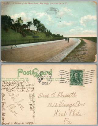
This is a HAND DRAWN rare and very large original Atlas/Map of Parts of Brooklyn New York 1917. It measures 27 x 37.  It is on linen and in Ex+/Nr. Mint.  PLAT 19 Map covers from 60th to 74th Street and from 2nd Avenue (Ridge Blvd.) to Shore Road and The Narrows.                  Each color represents the type of structure.  Yellow is wood, brown is stone, blue is iron and pink is brick.  Please see the leg...end in the photos for further information.REPRODUCTIONS ARE ALSO LISTED ON EBAY: 11x14, $19.95; 16X20, $24.95; 20X24, $29.95 36X48, $79.95.I am selling my collection of rare maps.  If there is an area or street address of Long Island, Westchester, Brooklyn, Manhattan, Queens, Staten Island, Bronx, Elmira, Buffalo, Rochester, Troy, Monroe County, Newark, Atlantic City, Essex, Berks, Montgomery, Bergen, Morris Counties, Baltimore, Washington, D.C., Los Angeles, New Orleans, Portland, Maine, Seattle, Cleveland, Baltimore, Toronto, Montreal, Vancouver, Denver, Portland, Maine, Kansas City, New Haven, Providence & Pawtucket, Rhode Island, Philadelphia, Rochester, Toledo, Youngstown, Pittsburgh, Harrisburg, Wilkes-Barre, Reading, Bucks, Delaware County, Boston, South Boston, Dorchester, Roxbury, Brighton, Worcester, Brookline, Newton, Haverhill, Malden, Middlesex County, Lawrence, Quincy, Salem, Massachusetts, Newport, Rhode Island and other cities  that you might be interested in, check my other listings or contact me.  I have insurance maps from 1880 to mid-1950s. Looks great framed! Check out my other items!
    

00862


    Similar items


  • 1917 Brooklyn Sunset Park Bay Ridge Owls Head Park 2nd Av To Shore Rd Atlas Map

    1917 Brooklyn Sunset Park Bay Ridge Owls Head Park 2nd Av To Shore Rd Atlas Map

  • Vintage Postcard Of Lake,  Sunset Park,  Bay Ridge,  Brooklyn,  Ny

    Vintage Postcard Of Lake, Sunset Park, Bay Ridge, Brooklyn, Ny

  • Postcard Ny Brooklyn Sunset Park Bay Bridge Rare 1935

    Postcard Ny Brooklyn Sunset Park Bay Bridge Rare 1935

  • 1908 Fort Hamilton Park Bay Ridge Brooklyn Ny Postcard To Schaefferstown Pa

    1908 Fort Hamilton Park Bay Ridge Brooklyn Ny Postcard To Schaefferstown Pa

  • 1873 Beers Map Brooklyn Kings County Bay Ridge - Ovington Village

    1873 Beers Map Brooklyn Kings County Bay Ridge - Ovington Village

  • 1913 Brooklyn Public Library,  Bay Ridge Kings County York Postcard 1c Stamp

    1913 Brooklyn Public Library, Bay Ridge Kings County York Postcard 1c Stamp

  • Brooklyn N.  Y.  Bay Ridge Shore Road 1907 Antique Postcard

    Brooklyn N. Y. Bay Ridge Shore Road 1907 Antique Postcard

  • Nyc Bus Sign Brooklyn Marine Parkway Bay Ridge Surf 3rd Avenue Art Ny Roll Sign

    Nyc Bus Sign Brooklyn Marine Parkway Bay Ridge Surf 3rd Avenue Art Ny Roll Sign


    • You might also like


    • 1860 Mitchell Hand Colored Map Colorado,  Nebraska & Kansas - Civil War Era

      1860 Mitchell Hand Colored Map Colorado, Nebraska & Kansas - Civil War Era

    • 18th Century French Map Of North America

      18th Century French Map Of North America

    • Las Vegas Nevada Vintage 1967 Us Geological Survey Quadrangle Map 4 Panels

      Las Vegas Nevada Vintage 1967 Us Geological Survey Quadrangle Map 4 Panels

    • Rare Antique 1845 Maps United States Exploring Expedition Book Antartica Hawaii

      Rare Antique 1845 Maps United States Exploring Expedition Book Antartica Hawaii

    • Vintage 1926 Map Hollywood From The Best Surveys Of The Time

      Vintage 1926 Map Hollywood From The Best Surveys Of The Time

    • American Continent (western Hemisphere) 1747 Bowen Antique Copper Engraved Map

      American Continent (western Hemisphere) 1747 Bowen Antique Copper Engraved Map

    • Gulf Coast Florida Texas United States 1705 De Fer Unusual Antique Engraved Map

      Gulf Coast Florida Texas United States 1705 De Fer Unusual Antique Engraved Map

    • California As Island United States 1700 De Fer Unusual First Edition Antique Map

      California As Island United States 1700 De Fer Unusual First Edition Antique Map

Avaluer          About Us          Privacy Policy          Contact Us          UP
© 2022, avaluer.net, Inc. or its affiliates