1868 US Coast Survey Chart Of The Straits Of Florida, Key West, Cuba


Item History & Price

Information:
Reference Number: Avaluer:58924897Cartographer/Publisher: A.D. Bache
US State: FloridaPrinting Technique: Lithography
Date Range: 1800-1899Format: Folding Map
City: Key WestType: Nautical Map
Country/Region: United States of AmericaYear: 1868
Original Description:
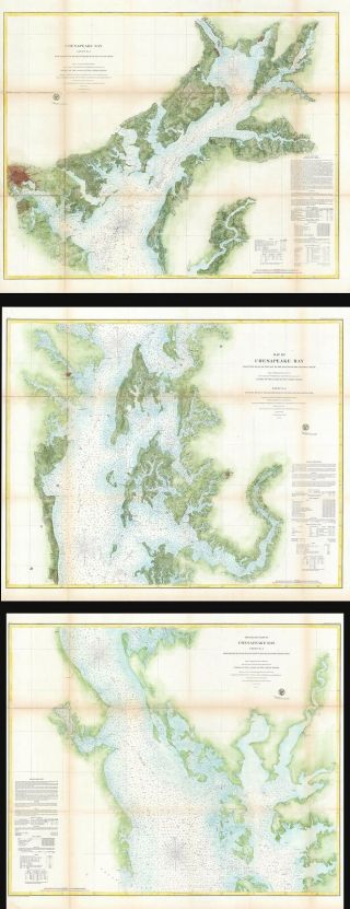
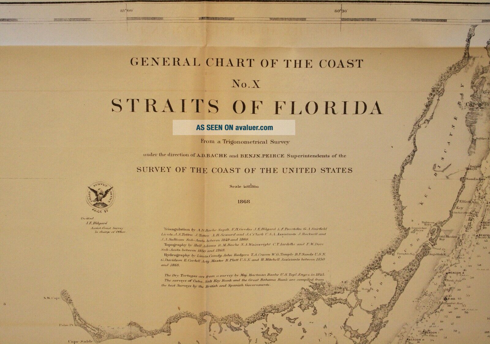
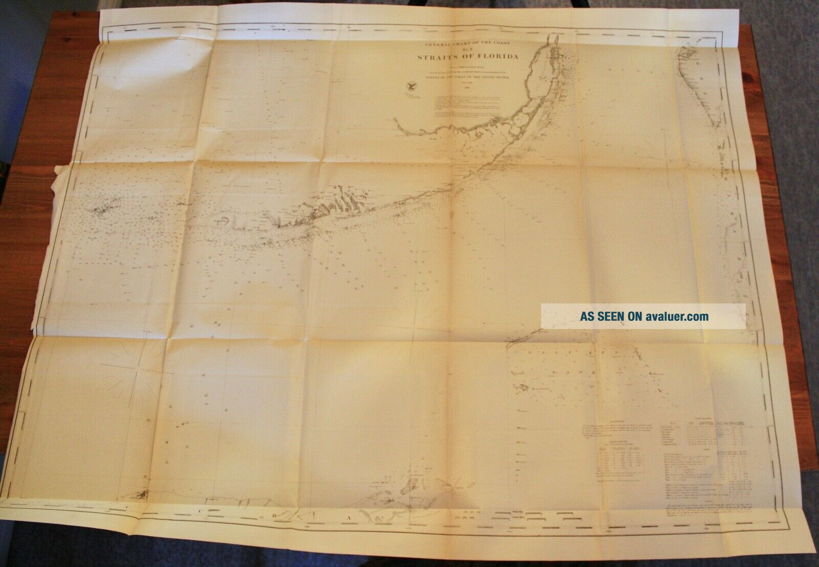
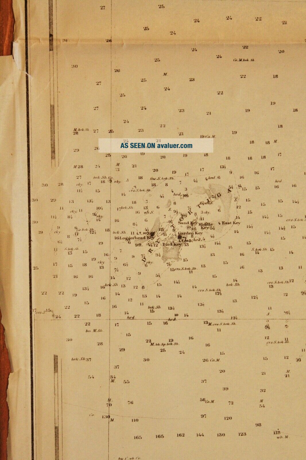
US Coast Survey General Chart of the Coast Straits of FloridaNo. X, Map No. 14, 1868From a Trigonometrical Survey under the direction of A.D. Bache and Benjamin Peirce SuperintendentsIncludes Soundings, Light Houses, Tides, and Remarks
Nice detail of the Florida Keys including Key West and the Salt KeysExtends to the north coast of Cuba including Havana
Good condition with some light discoloration and spots on folds, a small tear on the top margin, and one small hole on a fold in...tersection.42" x 34"
Item #MCS-71
Shipping is standard post (no tracking) for Canada and US. Express, tracking, and international shipping by quote. If purchasing multiple items to be shipped together, a refund of additional shipping will be issued upon mailing based on the actual cost.


    Similar items


  • 1856 Us Coast Survey Map Of The East Coast From Maine To Rhode Island

    1856 Us Coast Survey Map Of The East Coast From Maine To Rhode Island

  • 1868 Us Coast Survey Map Of Chesapeake Bay,  Maryland,  Delaware

    1868 Us Coast Survey Map Of Chesapeake Bay, Maryland, Delaware

  • 1851 Map.  Of Us Coast Survey Delta Of The Mississippi Louisiana

    1851 Map. Of Us Coast Survey Delta Of The Mississippi Louisiana

  • 1857 U.  S.  Coast Survey Map Of The Chesapeake Bay (3 Parts)

    1857 U. S. Coast Survey Map Of The Chesapeake Bay (3 Parts)

  • 1866 Map Cape Cod - Belle Isle Us Coast Survey Chart Coastal Nautical Art Poster

    1866 Map Cape Cod - Belle Isle Us Coast Survey Chart Coastal Nautical Art Poster

  • Us Geographical Surveys West Of The 100th Meridian Vol Vii Archaeology 1879

    Us Geographical Surveys West Of The 100th Meridian Vol Vii Archaeology 1879

  • Us Geological Survey Dept Of The Interior Washington Dc Jun 18 1908 Official Ad

    Us Geological Survey Dept Of The Interior Washington Dc Jun 18 1908 Official Ad

  • 1864 Us Coast Survey Chart Map Bristol Harbor Rhode Island Ad Bache 20 X 14 1/2

    1864 Us Coast Survey Chart Map Bristol Harbor Rhode Island Ad Bache 20 X 14 1/2


    • You might also like


    • 1860 Mitchell Hand Colored Map Colorado,  Nebraska & Kansas - Civil War Era

      1860 Mitchell Hand Colored Map Colorado, Nebraska & Kansas - Civil War Era

    • 18th Century French Map Of North America

      18th Century French Map Of North America

    • Las Vegas Nevada Vintage 1967 Us Geological Survey Quadrangle Map 4 Panels

      Las Vegas Nevada Vintage 1967 Us Geological Survey Quadrangle Map 4 Panels

    • Rare Antique 1845 Maps United States Exploring Expedition Book Antartica Hawaii

      Rare Antique 1845 Maps United States Exploring Expedition Book Antartica Hawaii

    • Vintage 1926 Map Hollywood From The Best Surveys Of The Time

      Vintage 1926 Map Hollywood From The Best Surveys Of The Time

    • American Continent (western Hemisphere) 1747 Bowen Antique Copper Engraved Map

      American Continent (western Hemisphere) 1747 Bowen Antique Copper Engraved Map

    • Gulf Coast Florida Texas United States 1705 De Fer Unusual Antique Engraved Map

      Gulf Coast Florida Texas United States 1705 De Fer Unusual Antique Engraved Map

    • California As Island United States 1700 De Fer Unusual First Edition Antique Map

      California As Island United States 1700 De Fer Unusual First Edition Antique Map

Avaluer          About Us          Privacy Policy          Contact Us          UP
© 2022, avaluer.net, Inc. or its affiliates