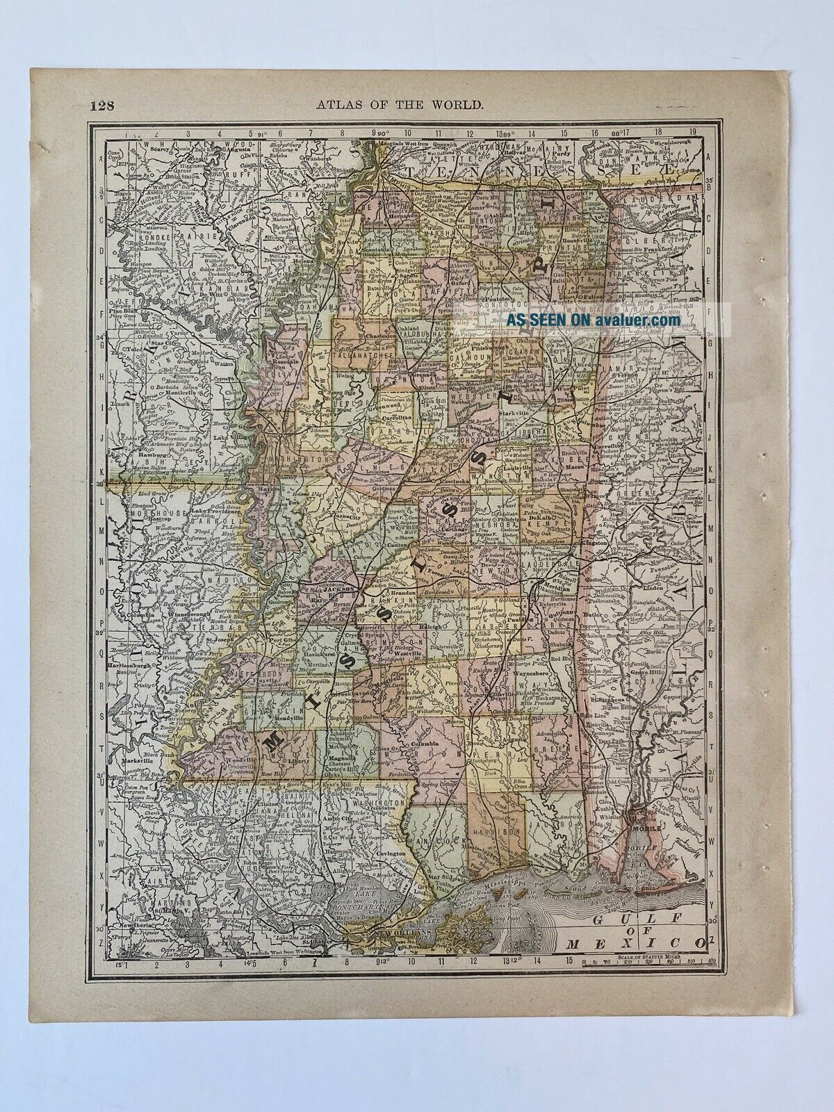
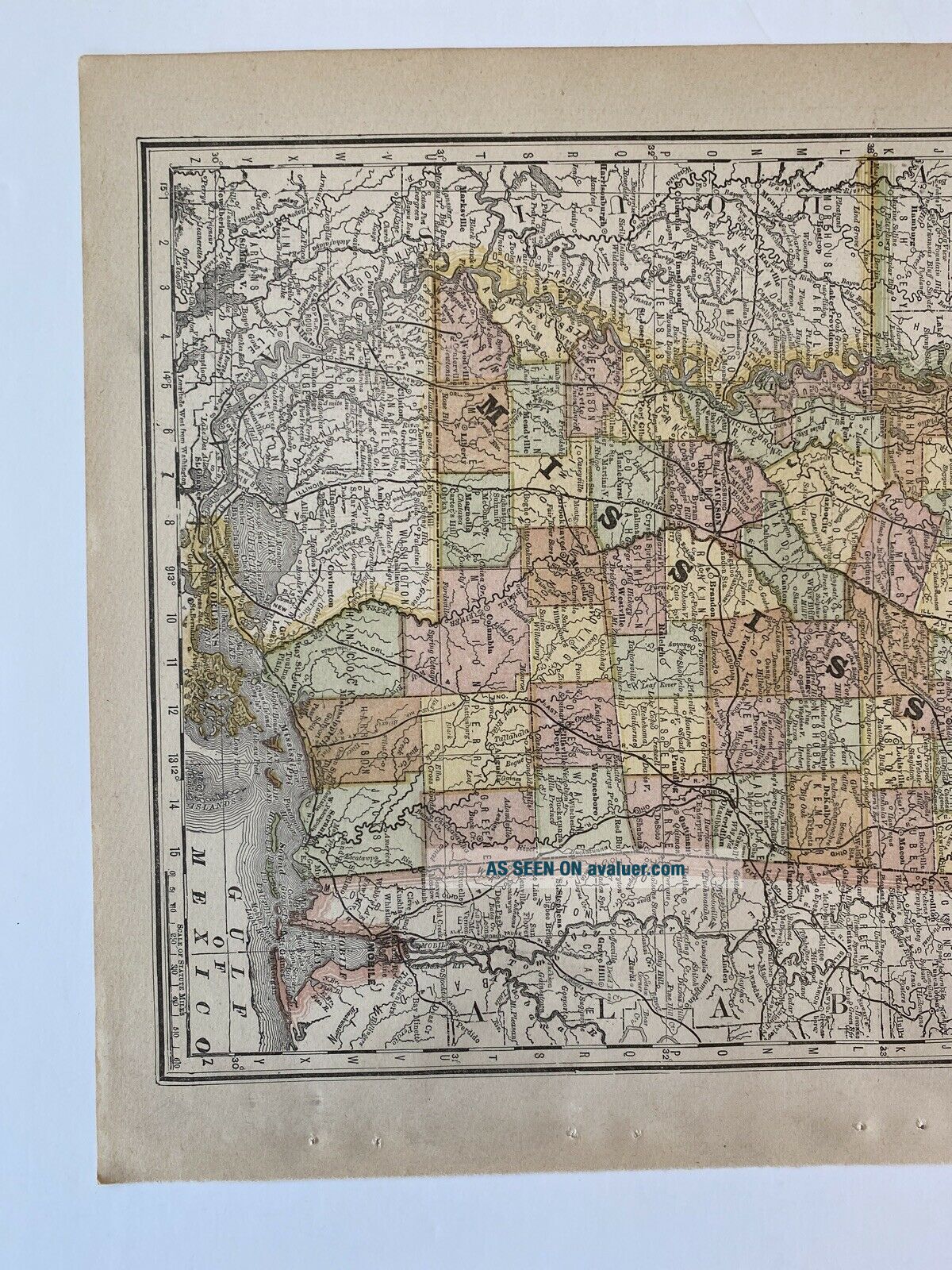
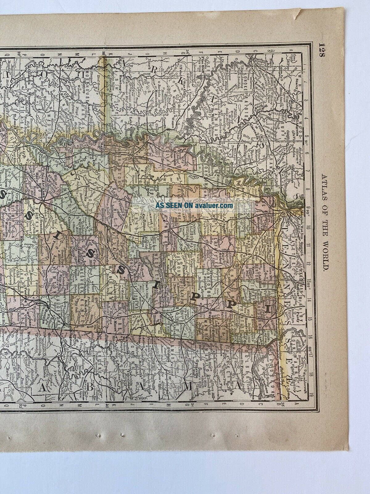
1890, Map Of Mississippi, Rand McNally Standard Atlas Of The World


Item History & Price

Information:
Reference Number: Avaluer:58938023Maker: 1890 Rand McNally New Standard Atlas of the World
Year: 1890Mexican State: United States
US State: MississippiOriginal/Reproduction: Original
Date Range: 1800-1899Format: Atlas Map
Country/Region: United States of AmericaType: Map
Original Description:
Up for sale is a map of Mississippi from the 1890 Rand McNally New Standard Atlas of the World.  There is some yellowing of the paper as would be expected of a 130 year old document and a tiny tear in the upper border. This map measures 14 x 11 inches. One side of the map is Mississippi, the reverse side of this map is a partial map of Florida. Please examine the photos carefully as they offer the best information regarding the condition and design of this interesting antique map. I've also... included the atlas coverage page and copyright info in the photos for your information only, as they are not part of the sale. Feel free to ask questions prior to the auctions end. This map comes from a clean, smoke free home. 


    Similar items


  • Military And Naval Map Of Wwii Rand Mcnally Battles Campaigns Vintage

    Military And Naval Map Of Wwii Rand Mcnally Battles Campaigns Vintage

  • 1916 Antique Map Of Italy Rand Mcnally

    1916 Antique Map Of Italy Rand Mcnally

  • Vintage Pictorial Map Of Africa Rand Mcnally 1957

    Vintage Pictorial Map Of Africa Rand Mcnally 1957

  • Vintage 1930

    Vintage 1930 ' S Map Of Europe Rand Mcnally Usa Fold Up Haskin Info Bureau

  • Antique Pocket Map Of China,  Rand Mcnally

    Antique Pocket Map Of China, Rand Mcnally

  • Vintage Fold - Out Map Of Illinois - Rand Mcnally 1975

    Vintage Fold - Out Map Of Illinois - Rand Mcnally 1975

  • Texaco Oil Company Map Of Kentucky Rand Mcnally 1964

    Texaco Oil Company Map Of Kentucky Rand Mcnally 1964

  • 1916 Antique Map Of Ireland Rand Mcnally

    1916 Antique Map Of Ireland Rand Mcnally


    • You might also like


    • 1860 Mitchell Hand Colored Map Colorado,  Nebraska & Kansas - Civil War Era

      1860 Mitchell Hand Colored Map Colorado, Nebraska & Kansas - Civil War Era

    • 18th Century French Map Of North America

      18th Century French Map Of North America

    • Las Vegas Nevada Vintage 1967 Us Geological Survey Quadrangle Map 4 Panels

      Las Vegas Nevada Vintage 1967 Us Geological Survey Quadrangle Map 4 Panels

    • Rare Antique 1845 Maps United States Exploring Expedition Book Antartica Hawaii

      Rare Antique 1845 Maps United States Exploring Expedition Book Antartica Hawaii

    • Vintage 1926 Map Hollywood From The Best Surveys Of The Time

      Vintage 1926 Map Hollywood From The Best Surveys Of The Time

    • American Continent (western Hemisphere) 1747 Bowen Antique Copper Engraved Map

      American Continent (western Hemisphere) 1747 Bowen Antique Copper Engraved Map

    • Gulf Coast Florida Texas United States 1705 De Fer Unusual Antique Engraved Map

      Gulf Coast Florida Texas United States 1705 De Fer Unusual Antique Engraved Map

    • California As Island United States 1700 De Fer Unusual First Edition Antique Map

      California As Island United States 1700 De Fer Unusual First Edition Antique Map

Avaluer          About Us          Privacy Policy          Contact Us          UP
© 2022, avaluer.net, Inc. or its affiliates