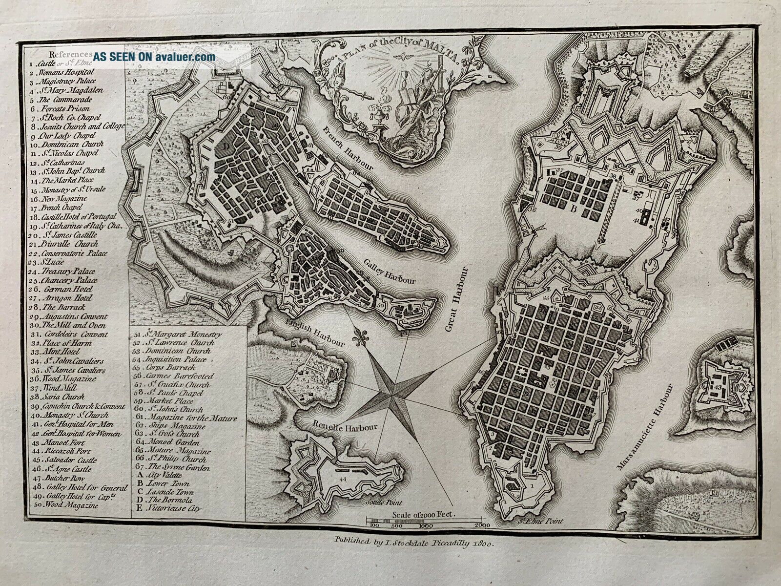
1800 MALTA VALLETTA CITY PLAN ANTIQUE MAP BY JOHN STOCKDALE 219 YEARS OLD


Item History & Price

Information:
Reference Number: Avaluer:59089Cartographer/Publisher: John Stockdale
Country/Region: MaltaPrinting Technique: Copper Plate
Format: Atlas MapDate Range: 1800-1899
Type: City MapCity: Valletta
Year: 1800Original/Reproduction: Antique Original
Original Description:
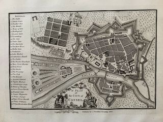
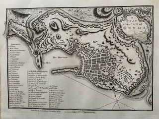
This original antique city plan is by John Stockdale and was published in 1800 in Piccadilly, London. 
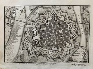
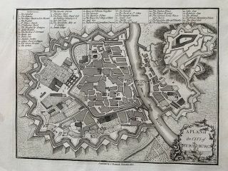
The map is printed on one side only and measures 29 cm x 23 cm.
If you have any questions or would like to see more photographs then please do not hesitate to ask. This interesting map is an original antique which is 219 years old. 
Please check my other auctions for more antique, books, maps and engravings which are added every week.


...


    Similar items


  • 1800 Kassel Germany City Plan Antique Map By John Stockdale 219 Years Old

    1800 Kassel Germany City Plan Antique Map By John Stockdale 219 Years Old

  • 1800 Mannheim Germany City Plan Antique Map By John Stockdale 219 Years Old

    1800 Mannheim Germany City Plan Antique Map By John Stockdale 219 Years Old

  • 1800 Regensburg Germany City Plan Antique Map By John Stockdale 219 Years Old

    1800 Regensburg Germany City Plan Antique Map By John Stockdale 219 Years Old

  • 1800 Paris France City Plan Antique Map By John Stockdale 219 Years Old

    1800 Paris France City Plan Antique Map By John Stockdale 219 Years Old

  • 1800 Genoa Italy City Plan Antique Map By John Stockdale 219 Years Old

    1800 Genoa Italy City Plan Antique Map By John Stockdale 219 Years Old

  • 1800 Wurzburg Germany City Plan Antique Map By John Stockdale 219 Years Old

    1800 Wurzburg Germany City Plan Antique Map By John Stockdale 219 Years Old

  • 1800 Amsterdam Holland City Plan Antique Map By John Stockdale 219 Years Old

    1800 Amsterdam Holland City Plan Antique Map By John Stockdale 219 Years Old

  • 1800 Bern Switzerland City Plan Antique Map By John Stockdale 219 Years Old

    1800 Bern Switzerland City Plan Antique Map By John Stockdale 219 Years Old


    • You might also like


    • Hungary & Romania 1579 (1584) Ortelius Unusual Antique Copper Engraved Map

      Hungary & Romania 1579 (1584) Ortelius Unusual Antique Copper Engraved Map

    • Brussels Bruxelles Belfium 1777 De Ferraris & Dupuis Large Antique Map Sheet Xxi

      Brussels Bruxelles Belfium 1777 De Ferraris & Dupuis Large Antique Map Sheet Xxi

    • 1616 Atlas Map Of Iceland.

      1616 Atlas Map Of Iceland.

    • Kazan Russia 1767 Le Clerc/lespinasse Antique Copper Engraved City View

      Kazan Russia 1767 Le Clerc/lespinasse Antique Copper Engraved City View

    • 1899 Stanford,  Folding Map Of Norwich,  Norfolk,  Arthur Collins,  Jarrold & Sons,

      1899 Stanford, Folding Map Of Norwich, Norfolk, Arthur Collins, Jarrold & Sons,

    • 1948 Vintage Linen Colour Map Geological Survey Ten Mile Of Great Britain

      1948 Vintage Linen Colour Map Geological Survey Ten Mile Of Great Britain

    • 1944 Map Flying Bombs Sussex Ww2 Newspaper Military Kent Courier German V1 V2

      1944 Map Flying Bombs Sussex Ww2 Newspaper Military Kent Courier German V1 V2

    • Dated 1638 Vellum Map Of Icklesham Sussex Showing Land Uses Owners Etc

      Dated 1638 Vellum Map Of Icklesham Sussex Showing Land Uses Owners Etc

Avaluer          About Us          Privacy Policy          Contact Us          UP
© 2022, avaluer.net, Inc. or its affiliates