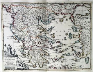
GREECE TURKEY 1735 VAN DER AA COVENS & MORTIER COLORED COPPER ENGRAVED MAP
Item History & Price
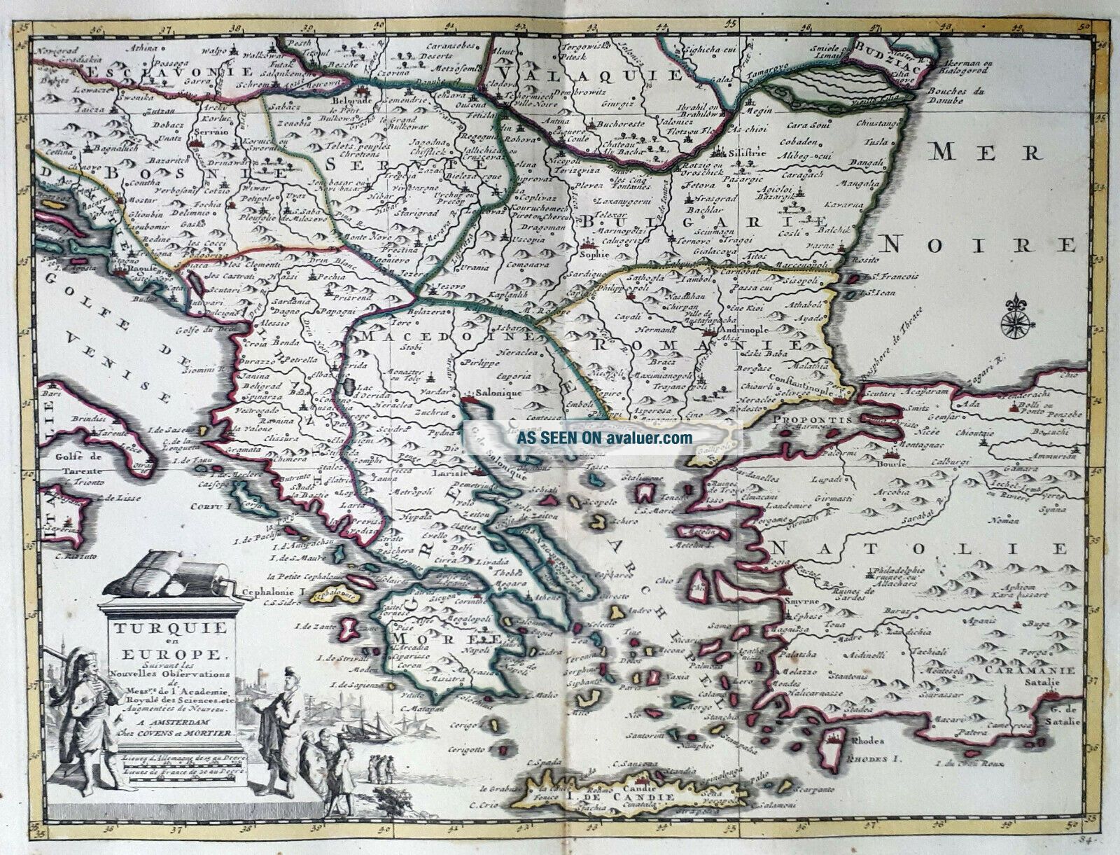
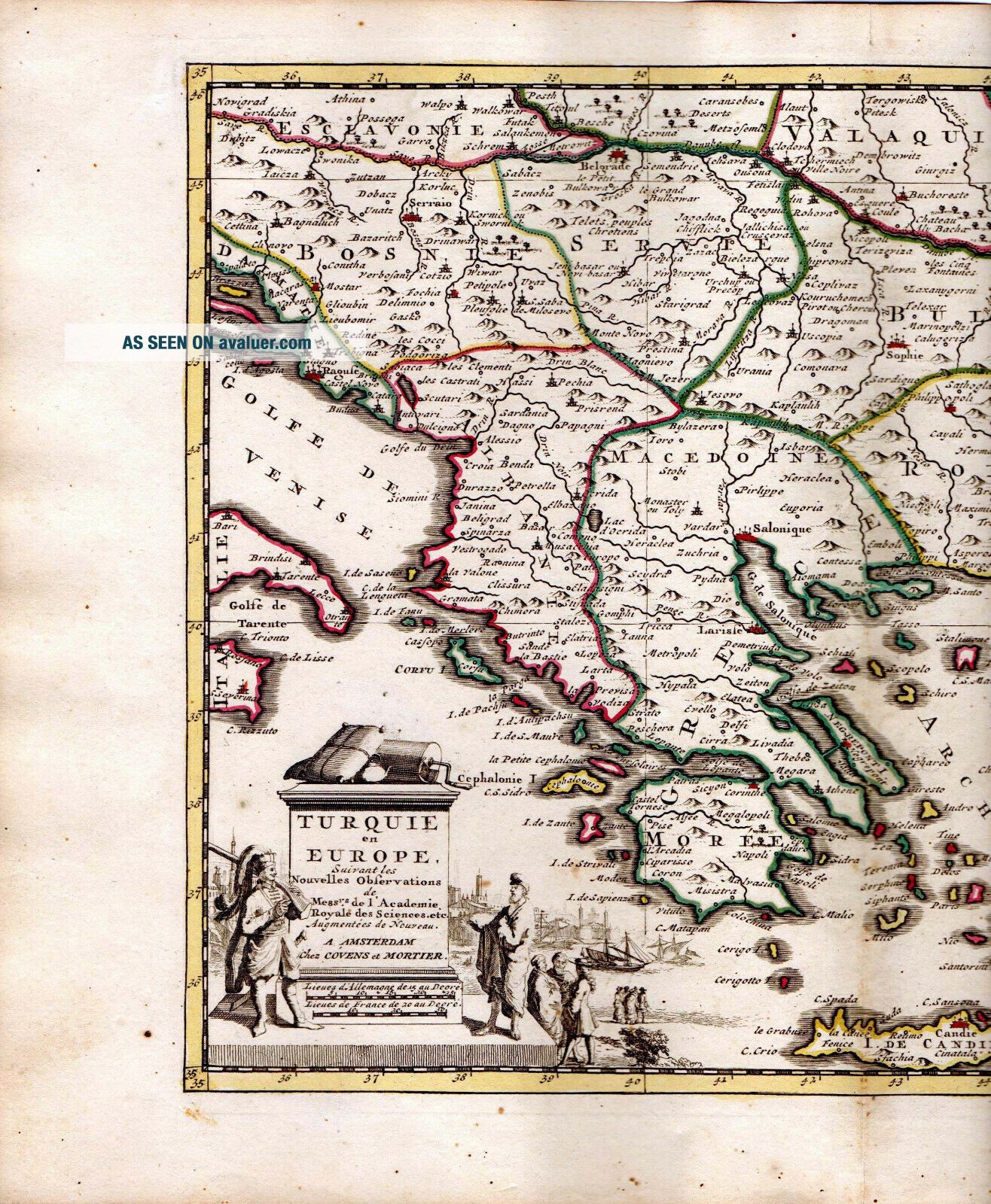
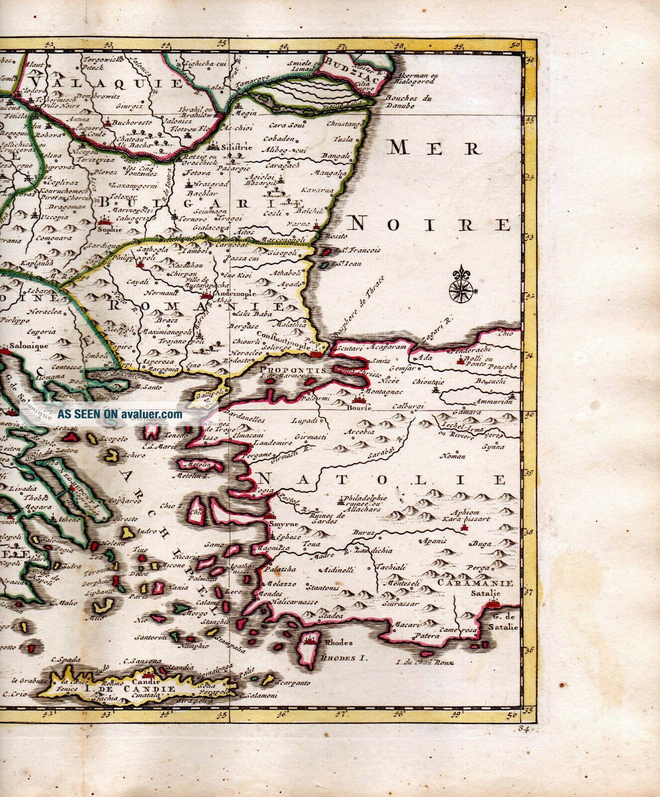
Title: TURQUIE EN EUROPE. Suivant les Nouvelles Observations de Messrs. de l'Academie Royale des Sciences, etc. Augmentées de Nouveau, á Amsterdam Chez Covens et Mortier.
Description: A very rare, fine decorative and detailed copper engraved map of Greece, Bulgaria, Yugoslavia and western parts of Turkey. It is completed with excellent topographic details of cities, towns, rivers, lakes, mountains as well as political divisions. Decorative title cartouche featuring two costumed ge...ntlemen, several gentlemen, two vessels and a city view at bottom left corner.
Date Printed: UNDATED BUT Ca. 1735.
Provenance: NOUVEL ATLAS très Exact et Fort Commode pour Toutes Sortes de Personnes, Contenant LES PRINCIPALES CARTES GÉOGRAPHIQUE. Dressé suivant les nouvelles observations de Mrs. de l'Academie Royale des Sciences, & rectifié sur les Relations les plus recentes des les plus fidéles voyageurs, a AMSTERDAM. Chez Covens & Mortier. Marchand Libraires. Avec Privilege.
Size of map: approx. 29.5 cm x 22.3 cm (11" 9/16 x 8" 3/4)Size of page: approx. 38.5 cm x 26.1 cm (15" 3/16 x 10" 1/4)
Mapmakers: This is a copper engraved map plate from the second edition of Van Der Aa "Nouvel Atlas" who sold his rights and copper plates to Covens & Mortier before dying in 1733. This company then reprinted this important Atlas in 1735 from which this map comes along.
PETER VAN DER AA (1659-1733) was a prolific publisher, working in Leiden during the first three decades of the 18th. century. Much of his output consisted of re-issues and re-engravings of maps and view plates that he had acquired from earlier mapmakers. Little of his output was original, though that which is has a very distinct style, precisely and elegantly engraved, and is much sought-after today.
An interesting feature of Van Der Aa's method is that several of his atlases include maps printed within large, separately engraved, elaborately designed mock-frame borders, which were prepared with a blank centre so that individual maps could be over-printed on that area.
Despite the quantity and variety of Van Der Aa's publications they seem to have had only a limited circulation, and so are now scarce.
COVENS & MORTIER: Johannes Covens and Cornelis Mortier were responsible of one of the most prolific map-making and publishing houses during the second and third quarters of the 18th century. They worked in Amsterdam where they were well situated to acquire the plates and rights from many earlier atlases. Johannes was the brother-in-law of Cornelis and the son of Pieter Mortier, a mapmaker and publisher in his own right.
The output of Covens & Mortier was vast and the business was continued until as late as 1866 by various relatives. Covens & Mortier were responsible for the re-issue of atlases, pocket atlases, wall maps and town plans by such important mapmakers as Sanson, Jaillot, Visscher, Van Der Aa, De L’Isle and De Wit amongst others. Some of their well-known reissues include the Atlas Nouveau of Guillaume De L’Isle, the Nieuwe Atlas of Sanson and the Nouvel Atlas by Pieter Van Der Aa amongst others.
Condition: Very good overall, with light yellowing and minor oxidation spots here and there. Folded at middle area as issued. Strong and dark impression on good watermarked paper. Hand-colored. Blank verso. Please check images of the actual item, images 2 and 3 are ultra hi-resolution scans.
THIS IS AN ORIGINAL ANTIQUE COPPER ENGRAVED PLATE FROM THE AFOREMENTIONED ATLAS, NOT A NEWER PRINT OR REPRODUCTION.
Shipping via REGISTERED AIR MAIL for 1 up to 10 similar prints / maps is US$ 15 to USA and rest of America, US$ 18 to EUROPE and US$ 22 to the rest of the world.
00021