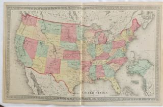
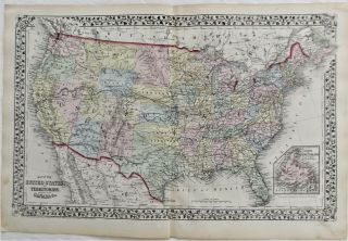
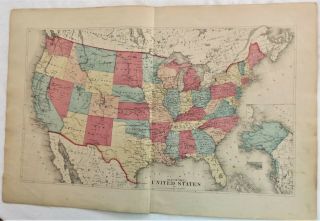
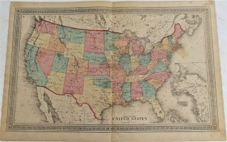
1876 NY United States Indian Territory From Franklin County Antique Atlas Map


Item History & Price

Information:
Reference Number: Avaluer:62632169Cartographer/Publisher: Beers
Maker: BeersOriginal/Reproduction: Original
Type: County MapCanadian Province: Ontario
Year: 1876Format: Atlas Map
US State: New YorkNorth America States & Provinces: New York
Date Range: 1800-1899Continent: North America
Country/Region: United States of America
Original Description:
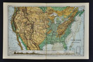
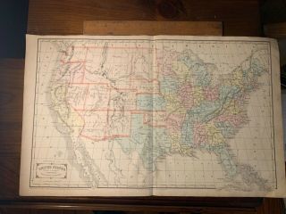
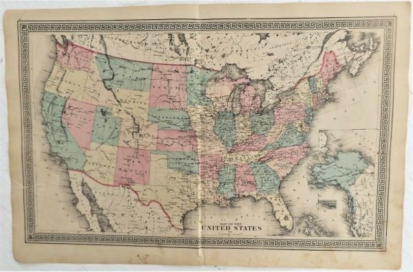
 An original 145 year old map from 1876, Ancient home of the Mohawk Native Americans, Measures approximately a large 16 1/2" x 25 1/2", Shows land and business owners at the time, Good condition for its age, Slight staining here and there and some edge roughness, Center seam has split and roughness on the bottom, Left edge has about a 2" tear, These maps looked super matted and framed up, We now have a maps category in our store, Click on the store icon and then scroll to maps and... click on it, We will be adding hundreds of NYS maps as we get time, One shipping charge no matter how many maps you purchase just wait and let me send you a revised invoiceOur files tend to blur, Actual image is sharper, Satisfaction guaranteed, Immediate return privileges, Map will be gently rolled and shipped first class in a tube mailer, NYS residents must pay sales tax or send a completed resale form to Ebay, Email with questions and we’ll try to answer them, Payment should be received within 7 days or a nonpaying bidder alert will be filed with Ebay, If immediate payment is a problem please let us know and we will work with you, Thanks, Charlie & Marcia

00017


    Similar items


  • 1875 Lewis County Ny " United States Indian Territory " Antique Atlas Map

    1875 Lewis County Ny " United States Indian Territory " Antique Atlas Map

  • 1875 Ny United States Indian Territory Chenango County Antique Map Atlas

    1875 Ny United States Indian Territory Chenango County Antique Map Atlas

  • 1875 Ny Madison County United States Indian Territory Oklahoma Antique Atlas Map

    1875 Ny Madison County United States Indian Territory Oklahoma Antique Atlas Map

  • 1874 United States Indian Territory Wayne County Ny Antique Map Atlas

    1874 United States Indian Territory Wayne County Ny Antique Map Atlas

  • Obsolete 1880

    Obsolete 1880 ' S Style United States Indian Territory Deputy Marshal Badge " Wdc "

  • United States Indian Territory Deputy Marshal Badge,  1880

    United States Indian Territory Deputy Marshal Badge, 1880 ' S

  • 1871 Guyot Physical Map - United States Indian Territory Dakota Texas California

    1871 Guyot Physical Map - United States Indian Territory Dakota Texas California

  • Handcolor Map 1855 United States Indian Territory 22x13” Framable Railroads Gift

    Handcolor Map 1855 United States Indian Territory 22x13” Framable Railroads Gift


    • You might also like


    • 1860 Mitchell Hand Colored Map Colorado,  Nebraska & Kansas - Civil War Era

      1860 Mitchell Hand Colored Map Colorado, Nebraska & Kansas - Civil War Era

    • 18th Century French Map Of North America

      18th Century French Map Of North America

    • Las Vegas Nevada Vintage 1967 Us Geological Survey Quadrangle Map 4 Panels

      Las Vegas Nevada Vintage 1967 Us Geological Survey Quadrangle Map 4 Panels

    • Rare Antique 1845 Maps United States Exploring Expedition Book Antartica Hawaii

      Rare Antique 1845 Maps United States Exploring Expedition Book Antartica Hawaii

    • Vintage 1926 Map Hollywood From The Best Surveys Of The Time

      Vintage 1926 Map Hollywood From The Best Surveys Of The Time

    • American Continent (western Hemisphere) 1747 Bowen Antique Copper Engraved Map

      American Continent (western Hemisphere) 1747 Bowen Antique Copper Engraved Map

    • Gulf Coast Florida Texas United States 1705 De Fer Unusual Antique Engraved Map

      Gulf Coast Florida Texas United States 1705 De Fer Unusual Antique Engraved Map

    • California As Island United States 1700 De Fer Unusual First Edition Antique Map

      California As Island United States 1700 De Fer Unusual First Edition Antique Map

Avaluer          About Us          Privacy Policy          Contact Us          UP
© 2022, avaluer.net, Inc. or its affiliates