1861 NY Atlas Map Wilna Fort Drum Woods Mills Settlement Natural Bridge Carthage

Item History & Price

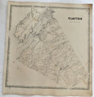
1861 Ny Atlas Map Grindstone Island Clayton Depauville
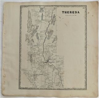
1861 Ny Atlas Map Town Of Town Of Theresa Butterfield Millsite Red Hyde Lake,
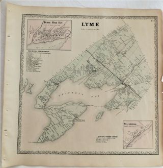
1861 Ny Atlas Map Lyme 3 Three Mile Bay Chaumont Wilcoxville
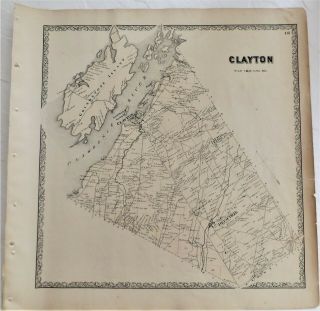
1861 Ny Atlas Map Town Of Clayton Grindstone Round Island Depauville
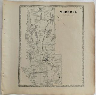
1861 Ny Atlas Map Theresa Red Butterfield Hyde Millsite Lakes,
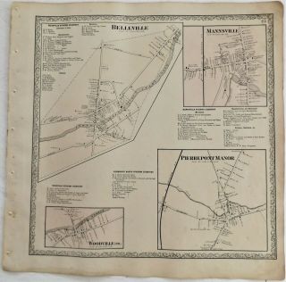
1861 Ny Atlas Map Mannsville Belleville Woodville Pierpont Manor
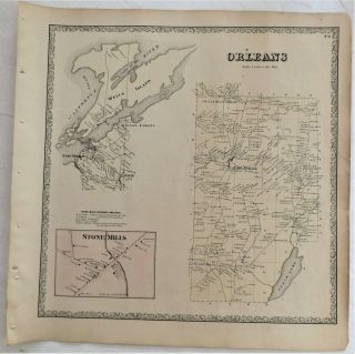
1861 Ny Atlas Map Orleans Stone Mills Lafargeville Wells Welsley Island
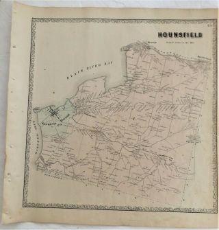
1861 Ny Atlas Map Hounsfield Sackets Harbor Jewettville Dexter Brownville,

1860 Mitchell Hand Colored Map Colorado, Nebraska & Kansas - Civil War Era

18th Century French Map Of North America

Las Vegas Nevada Vintage 1967 Us Geological Survey Quadrangle Map 4 Panels

Rare Antique 1845 Maps United States Exploring Expedition Book Antartica Hawaii

Vintage 1926 Map Hollywood From The Best Surveys Of The Time

American Continent (western Hemisphere) 1747 Bowen Antique Copper Engraved Map

Gulf Coast Florida Texas United States 1705 De Fer Unusual Antique Engraved Map

California As Island United States 1700 De Fer Unusual First Edition Antique Map