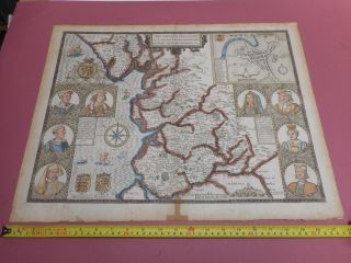
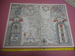
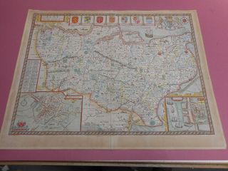
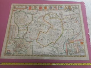
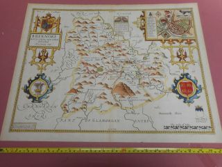
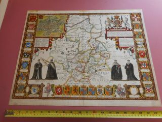
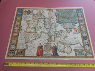
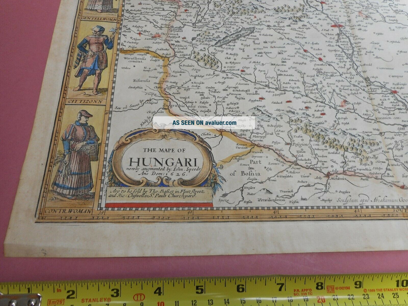
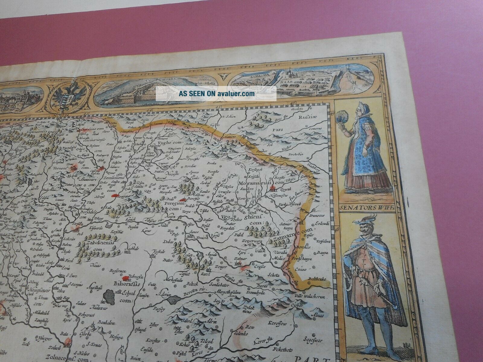
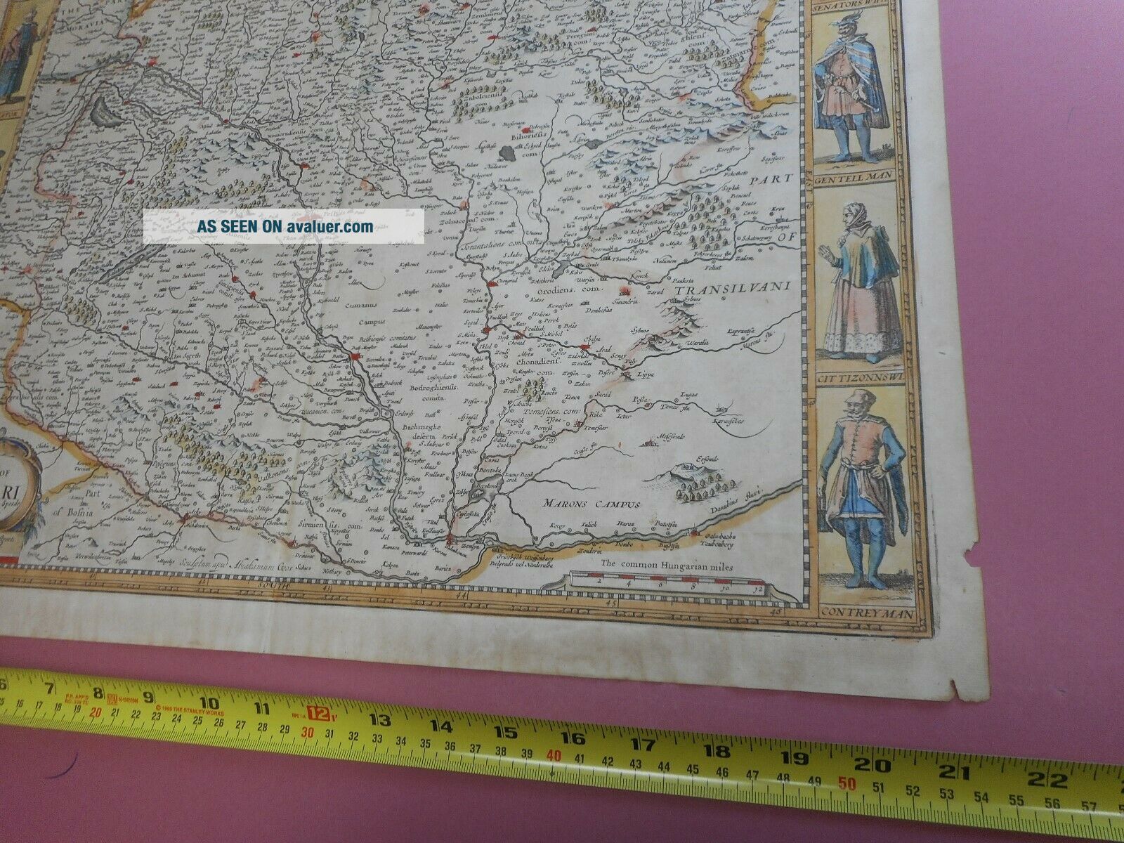
100 LARGE HUNGARY MAP BY JOHN SPEED C1676 VGC HAND COLOURED


Item History & Price

Information:
Reference Number: Avaluer:7507Year: 1676
Original Description:
100% ORIGINAL  LARGE HUNGARY MAPBY JOHN SPEED C1676  EDITION510MM X 390MM  TEXT TO REAR  MAP IN VERY GOOD CONDITION NO TEARS NO REPAIRS   
  PART OF A COLLECTION LISTED TO BE LISTED OVER THE NEXT FEW WEEKS !!LOW POSTAGE FOR UK BUYERS  2ND RECORDED DELIVERYEUROPE £10.00 RECORDED DELIVERY ANY AMOUNT OF MAPSWORLDWIDE £12.00 RECORDED DELIVERY ANY AMOUNT OF MAPS  


    Similar items


  • 100 Large Lancashire Map By John Speed C1676 Vgc Hand Coloured

    100 Large Lancashire Map By John Speed C1676 Vgc Hand Coloured

  • 100 Large Buckinghamshire Map By John Speed C1676 Hand Coloured

    100 Large Buckinghamshire Map By John Speed C1676 Hand Coloured

  • 100 Large Kent Map By John Speed C1676 Vgc Hand Coloured

    100 Large Kent Map By John Speed C1676 Vgc Hand Coloured

  • 100 Large Worcestershire Map By John Speed C1676 Vgc Hand Coloured

    100 Large Worcestershire Map By John Speed C1676 Vgc Hand Coloured

  • 100 Large Kent Map By John Speed C1676 Vgc Hand Coloured

    100 Large Kent Map By John Speed C1676 Vgc Hand Coloured

  • 100 Large Brecknockshire Map By John Speed C1676 Vgc Hand Coloured

    100 Large Brecknockshire Map By John Speed C1676 Vgc Hand Coloured

  • 100 Large Cambridgeshire Map By John Speed C1611 1st Editiohand Colour

    100 Large Cambridgeshire Map By John Speed C1611 1st Editiohand Colour

  • 100 Large Oxfordshire Map By John Speed C1627 Hand Coloured

    100 Large Oxfordshire Map By John Speed C1627 Hand Coloured


    • You might also like


    • Hungary & Romania 1579 (1584) Ortelius Unusual Antique Copper Engraved Map

      Hungary & Romania 1579 (1584) Ortelius Unusual Antique Copper Engraved Map

    • Brussels Bruxelles Belfium 1777 De Ferraris & Dupuis Large Antique Map Sheet Xxi

      Brussels Bruxelles Belfium 1777 De Ferraris & Dupuis Large Antique Map Sheet Xxi

    • 1616 Atlas Map Of Iceland.

      1616 Atlas Map Of Iceland.

    • Kazan Russia 1767 Le Clerc/lespinasse Antique Copper Engraved City View

      Kazan Russia 1767 Le Clerc/lespinasse Antique Copper Engraved City View

    • 1899 Stanford,  Folding Map Of Norwich,  Norfolk,  Arthur Collins,  Jarrold & Sons,

      1899 Stanford, Folding Map Of Norwich, Norfolk, Arthur Collins, Jarrold & Sons,

    • 1948 Vintage Linen Colour Map Geological Survey Ten Mile Of Great Britain

      1948 Vintage Linen Colour Map Geological Survey Ten Mile Of Great Britain

    • 1944 Map Flying Bombs Sussex Ww2 Newspaper Military Kent Courier German V1 V2

      1944 Map Flying Bombs Sussex Ww2 Newspaper Military Kent Courier German V1 V2

    • Dated 1638 Vellum Map Of Icklesham Sussex Showing Land Uses Owners Etc

      Dated 1638 Vellum Map Of Icklesham Sussex Showing Land Uses Owners Etc

Avaluer          About Us          Privacy Policy          Contact Us          UP
© 2022, avaluer.net, Inc. or its affiliates