1893 Crested Butte Colorado Gunnison NF Antique USGS Reconnaissance Topo Map
Item History & Price
1893 CRESTED BUTTE COLORADO RARE ANTIQUE MAP Vintage Cartographics Colorado Maps ∙ Antique Prints ∙ Bargain Bin ∙ Browse Nearby Sheets 1893
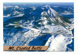
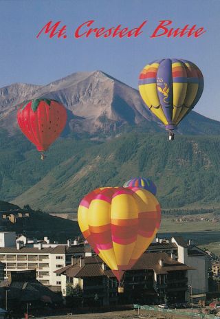
Crested Butte
Colorado
USGS RECONNAISSANCE TOPO MAP
1900 print in very good condition
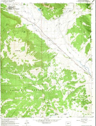
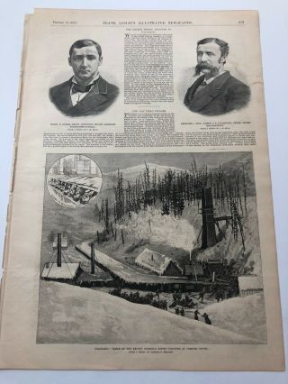
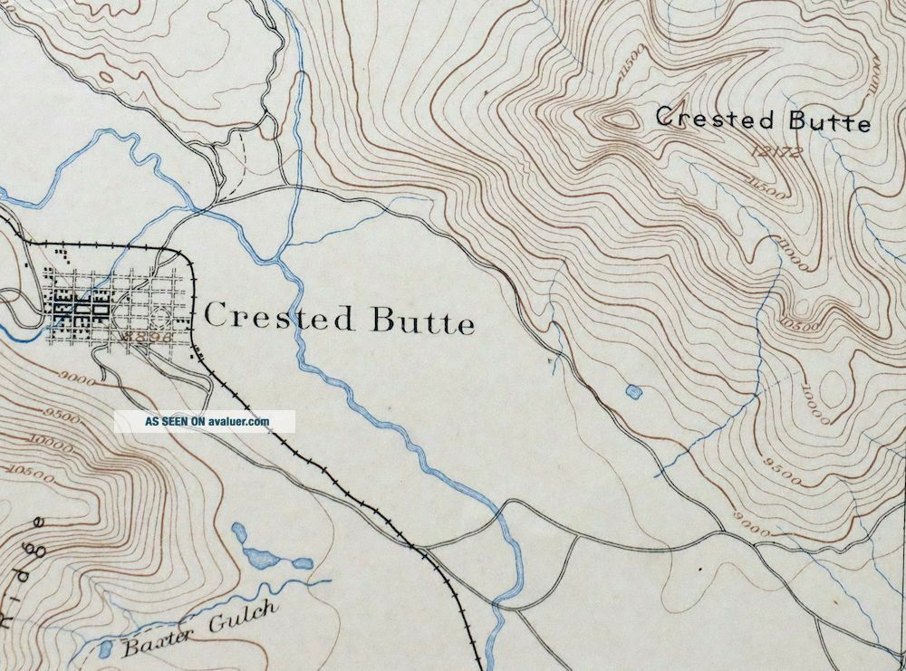
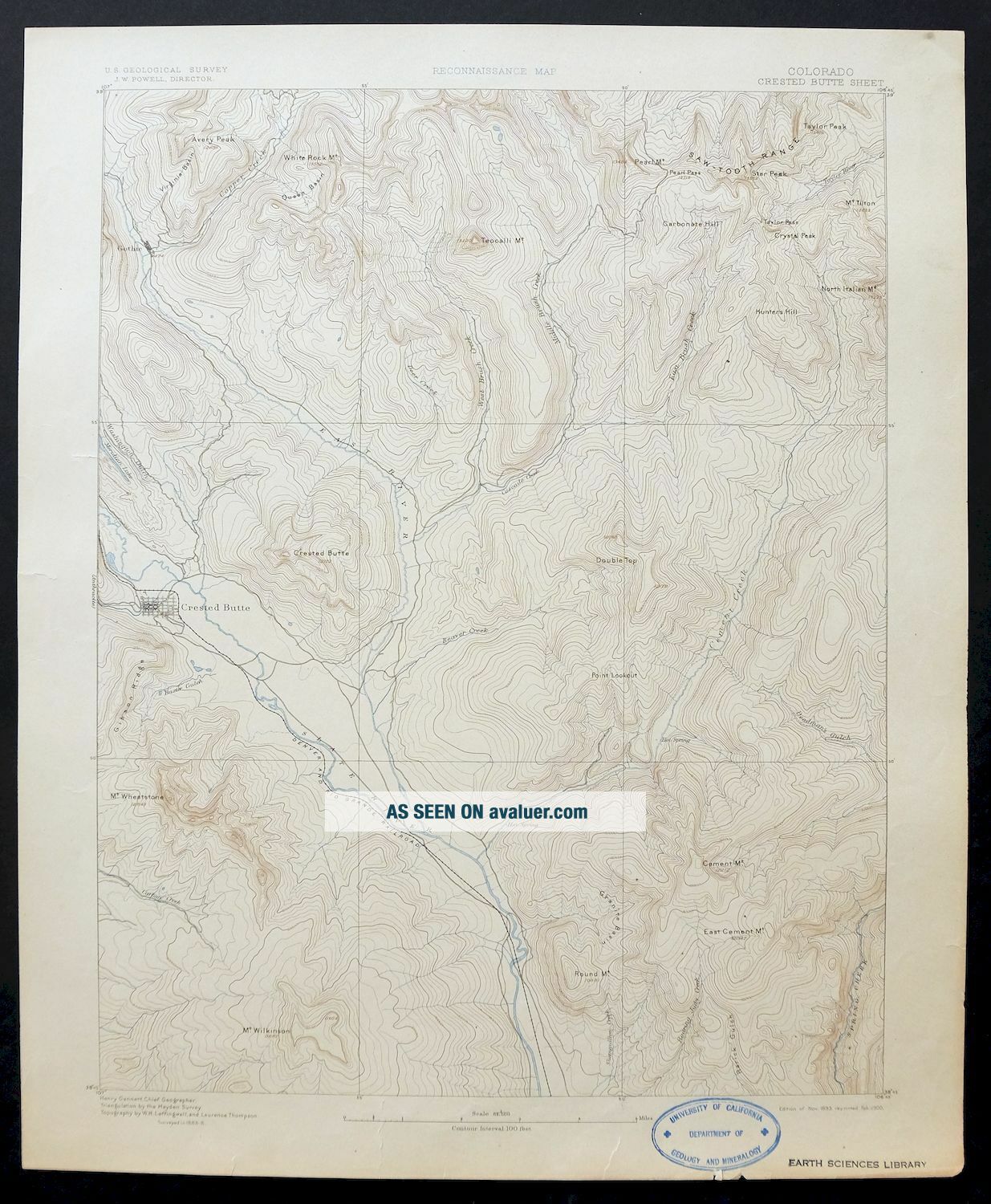
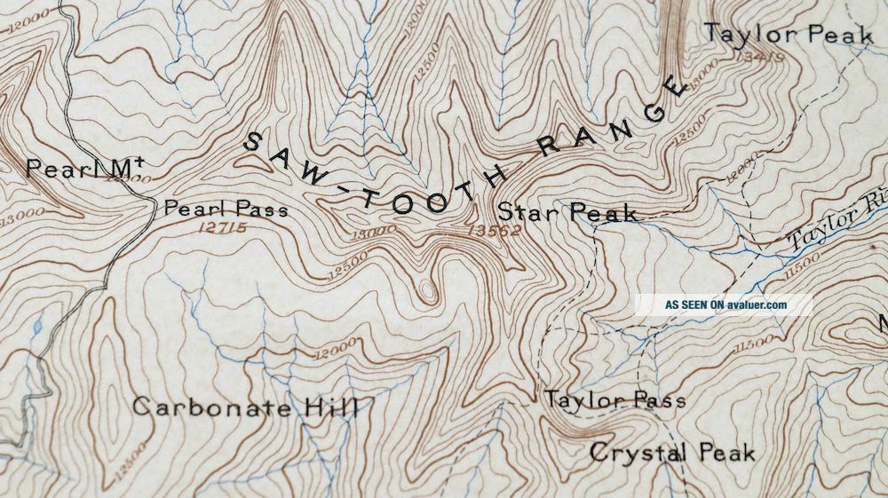
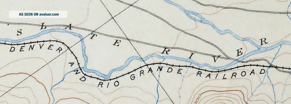
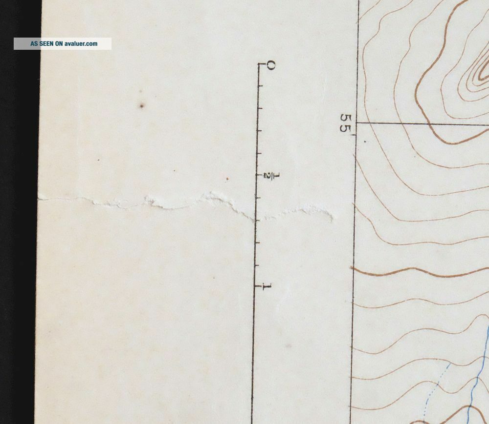
For sale is the 1893 edition of the Crested Butte 15-minute map. This map would be ideal for framing or display,... historical reference or research, genealogy studies, adding to your collection, treasure hunting, a nice conversation piece, a gift for a history or map enthusiast, or for anyone interested in this area. This sheet includes the only survey produced by the United States Geological Survey for the Crested Butte 15-minute quadrangle. The map is an original 1900 USGS print that is 119-year-old years old and in very good condition. The Crested Butte 15-minute map shows all roads, paths, towns, railroads, rivers, creeks, elevation contour lines, public land survey lines, county, state, and other administrative boundaries as they existed at the time of the survey in 1883 through 1888. All known structures (houses, businesses, churches, schools, barns, cabins, etc) are also shown, with exceptions in some urban areas, where only landmark buildings may be shown. The Crested Butte map was field surveyed before aerial photography methods were widely used in map data gathering. It was drawn by cartographers based on plane table field survey information as well as information gathered from local residents in the area. It displays the remarkable abilities of early government map makers, who placed a strong emphasis on creating complete, accurate, and cartographically appealing maps. Maps from the 15-minute series for the continental United States are no longer produced or printed by the USGS and original prints are becoming increasingly difficult to find. They are a valuable historical record for an area, as they contain many placenames and features that have been dropped from more recent maps. MAP DETAILS Title Crested Butte State Colorado Series 15-minute Surveyed 1883 through 1888 Field Survey Geographer Henry Gannett Edition 1893 Printed 1900, thick paper stock Woodland Tint No Scale 1:62500 Contour Interval 100 Foot Sheet Dimensions 16 1/2 x 20 inches (approximate) Map Dimensions 13 5/8 x 17 1/2 inches Coverage Area 13 x 17 miles Notes surveyed during Crested Butte's coal mining heyday, this map is a fascinating snapshot of one of the few mountain settlements in the area to continuously endure the harsh climate and cyclical mining busts and eventually become a year-round outdoor recreational hub SHEET CONDITION For maps of this vintage, effort is made to note all visible flaws, no matter how minor. Overall Condition VERY GOOD Sheet Notes very lightly handled, never folded, lightly age-toned sheet Map Area flawless map area Collar Area no markings, very minor blemishes, a few edge tears were carefully repaired with archival tape on backside of sheet MAP COVERAGE Quadrangle extent overlaid on current basemap. Browse Nearby
Sheets PLACENAMES Depending on map series and survey date, all of the features listed below may not be shown on this map. This list contains features that currently exist or historically existed within the area covered by this map. The list can be used as a reference to determine if this map covers your area of interest. Placenames are listed alphabetically next to each feature type. Cities and Towns (current) Crested Butte and Mount Crested Butte Counties Covered Gunnison and Pitkin Federal Land Units Gunnison National Forest, Maroon Bells-Snowmass Wilderness, and White River National Forest Rivers and Streams Bear Creek, Brush Creek, Carbon Creek, Cement Creek, Coal Creek, Cooper Creek, Copper Creek, Deer Creek, East River, Eyre Creek, Farris Creek, Granite Creek, Middle Brush Creek, Perry Creek, Slate River, Slumgullion Creek, Spring Creek, Taylor River, Waterfall Creek, and West Brush Creek Water Bodies Lake Grant, Peanut Lake, and Twin Lakes Populated Places: Crested Butte, Gothic, and Mount Crested Butte. Post Offices: Crested Butte Post Office. Locations: Avery Peak Campground, Brush Creek Cow Camp, Cement Creek Campground, Cement Creek Forest Service Facility, Cement Summer Home Group, Cold Spring Ranch, Deadman Trailhead, Grasshopper Park Campground, and Skyland Camp. Mountains, Peaks, and Summits: Avery Peak, Carbonate Hill, Cement Mountain, Crested Butte, Crystal Peak, Double Top, East Cement Mountain, Greg Mace Peak, Italian Mountain, Lambertson Peak, Pearl Mountain, Point Lookout, Red Mountain, Round Mountain, Snodgrass Mountain, Star Peak, Strand Hill, Taylor Peak, Teocalli Mountain, Mount Tilton, Timbered Hill, Whetstone Mountain, and White Rock Mountain. Valleys and Canyons: Baxter Gulch, Eccher Gulch, Oversteeg Gulch, Rosebud Gulch, Squaw Gulch, Walrod Gulch, and Washington Gulch. Parks: Crested Butte Town Park and Totem Pole Park. Drainages: Brush Creek, Farris Creek, Cement Creek, Coal Creek, Copper Creek, Deer Creek, East Brush Creek, Granite Creek, Horse Basin Creek, Middle Brush Creek, Perry Creek, Waterfall Creek, and West Brush Creek. Mines: Arrowhead Mine, Brush Creek Group Mine, Buckley Mine, Bulkley Mine, Cement Creek Quarry, Clara L Mine, Climax Mine, Horace Porter Mine, Italian Mountain Mine, K D Mine, Maggie Mine, Rosebud Group Mine, Taylor Peak Mine, and Twenty Percent Creek Mine. Churches: Queen of All Saints Catholic Church and Union Congregational Church. Lakes and Ponds: Peanut Lake, Red Mountain Lake, and Twin Lakes. Canals: Dillsworth Ditch, East River Number 1 Ditch, East River Number 2 Ditch, Halazon Ditch, Imobersteg Ditch, Verzuh Ditch, and Verzuh Young Bafand Ditch. Dams: Meridan Lake Park Number 1 Dam. Buildings: Chamber of Commerce Visitor Center, Crested Butte Fire Protection District, Crested Butte Mountain Heritage Museum, Crested Butte Teen Center, Crested Butte Town Office, and Old Rock Community Library. Basins: Eyre Basin, Conundrum Basin, Cumberland Basin, Dry Basin, Granite Basin, Horse Basin, Queen Basin, and Virginia Basin. Ridges: Teocalli Ridge. Reservoirs and Tanks: Big Alkali Lake, Lake Grant, and Meridian Lake Park Reservoir Number 1. Towers: KBUT-FM (Crested Butte) and Reno Radio Repeter. Trails: Granite Basin Trail and Trail Riders Trail. Waterfalls: Judd Falls. Springs: Cement Creek Hot Spring, Cement Creek Spring, and Ranger Hot Spring. Airports: Avion Club at Crested Butte Airport. Gaps: Coffeepot Pass, Copper Pass, Pearl Pass, and Triangle Pass. Schools: Crested Butte High School. BACKSIDE LEGEND A map summary is printed on the back side of the Crested Butte sheet similar to the one shown in the picture. It outlines the history, purpose, and status of the USGS mapping program at the time of the printing in 1900. It also provides instructions on how to read contour lines and a description of how they are used to depict the terrain. At the bottom of the page is a legend showing all of the symbols used to represent the cultural, relief, and water features found on the map. SHIPPING AND RETURNS This map sheet will be carefully rolled in a sturdy tube and shipped via the US Postal Service. Shipping and handling costs are included in the purchase price.
If you find that the sheet you receive is not as described in the listing, you may ship it back to us for a refund of the purchase price. 15~7284 15~7482 15~7484 15~7679 15~7680 15~7681 15~7682 15~7683 15~7684 15~7880 15~7881 15~7882 30~1913 30~1914 30~2111 75~28258 75~28259 75~28260 75~28261 75~28654 75~28655 75~28656 75~28657 75~28658 75~28659 75~29047 75~29048 75~29049 75~29050 75~29051 75~29052 75~29053 75~29054 75~29434 75~29435 75~29436 75~29437 75~29438 75~29439 75~29440 75~29441 75~29827 75~29828 75~29829 75~29830 75~29831 75~29832 75~30218 75~30219 75~30220 75~30221
Crested Butte
Colorado
USGS RECONNAISSANCE TOPO MAP
1900 print in very good condition
For sale is the 1893 edition of the Crested Butte 15-minute map. This map would be ideal for framing or display,... historical reference or research, genealogy studies, adding to your collection, treasure hunting, a nice conversation piece, a gift for a history or map enthusiast, or for anyone interested in this area. This sheet includes the only survey produced by the United States Geological Survey for the Crested Butte 15-minute quadrangle. The map is an original 1900 USGS print that is 119-year-old years old and in very good condition. The Crested Butte 15-minute map shows all roads, paths, towns, railroads, rivers, creeks, elevation contour lines, public land survey lines, county, state, and other administrative boundaries as they existed at the time of the survey in 1883 through 1888. All known structures (houses, businesses, churches, schools, barns, cabins, etc) are also shown, with exceptions in some urban areas, where only landmark buildings may be shown. The Crested Butte map was field surveyed before aerial photography methods were widely used in map data gathering. It was drawn by cartographers based on plane table field survey information as well as information gathered from local residents in the area. It displays the remarkable abilities of early government map makers, who placed a strong emphasis on creating complete, accurate, and cartographically appealing maps. Maps from the 15-minute series for the continental United States are no longer produced or printed by the USGS and original prints are becoming increasingly difficult to find. They are a valuable historical record for an area, as they contain many placenames and features that have been dropped from more recent maps. MAP DETAILS Title Crested Butte State Colorado Series 15-minute Surveyed 1883 through 1888 Field Survey Geographer Henry Gannett Edition 1893 Printed 1900, thick paper stock Woodland Tint No Scale 1:62500 Contour Interval 100 Foot Sheet Dimensions 16 1/2 x 20 inches (approximate) Map Dimensions 13 5/8 x 17 1/2 inches Coverage Area 13 x 17 miles Notes surveyed during Crested Butte's coal mining heyday, this map is a fascinating snapshot of one of the few mountain settlements in the area to continuously endure the harsh climate and cyclical mining busts and eventually become a year-round outdoor recreational hub SHEET CONDITION For maps of this vintage, effort is made to note all visible flaws, no matter how minor. Overall Condition VERY GOOD Sheet Notes very lightly handled, never folded, lightly age-toned sheet Map Area flawless map area Collar Area no markings, very minor blemishes, a few edge tears were carefully repaired with archival tape on backside of sheet MAP COVERAGE Quadrangle extent overlaid on current basemap. Browse Nearby
Sheets PLACENAMES Depending on map series and survey date, all of the features listed below may not be shown on this map. This list contains features that currently exist or historically existed within the area covered by this map. The list can be used as a reference to determine if this map covers your area of interest. Placenames are listed alphabetically next to each feature type. Cities and Towns (current) Crested Butte and Mount Crested Butte Counties Covered Gunnison and Pitkin Federal Land Units Gunnison National Forest, Maroon Bells-Snowmass Wilderness, and White River National Forest Rivers and Streams Bear Creek, Brush Creek, Carbon Creek, Cement Creek, Coal Creek, Cooper Creek, Copper Creek, Deer Creek, East River, Eyre Creek, Farris Creek, Granite Creek, Middle Brush Creek, Perry Creek, Slate River, Slumgullion Creek, Spring Creek, Taylor River, Waterfall Creek, and West Brush Creek Water Bodies Lake Grant, Peanut Lake, and Twin Lakes Populated Places: Crested Butte, Gothic, and Mount Crested Butte. Post Offices: Crested Butte Post Office. Locations: Avery Peak Campground, Brush Creek Cow Camp, Cement Creek Campground, Cement Creek Forest Service Facility, Cement Summer Home Group, Cold Spring Ranch, Deadman Trailhead, Grasshopper Park Campground, and Skyland Camp. Mountains, Peaks, and Summits: Avery Peak, Carbonate Hill, Cement Mountain, Crested Butte, Crystal Peak, Double Top, East Cement Mountain, Greg Mace Peak, Italian Mountain, Lambertson Peak, Pearl Mountain, Point Lookout, Red Mountain, Round Mountain, Snodgrass Mountain, Star Peak, Strand Hill, Taylor Peak, Teocalli Mountain, Mount Tilton, Timbered Hill, Whetstone Mountain, and White Rock Mountain. Valleys and Canyons: Baxter Gulch, Eccher Gulch, Oversteeg Gulch, Rosebud Gulch, Squaw Gulch, Walrod Gulch, and Washington Gulch. Parks: Crested Butte Town Park and Totem Pole Park. Drainages: Brush Creek, Farris Creek, Cement Creek, Coal Creek, Copper Creek, Deer Creek, East Brush Creek, Granite Creek, Horse Basin Creek, Middle Brush Creek, Perry Creek, Waterfall Creek, and West Brush Creek. Mines: Arrowhead Mine, Brush Creek Group Mine, Buckley Mine, Bulkley Mine, Cement Creek Quarry, Clara L Mine, Climax Mine, Horace Porter Mine, Italian Mountain Mine, K D Mine, Maggie Mine, Rosebud Group Mine, Taylor Peak Mine, and Twenty Percent Creek Mine. Churches: Queen of All Saints Catholic Church and Union Congregational Church. Lakes and Ponds: Peanut Lake, Red Mountain Lake, and Twin Lakes. Canals: Dillsworth Ditch, East River Number 1 Ditch, East River Number 2 Ditch, Halazon Ditch, Imobersteg Ditch, Verzuh Ditch, and Verzuh Young Bafand Ditch. Dams: Meridan Lake Park Number 1 Dam. Buildings: Chamber of Commerce Visitor Center, Crested Butte Fire Protection District, Crested Butte Mountain Heritage Museum, Crested Butte Teen Center, Crested Butte Town Office, and Old Rock Community Library. Basins: Eyre Basin, Conundrum Basin, Cumberland Basin, Dry Basin, Granite Basin, Horse Basin, Queen Basin, and Virginia Basin. Ridges: Teocalli Ridge. Reservoirs and Tanks: Big Alkali Lake, Lake Grant, and Meridian Lake Park Reservoir Number 1. Towers: KBUT-FM (Crested Butte) and Reno Radio Repeter. Trails: Granite Basin Trail and Trail Riders Trail. Waterfalls: Judd Falls. Springs: Cement Creek Hot Spring, Cement Creek Spring, and Ranger Hot Spring. Airports: Avion Club at Crested Butte Airport. Gaps: Coffeepot Pass, Copper Pass, Pearl Pass, and Triangle Pass. Schools: Crested Butte High School. BACKSIDE LEGEND A map summary is printed on the back side of the Crested Butte sheet similar to the one shown in the picture. It outlines the history, purpose, and status of the USGS mapping program at the time of the printing in 1900. It also provides instructions on how to read contour lines and a description of how they are used to depict the terrain. At the bottom of the page is a legend showing all of the symbols used to represent the cultural, relief, and water features found on the map. SHIPPING AND RETURNS This map sheet will be carefully rolled in a sturdy tube and shipped via the US Postal Service. Shipping and handling costs are included in the purchase price.
If you find that the sheet you receive is not as described in the listing, you may ship it back to us for a refund of the purchase price. 15~7284 15~7482 15~7484 15~7679 15~7680 15~7681 15~7682 15~7683 15~7684 15~7880 15~7881 15~7882 30~1913 30~1914 30~2111 75~28258 75~28259 75~28260 75~28261 75~28654 75~28655 75~28656 75~28657 75~28658 75~28659 75~29047 75~29048 75~29049 75~29050 75~29051 75~29052 75~29053 75~29054 75~29434 75~29435 75~29436 75~29437 75~29438 75~29439 75~29440 75~29441 75~29827 75~29828 75~29829 75~29830 75~29831 75~29832 75~30218 75~30219 75~30220 75~30221