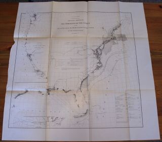
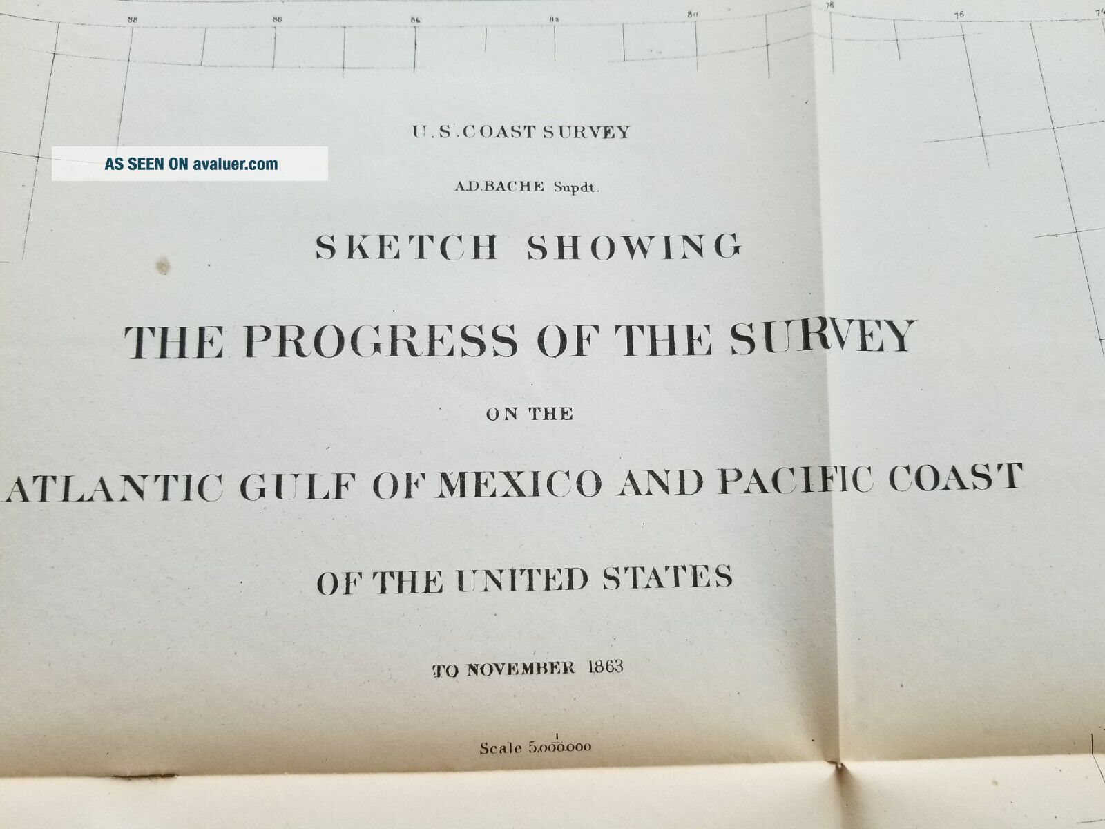
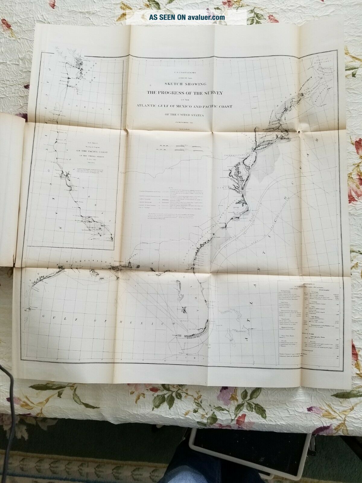
Atlantic Gulf Of Mexico And Pacific Coasts 1863 US Coast Survey Map Chart


Item History & Price

Information:
Reference Number: Avaluer:8489Year: 1863
Original/Reproduction: Antique OriginalFormat: Folding Map
Date Range: 1800-1899Type: Nautical Map
Country/Region: United States of America
Original Description:
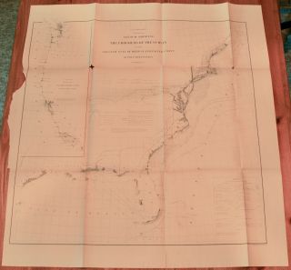
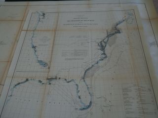
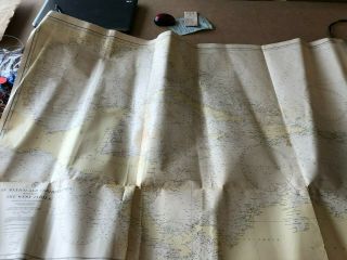
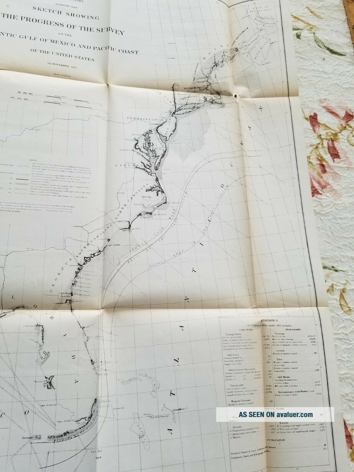
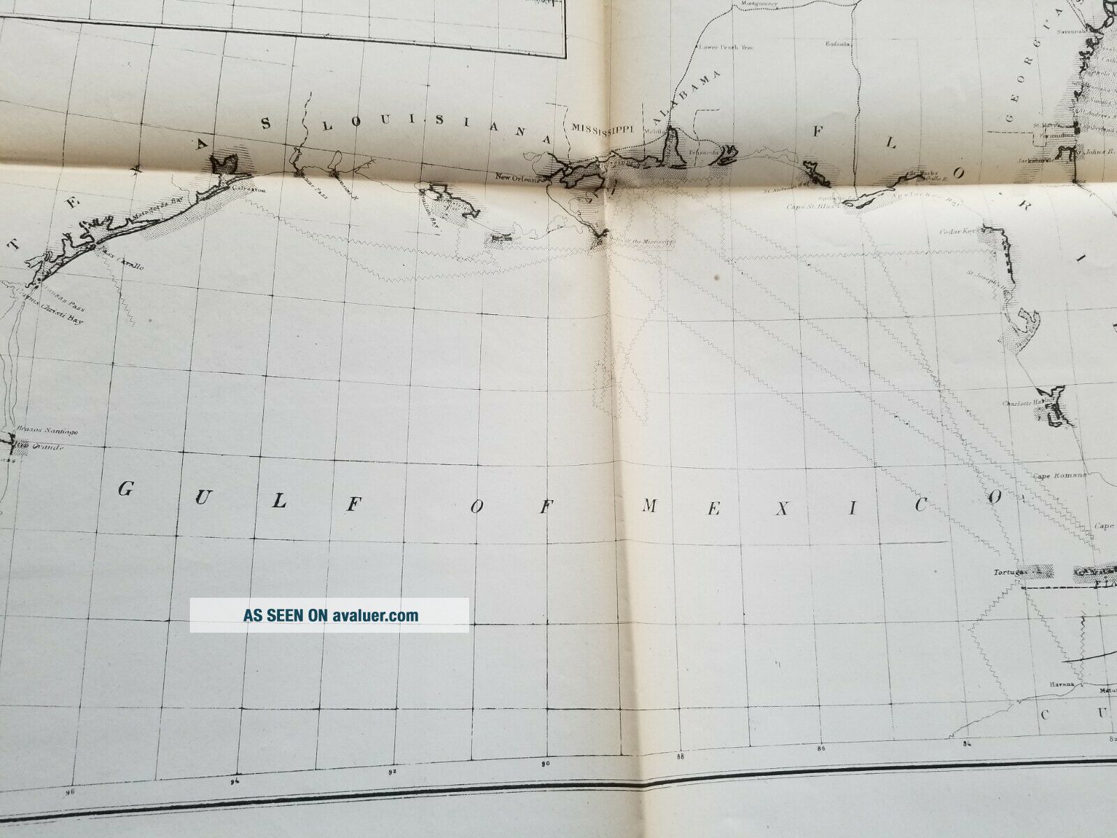
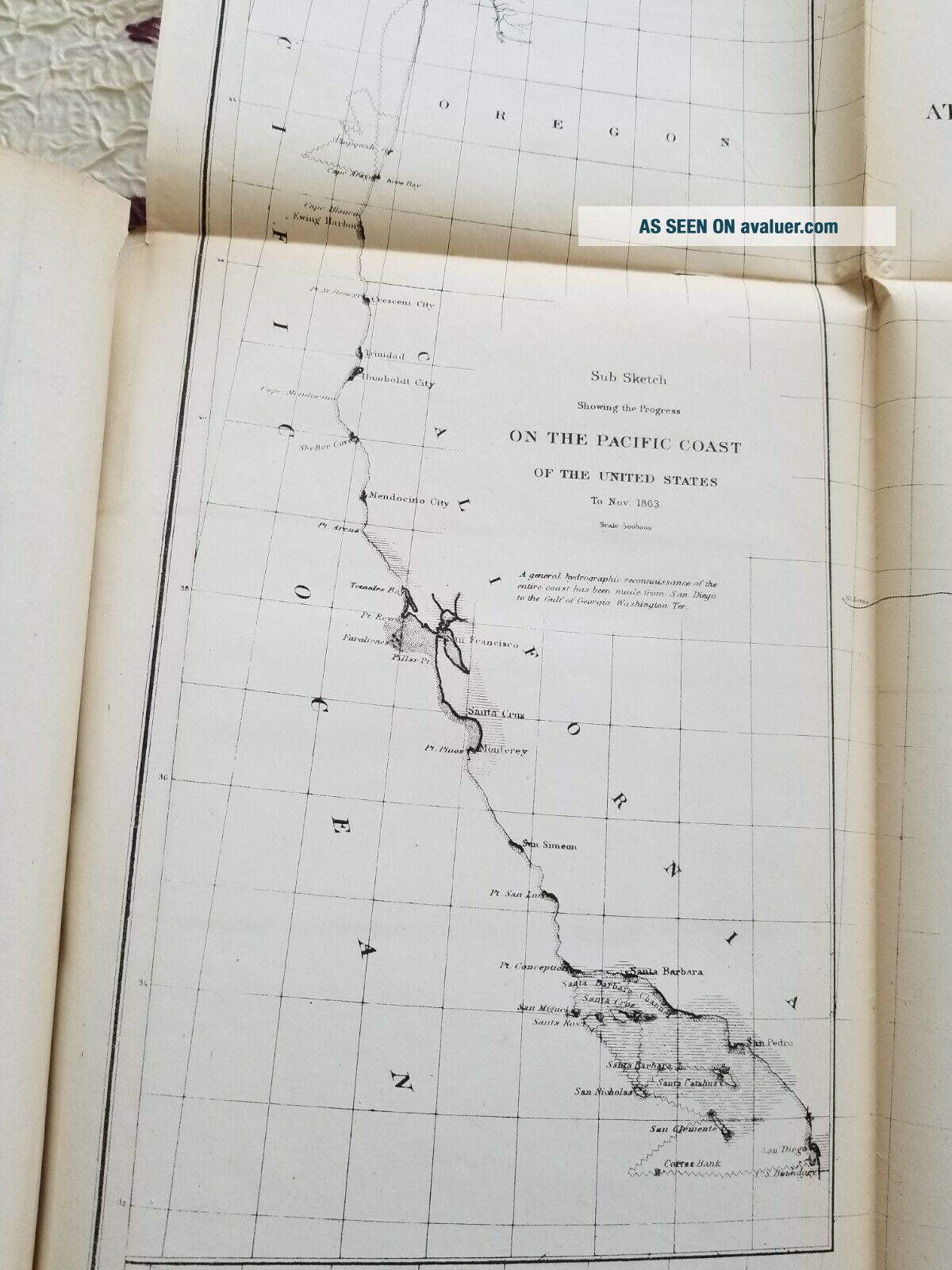
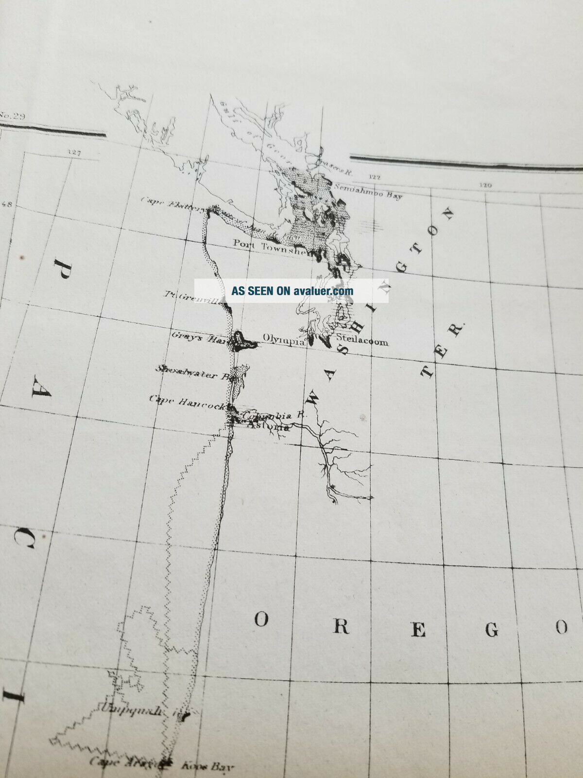
Folding map showing showing the Progress of theSurvey on the Atlantic Gulf of Mexico and Pacific Coast of the United States toNovember 1863 in beautiful detail. Divided into twosections, the large area extends from New Brunswick and the Gulf of St.Lawrence south to include the coasts of Maine, New Hampshire, Massachusetts, Connecticut, New York, New Jersey, Delaware, Maryland, Virginia, NorthCarolina, South Carolina, Georgia, Florida, Alabama, Mississippi, Louisiana andTexas. A smaller... section shown as an inset depicts the Pacific Coast of thecountry on the same scale and extends south from the Strait of Juan de Fuca toinclude the coasts of Washington, Oregon and California as far as San Diego.The chart includes several statistics and notes.Condition: Thechart has been protected in the 1863 US Coast Survey Annual Report for the past~150 years.  Condition is good as notedin the photographs and the grading scheme noted below. Slight toning along thefold lines. A small tear on the lower fold line where the map is attached tothe US Coast Survey book extends through the image frame. Slight toning alongthe fold lines, minor paper loss at one of the upper fold corners.Map will be shipped as folded, insured, andwell protected.A Note on the Grading of Maps (usingconvention outlined in Rosenthal's Antique Map Price Record & Handbook):•              Fine:Clean and bright, with crisp engraved lines. On sound paper with wide margins.Fine quality coloring.•              VeryGood: Clean and bright, with crisp engraved lines. On sound paper with noimperfections in the image. Small tears or minor discoloration in the marginsonly. Very good quality coloring.•              Good:No significant imperfections. Minor spotting, foxing, short separations oncenterfold with no image loss, or overall age toning may be present. May havenarrow margins but paper is still sound. Good coloring.•              Fair:Noticeable imperfections. Scattered foxing or spotting. Long separations oncenterfold or tears entering image which can be easily repaired. Color may beslightly faded.•              Poor:Needs significant repair and cleaning. Paper may be highly acid and brittle.Color may be faded


    Similar items


  • 1866 Us Coast Survey Map Atlantic,  Gulf Of Mexico,  Pacific

    1866 Us Coast Survey Map Atlantic, Gulf Of Mexico, Pacific

  • Antique Map " Sketch Progress Of The Survey Atlantic Gulf Of Mexico & Pacific C.

    Antique Map " Sketch Progress Of The Survey Atlantic Gulf Of Mexico & Pacific C.

  • Biloxi,  Mississippi,  1912 ; Gulf Of Mexico And Beach Front,  Trolley

    Biloxi, Mississippi, 1912 ; Gulf Of Mexico And Beach Front, Trolley

  • Buck Knife 119 Handmade Handle Of Driftwood From Gulf Of Mexico And Local Eb

    Buck Knife 119 Handmade Handle Of Driftwood From Gulf Of Mexico And Local Eb

  • Vintage Match Book Cover Hotel Galvez Gulf Of Mexico And Hotel Galveston Texas

    Vintage Match Book Cover Hotel Galvez Gulf Of Mexico And Hotel Galveston Texas

  • U.  S.  Military Map Of Gulf Of Mexico And Caribbean Sea Including West Indies,  1934

    U. S. Military Map Of Gulf Of Mexico And Caribbean Sea Including West Indies, 1934

  • 1870 Us Coast Survey Map Atlantic To Pacific Ocean & Gulf Of Mexico

    1870 Us Coast Survey Map Atlantic To Pacific Ocean & Gulf Of Mexico

  • The Southern Pacific Of Mexico And The West Coast Route By Signor & Kirchner

    The Southern Pacific Of Mexico And The West Coast Route By Signor & Kirchner


    • You might also like


    • 1860 Mitchell Hand Colored Map Colorado,  Nebraska & Kansas - Civil War Era

      1860 Mitchell Hand Colored Map Colorado, Nebraska & Kansas - Civil War Era

    • 18th Century French Map Of North America

      18th Century French Map Of North America

    • Las Vegas Nevada Vintage 1967 Us Geological Survey Quadrangle Map 4 Panels

      Las Vegas Nevada Vintage 1967 Us Geological Survey Quadrangle Map 4 Panels

    • Rare Antique 1845 Maps United States Exploring Expedition Book Antartica Hawaii

      Rare Antique 1845 Maps United States Exploring Expedition Book Antartica Hawaii

    • Vintage 1926 Map Hollywood From The Best Surveys Of The Time

      Vintage 1926 Map Hollywood From The Best Surveys Of The Time

    • American Continent (western Hemisphere) 1747 Bowen Antique Copper Engraved Map

      American Continent (western Hemisphere) 1747 Bowen Antique Copper Engraved Map

    • Gulf Coast Florida Texas United States 1705 De Fer Unusual Antique Engraved Map

      Gulf Coast Florida Texas United States 1705 De Fer Unusual Antique Engraved Map

    • California As Island United States 1700 De Fer Unusual First Edition Antique Map

      California As Island United States 1700 De Fer Unusual First Edition Antique Map

Avaluer          About Us          Privacy Policy          Contact Us          UP
© 2022, avaluer.net, Inc. or its affiliates