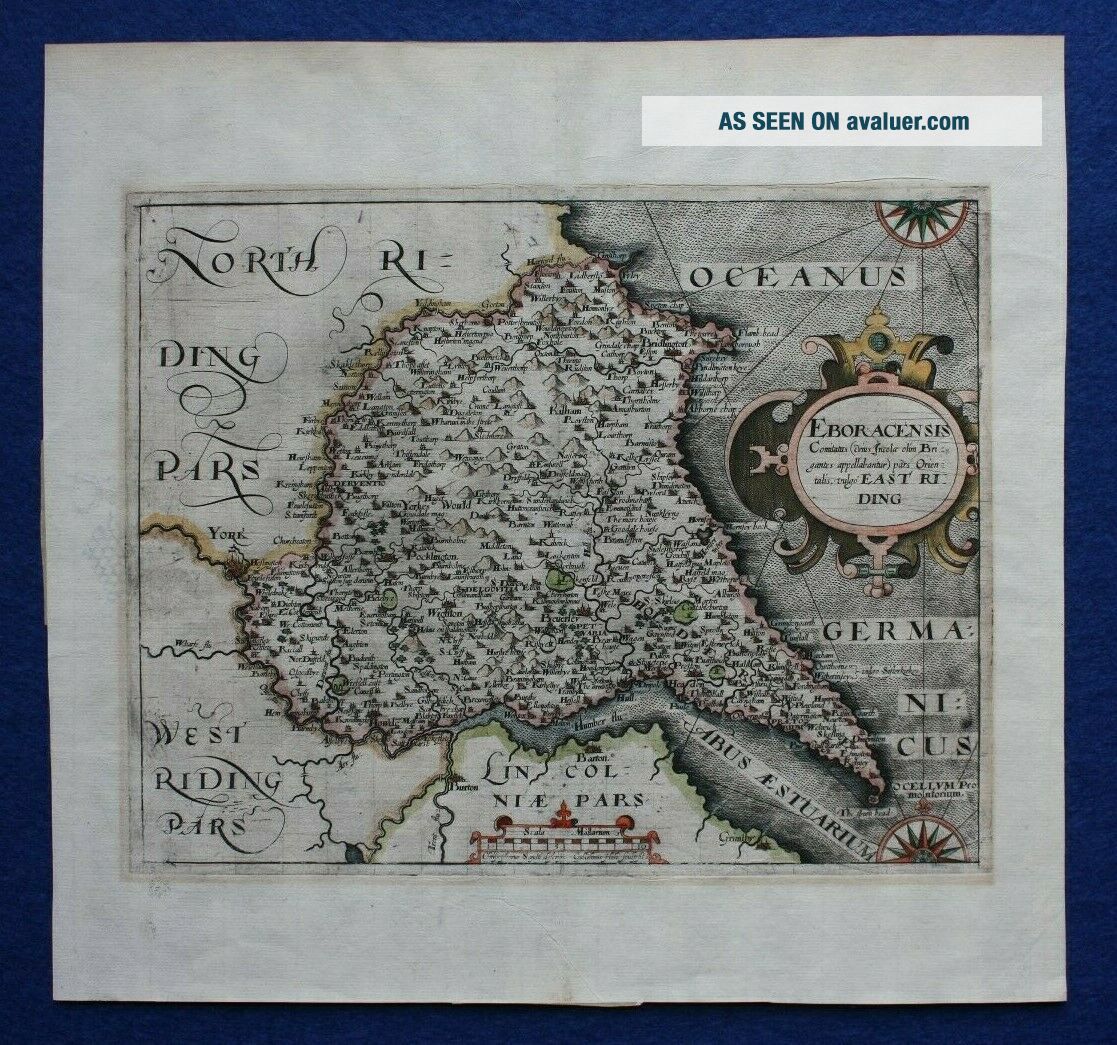
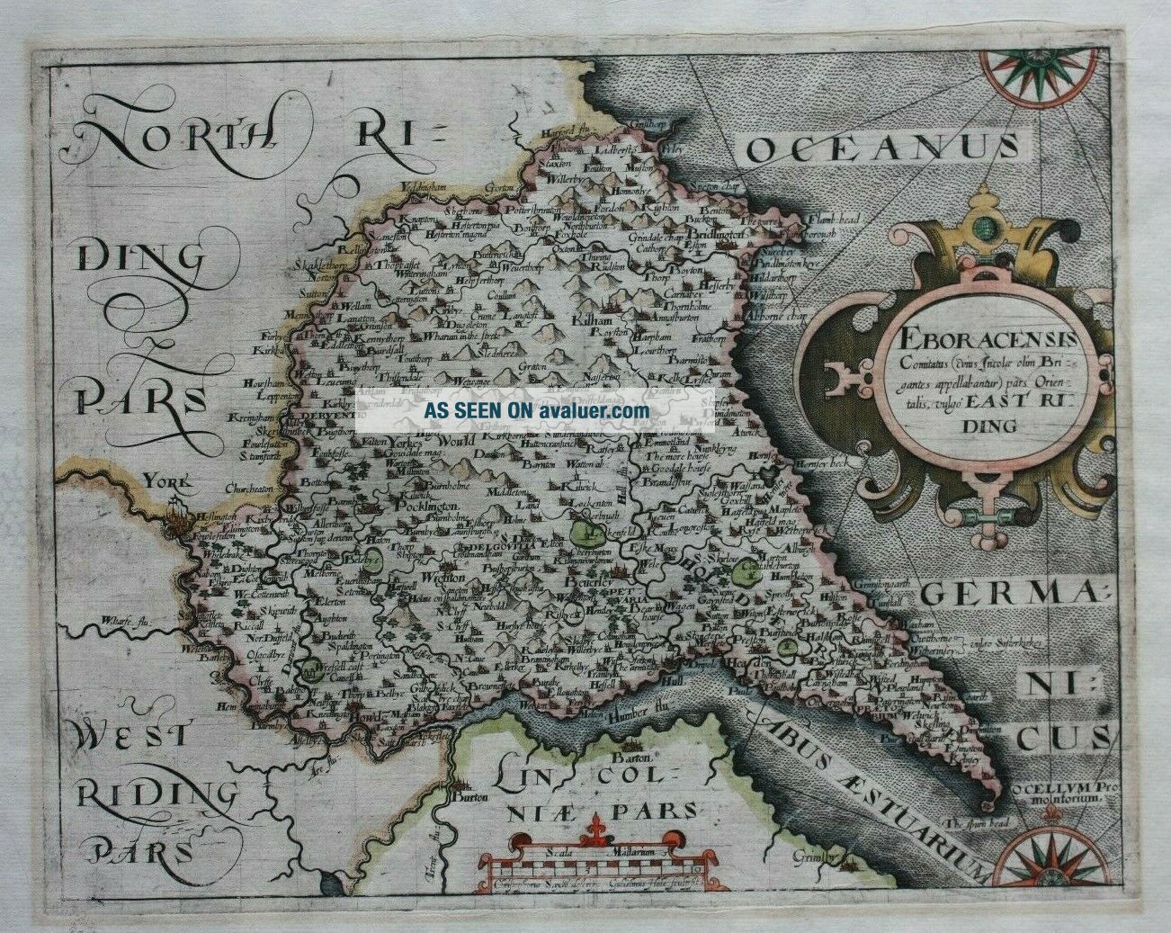
Antique Atlas Map EAST YORKSHIRE, ' EBORACENSIS. ', Saxton & Hole, Pub. 1610 - 37
Item History & Price
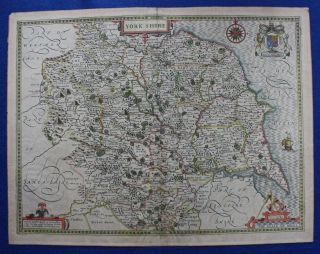
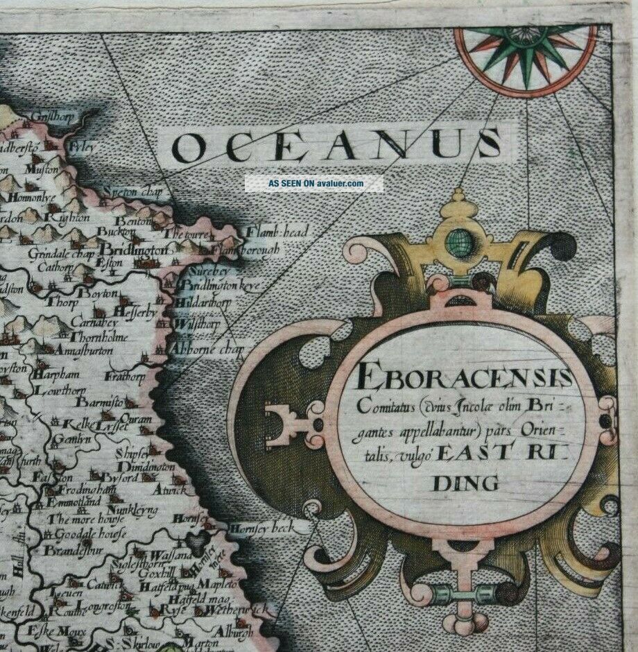
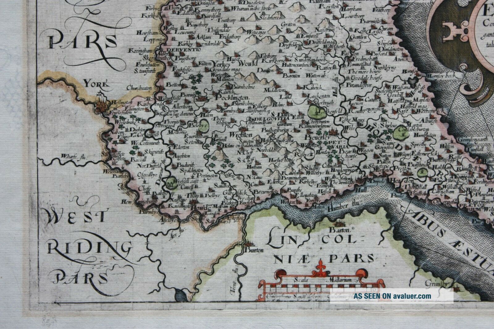
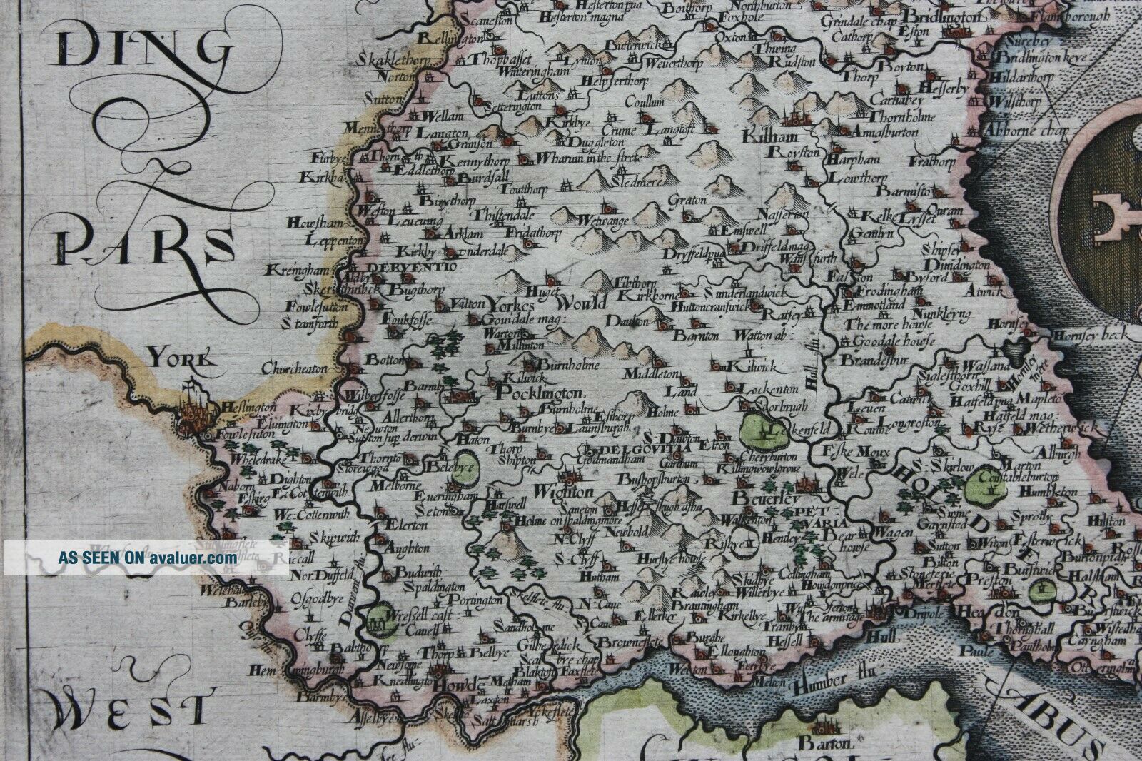
Title / Subject: Eboracensis Comitatus (cuis incola olim Brigantes appellabantur) pars Orientalis, vulgo East Riding'
Date: 1610-1637
Size: 250mm x 200mm (printed area only), margins beyond, blank verso.
Description: A superb, copper engraved, hand-coloured, county map of the East Riding Of Yorkshire with significant detail of place names and topographical features. It features a decorative title cartouche and distance scale. Printed on high quality, hand-laid, watermarked pap...er (the watermark is a bunch of grapes).
Cartographer / Engraver: Engraved by William Hole after Christopher Saxton.
Provenance: 'Camden's Britannia', 1610-37, 2nd or 3rd edition. 'Britannia' was published in three editions from 1607. The maps in the first edition had Latin text on the reverse so this can be ruled out. The 2nd and 3rd editions were both blank on the reverse although many of the 3rd edition maps had plate numbers added in the corner. East Yorkshire was one of those which did not have a plate number added for the 3rd edition.
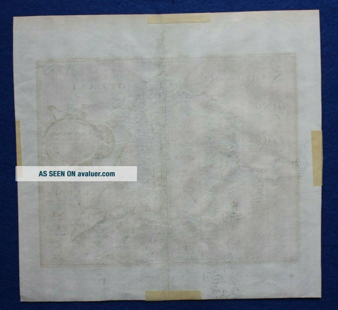
Condition: Excellent condition. Centrefold as published. Four small pieces of mounting tape verso with no detrimental effect to the printed area (presumably from where the map has previously been framed for display - see photo of the reverse of the sheet). Please study all the photographs carefully to fully appreciate the condition.
Ref: #03862
Date: 1610-1637
Size: 250mm x 200mm (printed area only), margins beyond, blank verso.
Description: A superb, copper engraved, hand-coloured, county map of the East Riding Of Yorkshire with significant detail of place names and topographical features. It features a decorative title cartouche and distance scale. Printed on high quality, hand-laid, watermarked pap...er (the watermark is a bunch of grapes).
Cartographer / Engraver: Engraved by William Hole after Christopher Saxton.
Provenance: 'Camden's Britannia', 1610-37, 2nd or 3rd edition. 'Britannia' was published in three editions from 1607. The maps in the first edition had Latin text on the reverse so this can be ruled out. The 2nd and 3rd editions were both blank on the reverse although many of the 3rd edition maps had plate numbers added in the corner. East Yorkshire was one of those which did not have a plate number added for the 3rd edition.
Condition: Excellent condition. Centrefold as published. Four small pieces of mounting tape verso with no detrimental effect to the printed area (presumably from where the map has previously been framed for display - see photo of the reverse of the sheet). Please study all the photographs carefully to fully appreciate the condition.
Ref: #03862