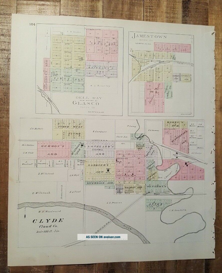
Antique Colored MAP - JAMESTOWN, CLYDE Or CLOUD COUNTY - 1887 KANSAS ATLAS


Item History & Price
| Reference Number: Avaluer:9162 | US State: Kansas |
| Original/Reproduction: Antique Original |
Up for sale is a great, original, colored, ANTIQUE MAP from the THE OFFICIAL ATLAS OF KANSAS - 1887.
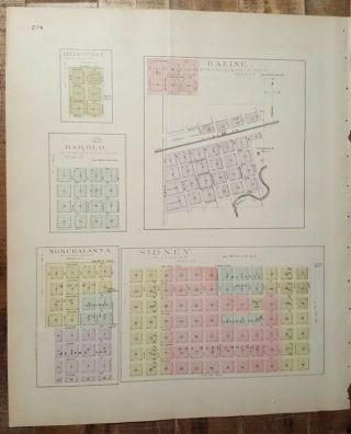
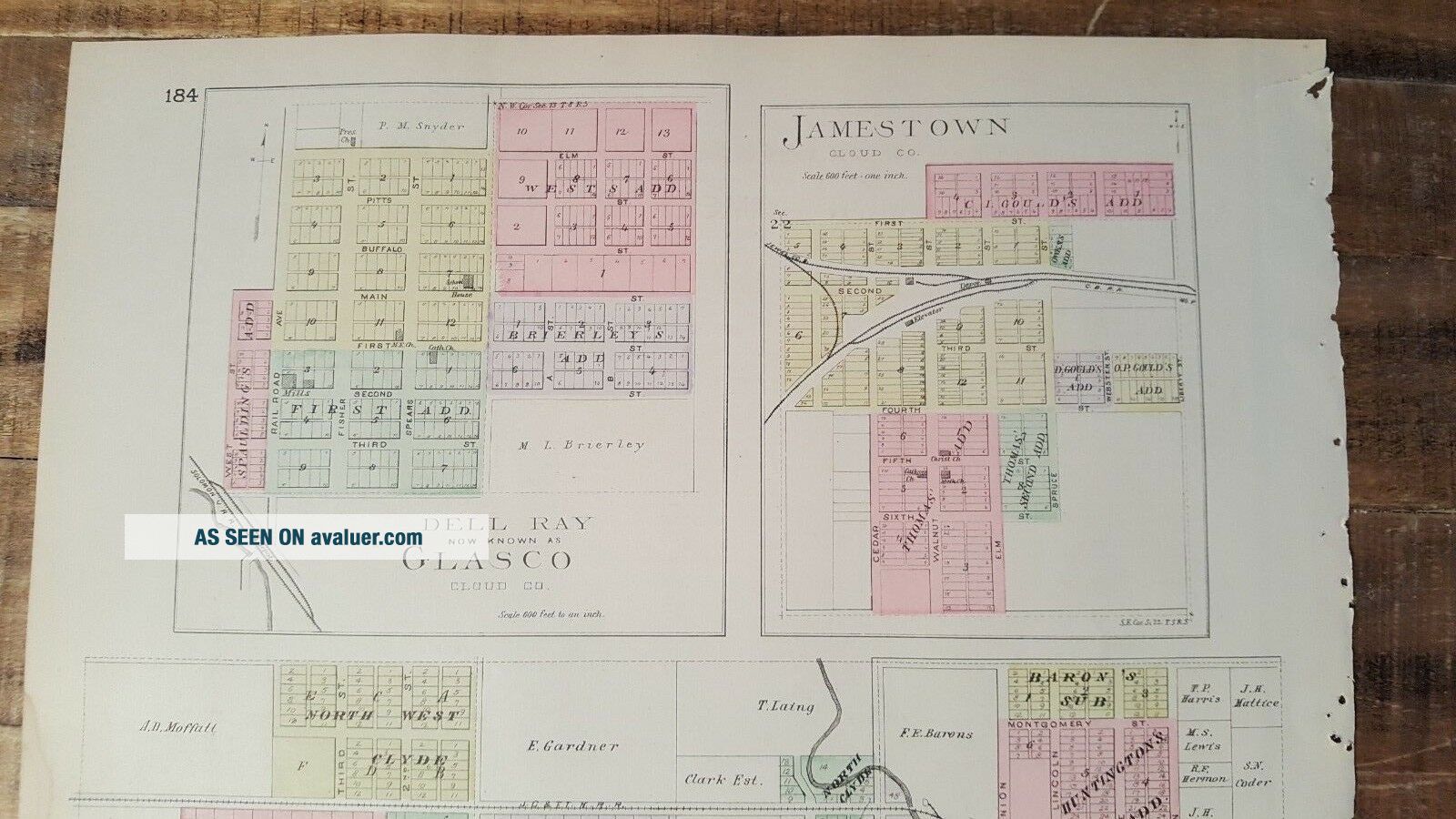
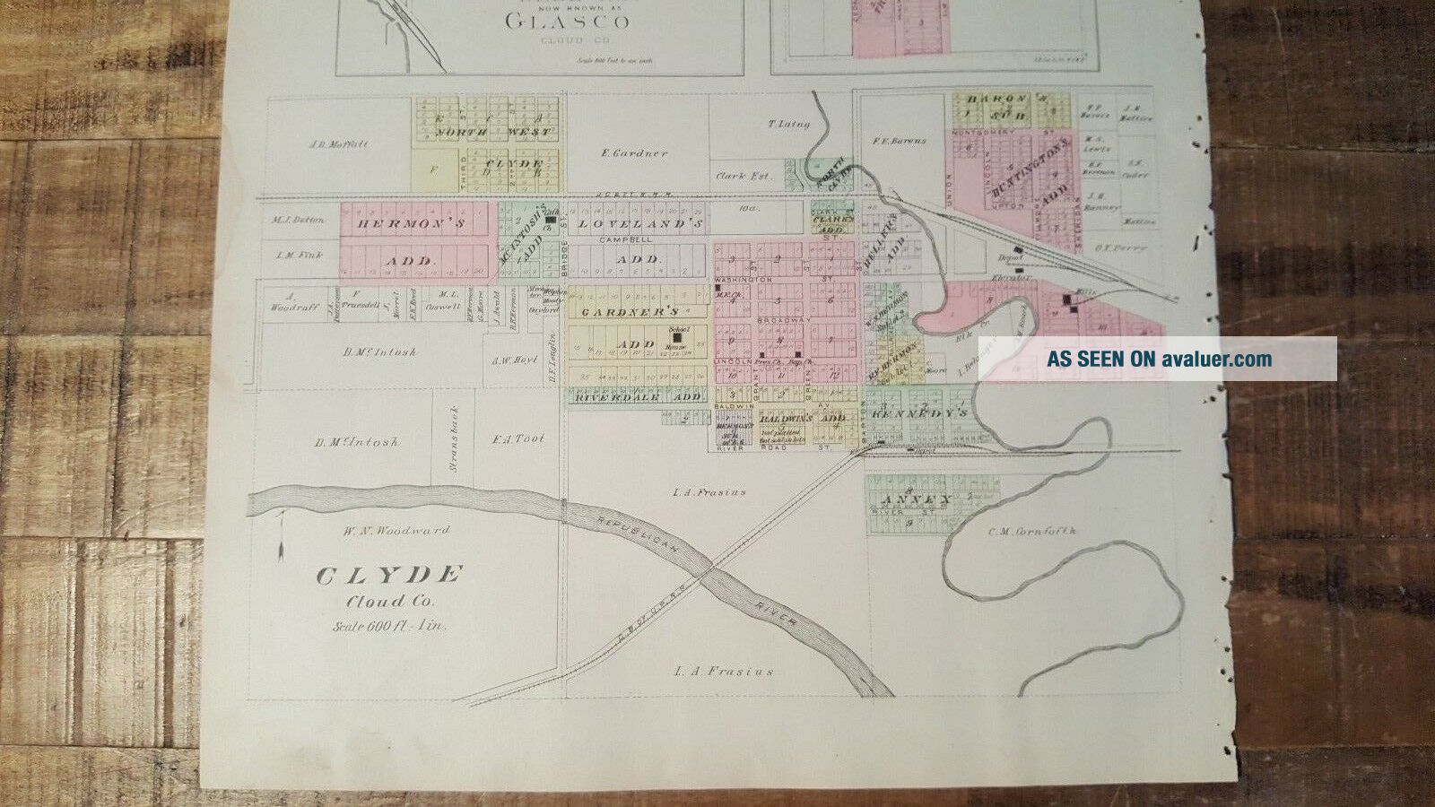
It features a map of GLASCO, JAMESTOWN, & CLYDE. (NOTE: There is a dampstaine at the side border of this map.)
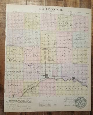
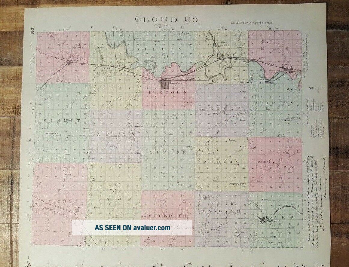
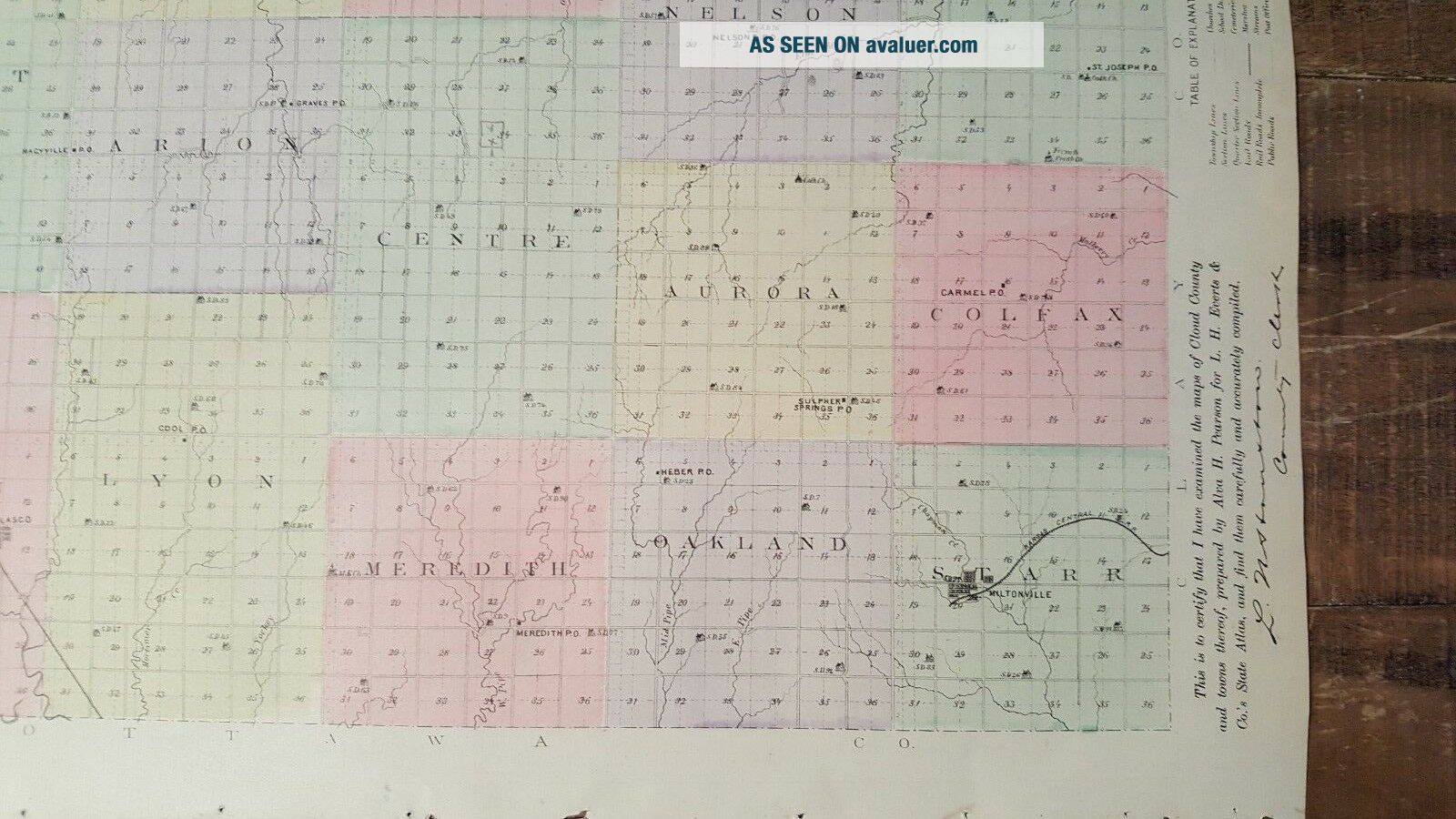
On the reverse side is a map of CLOUD COUNTY.
It is a detailed map measuring approximately 14 1/2 x 17 1/2 inches, including the border area.
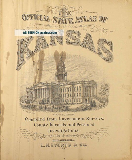
This map is from "THE OFFICIAL ATLAS OF KANSAS" - Compiled from Government Surveys, County... Records and Personal Investigations. Published by L.H. Everts & Co. 1887, Philadelphia, PA. - Copyright, 1887, L.H. Everts & Co.
There are tears down one side from where it was originally bound. It is generally in Very Good Condition. Some age related browning and toning and some spotting and stains. It has some small tears and chips around the edges, but they do not affect the map, as well as some other stains here and there. Some other dings here and there, as well.
This map would be a great addition to any collection and will look very nice when framed!
Please note that while I have included a picture of the Title Page of the Atlas that this map was taken from, it is NOT included in the sale, as it is a reference piece to determine authenticity for other maps/engravings.
Please see my store for other great items.
00164
It features a map of GLASCO, JAMESTOWN, & CLYDE. (NOTE: There is a dampstaine at the side border of this map.)
On the reverse side is a map of CLOUD COUNTY.
It is a detailed map measuring approximately 14 1/2 x 17 1/2 inches, including the border area.
This map is from "THE OFFICIAL ATLAS OF KANSAS" - Compiled from Government Surveys, County... Records and Personal Investigations. Published by L.H. Everts & Co. 1887, Philadelphia, PA. - Copyright, 1887, L.H. Everts & Co.
There are tears down one side from where it was originally bound. It is generally in Very Good Condition. Some age related browning and toning and some spotting and stains. It has some small tears and chips around the edges, but they do not affect the map, as well as some other stains here and there. Some other dings here and there, as well.
This map would be a great addition to any collection and will look very nice when framed!
Please note that while I have included a picture of the Title Page of the Atlas that this map was taken from, it is NOT included in the sale, as it is a reference piece to determine authenticity for other maps/engravings.
Please see my store for other great items.
00164